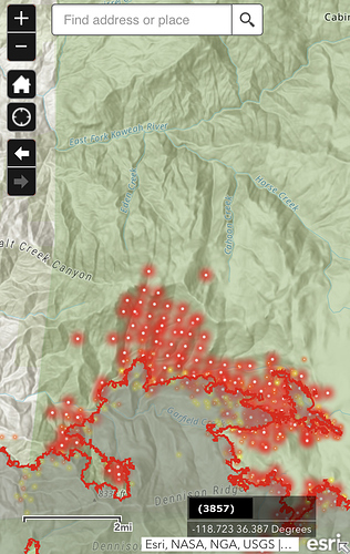
Agreed. A lot of personal property to lose if things go sideways.
No other options due to lack of resources.
welp, there goes the orange salamander population on Blue right road.
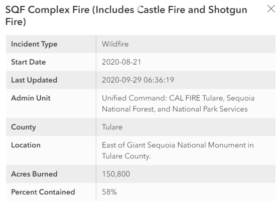
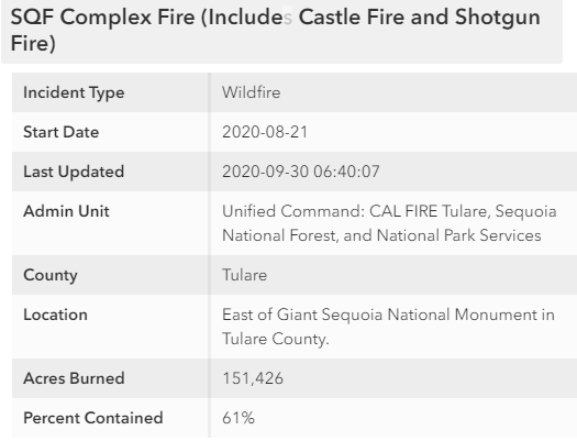
Does anyone know if done rock is accessible from hot springs side?
No it is not. Parker Pass (M90) remains closed.
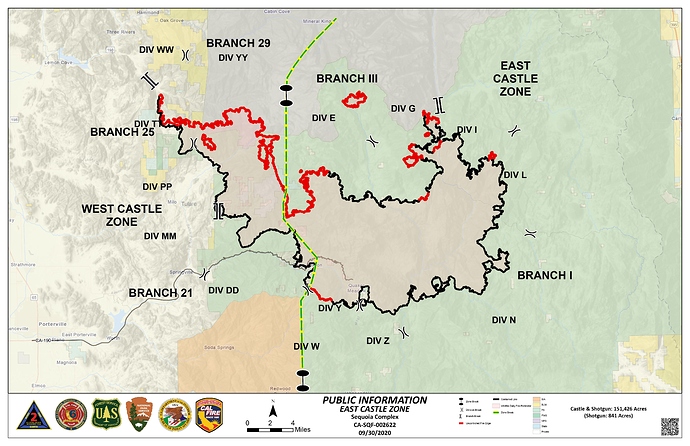
Friday, October 2nd, at 3 PM, the highway (Great Western Divide / M107 - via Kern / Cal Hot Springs) is being opened for Ponderosa residents to return. Highway 190, above Redwood Dr., remains closed.
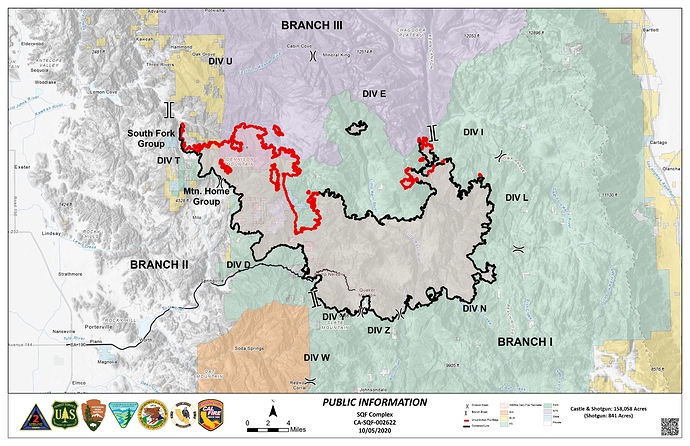
Today Monday Oct 5th…
Big change in weather ahead. huge drop in temps by weekend and possible rain on the fire however it still remains to be seen how far south the rain will actually make it… Wind with the front could be an issue if no rain materializes.
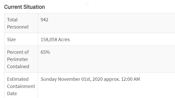
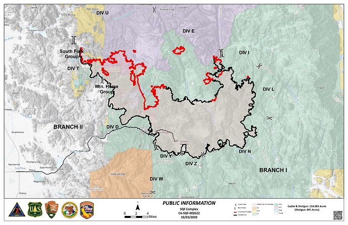
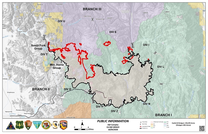
Not digging how it’s making runs towards Homer’s Nose. If it crosses the ridge and establishes itself in the East fork drainage, it could get ugly…
Hats off to the crews working in that country. Steep and a crazy fuel bed in areas.
East fork has a lot of beetle trees but granite at the top. Would be a rough go.
I’m assuming this was a planned burn operation to strengthen the contingency line from case to homer’s. Appears to be some slop over, possibly spotting on the north side.
Fingers crossed that they tie it in. It could get quite nasty in that East fork drainage.
Watching the time lapse of Blue Ridge from last night and looking at the satellite fire detections this morning it seems certain that it’s at or over the ridge.
I believe the idea of holding the ridge was abandoned. On the north side the plan appears to be to hold it at the east fork, so I’d expect it to back down to the north until it rains. On the west side they are working off the dirt road between Oak Grove and Case Mtn.
The 2018 Eden Fire burned to the east of Coffeepot Canyon which may slow things down, but I expect Coffeepot Canyon itself will be “interesting”.
Wow. Thanks for the insight, not that I like it, but it is what it is.
We have a historic family cabin in Silver City. Obviously watching this closely. Any intel (even if you have to pm me) is greatly appreciated
Judging by the degree of resources thrown at the Kern Ranger Station, I would imagine they’d get even more outside help for Silver City. Look at the tree mortality rate maps for the Sierra Nevada published by USGS and NRCS. Interesting to note that the highest mortality rates pre and post-2014 drought are Mountain Home, South Fork, upper East Fork. Mountain Home to Isabella has recent and major fire history. The South Fork and East Fork, both of which are less accessible? We’re super lucky it’s been burning ‘cold’ with an inversion over this thing with dry fuels in the 97 percentile. With development encroachments on the docket, and absolute disregard for the WUI, I fear this type of megafire season in the southern Sierra is just the very beginning.
The fire is in South Fork. That part of the South Fork neighborhood is in Very High Fire Hazard Severity Zone. New mandatory evacuation orders were issued yesterday.
Looks like another big firing op underway.
http://www.alertwildfire.org/sierra/index.html?camera=Axis-BlueRidge1&v=81e004f

