3 Likes
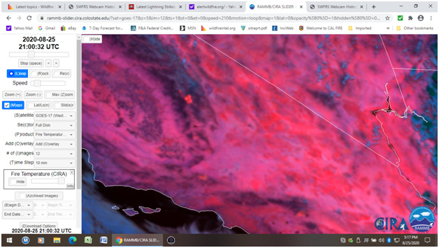
Here’s the latest IR from last night they finally got. It got across the main Kern on the very north end to the east and well established across the Little Kern on the west.
3 Likes
I will go ya one better and make the resource update-able. Click on the link, (or cut and paste if needed)then save as a Bookmark once opened in a browser. Then you can open the Bookmark with all of the correct IR settings and refresh it as often as needed, and the user can zoom in and out.
https://rammb-slider.cira.colostate.edu/?sat=goes-17&z=5&im=12&ts=1&st=0&et=0&speed=130&motion=loop&map=1&lat=0&opacity[0]=1&hidden[0]=0&pause=0&slider=-1&hide_controls=0&mouse_draw=0&follow_feature=0&follow_hide=0&s=rammb-slider&sec=full_disk&p[0]=fire_temperature&x=13875&y=3626.5
4 Likes
Looks like the wind has shifted to the west and the fire is starting to move east.
3 Likes
Its a bit blurry & jumpy video, but the SQF / Tulare County fire just had a virtual community meeting. about an hour long with Q& A at the end, but starts with an operational update.
2 Likes
N66gw is mapping the fire.
17,998 acres.
5 Likes
Looks like Shotgun and Castle got combined into SQF Complex:
https://inciweb.nwcg.gov/incident/7048/
There is another fire to the north on the Fresno/Tulare line. Anyone know what that one is?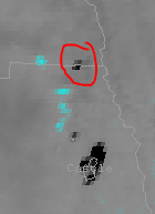
2 Likes
Two fires actually, arroyo on the Fresno county side and rattlesnake on the Tulare county side of Kern river canyon in Sequoia national Park.
3 Likes
N66GW was mapping again and looks like they did the arroyo and rattlesnake fires also.
2 Likes
20,979 acres.
3 Likes
CA-KNP-Moraine
http://www.wildcad.net/WCCASQCC.htm
1 Like
22,076 acres. N66gw is enroute for another mapping flight, tanker 160 made it’s last drop for the day and is headed back to Fresno.
3 Likes
23,675 acres.
2AL, AA51, tankers 160, 78, and 76 working along with a couple of helos.
1 Like
AA was concerned about the east winds pickup and pushing the fire to the point it’s threatening the west line.
AG Command 169.15
3 Likes
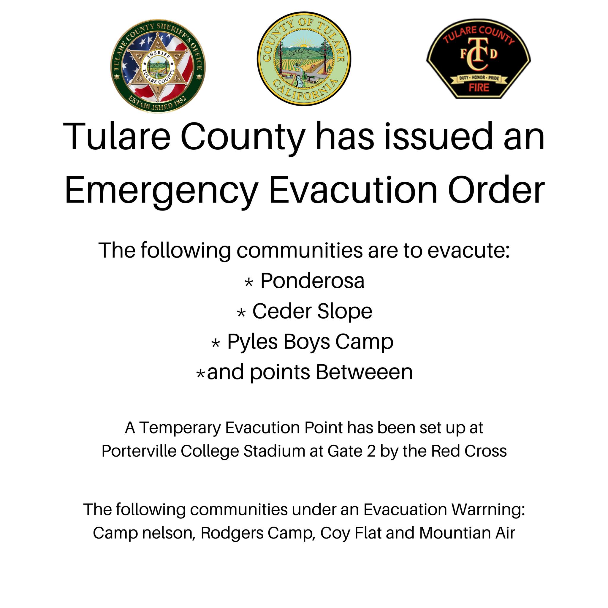
Evacuation Orders for Ponderosa, Cedar Slope and Pyles Boys Camp including points between.
Evacuation Warning for Camp Nelson, Rodgers Flat, Coy Flat and Mountain Air.
1 Like
Is there any broadcast info for the incident? I know we can normally almost never hear feds radio traffic here.
HAPPENING NOW: Mandatory Evacuations Underway for Communities Impacted by the Castle Fire
A MANDATORY EVACUATION ORDER has now been issued for people in the following areas: Ponderosa, Cedar Slope, Pyles Boys Camp and points in between.
For evacuees who need somewhere to go, a temporary evacuation point has been set up by the Red Cross at Porterville College Stadium, Gate 2.
As of now, the areas of Camp Nelson, Rodgers Camp, Coy Flat and Mountain Air are under an Evacuation Warning.
Sheriff Boudreaux wants to ask everyone to take the orders seriously. If you’ve been told to evacuate, please do so. It’s for your safety and that of your family.!
2 Likes