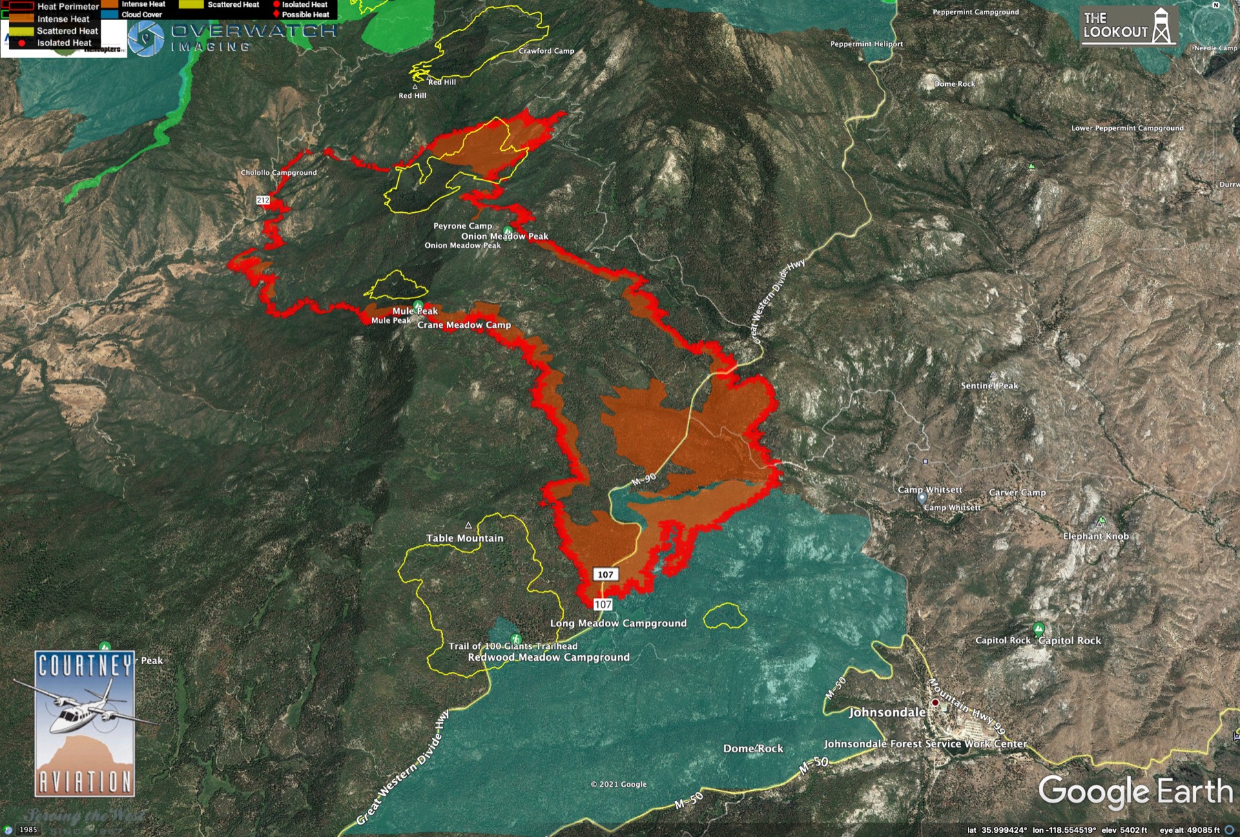
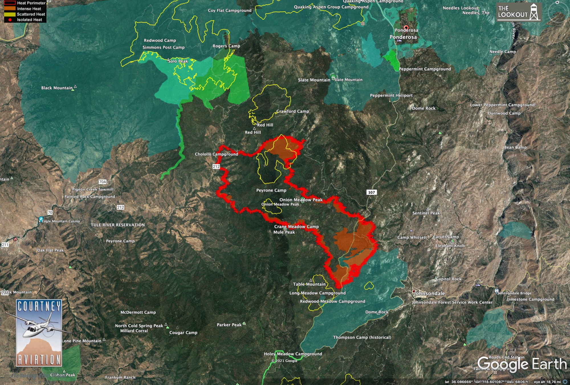
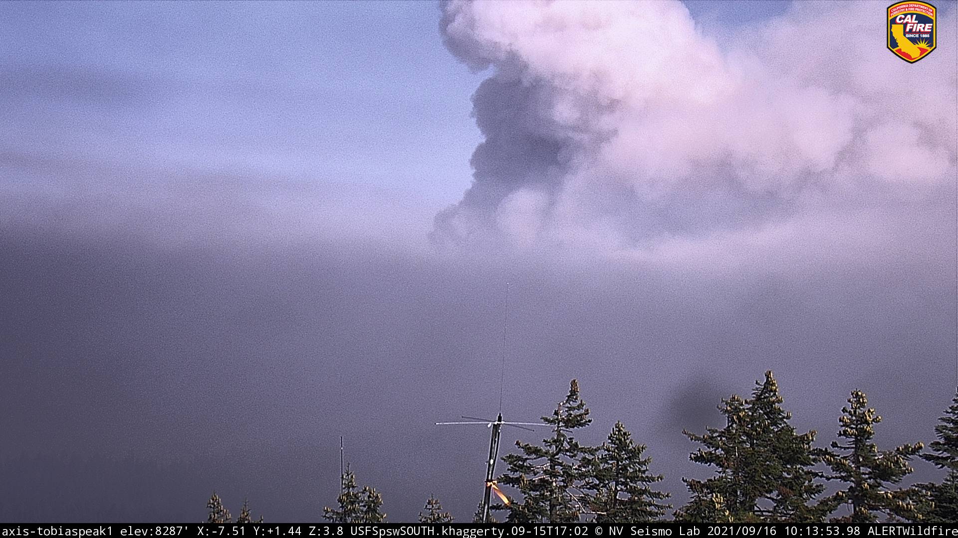
6 hour timelapse from Tobias showed very active fire moving east overnight. This morning it is pretty smoked out in the Kern drainage from Tobias, so difficult to gauge actual activity and location for now based on cams. However Caltopo has updated pins dropped from 0453 hours this morning showing large east/southeast growth all the way across 190 and Lloyds Meadow Road and onto the Kern. If the IR is correct and not picking up heat from the column, that means Johnsondale/R Ranch might be impacted? If any experts want to chime in on that I would be most appreciative. The last Courtney IR flight was at 2130 last night and verifies fire out to 190 with spots across 190, so the Caltopo heat signatures might be right. Still no IAP on the FTP server so resource commitment is still unknown.
NWS states the weak trough will remain overhead for now, but the bigger concern is the frontal passage on Sunday that has forecast uptick in winds for the mountain passes, with a reversal and weak offshore flow after that. Could be interesting.
https://caltopo.com/map.html#ll=36.01307,-118.52411&z=13&b=t&o=f16a%2Cr&n=1,0.25&a=mba%2Cmodis_mp
20210916_Windy_IR_Topo_11x17.pdf (1.0 MB)
Posted IR maps from 9:30pm here:
Thanks Zeke! Better way to access than my downloaded pdf.
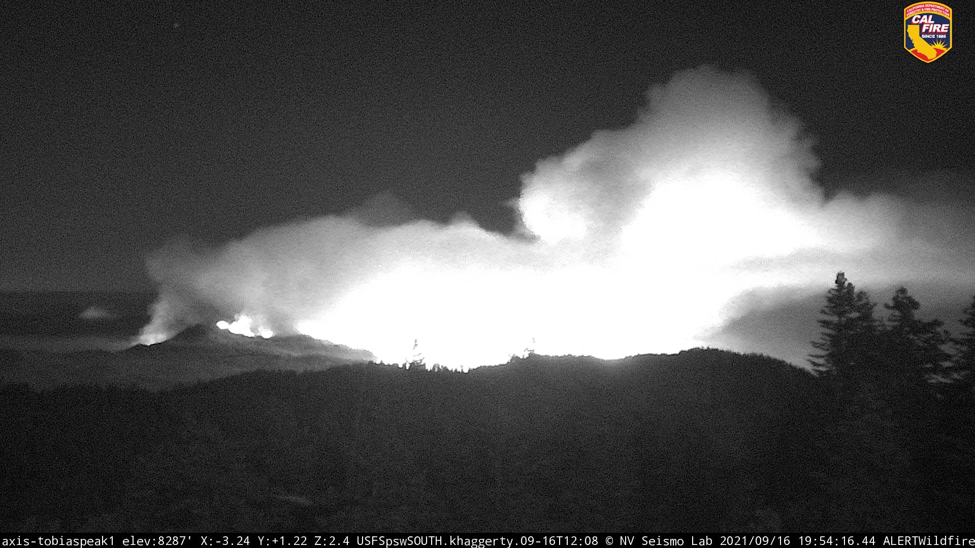
She shows no sign of slowing down, Just took this SCAP. Running hard in heavy fuels. Winds still out of the West. I did a 12 hour time lapse and it was pretty wild. It was off to the races all night…
Evacuation Warnings posted for Johnsondale/R-ranch and camp Whitsett BSA. 190 closed at Ponderosa.
https://tularecounty.ca.gov/emergencies/?fbclid=IwAR0ZMR_4KikdgAKHzqntgvWdifR-Z4pmMK-BxULnFBQn-oW063CfgNLWo8Y
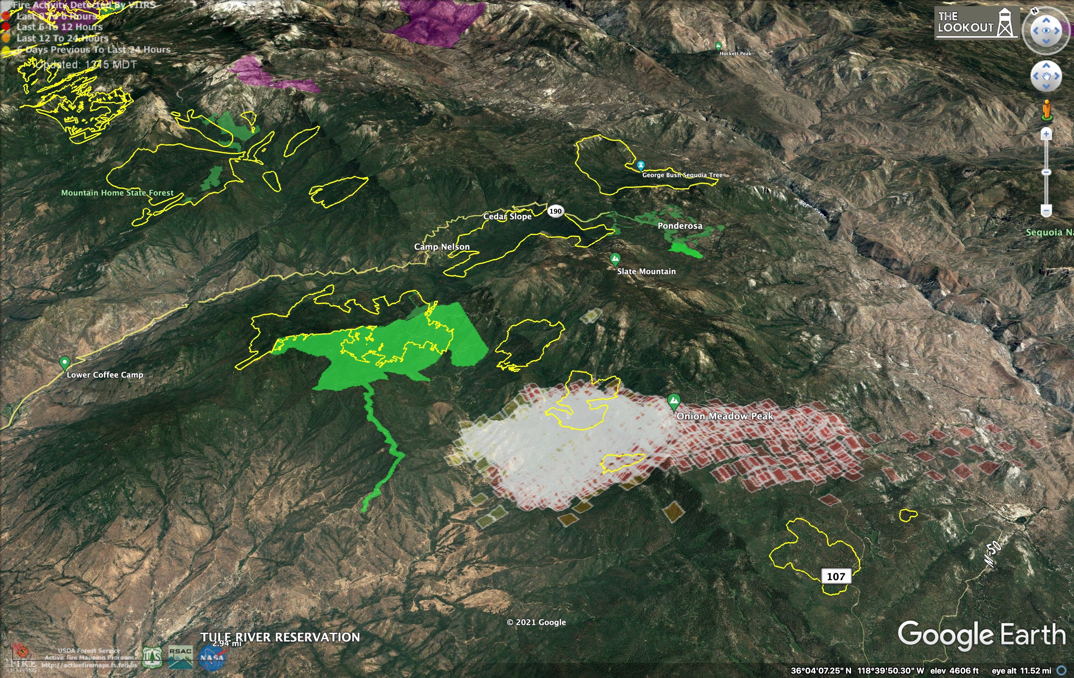
Here are some maps we just made using data from the US Forest Service and National Park Service showing the locations of giant sequoia groves (yellow outline) along with prescribed fires since 2010 (green). The heat colors on here are from 2am, 9/16/2021.
Fire is definitely down into areas east of and below Windy Gap based on the Tobias cam based on the elevation of smoke production.
Evacuation Orders
AA requesting 4 LATs and 2 VLATs for impending structure threat. Haven’t checked for heads direction for community threatened. Probably one of those posted by muni_captain.
Johnsondale/R-ranch and camp Whitsett BSA.
EDIT UPDATE: due to immediate need, getting 2 S2’s from Porterville.
8 Tankers if they get them all. So far, 76, 78, 160, 164, 02 @ 14:20
Erickson 105 also heading up from Fox field.
Update: 910 coming from SBD, 912 from MCC
Yep the S2’S are working above johnsondale and camp whitsett now.
looks like 912 on its way from MCC…anyone else have track on other VLATs???
RAWS Johnsondale readings conducive to the fire activity:
1 pm Solar Radiation 74.1 kind of Smokey
Wind direction 244 Gusts 12.0
Air temp 80.0
Fuel temp 95.0
Fuel stick 6.8 not critical
RH 24
2 pm Solar Radiation 69 smoke clouding out sun
Wind direction 259 Gusts 12.0
Air temp 81.0
Fuel temp 94.0
Fuel stick 6.4 not critical
RH 22
3 pm Solar Radiation 55 smoke clouding out sun
Wind direction 236 Gusts 16.0
Air temp 80.0
Fuel temp 89.0
Fuel stick 5.9 quickly drying
RH 23
Johnsondale California Daily Summary
T910 from SBD is enroute and 10 out…
Ponderosa now in “evacuation warning”
Tulare County Sheriff via AlertTC.
Mixed Type 1 STEN en route from Area C/E LAC 1204A, ARC E106, MPK E63, GLN E26, WCV E1, SFS E821, PAS BC 3 Leader.
EDIT at 0900: Sent to Johnsondale Structure Group.