Anyone have logs section contact info you can private message me. There are lots of open and utfs
Could possibly tap south ops for the 8 UTF heavy equipment bosses? Fed dozers are usually come with a few and are able to run without even needing one.
What position are you looking for? I know they need 2 RADO’s
STEN Type 3 - 2
DIV - 2
TFLD - 6
HEQB - 8
Falling Module - 5
RADO - 2
SOFL - 2
SOFL1 - 1
EQTR (Q) - 1
LTAN - 1
Are those CFAA approved? I work for a very small rural agency that uses retired folks that may be able to help if it is CFAA.
I’m going tomorrow on an approved CFAA order.
Any trainees accepted? I have RADO and COMT task books open and am ready to roll.
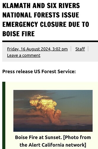
Looks like it got legs this afternoon and it’s running a bit. 2 hour timelapse shows it well: https://ops.alertcalifornia.org/cam-console/2304
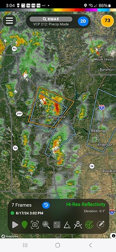
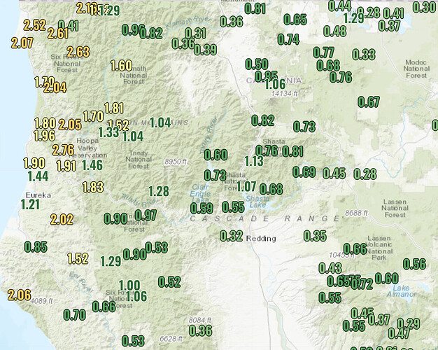
Hopefully they get some rain over the fire tomorrow with the predicted thunderstorms.
50% chance of rain for this area tomorrow afternoon?
NWS Orleans, CA Forecast for Saturday: Looks to be beneficial without turning into a mud bog.
Showers and possibly a thunderstorm, mainly after 11am. High near 78. Calm wind becoming southwest 5 to 8 mph in the afternoon. Chance of precipitation is 80%. New rainfall amounts between a tenth and quarter of an inch, except higher amounts possible in thunderstorms.
IMET:
SATURDAY:
Areas of smoke in the morning lifting around noon. Rain and isolated thunderstorms in the afternoon and evening. Chance of rain 70%, Chance of thunderstorms 20%.
Critical weather: Small potential for outflow winds from thunderstorms.
WIND (EYE LEVEL): Sheltered areas: Downslope/down valley 1-3 mph through 1100 then upslope 2-6 mph. Unsheltered areas and wind-aligned drainages: Southwest 5-8 mph through 1100 then increasing to 10-12 mph with gusts 17 - 22 mph.
MAX TEMPERATURES: 67-75 lower slopes and drainages, 64-69 mid-slope and above.
MIN RH: 57%.
INVERSION: Moderate mid-slope… mixing out 1300 - 1400 hrs.
Extended outlook: Sunday through Tuesday: Lingering light rain and drizzle possible Sunday morning. Temperatures will remain cooler than normal through the remainder of the weekend and into next week. Areas of smoke will likely remain an issue through the morning hours with the inversion holding on until the afternoon. There are no critical fire weather concerns.
This morning’s Lookout Livestream evaluates progress in containing the western portions of the #BoiseFire, and reviews preliminary satellite imagery of the fire’s severity and effects.
https://youtube.com/live/I_aOrS0QjYw
Rain starting to show up on some of the nearby cameras, especially those SW of the fire.


