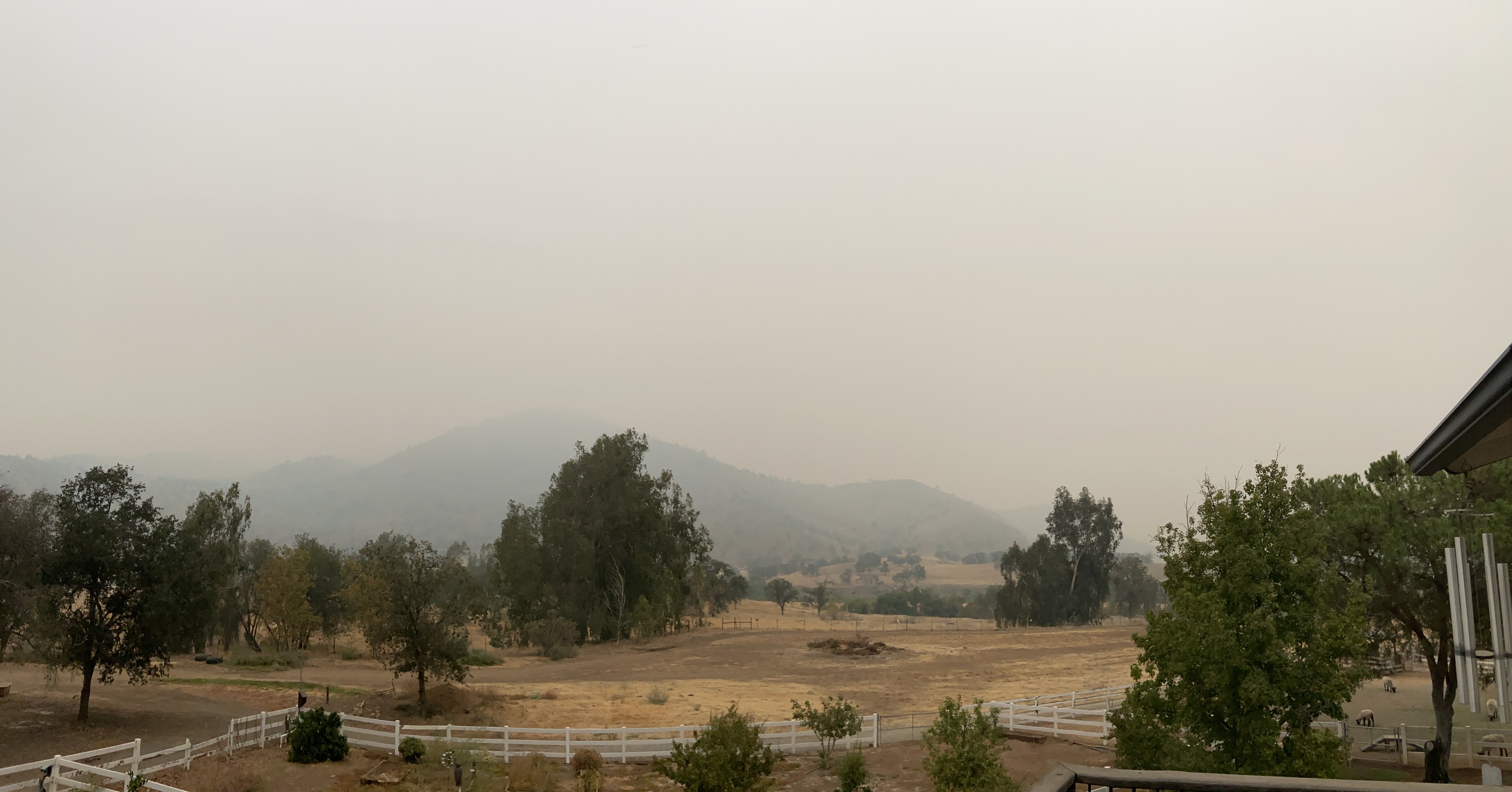
Heavy smoke in Three Rivers this morning. Visibility less than 1/4 mile
3 Likes
The smoke in 3 Rivers would be from the KNP complex.
3 Likes
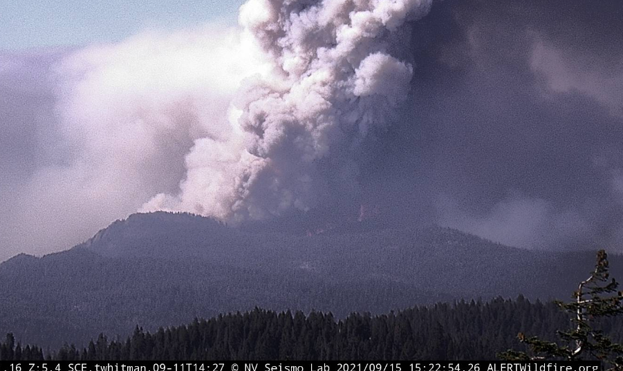
@pyrogeography , Zeke posted on the Lookout, regarding “good fire” on the Dixie, a great example of what low intensity fire does to restore the forest. https://youtu.be/eydp4MIG0y8 The 2017 Pier and 2020 SQF Complex had intense heat, completely nuked wide swaths in the Middle Fork Tule, and torched 10% of the entire Giant Sequoia (Gigantea, not Sempervirens) inventory. Looking at the activity in the Peyrone Grove now, South Fork, it is a bit troubling. On the plus side, there are currently no communities at risk, and this fire could run into the 2016 Slate, 2017 Pier and 2020 SQF perimeters. At least the Slate was not a nuke-fest and that area benefitted from fire. Looks like fire has made it to the ridge adjacent to Windy Gap: CalTopo - Backcountry Mapping Evolved
9 Likes
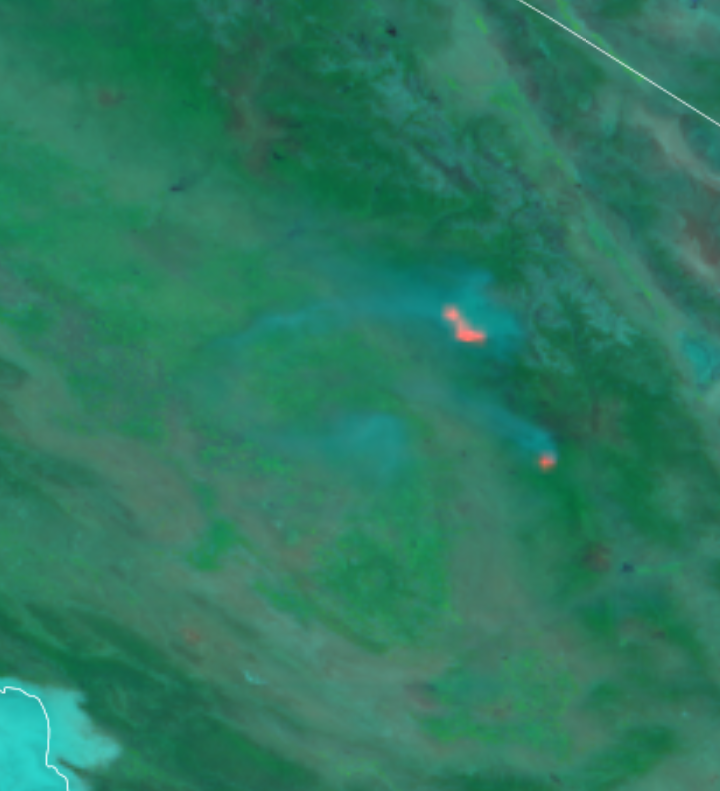
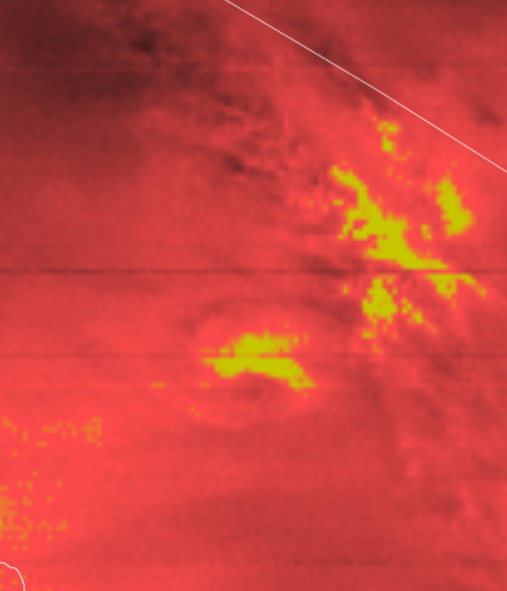
Here is a bluesky run from this morning - I think the model didn’t quite account for fire activity picking up overnight because there is way more smoke now. Got alot of smoke over the San Joaquin this morning.

5 Likes
Yes, in the notch between Onion Meadow Peak and Mule Peak. Plus side is that it pushed the fire eastward, away from Slate/Nelson and Ponderosa and Peppermint/Dome Rock area. Down side is it is creeping towards Pine Flat/California Hot Springs.
3 Likes
Looking at the fire history map this one looks like it can push straight east for a bit. If it gets a red flag day or two could push to McNally scar. Any one have intel on what the fuels are like on the western side of that burn after 19 years?
2 Likes
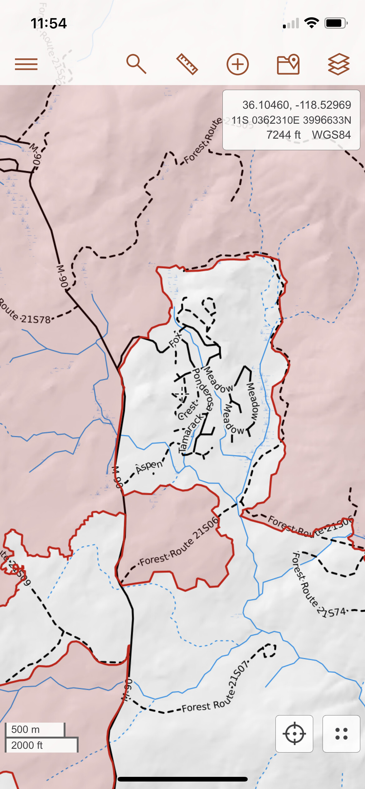
Not this area, no. The fire burned west and north of this current footprint. Peppermint and the area around Dome Rock and Crane Meadow were spared. The SQF took out the upper parts of the Middle Fork of the Tule, around Camp Nelson, Sequoia Crest, Cedar Slope and areas surrounding Ponderosa. The Windy is burning in fuels that have no fire history that I am aware of. For reference see this Caltopo linked here with fire history outlines.
https://caltopo.com/map.html#ll=36.04438,-118.45322&z=11&b=t&o=f16a%2Cr&n=1,0.25&a=mba%2Cfire%2Cmodis_mp
4 Likes
Negative. Everything north of Ponderosa burned in the Castle last year. The west side of the Western Divide that the fire’s currently chewing through is dense. The east side has the McNally scar, and a lot of snags leftover from that.
4 Likes
Have you put boots on the ground there yourself??
I have, was a part of the holding forces on the west side of Ponderosa on Western Divide
1 Like
Copy thanks good info , I haven’t actually been up there in a few years, thanks
1 Like
Giant sequoia (Sequoiadendron giganteum [Lindl.] Buchholz) depends on fire for natural regeneration (Hartesveldt et al. 1975, Harvey et al. 1980). Fire in these ecosystems creates forest canopy gaps, increases understory light penetration, exposes mineral soil, and removes shade-tolerant competitors from the forest understory (Harvey et al. 1980, Stephenson 1994), creating conditions suitable for giant sequoia regeneration
Yep! The SQF did a prescribed burn Memorial Day weekend in 2017 on the Black Mountain Grove along 21S94 and out to Solo Peak 21S12. It cleaned out tons of fuel and left the forest looking very park-like. The 2017 Pier bumped the edge of that prescribed burn later that summer and it was beneficial in defining the perimeter.
6 Likes
Was up there supporting the burn opp around Pondo last year. It definitely burned pretty well around it and cleaned a lot up.
1 Like
So I noticed that there is a burn scar to the west of johnsondale/r ranch. What are the chances of that keeping it out of j-dale?
hmmm, not even the Manter fire?
Edit: I see now on the map. I use to pack into that area on horseback and looper to clean up the low hanging branches on the horse trail to windy gap. Gonna be a loss of historic lumber camps in that area if it drift South west to Table Mountain and the fallen grove. You guys stay safe out there,
2 Likes