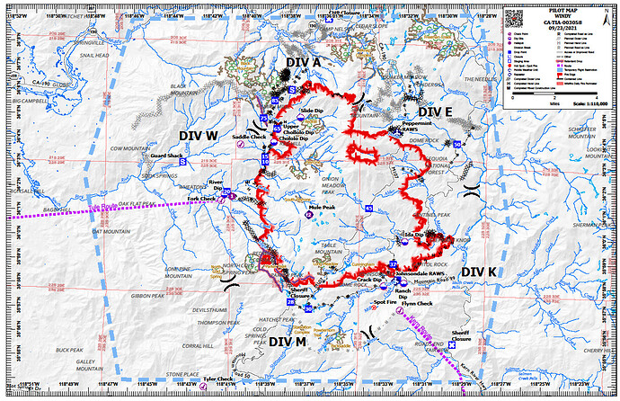
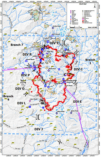
Thank you all, the maps and insite are awesome. I’m vaguely familiar with this area, that Southern end is vary worrisome.
The Tobias camera is back up. It looks like it will take a direct hit before the day is over.
I read that Mule Peak lookout burned despite protective measures. Any confirmation?
Mule Peak was a victim.
Tobias has a large clearing around it.
Just left there this morning. There is a spot in the drainage that is causing concern to the North of Sugarloaf but when I left 2 hours ago it was all good
see link I just posted…
Re: Sugarloaf… I know they had some folks in there yesterday and were scraping up more spare resources this morning. Heard some traffic about a spot fire in a drainage below some cabins near Sugarloaf last night but nothing since. That Tobias camera activity is pretty telling thought
Did they order some local Tulare Co resources to the fire (for structure protection?) - hearing some local sounding units on the county/TUU channel going en-route to the incident.
Currently Tulare County has two task forces on the KNP and one on the Windy pretty much on draw down in county and not sure if anything else is being committed without leaving stations uncovered
Headed up on the Windy with little info. Anyone have an Avenza link for an ops map?
I looked around and couldn’t find anything, but clearly something happening north of Lake Isabella.
Sorry if I missed something already posted.
South East part of the Windy fire.
Everything is through the ftp site
Interesting I saw a US Navy 737 with tail number CNV4837 that flew over these fires from Fort Worth, on radar. Mission is not IDed beyond takeoff location. But, why would they. NAVAIR naval craft.
This is what I could find for smaller sizes as quick reference. One is 25th other is dated 23rd. The current detailed
maps are over 15mb too big to post.I converted these to .png so, print quality maybe poor.
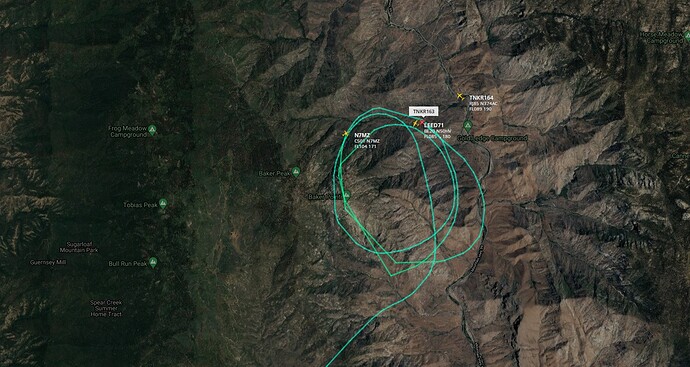
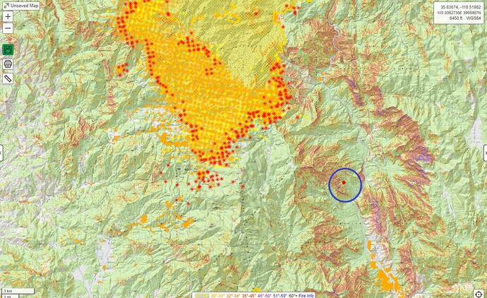
That’s what I thought at first; but it’s not on the heat map yet and quite a ways from the KNP/Windy fire? The blue circle is where the air tankers were flying.
I’m not seeing else either and it doesn’t look like a normal heat marking used on caltopo.
Those marks, the red dot and blue circle, are made by me for a place of reference.


