Tobias CAM had a nice glow on at 6am this morning but, looks like its off line
currently: (IR says it hasn’t reached the site)
http://www.alertwildfire.org/sierra/index.html?camera=Axis-TobiasPeak1&v=fd40742
Here is some reporting from Lookout correspondent Chuck Ervin, with maps from Ryan Stephens: Southern Sierra Fires – 9/25/2021 – The Lookout
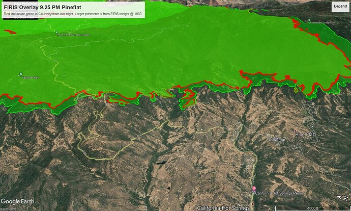
Pretty quiet this morning in Pine Flat. Fire made it to the NW part of the community near Flying T and Rocking K yesterday, but there were no issues. Tons of resources remain in the community doing various prep work. Otherwise no fire has entered Pine Flat. Very smoky conditions still exist. Winds pretty much calm. Fire remains well north of M56 and King George Peak as well at this time. Pretty quiet right now.
Tobias peak might get a little hot soon.
http://www.alertwildfire.org/sierra/index.html?camera=Axis-TobiasPeak1&v=fd40742
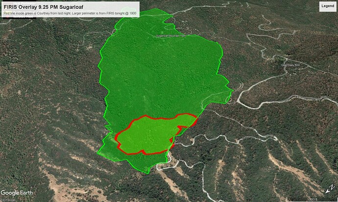
AA requesting 2 LATs and 1 VLAT to get a rhythm going for a few targets (structures) around Sugar Loaf… (spot fire threats). A Copter is in recon and bucket drops seem viable as well as fixed wing.
I believe Mtn.Aire was secondary targets or mission if they get smoked out.
Comm’s from the Command Channel traffic indicate/warn that fire impacting tobias could unlink the command repeaters, since the HUB link repeater is up there. Fallback will revert to forest fire ch.2.
EDIT 14:45
Tobias is too smoked out to work.
Two LATs (RJ85#163 and #164) plus LEED71 are all on scene right now. Expect VLAT from
Santa Maria to arrive shortly to join the fun!
16:10 I believe Lead cancelled the VLAT. It won’t be viable for these runs.
164 and 163 might have limited time to drop. Getting too smokey.
I don’t even see the AA on radar now.
Firewatch 51 did an IR early AM pass then up to he Caldor, now on return to Fox.
These posts are now getting time stamped hourly instead of minutes ago.
Incident related comments only on this thread
I am being told of a crown run near Peppermint. Will add to this when I get more, if I can.
EDIT: Just watched the FIRIS IR video and fire was east of Peppermint Helibase and active in lower Peppermint. The helibase is intact.
AA, lead and all 2 tankers are off the fire @16:30. I think they got one drop run in on a small group of cabins.
19:00 EDIT:
Div. C reports 100 acre slop in Peppermint Creek Falls handline. Planning on engaging tonight. If conditions allow they may do some firing around dawn to cleanup the line.
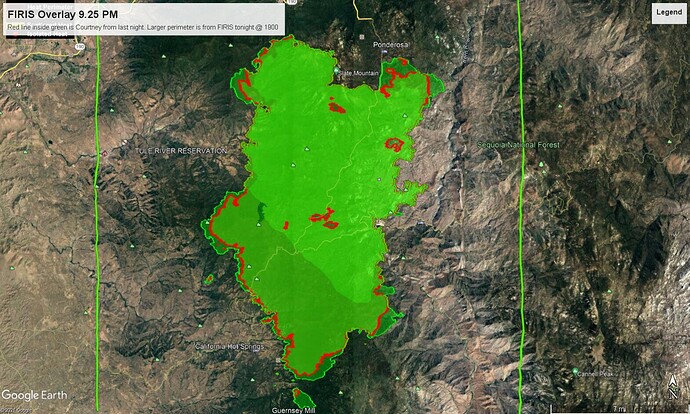
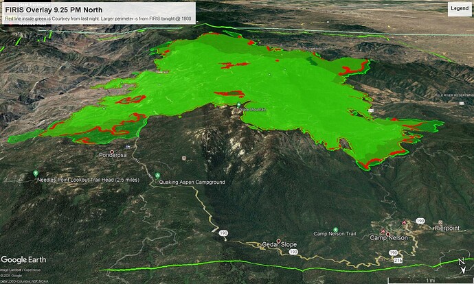
Tonight’s IR flight map update from FIRIS with Courtney IR in red from last night inside the new perimeter.
Overview
North End View
My intel from boots on the ground late last night…
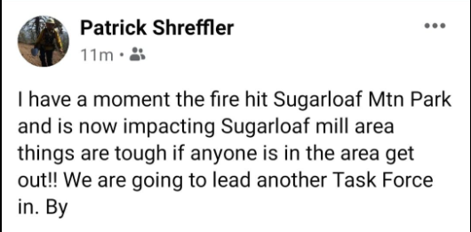
- Spot that took off south of PF yesterday ran to Sugarloaf and Tankers had to bail due to visibility. Reports of structure loss there. No details yet.
- A lot of Cal Fire presence now in PF . A lot of movement south of town with dozers, crews and engines. Working on line construction to keep the fire from swinging around the south end of PF and heading back toward Hot Springs.
- It was eerily quiet in the village last night. Heavy smoke conditions. A LOT of structure protection in place in the village. Red glow on 3 sides, but have kept it out of PF thus far. Continued patrolling and vigilance for spots.
- Fire rolled over Tobias early this morning. Amazing enough cam is still up. They wrapped a lot up there late yesterday so we’ll see.
The 12 hour time lapse on Tobias 1 shows impressive movement in a little time. It also shows the wrap job on some equipment up there.
Will have to wait a few hours to see if Caltopo heat continues to show in the 2016 Cedar burn scar but, it’s looking like there is enough fuel to carry on it’s southern spread.
https://caltopo.com/map.html#ll=35.80656,-118.5454&z=12&b=t&o=f16a%2Cr&n=1,0.25&a=mba%2Csma%2Cfire%2Cmodis_mp

