They can be.
Sounds like they are evacuating Gorman Ranch rd. That’s below Michigan Bluff, mid slope above the North fork of the American, above Mosquito ridge Rd. Road starts across from the green gate for going down to Horseshoe bar and the tunnel chute. Once again steep, brushy and all around nasty country
3 Likes
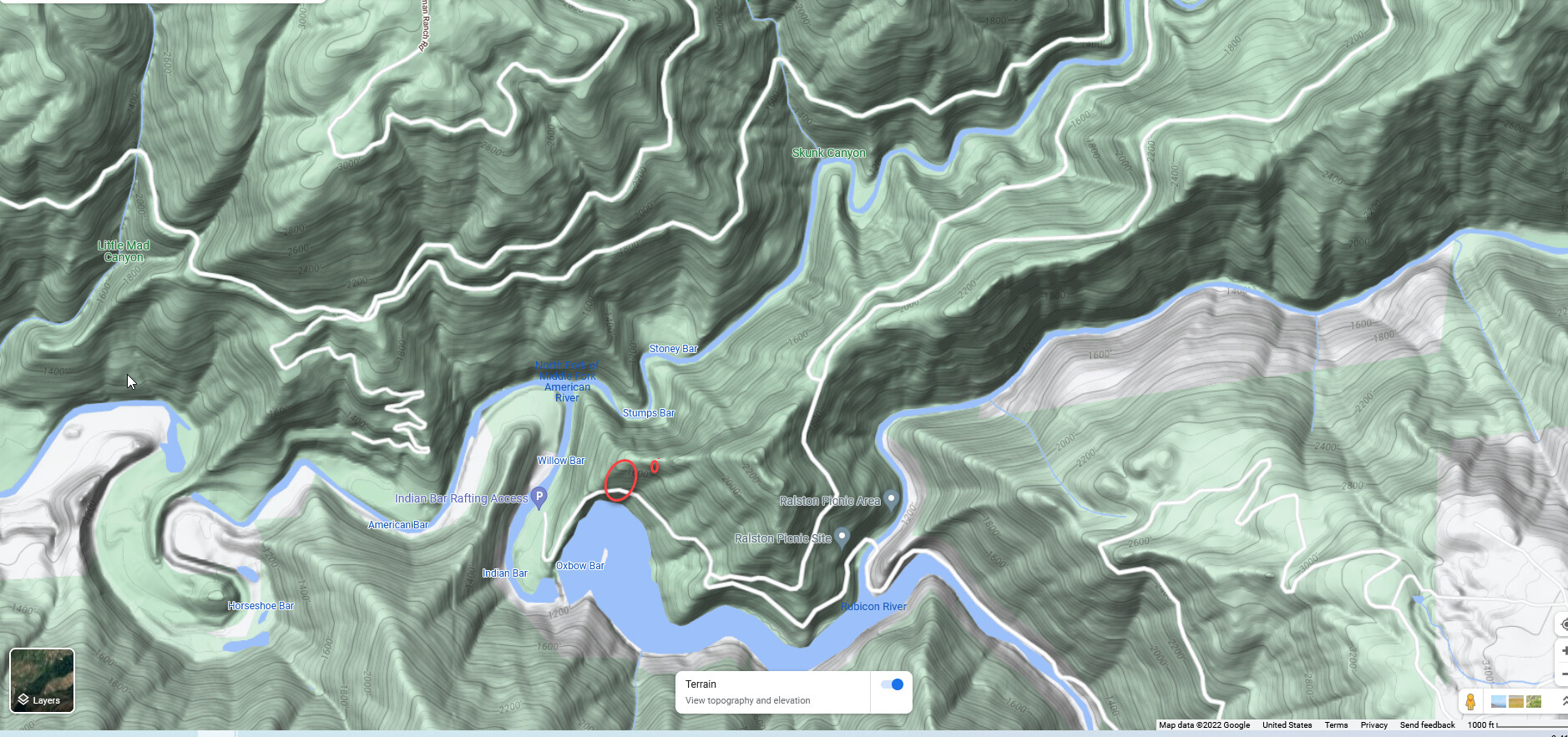
Looking at the Cal Fire AEU video it looks like the fire runs from the water’s edge to the ridge where I’ve got the larger oval. The small circle is a spot fire. It looked like the fire was hanging up on the ridge, but that video is 3 plus hrs old. Looking at all the cameras, it looks like its well past the ridge and on the run.
4 Likes
Reporting a spot fire near Circle Bridge. Which crosses the North Fork of the American and is prompting the evacs of Baker Ranch as well. Sounds like they are getting up canyon winds. Once again, not good.
2 Likes
If that location is correct, or even close, that could be a real problem. Very close to getting across the North Fork of the American, and if it does that, it could run up the slope to the evac area.
2 Likes
Watch duty is reporting the 10 acre spot is established and the original fire is 50 acres now. Reporting significant increase in fire activity
2 Likes
(If I had a nickel for every time this summer that thunderstorm outflow winds kicked a fire in the pants when it was sitting at the bottom of a nest of drainages… I’d have two nickels now and I’d be nervous.)
10 Likes
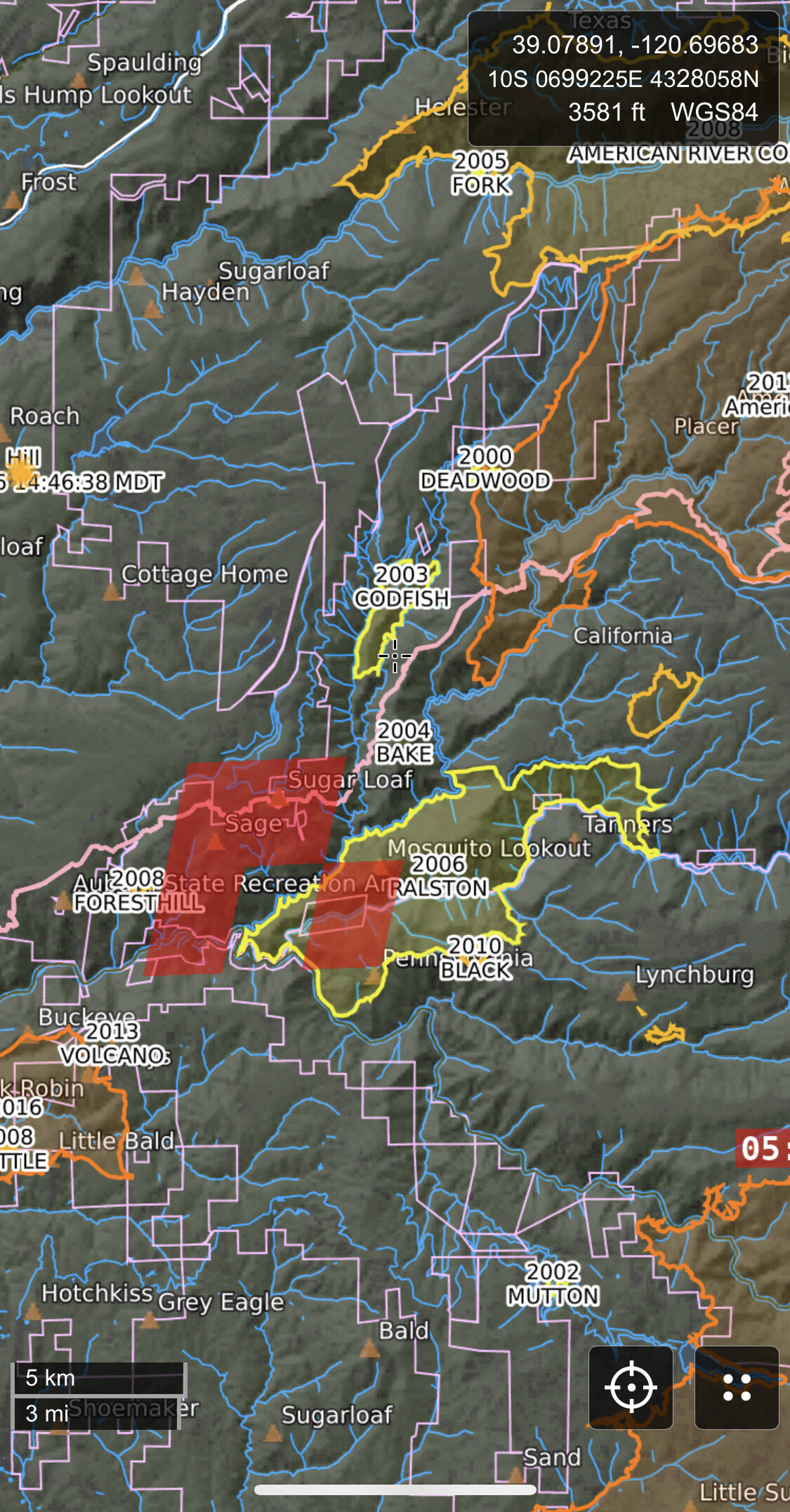
They said it’s across Mosquito Ridge Rd in section 33 half an hour ago. If I understand correctly, it is well on its way up the slope now.
Sounds like difficulty engaging due to darkness.
3 Likes
Gorman Ranch compromised, 3 dozers, Code-3, en-route to drop off at Michigan Bluff Rd. at Baker Ranch it sounds like.
3 Likes
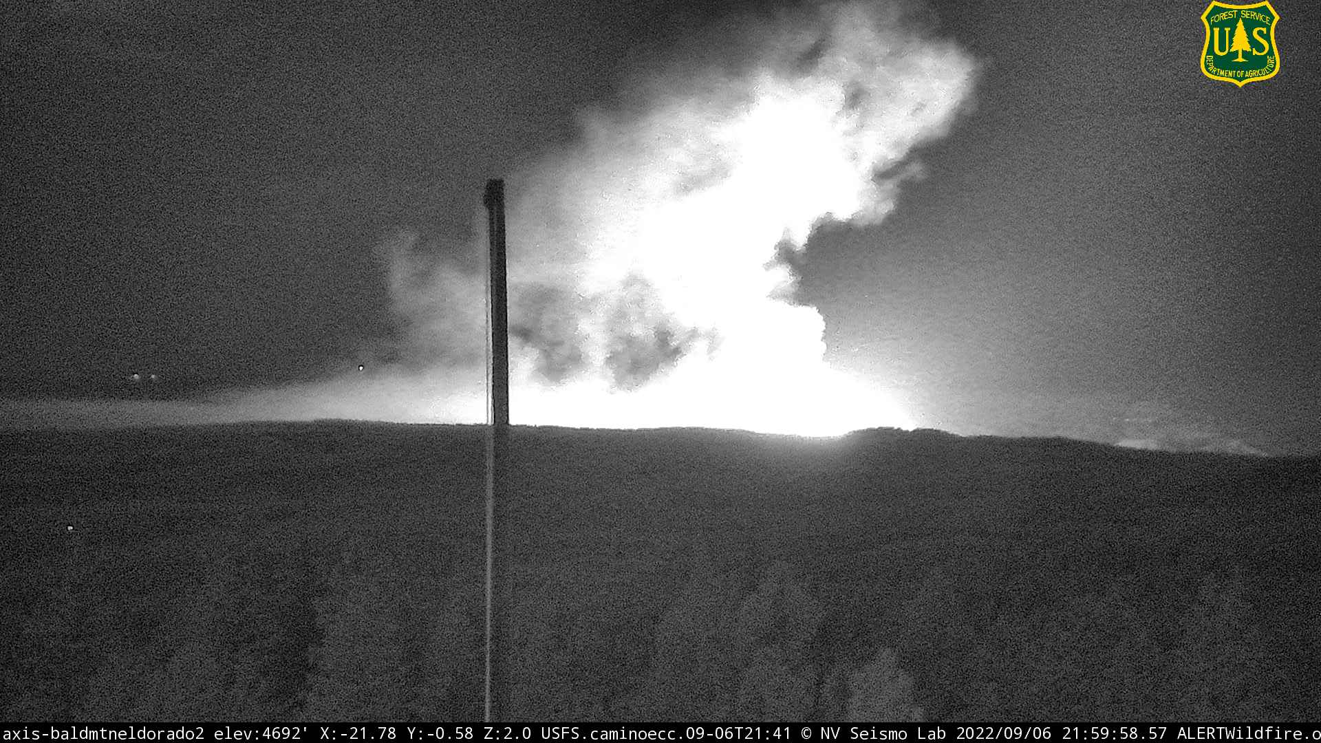
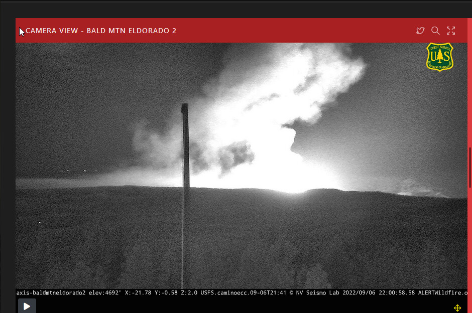
A spot at Circle Bridge would be over that ridge and about 1.6 miles up-river from the origin. That’s some impressive movement for a fire that was still just a few acres at sunset. Fire is just blowing up right now on several of the cameras. Bald Mtn. 2 is below. (#1 camera still offline.) This camera was just barely showing a little glow an hour and a half ago. Looks like a long and frustrating knight for the folks on the line. Stay safe.
4 Likes
Just toned out two dozers to Baker Ranch code 3. Not sure if that makes a total of 5, but concerning none the less. Heard Diamond dozer responding
PCSO evacuating Chicken Hawk, now.
3 Likes
Ordering a dozen dozers and and a bunch of falling modules would not be misplaced in this situation IMHO. There is some good dozer country and some treated fuels which may provide an opportunity to pick things up as they move if resources can get in place.
2 Likes
Chicken hawk is last road before Foresthill Rd… she’s off to the races
4 Likes
Looking at the one-hour time lapse of the Omo Ranch camera, this thing just erupts at about 21:55 hrs. I suspect they’re going to be playing catch-up o this for a while.
4 Likes
I think you’re right. Fighting this in the dark is next to impossible and if she gets going up that slope, look out
3 Likes
Foresthill PCWA cam you can see it illuminating the trees on the other side of the canyon on the Georgetown side almost like daylight.
5 Likes
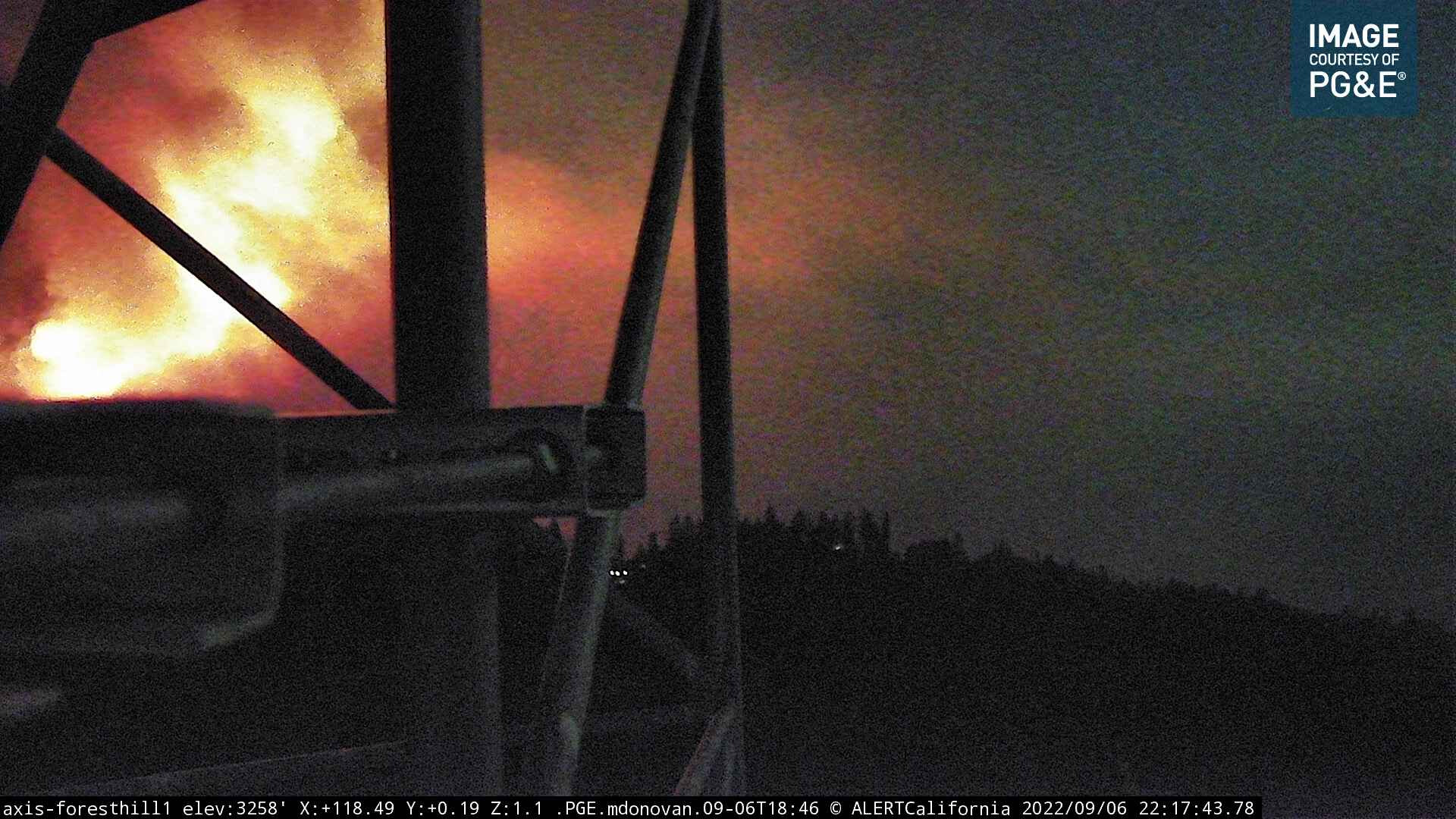
Bright enough to show up in color for a moment on the FH cam!
2 Likes
It’s not pretty country out there. Straight up and down in some areas. Similar country to the Electra Fire… just brush and timber with slightly more fire history but not enough to slow it down with these up canyon winds and not the best dozer access…
6 Likes