Put the 2 FF HCs together to form a Golf
Need a Strike Team leader.
And a order and request number
So? all of the FCs assigned the Castle are STL qualified. Just saying
Simple question: How can a non-firefighter or person (agency administrator) with little fire experience have a “comfort level” with an emerging fire or make critical, time sensitive decisions with lack of understanding or appreciation for the potential or life and community risks?
There are two things I don’t understand. #1 a good answer to your question. AND #2 why you directed it to me LOL
John you know the answer because you have dealt with the problem for 50 years.
Capt4711. Is not about you. I just grabbed the Reply button. Please accept my apology for pointing at you.
Problem is with egocentric agency administrators that must employ their authority even it they don’t get it.
Thank you.
Central Sierra tactical feed was created by a friend for the Creek Fire and now has been updated to the Washburn. Any radio freqs we have can be added easily.
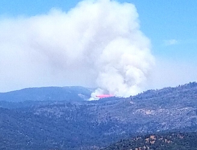
Looking at the cam, the bigger spot out front is starting to take off. Not good.
I feel like the Hawk was asking a rhetorical here. It’s a very good point though and it plagues the fire service in one form or another from LG to Fed.
It’s been trying to cap out for a while and probably will really get with it in the next hour or so.
https://www.alertwildfire.org/region/sierra/?camera=Axis-Deadwood2
History repeats itself as evidenced by many fires over the years that duplicate an earlier or many earlier fire footprints, i.e. Oakland-Berkeley Hills (1923, 1946, 1970, 1991).
The Washburn Fire must be closely watched to be sure it does not duplicate the 1961 Harlow Fire which burned nearby. Attached is the fire progression map for the Harlow Fire which I believe IMT_Geek posted a week or so ago at this website.
HarlowFireBurningProgressMap~July10-12,1961~28jun22.pdf (286.3 KB)
Got it thanks…
Many spots over the north head of the fire into Merced River Drainage.
GOES17 should light up a bright orange by night fall.
Mapped 466 acres before the spots.
Is there a place where someone can view the resource orders that are unfilled?
Just a little later than I thought.

