Come Hell or High Water

The atmospheric rivers feel like weeks ago, but the impacts of flooding continue to be felt and may for some time. Last week, four crews from the CCC Chico, CCC Los Padres, and CCC Pomona centers put their flood fight training to use in Merced County. The 60 Corpsmembers filled sand bags, installed wave wash protection, and even used some newer techniques and equipment. The end goal, a more steady levee along the San Joaquin River for residents of the El Nido community in Merced County.
Crews Hustle to Protect Four Miles of Levee in Merced County

CCC Alumni might remember Los Padres Center and the attached CalFire yards as the original home of the CCC Academy, where all Corpsmembers went through 2 weeks of rigorous training before assignment. The Academy was closed in the 90s and training was integrated with CalFire and other state and federal agencies in a more distributed way, reflecting the CCCs growth as an institution.

Crew Leader Training included a week with the obstacle course and puzzle pits built by CalGuard. We shared another PT challenge at nearby Cerro Romualdo Peak, one of the “Nine Sisters”.

5 Likes


Wikipedia has a very nice panorama photo of 8 of the 9 Sisters.

2 Likes
1 Like

Thanks for participating in the thread. Although I started it with the intention of having a place for intel about the rivers, a few other topics have been included; search and rescue, drought conditions, status of Tulare Lake, high-voltage battery fires and some international fire news. Aircraft and the CCC are other favorite topics of mine and my threads are usually peppered with these, too. Where we have intertwined intel between this thread; Turkey, K9s, storm chasing and others more fit for the leader’s intent, I apologize and thank you for your patience. We all should know that there are no substitutes for situational awareness, straightleg handcrew and water. Let’s make sure we stay in our lanes.

3 Likes

Snowpack has largely retreated from the coast south of Clear Lake and inland south of Bakersfield. There’s still snow at Big Bear, but rain-on-snow flooding isn’t looking like a factor in the Los Padres range, Santa Ynez, Ventura and the San Gabriels. Likewise for the Santa Anas, Cleveland and mountain ranges around Oceanside and San Diego.

3 Likes

Humbolt River around Battle Mountain, Nevada. The river basin catches water from a large watershed that covers about 80% of the land area in the image and almost a third of the total state. Not recent precip, this is the melt from the Fish Creek and Independence Mountains, especially seasonal creeks in the Humbolt National Forest.

2 Likes

Areal flooding of the Red River and tributary rivers and forks in North Dakota around Fargo. Primarily snowmelt. This basin serves a watershed stretching north across a statewide section of the border to Regina and Winnipeg, Canada, and eastward into Minnesota. Although snow depth is clearly less than points in the Rockies and Sierra Nevada, these areas have been receiving both rain and snow which may be contributing to accelerated runoff. Flooding that one might associate with rain-on-snow is also occurring in Minnesota, Wisconsin and Iowa.

The seasonal information from this article on the Red River of the North, from the University of North Dakota, is from 2009, however, it does explain four enduring features of the river that contribute to flood risk:

  1. SYNCHRONY OF DISCHARGE WITH SPRING THAW: The Red River flows northward. But, at the same time, spring thaw proceeds steadily northward along the Valley. Thus, along the Red River, runoff from the southern portion of the Valley progressively joins with fresh, meltoff waters from more northerly localities. If this synchrony is perfect, the consequences in the northern portion of the Valley can be truly disastrous.
  2. ICE JAMS: This factor is also related to a northward-flowing river system. Ice derived from the southern Valley progressively meets with freshly-broken ice in the central and northern Valley. Ice concentrations in this regime can only build, retarding or damming water flow.
  3. GLACIAL LAKE PLAIN: The Red River has incised a shallow, sinuous valley across one of the flattest expanses of land in the world: the floor of Glacial Lake Agassiz. Therefore, when the river floods onto this plain, areal coverage of the waters can become dramatic. Related to this physiographic factor is the young age of the Red River. In its present form, the Red River is about 9,300 years old and far too young geologically to have carved a significant valley-floodplain system. Therefore, the lake plain becomes the “floodplain” to this river.
  4. DECREASE IN GRADIENT DOWNSTREAM: “Gradient” refers to the slope of a river. In the region of Fargo-Halstad, the gradient of the Red River averages 5 inches per mile of length. In the region of Drayton-Pembina, however, the gradient drops to 1.5 inches per mile. During floods, the Red River at Drayton tends to pool due to lack of slope - the region becoming essentially a massive, shallow lake.
3 Likes

NOAA/NWS Spring Flood Outlook 2023
Interactive StoryMap and Video (6m42s)

StoryMap: 2023 Spring Flood Outlook (arcgis.com)

Video: NOAA/NWS Spring Flood Outlook 2023

3 Likes

Flood Warning issued April 17 at 5:06PM PDT until April 21 at 5:00PM PDT by NWS Hanford CA

  • WHAT…Flooding caused by upstream dam release is occurring.
  • WHERE…A portion of central California, including the following counties, Fresno, Kings and Tulare.
  • WHEN…Until Further Notice.
  • IMPACTS…Flooding of rivers, creeks, streams, and other low-lying and flood-prone locations is imminent or occurring. Several structures are flooded and some sand bagging operations are continuing. Streams continue to rise due to excess runoff from earlier rainfall. Low-water crossings are inundated with water and may not be passable.
  • ADDITIONAL DETAILS… - At 459 PM PDT, an upstream floodgate release is expected to cause flooding in the warned area. - Some locations that will experience flooding include…Sanger, Minkler, Reedley and Laton. The Riverland RV Park and the Kings River Golf and Country Club are expected to see continued flooding concerns.

From the snowpack in the Sequoia to groundwater. The red triangle in the lower left is a groundwater extensometer showing a gradual rise in groundwater levels. Clearly, control of the water along these ancient courses is the challenge.

It should be made abundantly clear that releases like this are defensive, triage measures and would not be performed were it not for threat to the integrity of the dams, weirs, sequesters and other infrastructures that are preventing more widespread and destructive flood incidents.

3 Likes

1706JEMSmer-p05

A Swift Water Rescue Primer for EMS Providers - JEMS: EMS, Emergency Medical Services - Training, Paramedic, EMT News
By Greg Merrell, EMT
05.31.2017

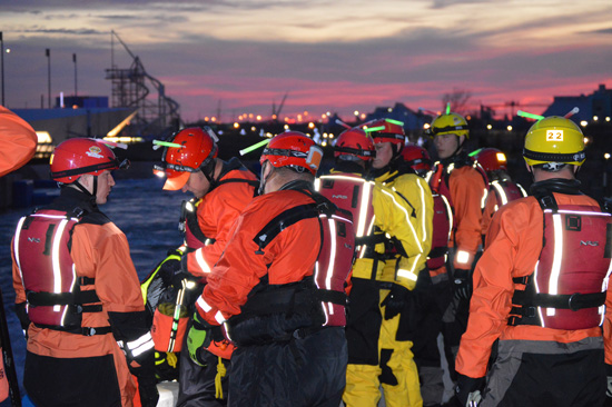
Any time a swift water rescue incident occurs, it’s considered to be a dangerous operation and there’s extreme risk to all involved. The actions of the first arriving units form the foundation on which the incident will be built.


Principally, a wildland handcrew is not going to be in possession of a lot of swift water gear in the normal course of work. Nevertheless, a Type 1 or 2 crew, and even most Support crews have more preparation than most residents. I might be optimistic to say that the ‘first arriving units’ may very well be the victim’s crewmates.

It’s particularly gear, for an incident-within-an-incident, IWI, that will be wanting. There are several scenarios that a wildlands crew could encounter; felling on slopes, fording to get access across running streams, vegetation management and the like. Water safety courses are sometimes mandatory for agencies, but it isn’t always a guarantee that a crew member can swim!

This article provides a comprehensive overview and briefing of many salient factors that might be present at an incident-within-an-incident, IWI.

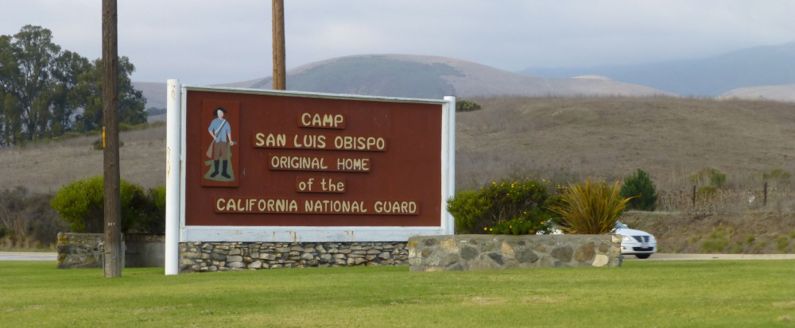
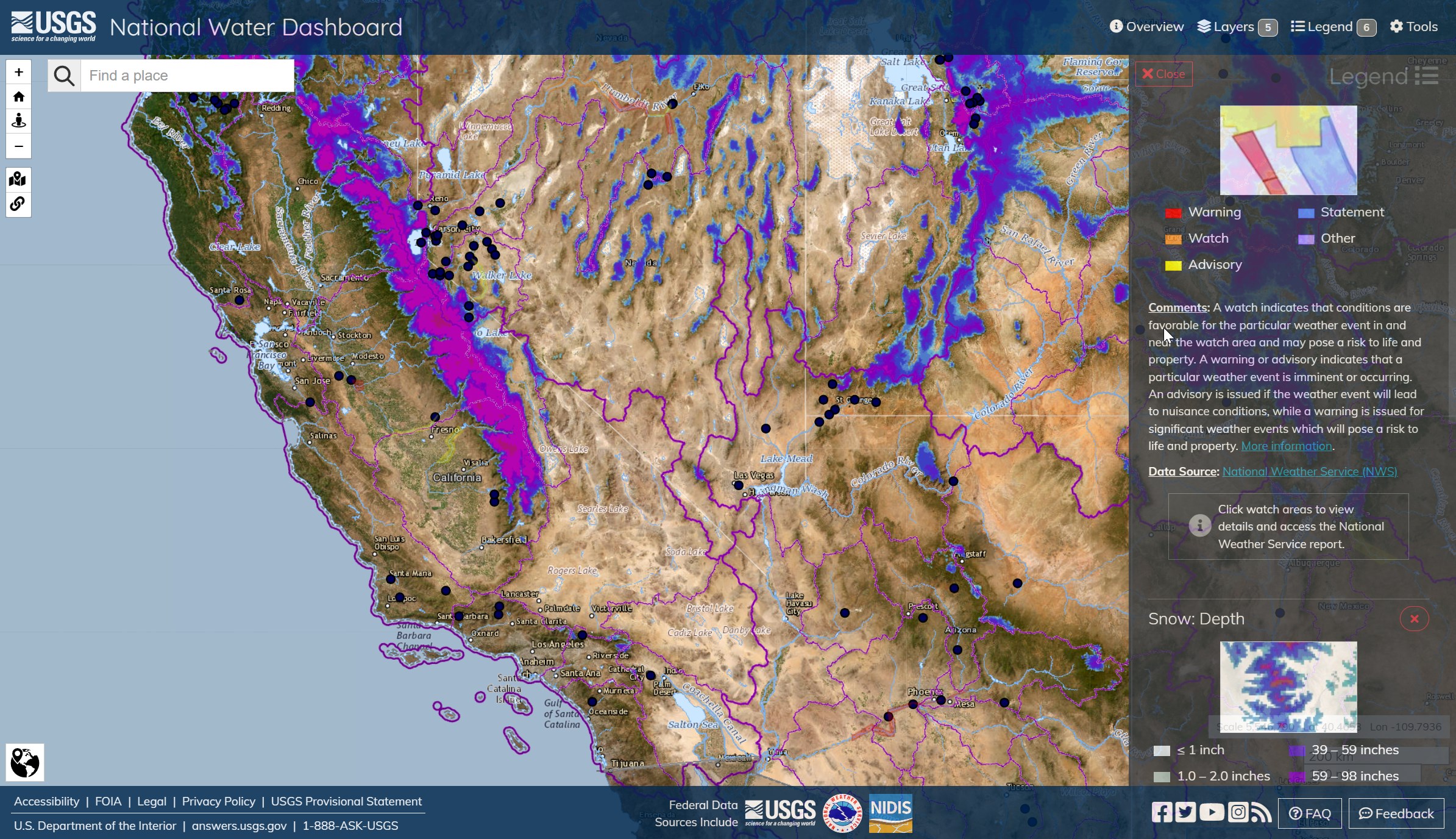
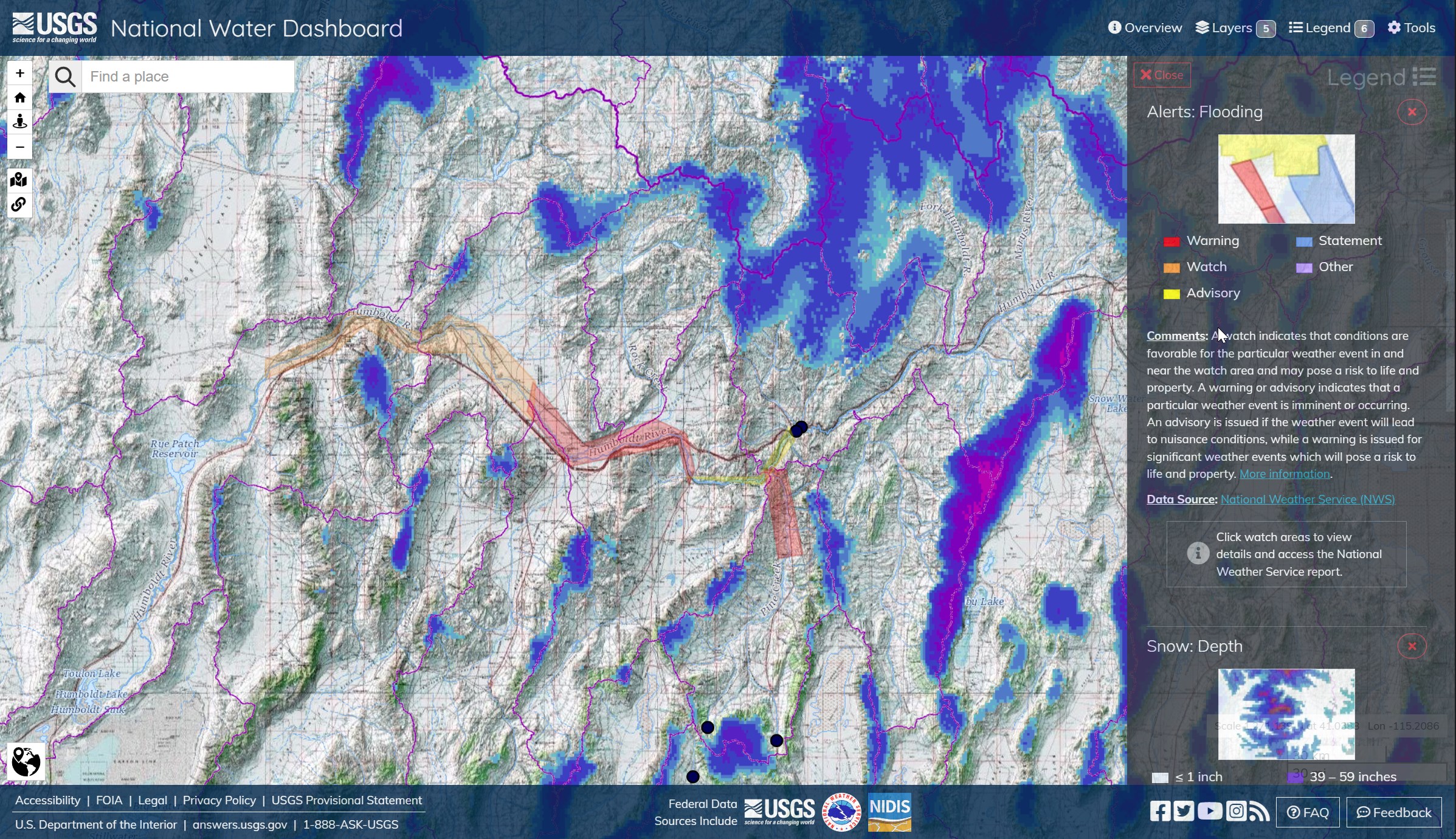
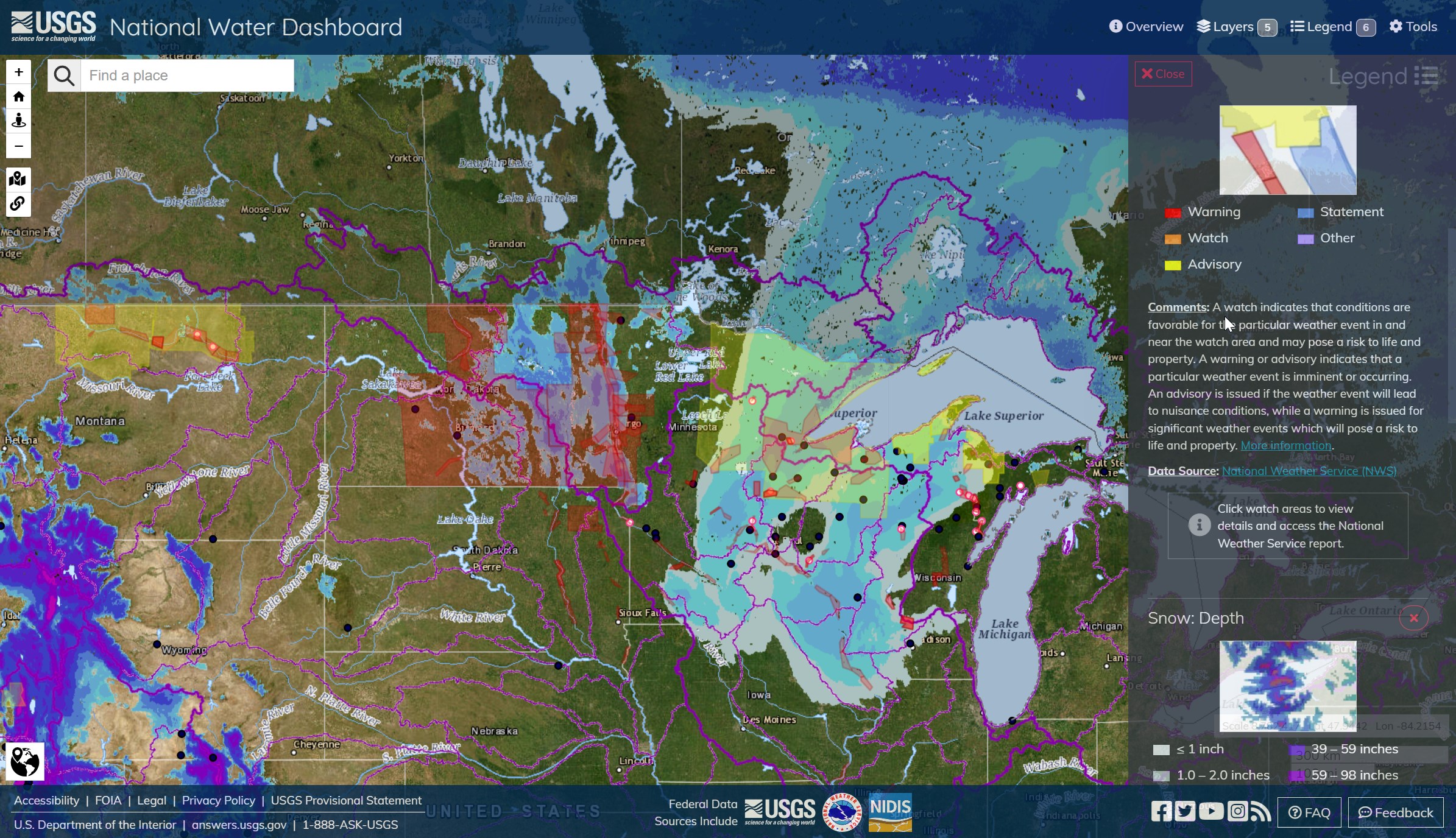
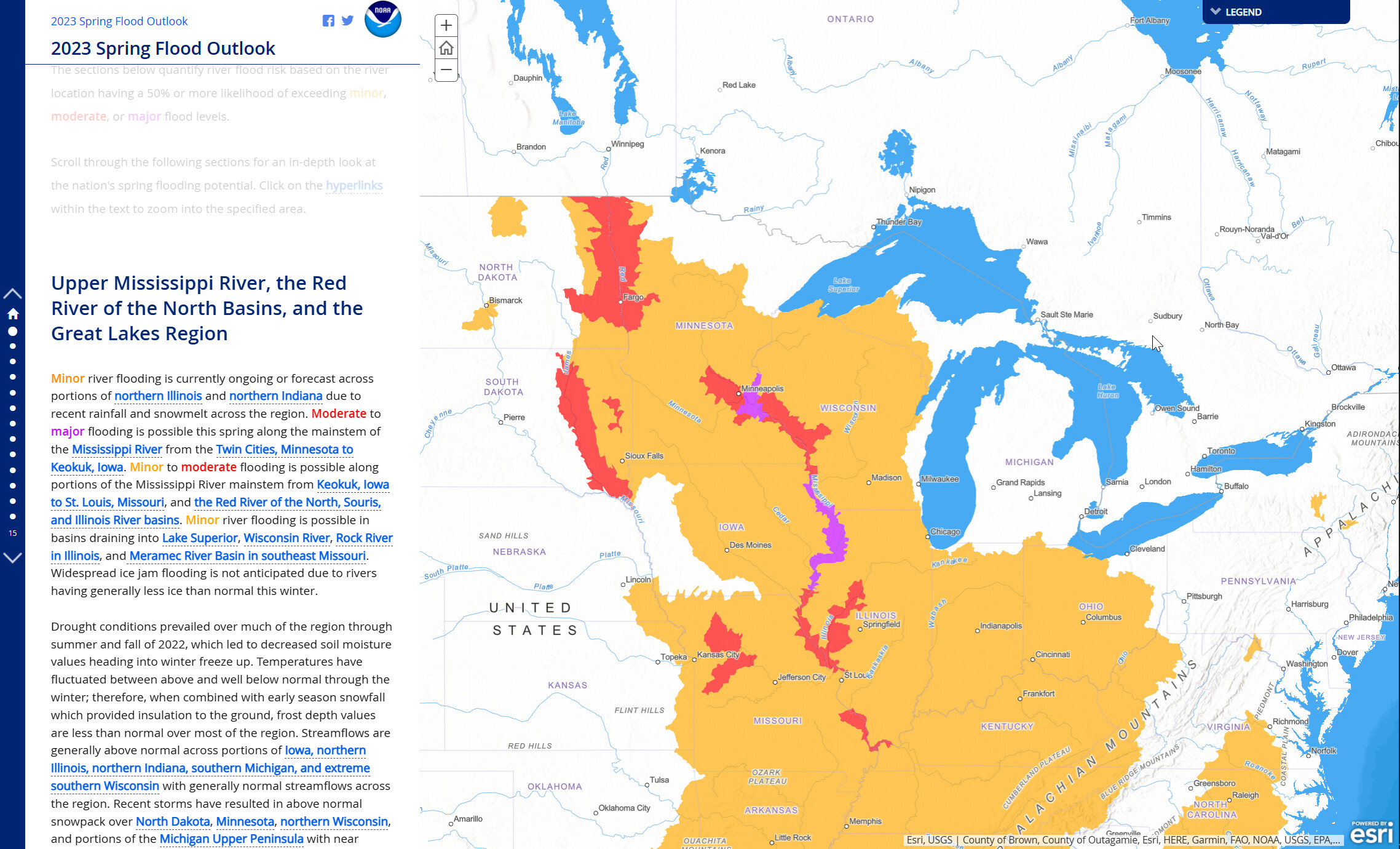
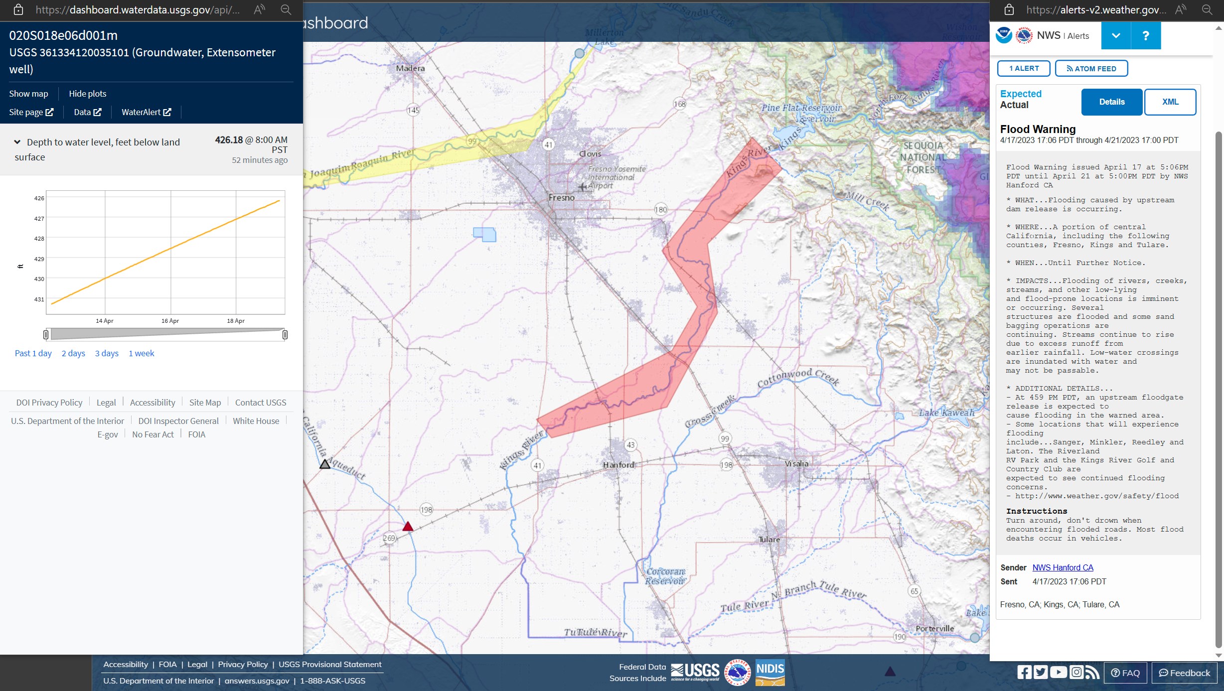
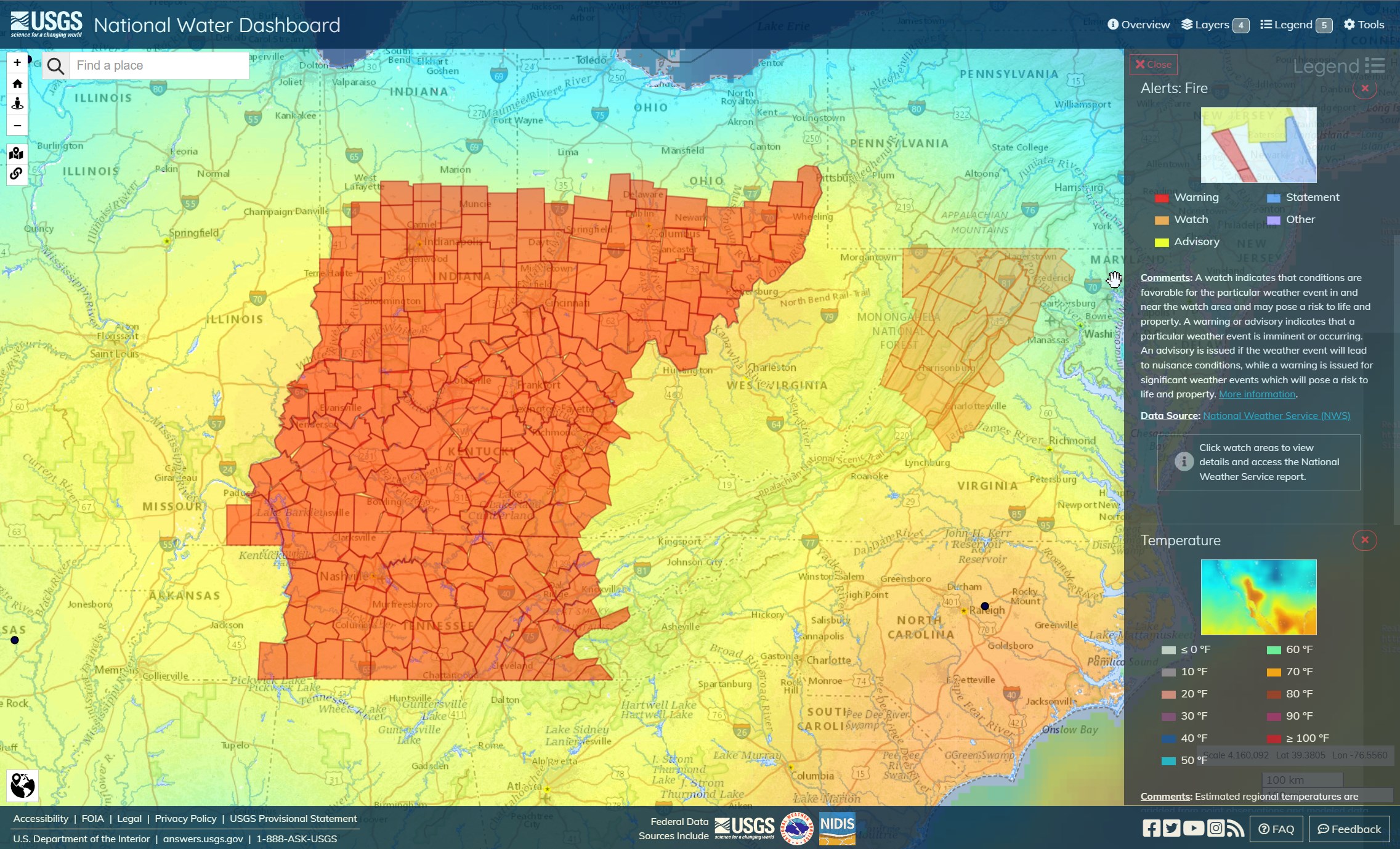
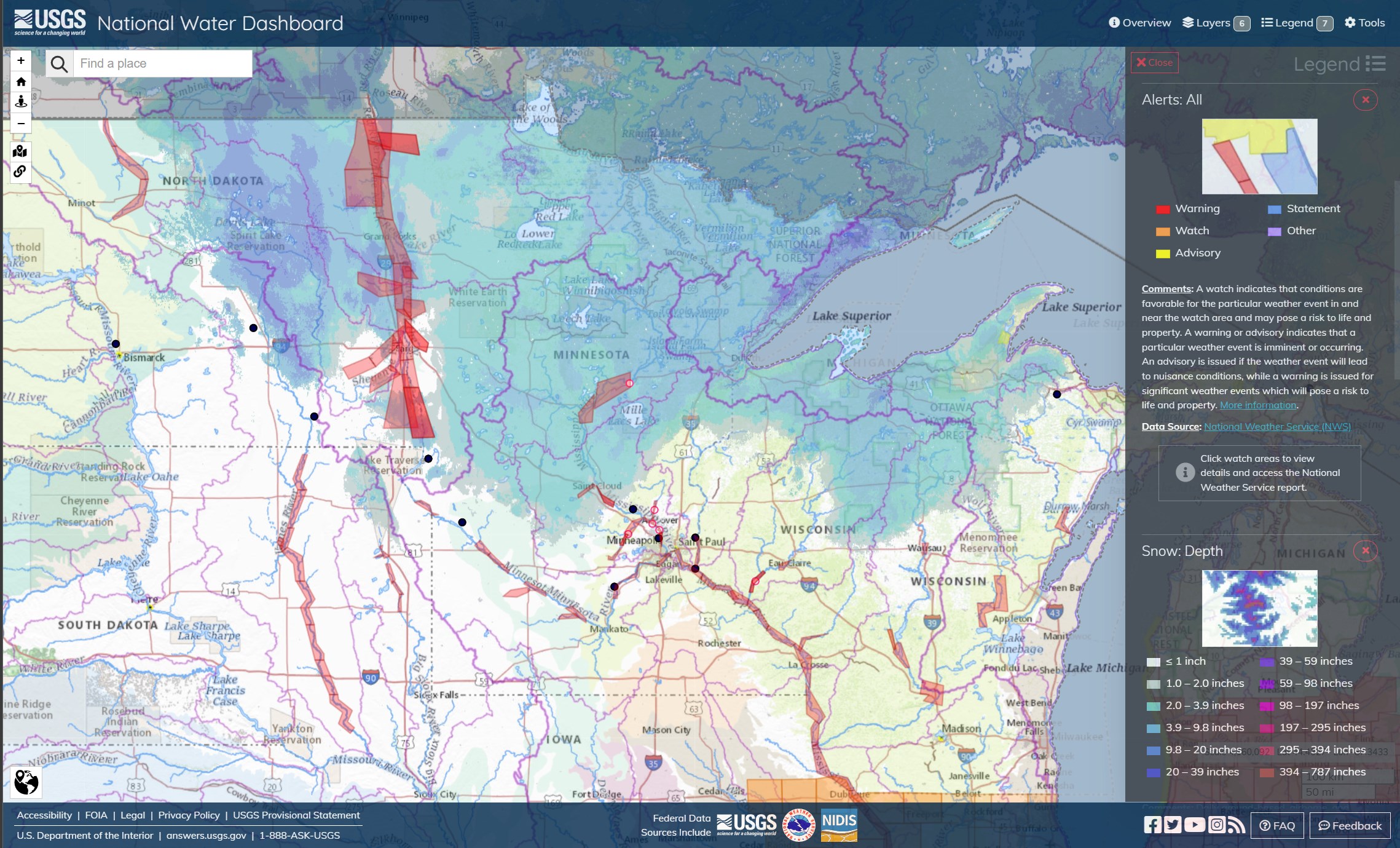
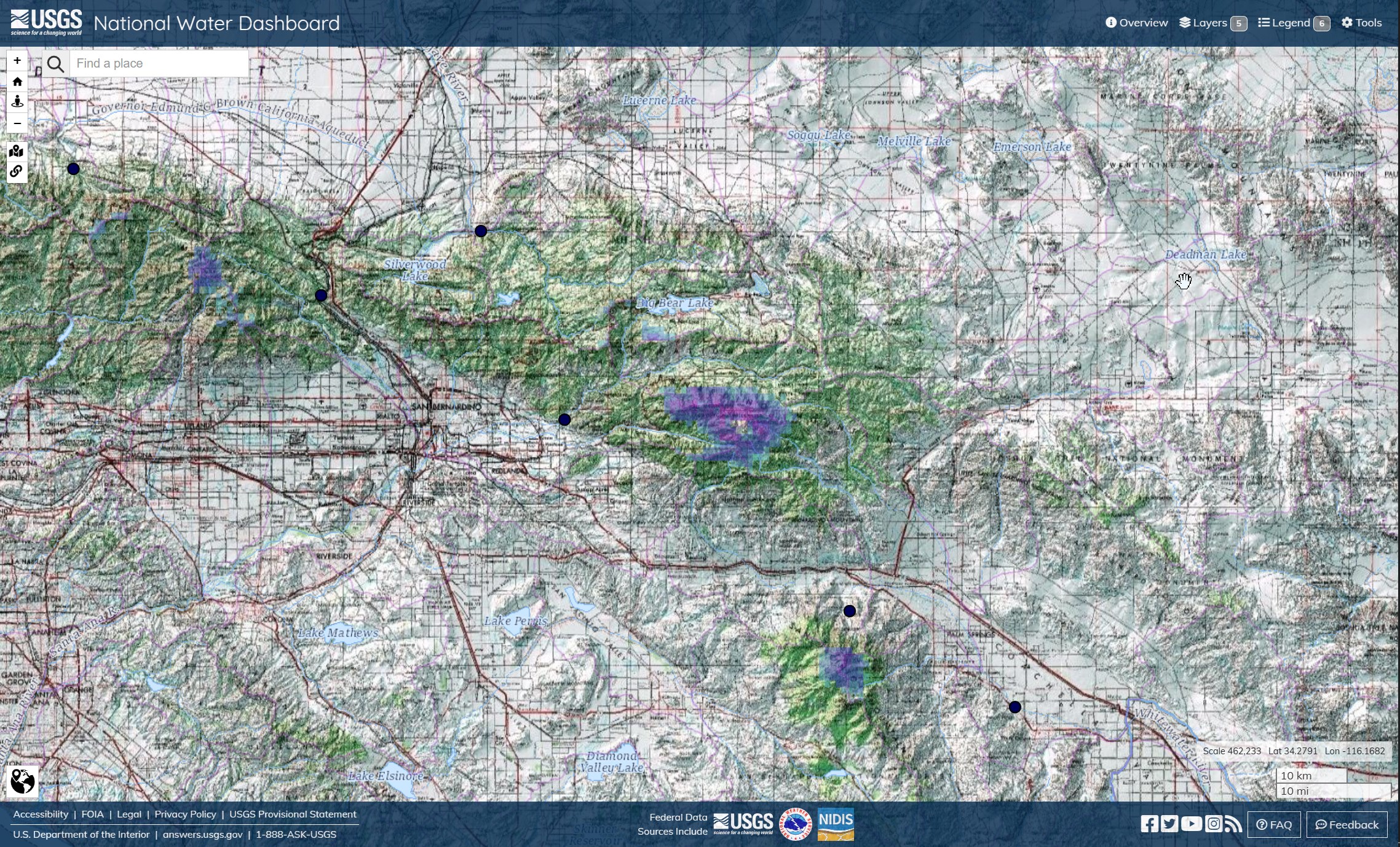
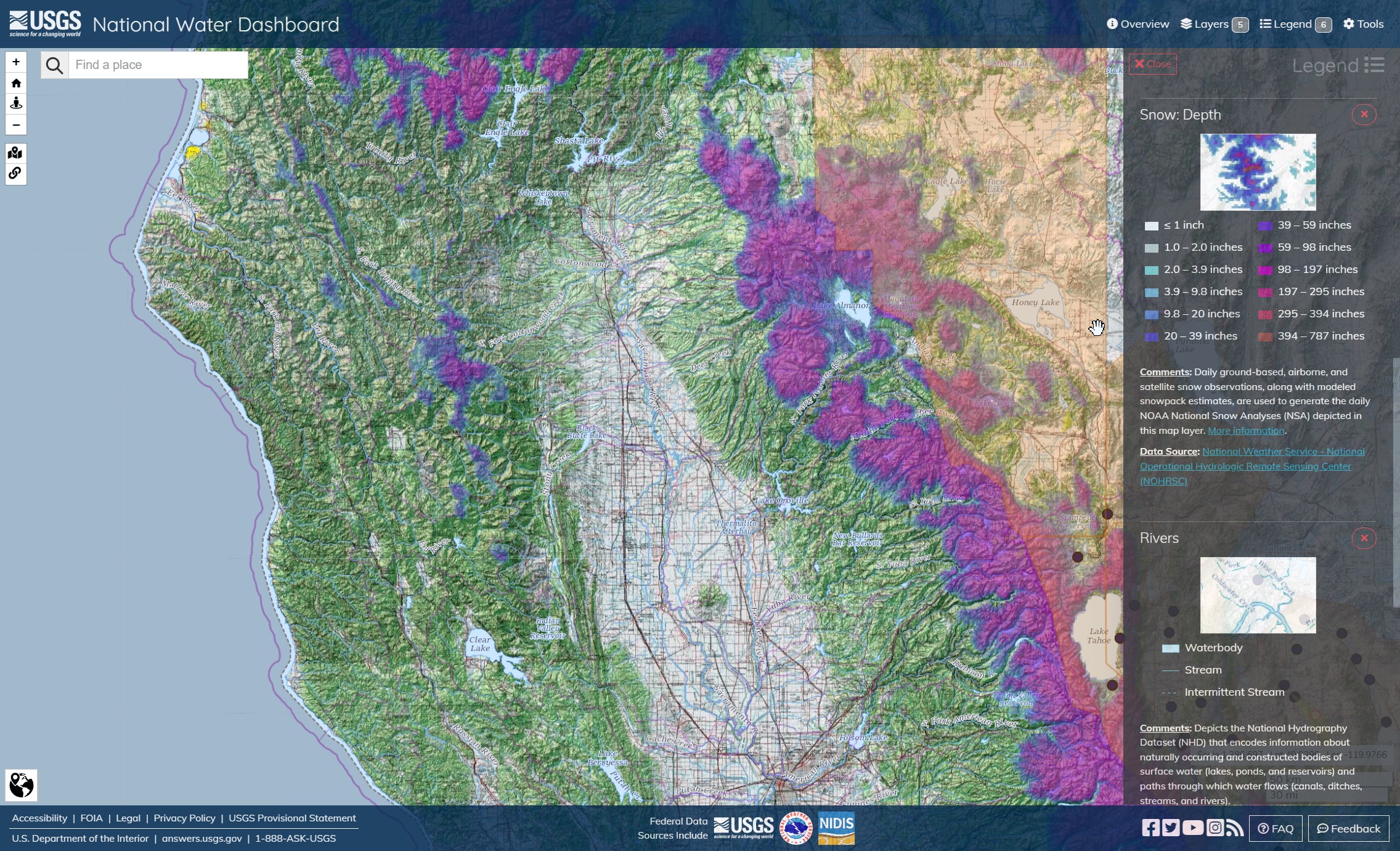
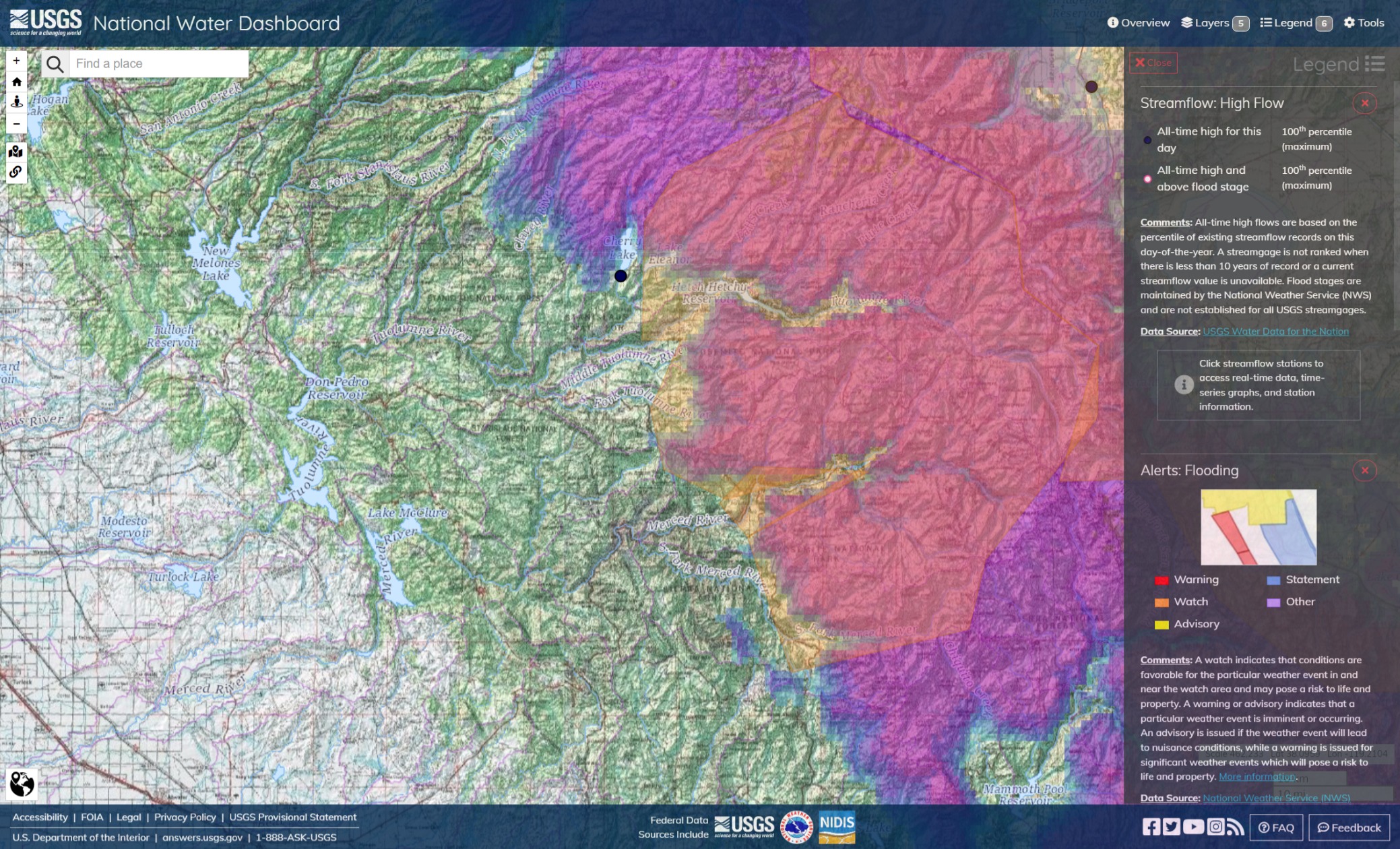
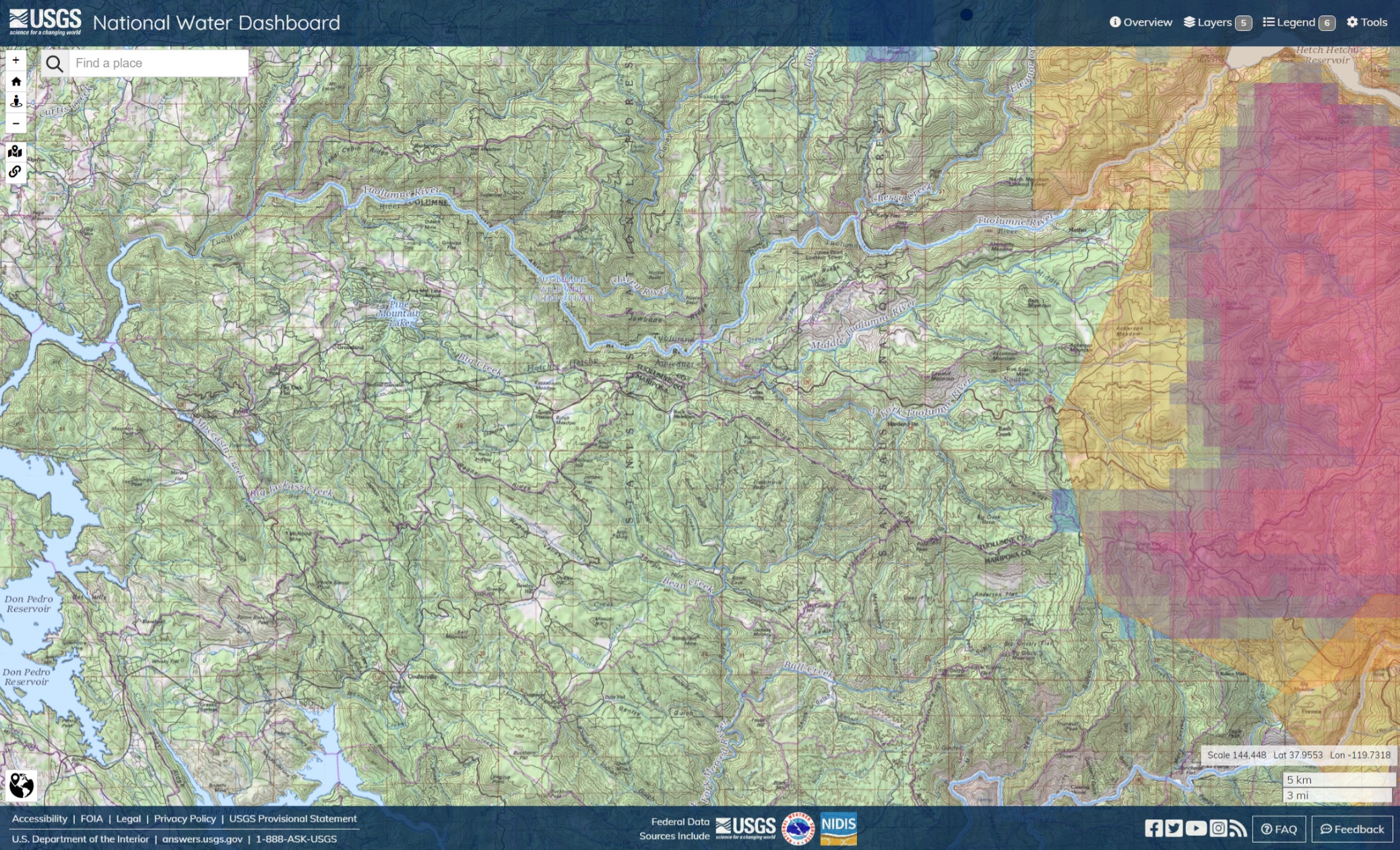
Responders should get out into their local area and look at the places in their community that continuously flood year after year. These areas can be pre-planned for hazards, access points and rescue tactics.


Clearly, this applies to a lot of activities of natural resources management and conservation besides Initial Attack, Extended Attack and mop up.

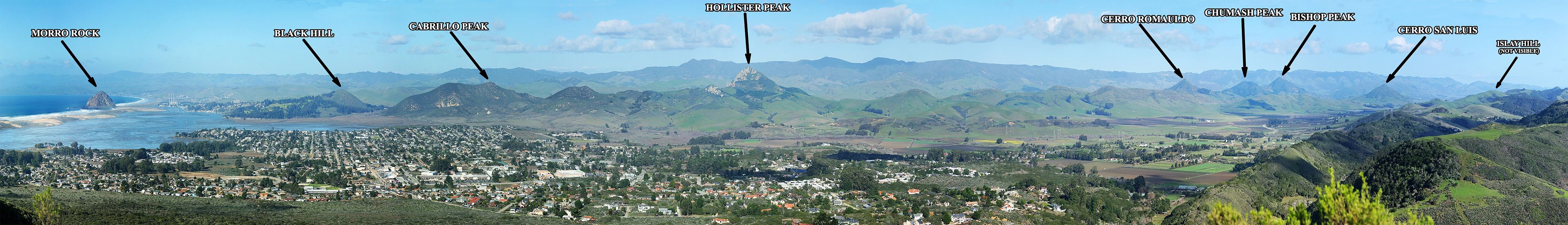
Rivers are natural fire lines, and natural fire hazards when the courses they cut run dry and steep; they are also natural gathering places and are responsible for a lot of decisions made on wildfires; crew and vehicle access, helo and scooper dips and ground engine and tanker resources.

The river’s bridges are critical when navigating landscapes, especially after severe storms or earthquakes and rivers often form municipal, parish, county and state boundaries, involving interagency cooperation and mutual aid.

Rivers are also factors in the use of fire retardant and where long-term consequences require particular tactics; debris flows, road access and dams.

Local responders should remain in tactically important locations, forward to the incident of mutual aid and IMT resources. The same familiarity with the ground serves both fire and swift water response.

Red Flag Warning conditions in Indiana, Ohio, Kentucky, Tennessee. Hundreds of square miles. No drought conditions there, and that region got quite a bit of precip with attendant flooding over the winter. No matter that, though. Elevated fire conditions extend outward to the north, east and south into Pennsylvania, West Virginia and Georgia. Including the large Red Flag zones over Colorado, New Mexico, and Texas, a pretty significant percentage of the country is under Red Flag and elevated fire conditions today.

This region might have more receptive fuels than one might suspect, otherwise, for the presenting conditions. BI Fire Behavior Potential is rated FBP-III to FBP-V, particularly around Indianapolis.

2 Likes

Crews, including the Hope Fire Company, were called at around 4 p.m. April 20, to Sandy Ridge Trail in Rush Township for a wildfire. The fire began to quickly spread, prompting fire departments from Blair and Clearfield counties to respond for help.

As first responders worked into the night, it was reported that the fire was spreading as fast as 10 miles per hour and ultimately spread across roughly 4,000 acres. At one point, firefighters were estimating the flames spanned over 600 football fields.

The Pennsylvania Department of Conservation and Natural Resources (DCNR) used two planes and a helicopter to see what the blaze looked like and where it was heading. They were able to bring in bulldozers to build fire lines, which cleared areas of wood and trees and helped contain the fire.

Columbia Fire Company stated Friday morning that they expect fires to burn through most of the day and it has not yet been fully contained.
Thousands of acres burned in Centre County Wildfire (wtaj.com)

Wildfire Today has been covering fire weather and news on the Eastern seaboard:

This and other regional fires prompts a visit to the Eastern Area Fire Environment Outlook to explore the conditions that led to the late April fire bust. On Friday’s Morning Briefing, the Eastern Area Coordination Center had nearly 40 percent of reporting units in Very High to Extreme Fire Danger, with the largest fires in New Jersey, Missouri, Pennsylvania, Michigan and Rhode Island. In the past week, the region recorded 349 fires for 12,600 acres.
Earlier, warmer spring ramps up Eastern Area fire season - Wildfire Today

North Carolina has a new large fire in Croatan National Forest:

CRAVEN COUNTY, N.C. (WITN) - A fire burning in the Croatan National Forest has grown to 12,000 acres.

Smoke from the fire southeast of New Bern is blanketing parts of Eastern Carolina.

Earlier today, firefighters said the fire had consumed 7,000 acres of forest.

The National Forest Service said the Catfish Lake Road and Great Lake Road areas were seeing the worst smoke. Additionally, the Black Lake OHV area is closed until further notice.

Lia Parker, a spokeswoman for the Forest Service, says the fire is 0% contained, while fire personnel from the U.S. National Forest Service, North Carolina Forestry are battling the fire, along with aerial assistance.
Croatan fire grows to 12,000 acres; smoke seen in Greenville, Kinston & Washington (witn.com)

1 Like

Addressing the heightened challenge fire poses requires rethinking how we approach our relationship with it. One step in that shift is changing how we quantify wildfires in the first place. Increasingly, experts suggest that we shouldn’t focus so much on their size, but rather on the damage they do.
Wildfire Size Doesn’t Matter | Essay (zocalopublicsquare.org)

I’m not sure wildland firefighters are so easily persuaded by pretty polygons. There’s nothing so much on the minds of firefighters during incidents than how to protect as many lives and structures as possible with the resources available, in the amount of haste required. Life, property, and environment is the core code and creed. Insofar as individuals become dazzled by datapoints like acreage, this measure is sometimes useful in earlier stages of an incident, when the size, scope and mutual aid need of incident responders is uncertain, as the issue of responder personnel and resource scarcity, divert or no-divert aircraft tasking, for example, has trigger points and escalation procedures.

I think, sometimes, overgeneralizations make snafus and rats nests out of so-called controversy.

Retardant is another public issue that bears directly on the essential imperatives. Where environmentalists might argue the natural resource benefit of restraining use of retardant in order to protect natural resources, and fires burn more acres of wilderness, aka environment or natural resources, they will have much tougher issues to resolve where retardant protects property and parks considered proprietary by state and local government.

Penalizing the use of air tanker delivered fire retardant to protect lives in immediate and direct threat should be off the table, with prejudice, to a lengthy list of values, in no particular order; young redwood groves, cultural artifacts, strategic resources, dams, vital roads and drop points, livestock, even wildlife.

Even so far as to say that the search for a compelling legal argument that will keep retardant out of the WUIs might be tedious and fraught with moral dilemma.

3 Likes

Summary:

  • High pressure building across the west coast will bring dry conditions and temperatures soaring above normal for this time of year. Positive anomalies will peak sometime between Friday and Sunday from +10F to +20F local to +25F near the CA/OR border and NW NV.
  • The San Joaquin system continues to see high flows due to reservoir releases and snowmelt.
  • Snowmelt-fed rivers will be on the rise this week through the weekend as snowmelt increases in response to warmer temperatures and sunny conditions.

Confidence: High

Staffing Level: Normal

Detailed Hydrometeorological Discussion: cnrfc.noaa.gov/discussion


Virtual Office Hours with Dr. Swain:

04/24/2023 topic: Ongoing (and worsening) flooding in parts of San Joaquin Valley (and especially Tulare Basin) as Sierra snowmelt (finally) accelerates. Plus: the latest news about the rapidly-developing El Niño event in the tropical Pacific and its potential implications for California and the Southwest.
Virtual weather and climate office hours by Dr. Daniel Swain: 04/24/2023 edition - YouTube

1 Like

Souris, Red, James, Minnesota and Mississippi Rivers, basins, watersheds and aquifers. Darker blue and greens represent snow. Minneapolis and Saint Paul gages are registering some of the highest numbers since 1950.

1 Like

Not to belabor the point, but if your going to play conservationist, play it like you mean it. The EPA have bigger fish to fry than vanity suits, yeah, locking themselves inside the beltway, yeah, and threatening to turn the house upside-down and ban and permit over fire-retardant edge-cases.

In an April 21 letter to U.S. Transportation Secretary Pete Buttigieg, Weiser wrote that the 88-mile Uinta Basin Railway “poses an extreme risk to Colorado’s most important water source and the surrounding environment.”

The multibillion-dollar project would connect Utah’s oil-producing Uinta Basin region to the national rail network, allowing 350,000 barrels of crude oil per day to be transported to refineries along the Gulf Coast — a route that would run directly through mountain communities in central Colorado and the densely populated Front Range.
Colorado AG: ‘Extreme risk’ posed by Utah oil train proposal (missoulacurrent.com)

Just a little crowning of snow left in Angeles and the 'Dino.

LA (and the other CalFire Contract Counties, for that matter) are unlikely to experience major impacts from Sierra snowmelt. Although the Los Angeles Aquaduct sources in Owens Valley, LA County Flood Control is pretty robust and it would probably take another major atmospheric river to put the sort of stress on it that occurred during winter storm Piper.

Hammerhorn Mountain in Mendocino National Forest is holding out, but it won’t be long before the snow is gone southwest of Shasta Lake.

Hetch Hetchy Reservoir; the Stanislaus, Tuolumne, and Merced River basins are surging down the mountain. Don Pedro Reservoir and Lake McClure are whistle stops for the Tuolumne and Merced. Just after Piper, these rivers flooded intermittently, on both banks, right down to the San Joaquin and points west. The slope and volume puts tremendous hydrostatic pressure against the entire length of a river, causing the whole length to rise.

On the ground, this whole area from Hetch Hetchy, Big Jackass Creek, Wagner Ridge and the topographical divide make access to the ridge and water and fire sheds problematic. I can’t but imagine there are a few Type 2 helicopters with the lift power to provide SAR coverage for anyone unfortunate enough to get trapped there.

1 Like