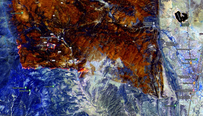
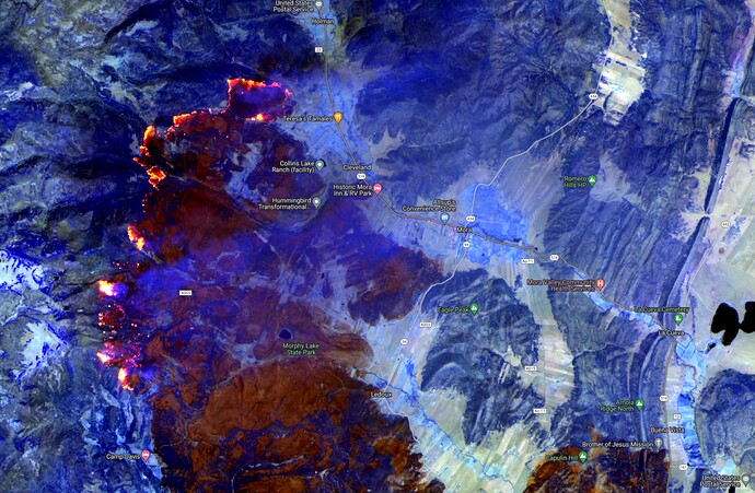
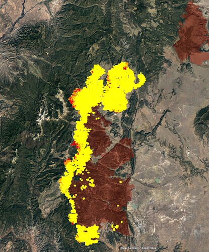
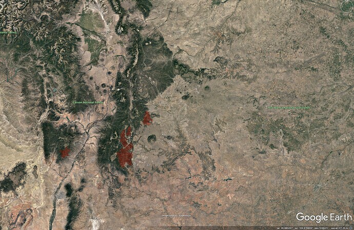
176,273 acres and 43% contained. The fire has crossed the 518 again near Holman on the northeast portion of the fire.
I hope it does not make it to Angel Fire.
If the wind stays the way it is now Angel fire will be looking good, keep your fingers crossed.
I dunno. They’ve had very little success holding onto anything just about anywhere in the timber on this fire. It’s reminding me of the Dixie, and looking at it with that lens, it seems like it could go all the way to Taos. I’ve got really limited on-the-ground experience out there to run on, but the fuels look tough and outside of areas where they’re able to easily fire off of roads in light fuels, wind is going to keep pushing it wherever it wants to go.
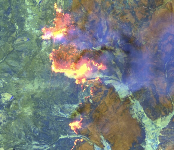
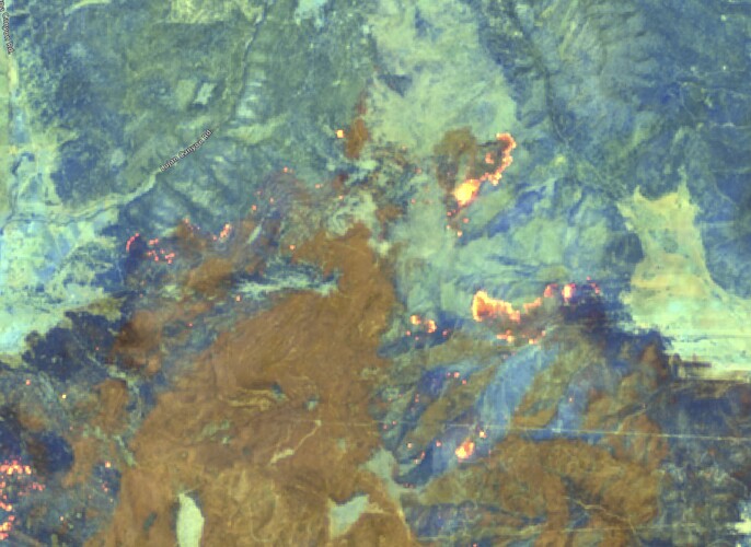
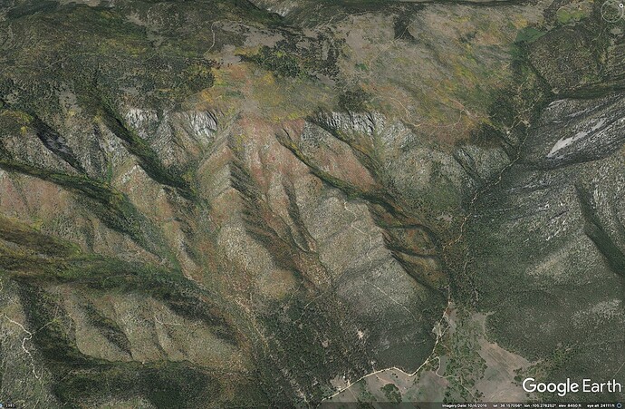
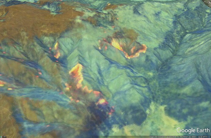
Here are satellite images from midday yesterday on the western flank and northern edge. Check out all the spotting.
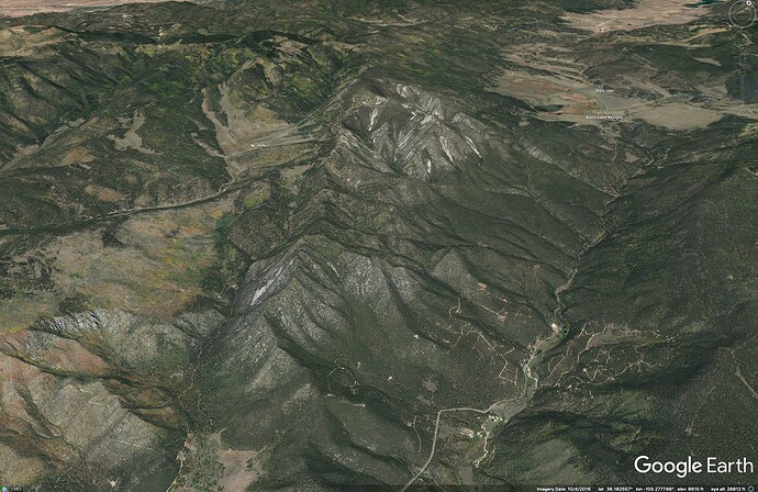
The northeastern edge seems to be chewing steadily across an old burn scar.
And the area to the immediate north of the fire, above Guadalupita, toward Angel Fire, has very limited ground access, and no dozer line or good road-as-line options showing on the Ops maps.
From there, there are continuous heavy fuels all the way to Angel Fire.
.FIRE WEATHER… From ABQ Forecast Dsicussion…
Hot, extremely dry and unstable conditions will persist through the
weekend under the influence of a building upper level ridge. A
backdoor front will slide southwest into central NM late Sunday,
bringing a wind shift and increased humidity west to the central
mountain chain. A round of mostly dry convection is forecast Monday
afternoon as a dryline progresses east from the central mountain
chain into the eastern plains. Very little measurable rain is
expected, so count on strong/erratic wind gusts and some dry
lightning. Weak and disturbed westerly flow will be the rule
Tue/Wed, with continued very dry conditions and elevated fire
weather conditions. Another weak backdoor front may impact northeast
NM late Tuesday night into Wednesday, bringing a wind shift and the
some moisture for another round of convection by late Wednesday. The
jet stream will dive southeast from the Pacific NW toward the Great
Basin and southern Rockies to end the work-week, resulting in
increasing westerlies, a deepening lee side trough and the return of
critical fire weather conditions for at least a couple of days.
Just trying to hold on to a little hope that it doesn’t go through angel fire and black lake but goes around.
I hear you, westerlies could push the NE edge to the east, but that also just opens more flank to eventually blow north, later. When you look at the big picture, though, it really reminds me of Dixie, just pushing relentlessly north.
The setup here reminds me of burning in the Great Plains this spring, in Nebraska - the crest of the Rockies, to the west, really seemed to force/channel any sort of continental flow following a frontal passage to the north. I’m not much of a meteorologist, maybe someone here can talk about how the N/S ranges effect local-scale winds here? @anvilhead @mesocyclone
We’ve got a new post on The Lookout about Hermits Peak.
Angel Fire is my Shangri-La. When I was younger all I cared about was going to fires, putting in line yada yada. It breaks my heart now to see these areas burn with such intensity. Early monsoon or something please.
Yeah, man, I feel you, AJ. Dixie burned everything within 40 miles of my hometown in 3/4 of the cardinal directions. So much loss.
If things hold out there it will be a good remainder of the day on the southwest part of the fire, they actually got some wetting rain in areas and there doesn’t appear to be any real active fire right now…of course subject to change.
http://astronomy.from-nm.com:575/nmfire.html
I posted these earlier and then removed them. Sorry, i’ve been a bit of a mess the last few months.
Good to see you back. I look forward to your very informative site.
