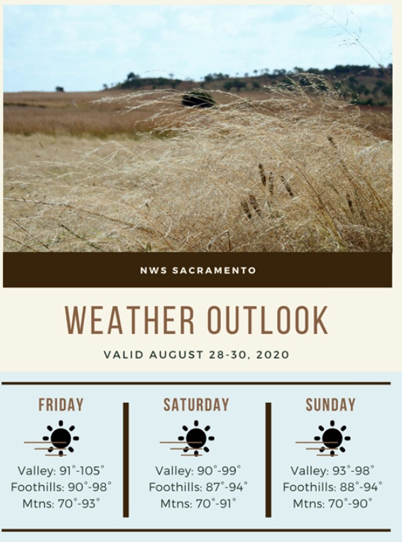
Regional Forecast
Forecast Discussion
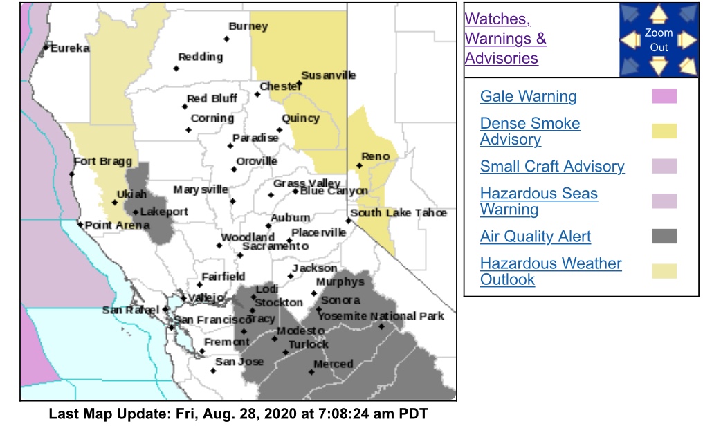
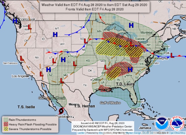
https://www.weather.gov/wwamap/wwatxtget.php?cwa=sto&wwa=all

Anvilhead, you post good stuff but expand please…what’s the significance of the dome? Who will it affect and how?
What’s a doom heat wave?
Hi, please read my post about 4 posts above.
A heat wave with no apparent end… le sigh
Anvil, I’ve noticed during past lightning events that during these extended high-pressure events, the packed-in smoke and atmospheric stability seem to moderate the fire activity, especially in the canyons. We seem to have a lot of backing and flanking fire under the inversions, and get our big runs only when they lift in the afternoon.
How much do you expect the smoke to reduce the forecast high temps?
Likely about 3-5 degrees if the smoke is still prevalent. There may be some light offshore flow at some point, so will have to see how things evolve.
Possibly describing a Subsidence High Pressure event.
Look it up
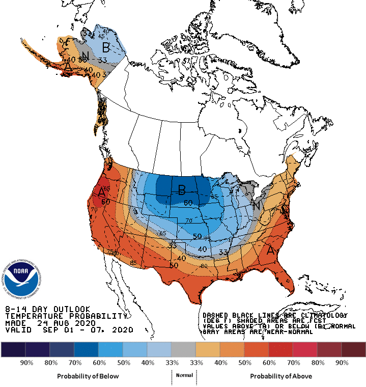
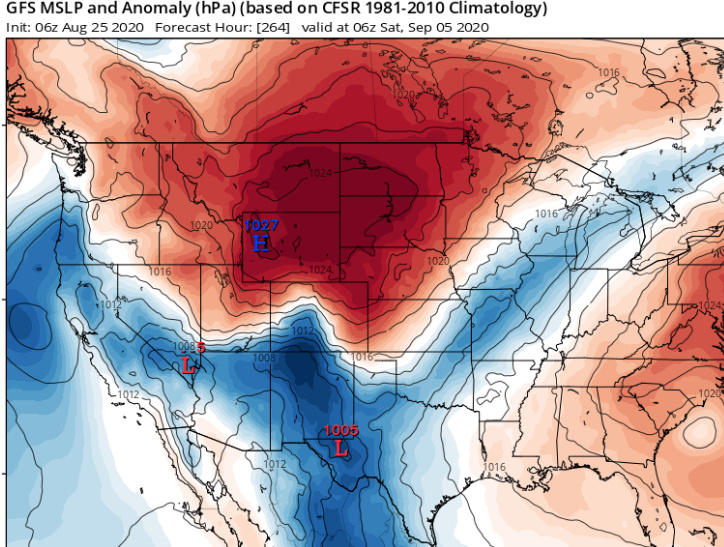
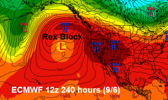
Quick update… both of the global models and their ensembles are in agreement that another long duration heatwave will develop starting around the 1st or 2nd of September. This is going to be different, in that a Rex Block forms over the North Pacific. A rex block is when a high pressure system and low pressure system’s strength and flow aligns causing them to become near stationary. This pushes the jet stream to the north away from CA. This will usher in a strong Canadian ridge as sinking air arrives into the Great Basin around the block. This will promote strong ridging and offshore flow (no longer the monsoon high pressure from the SE) as the jet stream dips down into the midwest. If this pattern continues into offshore wind season it will likely be a very bad offshore wind season. This ridge is building over an already very warm and dry airmass from the last heatwave, which will make it a bit worse.
Extra note: the confidence for this pattern verifying is now medium to high, as we are essentially in the 2-4 day range where forecasting this becomes near certainty.
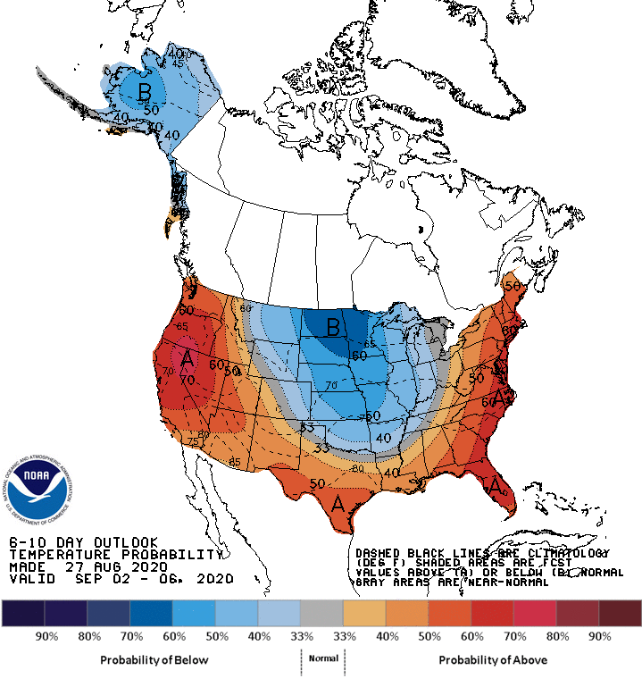
CPC has also bumped up their above normal temperature odds:
From NWS Bay Area AFD:
“Models now agree that an atypical oriented 590dm ridge apex will jab into the San Francisco Bay area from roughly west to east ahead of an even stronger 597dm parent ridge later Sunday and into early next week. Forecast models are now generally favoring a solution where the broader, stronger parent ridge builds into the region throughout the course of next week, bringing steadily warmer and drier weather to the region. This is a fairly chaotic weather pattern with several smaller scale circulations/shortwaves intertwined with medium to large scale ridges across the broader region, so expect the forecast to evolve as these smaller scale circulations are bounced around by the larger scale circulations. That said, a brief period of northerly/slightly offshore winds will be possible ahead of the arrival of the stronger high pressure circulations early next week, though it looks to be much weaker than previously modeled and concentrated into a smaller area (extreme inland North Bay) and over a shorter duration. High pressure is expected to peak over the region mid to late week next week with models now in decent agreement (for the first time regarding this timeframe) about a 594dm 500mb high pressure ridge directly over California. Between now and the peak of the ridge, 850MB temperatures are forecast to increase by 9C which translate to around an increase of 16F, which would push many areas back into the 90s to low 100s during this time frame. As such, expect very hot and very dry conditions to resume by mid to late next week.”
So glad I have vacation coming up. I think I may go to Iceland for a week.
That doesn’t sound promising at all…….LOL sofr_bear, better make that two!
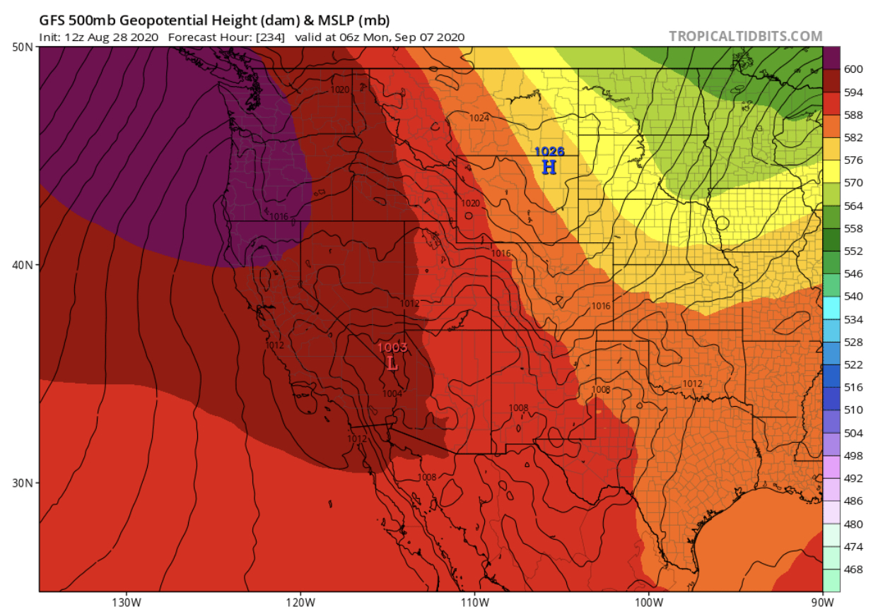
Please interpret the data for us simpletons… I only made it to S-290
The 500mb heights on the GFS run would support temperature at the coast 20 degrees above normal.
The dark purple areas are higher heights (hotter, higher pressure) it is very rare to see heights this high let alone in this area.