Your input. latest following, to me, seems to be skirting N to NW. what do you and your resources see the change, if any, to projections???
1 Like
Lightning call on radio but all I see is a single strike near the wind farm by rio vista which creates favorable conditions. Wouldn’t be too sure yet
Looks like the Inyo and Sierra Forest’s getting most of the strikes. The Stanislaus getting hit pretty good also
1 Like
East side, mostly…we will see tomorrow or???
We are getting sprinkles here in Fresno.
Sounds like it will be like last Monday… Chasing smokes all day long, drawing down resources. Stay safe everyone
2 Likes
I’m not seeing anything on lightning maps in the Bay Area. Am I missing something?
Sorry just saw this. This will probably be nothing like the last event but a couple dry strikes to potentially 50 dry strikes seems realistic.
1 Like
IMT4 IMET on TGU/BTU complex mentioned we’re due up here roughly between 1-6am tonight, breaking off around 10am and then picking back up again more on the east/BTU/Sierra side for the second wave.
Thanks Jim and team - great work!
1 Like
Did the imet say when the 2nd wave was to begin?
That second wave he was thinking about 5pm Monday going into early Tuesday, and focused more for the Butte Zone into the Sierra, and the chance of significant cells sounded much less, closer to 15% vs an 80% he gave for this evening’s first wave. Butte’s “Sierra” is certainly PNF North and Sheep.
2 Likes
Flashing and booming here in Modesto pretty good right now. About 30 seconds to a minute between strikes
2 Likes
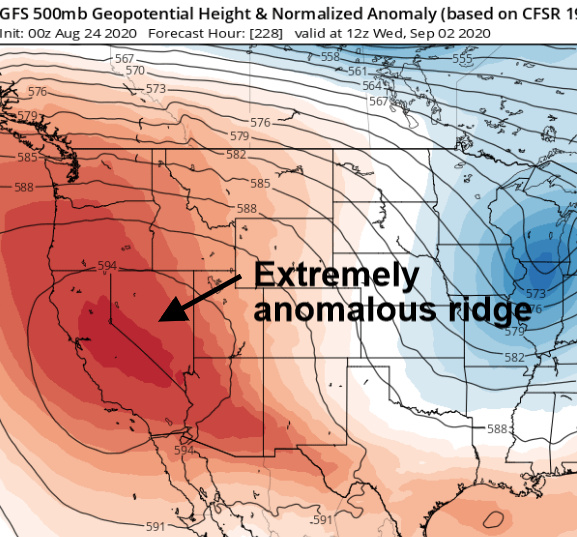
Good evening, I am ready to drop some thoughts. The ridge is on a 14 day cycle, and the next round looks very amplified. This time it’s a bit different set up. Instead of a subtropical high pressure amplifying across the desert south west, models are indicating a Canadian High nosing into CA from the NW. This is in response to a vigorous and very very anomalously cold trough that digs into the midwest and eastern great basin.
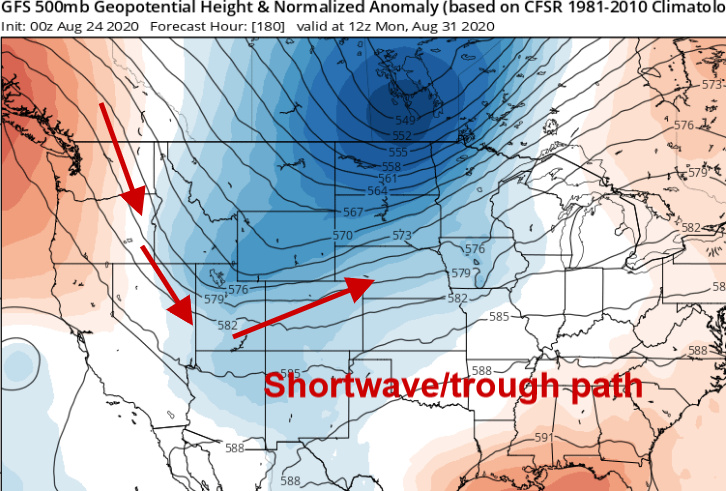
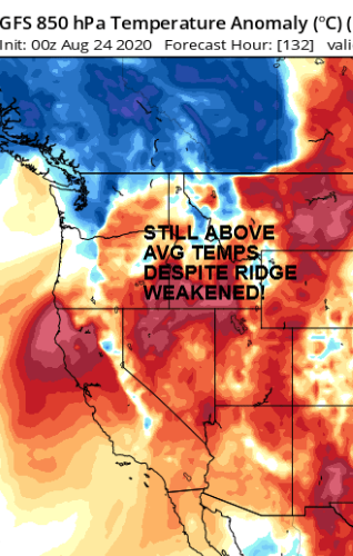
In response to the trough, the very anomalous ridge noses into an already warm airmass across CA, compounding drying and heating.
Already warm airmass and above average SST:
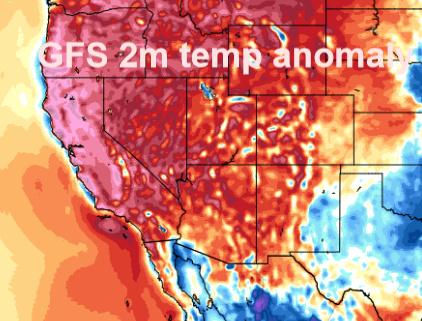
Model runs are starting to get into agreement with ensembles, for another long duration heatwave from 9/2 to 9/5, this time with some weak offshore winds possible. The exact strength of the next heatwave is yet to be known, but up to 10 degrees above normal looks like a fair assessment at this time. The latest run of the GFS would have temperatures 15-20 degrees above normal. The implications for fire weather conditions if this verifies will be severe.
12 Likes
We getting some flashes up here in Twain Harte and some rain with big drops. It was enough to wet the ground but still dry under the drip line of the trees. See what the rest of the night will bring.
3 Likes
Good visual to what and where things are happening… But it looks like it’s mostly in the valley, for now
Lightningmaps.org https://www.lightningmaps.org/#m=oss;t=3;s=0;o=3;b=0.00;z=6;y=39.521;x=-119.8169;ts=0;tsc=1;d=2;dl=2;dc=0;
Has show a few (not a lot) of strikes in the East Bay hills in the last hour.
2 Likes
20 or so strikes from about the latitude of Merced running up the Sierra to just past Reno in the last 10 minutes. Includes three around the area of the Loyalton fire. Very light shower in Reno
South Lake Tahoe is getting hammered pretty good right now.
A lot less lightning and a lot more rain this time, in the area of the Jones burn.
2 Likes