Regional Forecast
Saw that in NWS report…
“Thunderstorms with little to no rain” sums up 2020
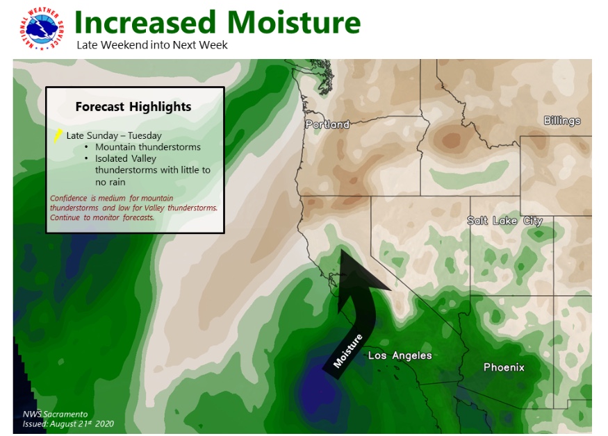
I genuinely hate to say it, but it looks like the odds of another relatively widespread lightning event across Norcal is rising. Some slight chance as early as tomorrow PM; greatest risk late Sun into Mon. Could affect much of NorCal, including coast and foothills, as did last event. I doubt there will be quite as much lightning, but any number of new dry strikes/gusty downdraft winds would be very bad news right now. High risk issued Sun/Mon for most/all of NorthOps.
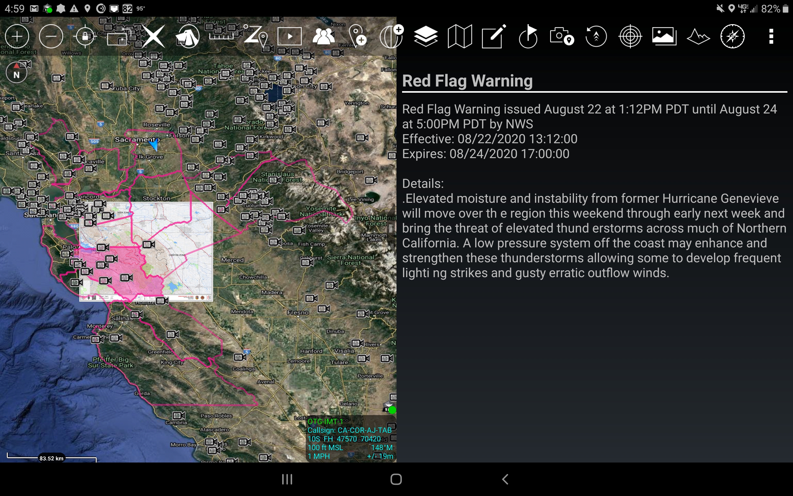
NWS Sac: 1104 AM PDT Fri Aug 21 2020
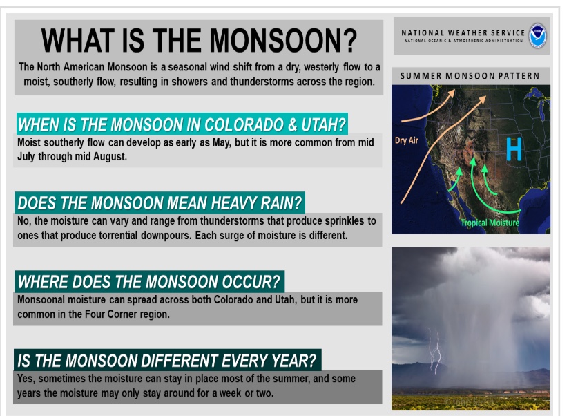
.Elevated moisture and instability from former Hurricane
Genevieve will advance northward later this weekend through early
next week and bring an increased potential for elevated
thunderstorms across much of Northern California. A low pressure
system off the coast may enhance and strengthen these
thunderstorms as they transition into the region by early next
week.
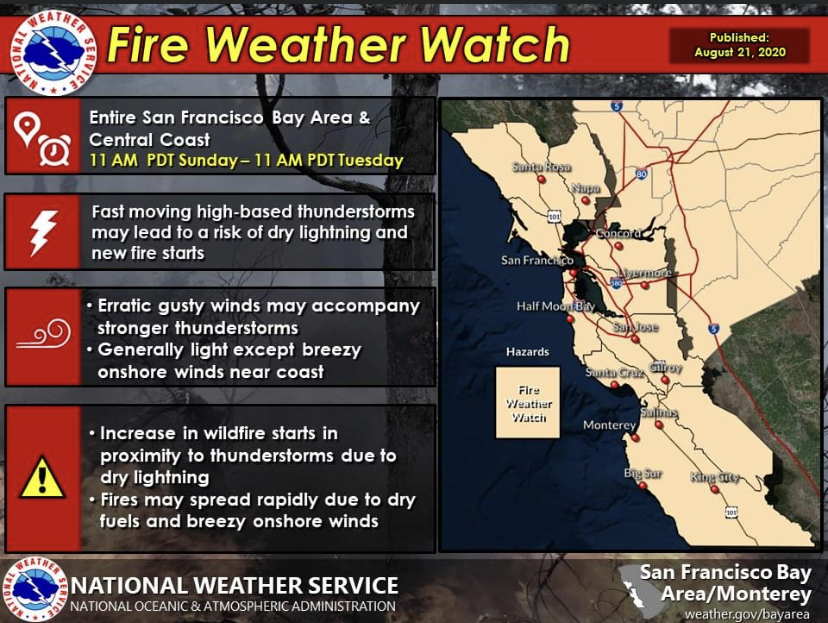
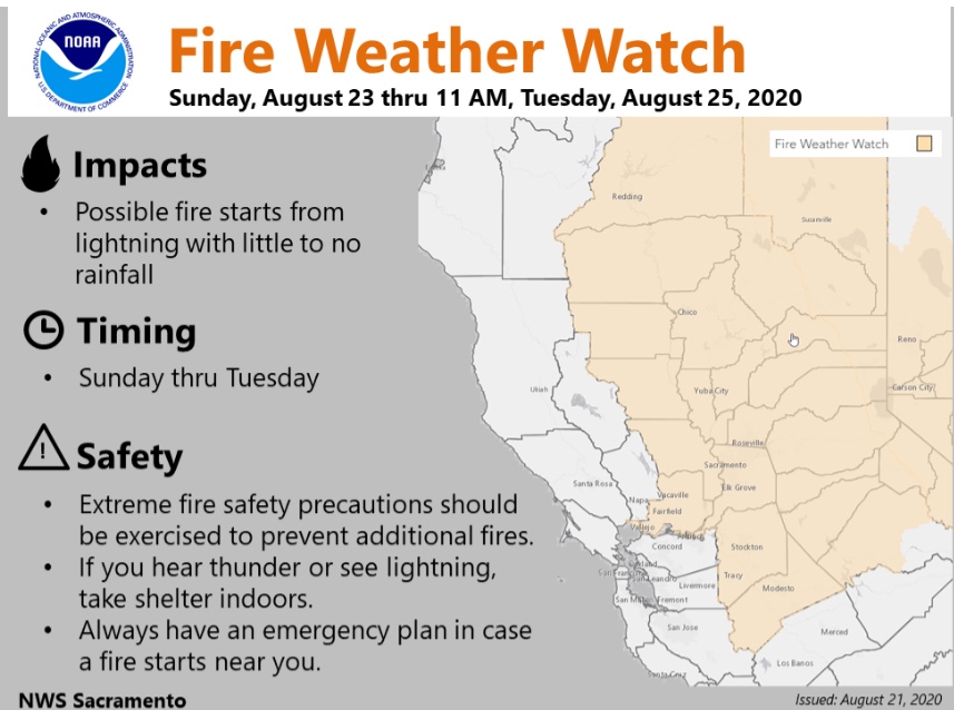
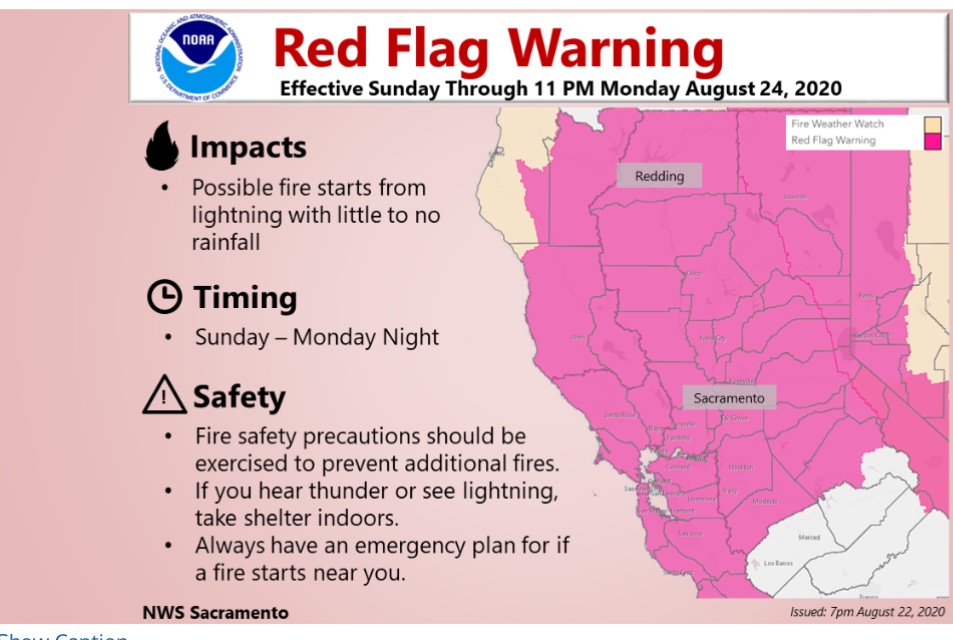
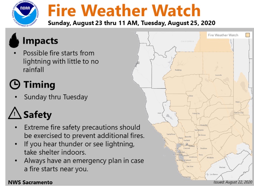
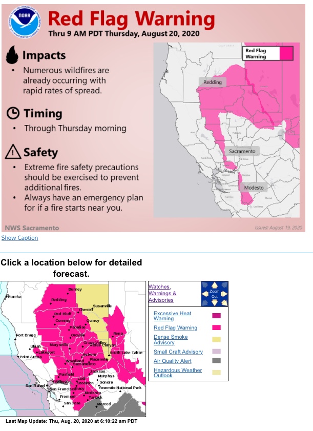
The National Weather Service in San Francisco has issued a Fire
Weather Watch…which is in effect from Sunday morning through
Tuesday morning.
AFFECTED AREA…Entire San Francisco Bay Area and Central Coast.
Areas of highest concern will be included in future updates.
WIND…Generally light onshore winds. However, erratic gusty
winds 40 to 65 mph may accompany stronger thunderstorms.
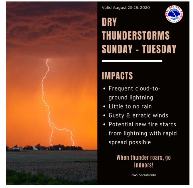
THUNDERSTORMS…Isolated to scattered dry thunderstorms will
develop Sunday afternoon and into Monday morning. An additional
round of thunderstorms are expected to arrive later Monday into
Tuesday. Dry thunderstorms may become wet as the event
progresses.
IMPACTS…Lightning will likely spark new fires across the
region, including remote areas. Wildfires in remote regions may
not become apparent until warmer and drier conditions allow them
to grow.
Thank you for the well explained and early heads-ups that you continue to provide Mesocyclone.
Everyone in this community appreciates and learns from your insights.


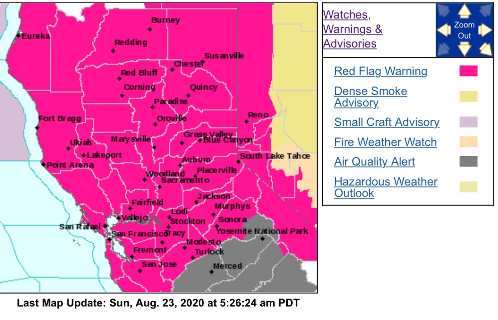
Red Flag coming - read below NWS San Francisco Bay Area 10:12 AM
Following the morning fire weather coordination calls with
neighboring and regional offices and resources as well as incident
meteorologists (fire weather experts staged at each major fire),
the plan moving forward this morning is to upgrade the fire **
** weather watch to a red flag warning late this morning, likely
between 1030 and noon, so look for that.
Confidence is increasing
that we will see a period of increased potential for elevated
thunderstorms over the next 72 to 84 hours, however, given that we
are dealing with a disorganized mess of moisture of instability
from the leftovers of the former hurricane, there are a lot of
pockets of favorable and unfavorable thunderstorm “fuel” heading
our way, while the other moving parts that will enhance this fuel
are also coming together in differing ways throughout the duration
of the event. At this time, the most favorable timeframe for this
to occur is roughly midday Sunday through midday Tuesday, however,
even in that time frame there may be a break midday Monday. In
addition, the initial pockets of more favorable air for
thunderstorms will begin to arrive as early as today. KMUX radar
has already detected a few cells well offshore
of the Central Coast with increasingly favorable pockets of air
arriving through the day. That said, we are not expected much
enhancement/upper level support from the neighbor ridge/trough
until at least late Sunday, so we are keeping time periods prior
to Sunday outside of the main concern period as any showers or
thunderstorms that develop are expected to be on the weaker side
and primarily offshore. The initial, primary concern from these
thunderstorms, given the numerous active fires on the ground, is
not the additional potential dry lightning, but the gusty, erratic **
** outflow winds that can be generated from this convection which can **
** be catastrophic to existing fire lines. As such, the timing of the **
** fire weather watch (and by extension, further red flag warning) is
primarily focused around the time period we may see the stronger
showers and thunderstorms capable of producing strong outflow
winds, while the dry lightning threat will be more of a concern in
the wake of passing thunderstorms. As previously mentioned,
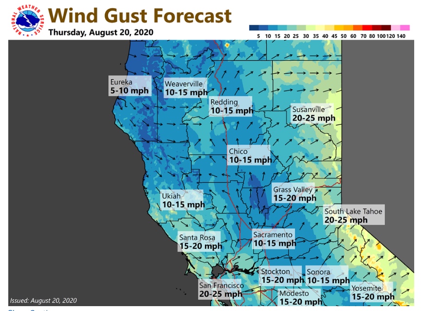
locally breezy southwest winds will also be expected during the
afternoon and evenings of the next few days which will further
complicate matters. Dry conditions at the higher elevations will
also exist as a result of the nose of the high pressure pushing
over the region today and tomorrow before exiting early next week.
Generally speaking, the last 24-36 hours and the next 8-12 hours **
** will be most favorable for fire fighting efforts as the last of **
** the marginally cool, wetter air and generally weaker winds are **
** present over the fires. Given the upcoming wind shift in the next
12-24 hours, potential for elevated thunderstorms bringing erratic
gusty winds and dry lightning, and breezy afternoon winds, expect
to see increased activity from the regional wildfires. This may
result in the wildfires moving in directions we haven`t seen yet,
increased smoke production, and potential for new wildfire starts.
New lightning induced wildfire starts may not be immediately
obvious if surface conditions are less favorable for fire spread,
but once windy or dry conditions hit a location, we could see
additional wildfires develop across the region.
Soooo,
Pretty much armageddon is what I’m reading for the next 48-72 hours.
And I was having such a good day off…
Please be sure your crews are well briefed, +coms (many 204’s are not matching the 205’s on several fires I have been on in the last 2 months), and LCES and PACE are in place before engagement. Also, take that tactical pause and re-evaluate when the established plan is not working.
Be safe and stay hydrated my friends.
What program is that?
A question for those more knowledgeable, can we expect widespread lifting of the inversion layer over the major fires over the next two days with the coming of an unstable atmosphere?
Indeed, convection should disrupt the inversion and marine layer.
@chukar…Also recognize that as the inversion and marine layers change and lift, there will be a marked increase in the fire activity and behavior. The goal always, is to be able to get aircraft in and place some retardant before the fire behavior becomes intense. So, there are trade-offs that have to be taken into account as the Team’s plan for the changing weather conditions.
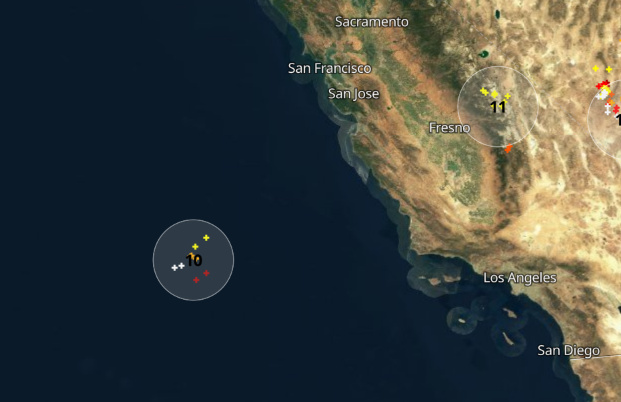
Some lightning, but way offshore.
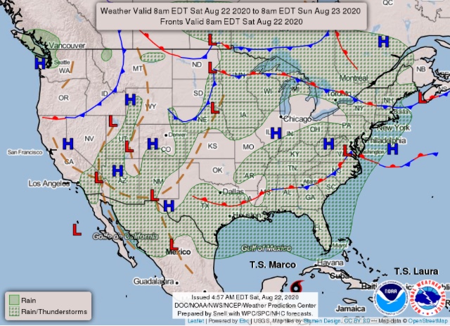
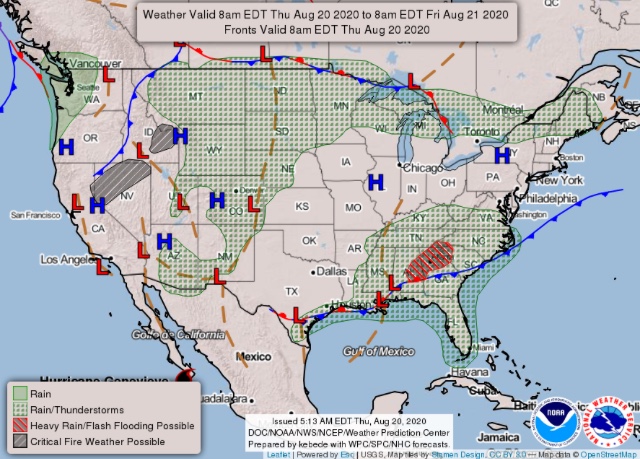
Forecast for the rest of the night from the SPC: