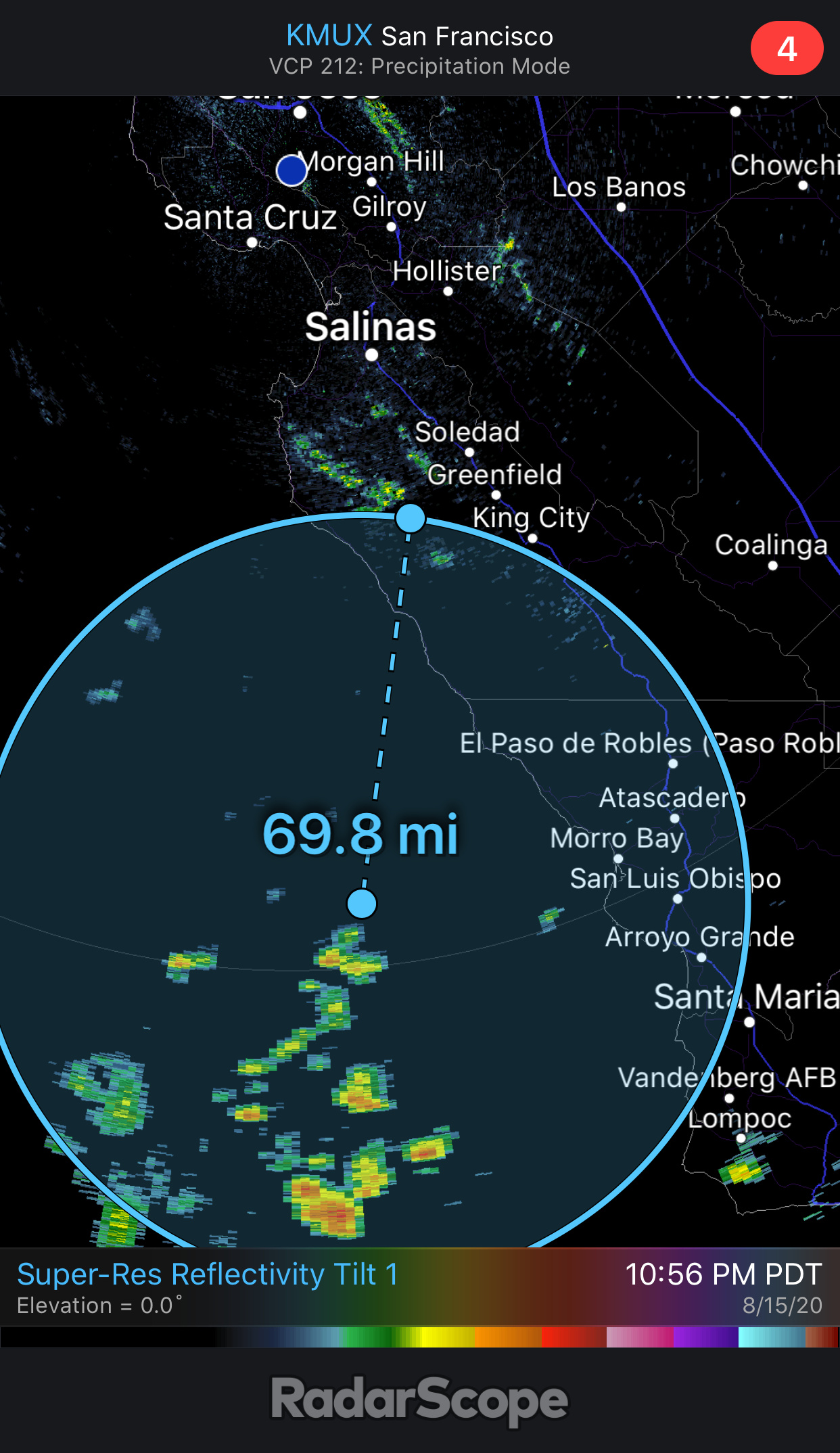
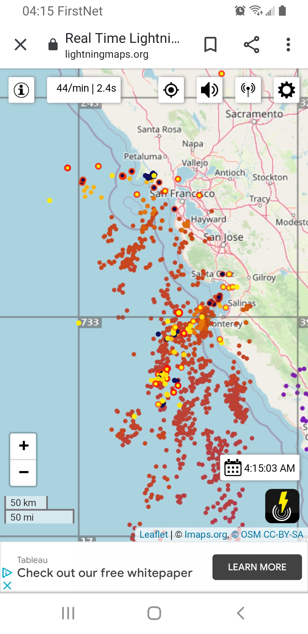
The elevated dry thunderstorms are developing offshore.
3 Likes
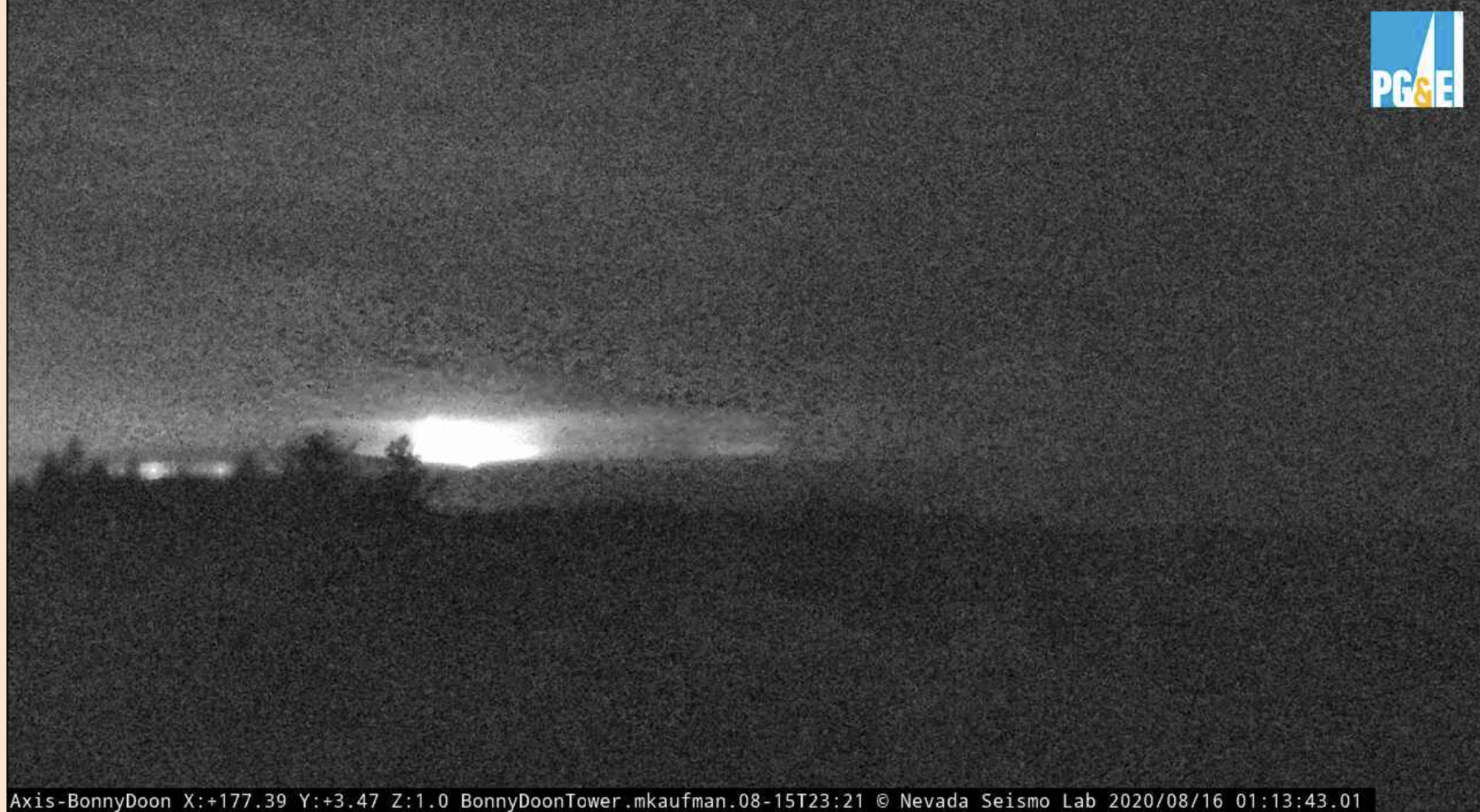
The one hour timelapse on the Bonny Doon cam is incredible. Crazy lightning storm headed for the Bay Area.
1 Like
This is what sky looked like ahead of Kirk-Hare fires in Sept 99.
BEU/CZU and LPF about to get lit up.
1 Like
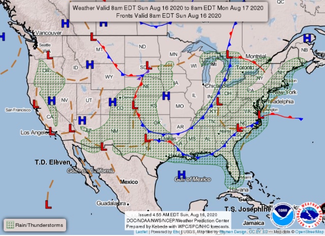
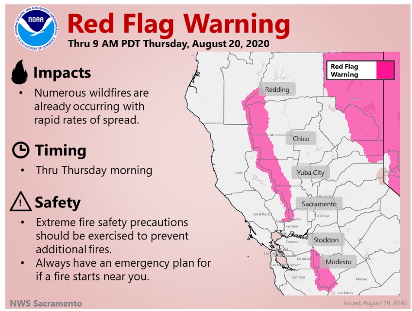
Area Forecast Discussion
National Weather Service Sacramento CA
336 AM PDT Sun Aug 16 2020
.SYNOPSIS…
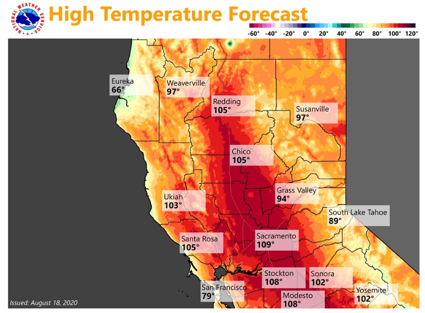
Prolonged heatwave will impact the region through at least the
middle of this week. Daytime temperatures will be 10 to 20
degrees above normal with limited overnight relief. Isolated dry
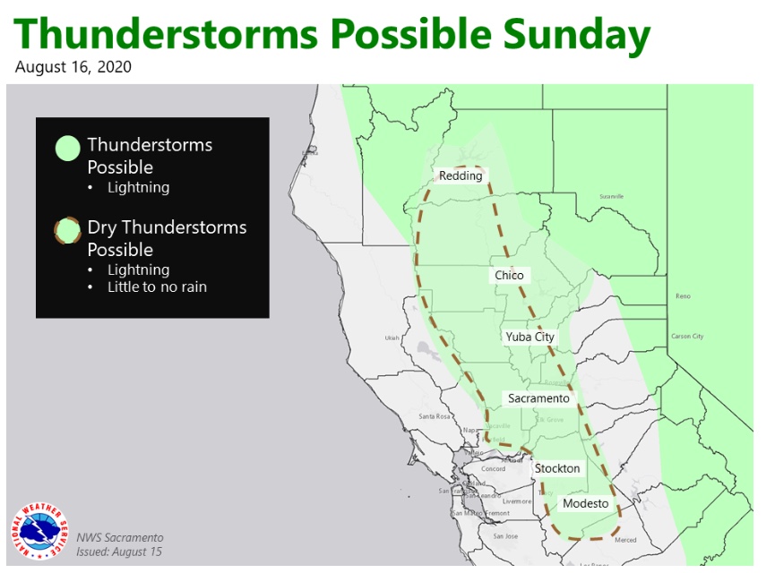
thunderstorms possible over the Valley and mountains today,
possibly lingering into early Monday morning. Renewed chances of
afternoon showers/thunderstorms over the mountains Monday
afternoon and evening.
&&
.DISCUSSION…
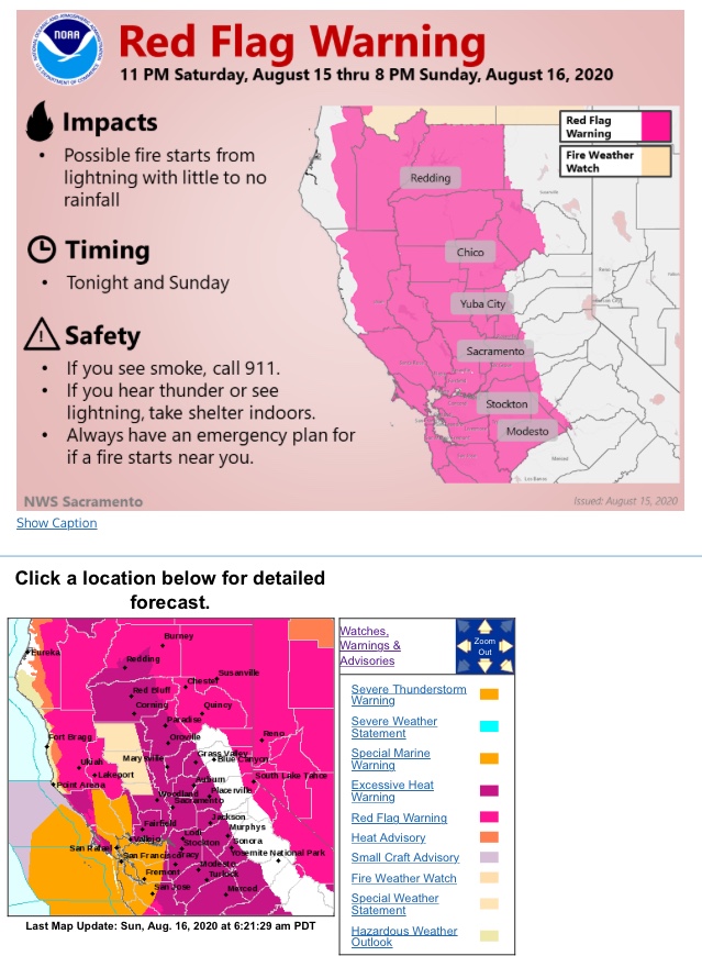
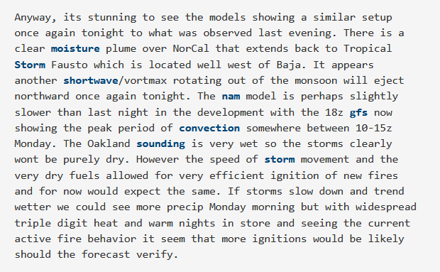
This morning weve been watching a cluster of storms travel up the coast of CA and it is now entering into the Bay area. The forecast looks to remain mostly on track, with some changes occurring in the short term. We trimmed the Red Flag Warning back, cutting out the northern San Joaquin Valley. The Southern Sacramento Valley was trimmed as well, but we kept areas west of I-5 included. Based on the current convection, that seems to be working out. If storms do hold together and make it into our area, we may see a few sprinkles or virga. PWATs are favorable, but with the lower levels of the atmosphere being dry, we expect dont
expect to see much, if any rain from thunderstorms.
Along with the chance of thunderstorms today, the next challenging
aspect of the forecast will be cloud cover and temperatures.
Satellite imagery this morning depicts scattered to widespread
upper level clouds due to the short wave riding up the coast. With
renewed chances of convection throughout the day, partly to mostly
cloudy skies seem to be reasonable for the forecast. This, in
conjunction with slightly lowered heights, should keep
temperatures in the 103 to 108 range for the Valley. The higher
end of the spectrum is possible if areas are able to get some
clearing.
Later tonight and into Monday morning, CAMs are suggesting another
round of nocturnal storms. The track of this disturbance looks to
be a touch farther west and should mostly impact the coastals and
perhaps even the southern Cascades in Shasta County. Because of
this, weve extended the Red Flag Warning through 18Z Monday. Heights will be rising again, which means well also see high
temperatures bump up a few more degrees. Triple digit heat will be
widespread across the Valley and foothills, with some locations
getting close to 110 degrees. Tuesday will be another scorcher
and may actually be closer to what we saw yesterday (Saturday).
Will need to keep an eye on 850 temps and overall heights and
adjust the forecast accordingly.
Wednesday and into Thursday, the high weakens a bit which will
knock high temperatures down a bit. Triple digit heat is still
expected, which combined with oppressive overnight lows, means
little to overnight relief. The “good” news is that Wednesday
night into Thursday, we could see our first reasonable night of
temperatures. Latest model guidance shows temperatures in the
upper 60s to upper 70s instead of the low 70s to mid 80s weve been seeing. This doesnt mean that we`ll be out of the woods
though, as our dog days of summer look to continue into the
extended forecast.
As a reminder this is a significant and dangerous heat event. Heat is
the number one weather-related killer in the U.S. Heat related
illness to humans and animals is likely with extended outdoor
exposure. Take necessary precautions to stay hydrated, cool, and
safe during this prolonged heatwave.
2 Likes
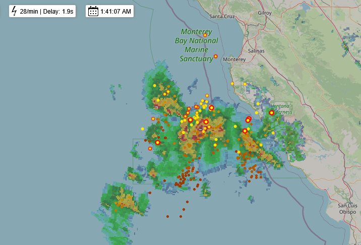
Round two is expected late tonight.
4 Likes
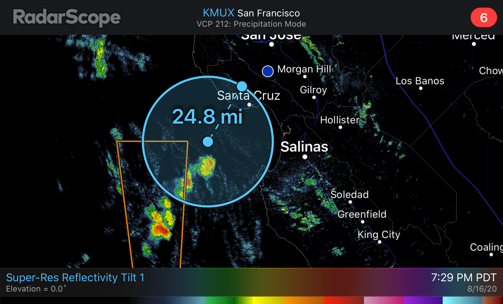
Big cell going thru Yolo county West Sacramento and west. No precipitation.
1 Like
Over NEU/AEU multiple down-strikes. Little to no precip.
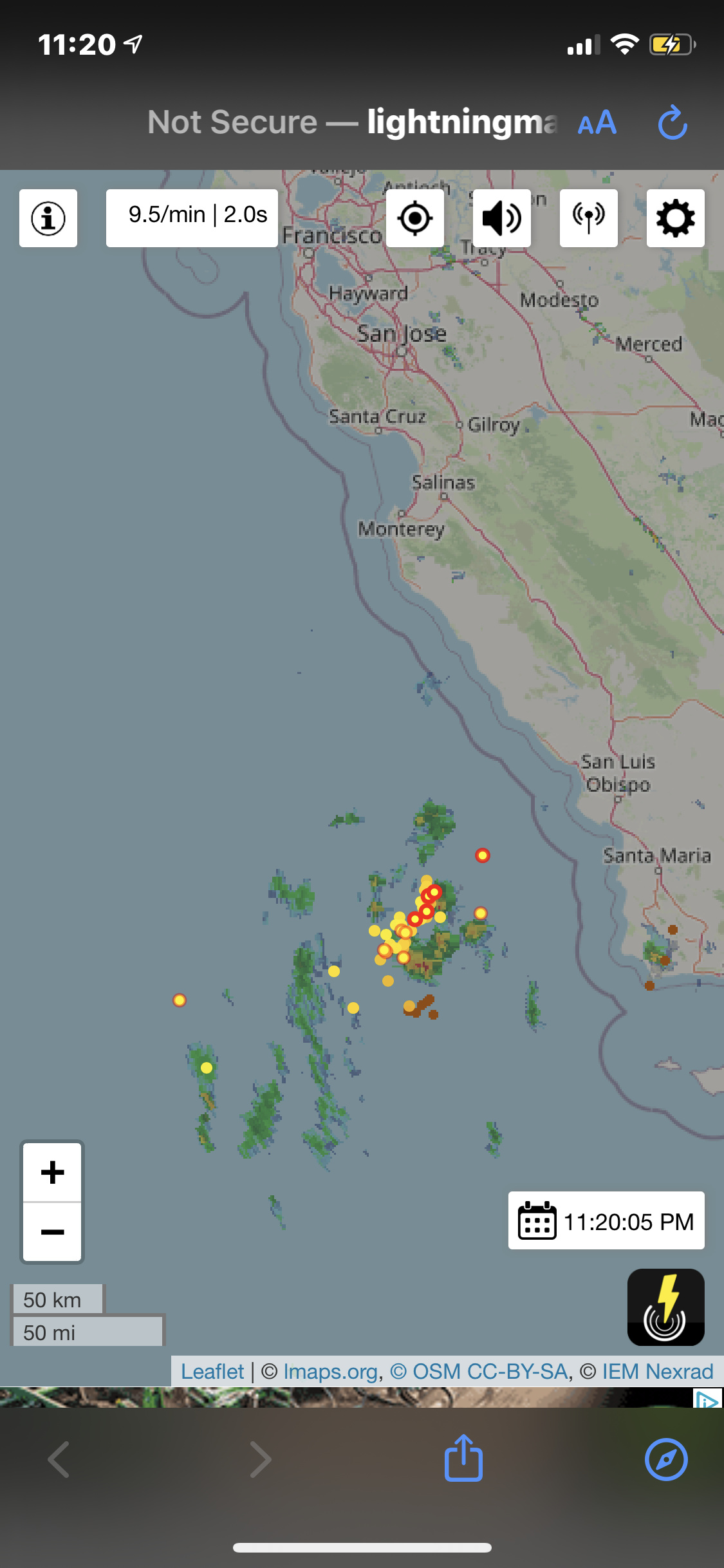
Activity picking up over the last hour west of SF and moving north towards Marin.
Blitzortung map found here: https://map.blitzortung.org/#7.87/37.73/-122.626

Regional Forecast


2 Likes
2 Likes
He mentioned on his blog tonight that NW winds will be a big factor late tonight and tomorrow
1 Like
Regional Forecast


A local Bay Area weather guy on last night said it’s possible, and an exceptionally rare occurrence, that Hurricane Genevieve could push a second wave of lightning into NorCal next week.
1 Like
We will have plenty of new black to limit spread of new starts!
7 Likes
Very ominous site of all the fires burning in NorCal…
4 Likes