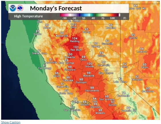
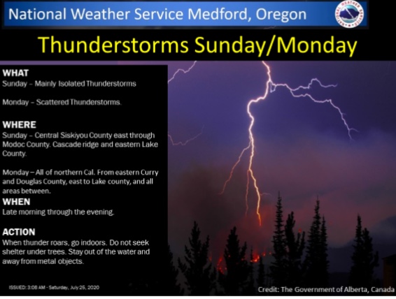
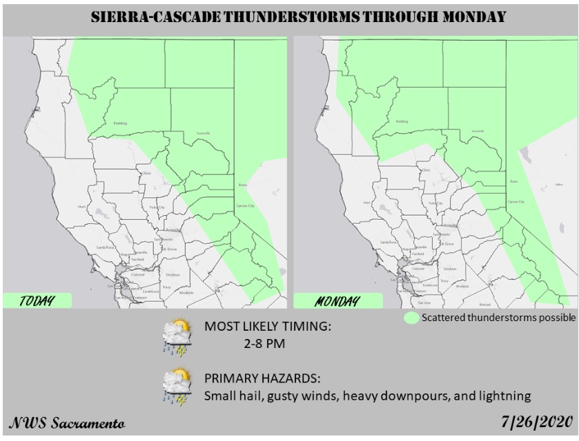
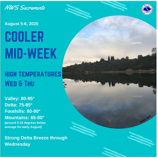
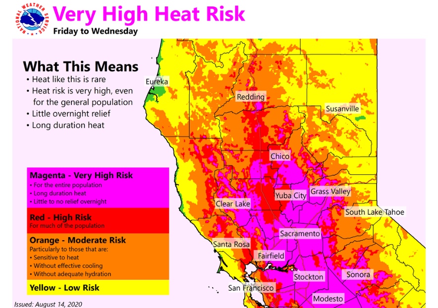
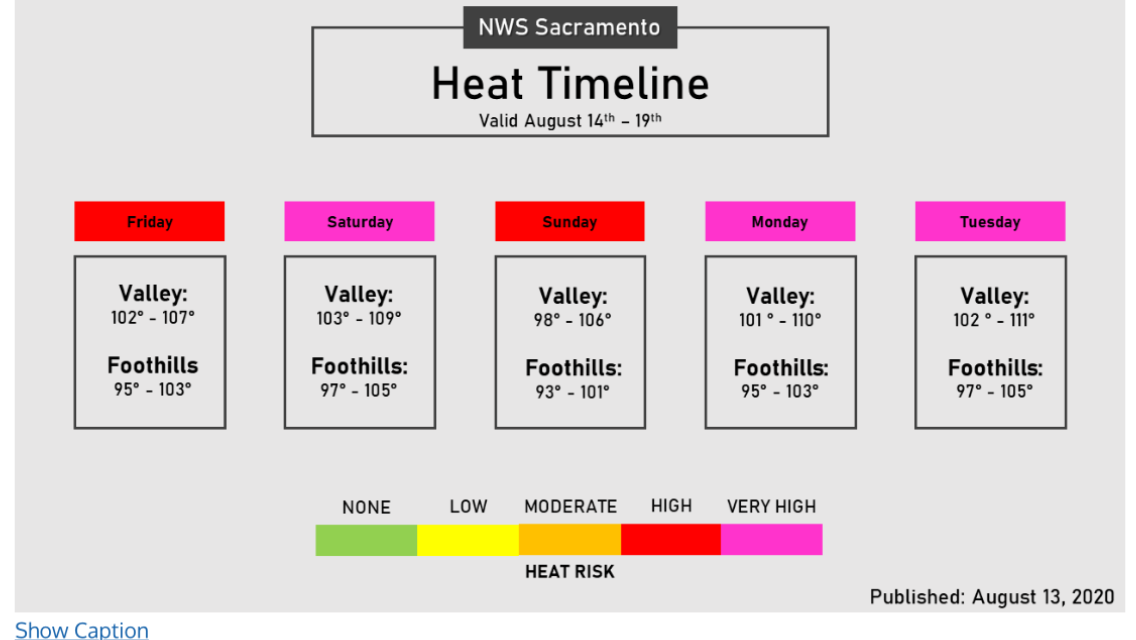
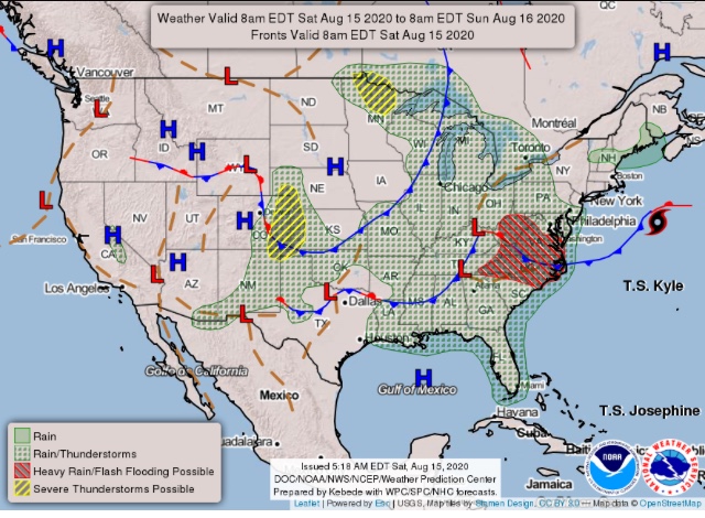
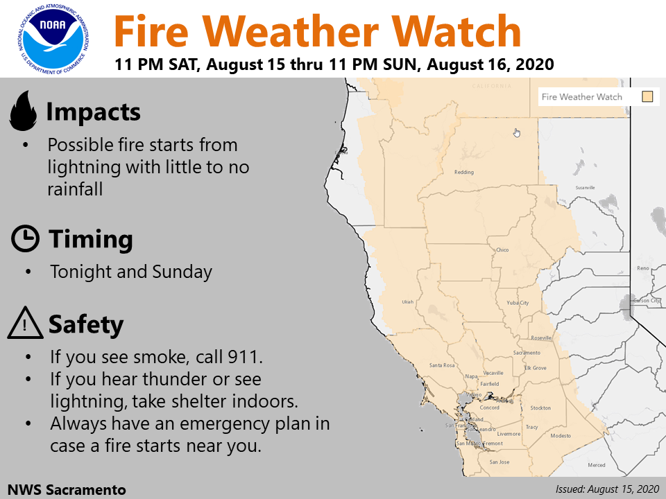
…Northern California and far South-Central Oregon…
The latest convection-allowing guidance indicates potential for
isolated dry thunderstorm development during the late
afternoon/early evening over this confined region on Sunday. PWAT
values here should remain near or under 0.75 inches amid fuels that
remain conducive to large-fire spread despite some recent rains.
Thus, an area has been introduced delineating the potential for dry
lightning starts Sunday afternoon/evening.
We had some pretty decent buildups over the July Complex on the Modoc. Getting some winds out of it now and looks like quite a few lightning strikes over the fire area.
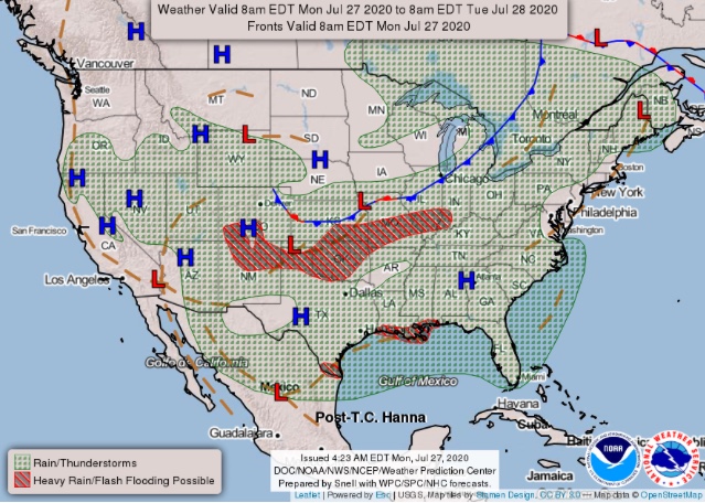
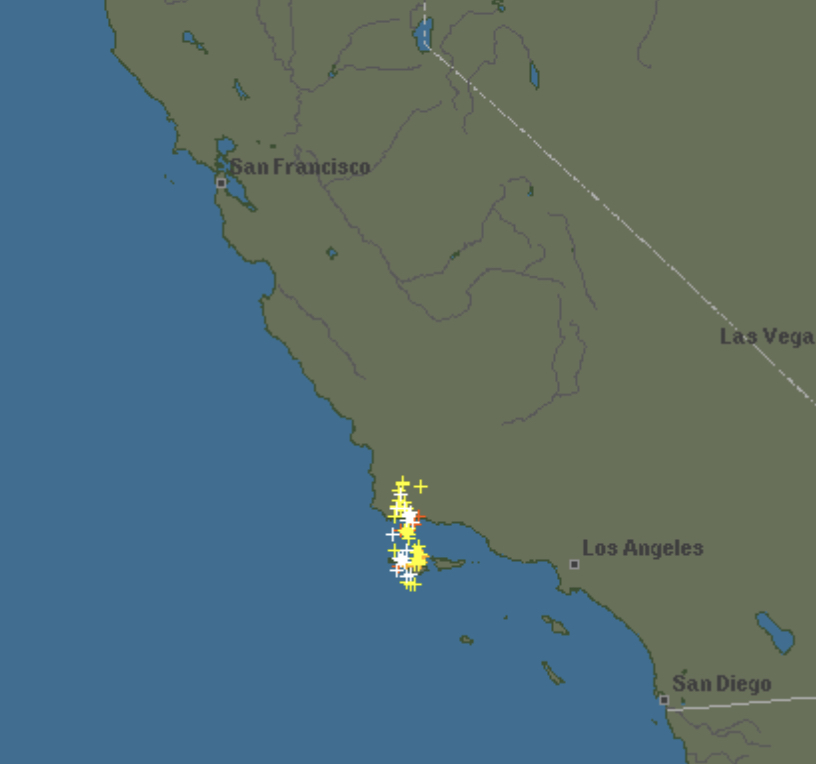
From this mornings forecast discussion out of NWS - Monterey. (Link after)
… a surge of moisture at 700-500mb aloft will be advected in from the south in the southerly flow between these features later today, tonight, and into Sunday morning. Elevated convective parameters meet critical thresholds to spark the potential for fast moving, high based convection of which some isolated thunderstorms may develop and move across the area from south to north. Given the dry fuels and hot, drying air mass in place, any isolated lightning strikes could lead to new wildfire starts. In addition, due to both the high based and fast northward progression, little if any precipitation will accompany lightning strikes at the surface, suggesting that isolated dry lightning will be the main outcome of any elevated convection through the coming days.