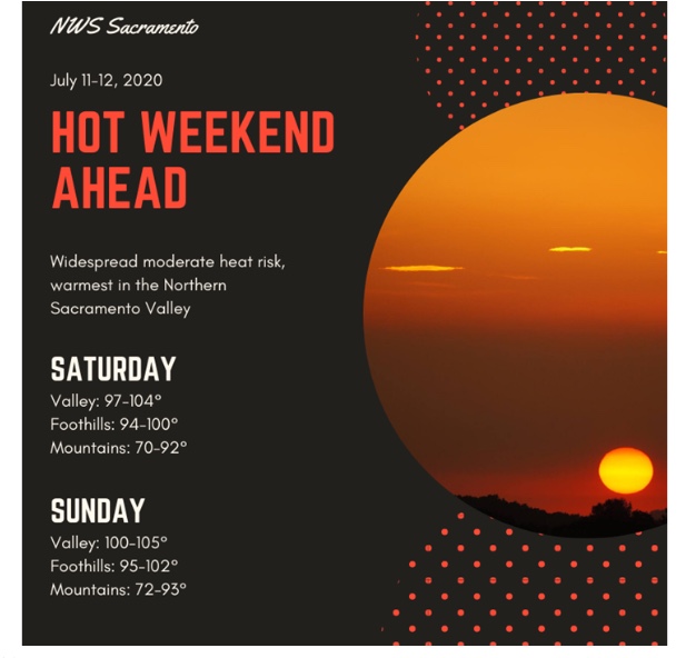
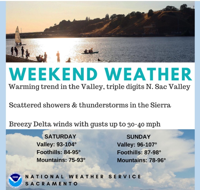
As was forecast by PDS and other long termed outlooks, the regional high pressure ridges have not shown to have a lot of staying power so far this year. So our heat waves have been more transient, with long wave troughs replacing ridges, which has produced some dramatic swings in temps.
Going into this, we had to expect more wind. Any change in pressure differential will produce wind. Do not discount the long term effects of wind on our fuels. Even when we have relatively cooler( 80’s-90’s) with the moderate Delta Breeze, the effects of the wind will be felt by the fuels and help to accelerate the drying process.
4 Likes
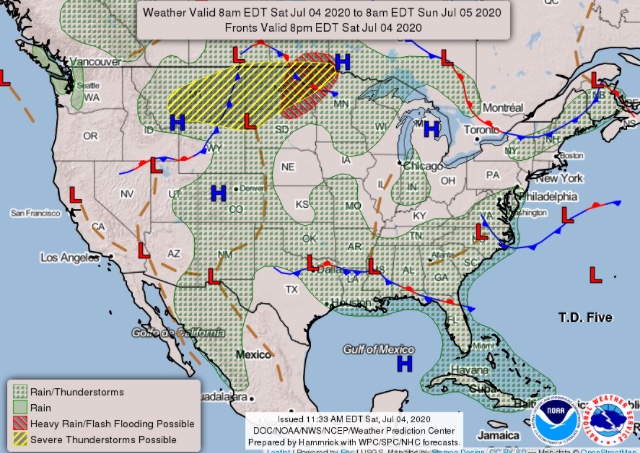
Looks like some decent lightning activity just NW of Eagle Lake up in Lassen Co. No noticable precip on the WeatherBug Radar either.
1 Like
Some random thoughts on fuels and weather as we move forward into the “heart” of fire season.
June will tie or be near the warmest on record for many places across the US. Remember, the warmest is not necessarily the hottest- but rather an average of the low and high. Overnight minimums even ticking up 1 degree have a huge impact on the average.
Those overnight minimums averaging higher, can have a resulting drop in RH, which means accelerated drying time for our fuels. If we think about the evapotransportation of moisture during the drying process- one more hour a day at the level that causes a plant to loose moisture, means 7 hours a week, or 30 hours a month.
Those add up quickly and we are seeing our vegetation change in response to that.
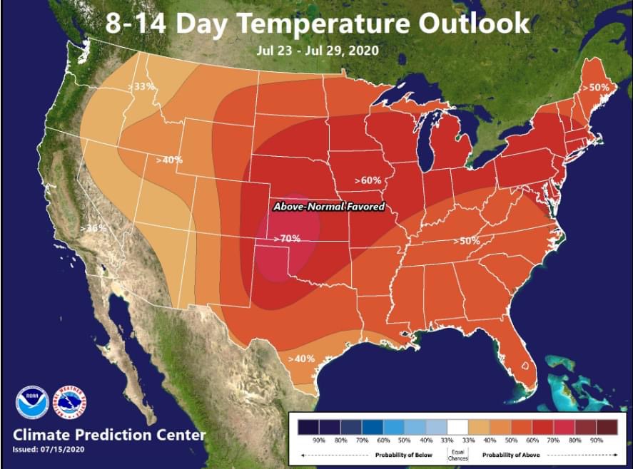
In addition, I would watch the northern 1/3 of California, much of that area is in a significant precipitation deficit, and that will become magnified over the next two weeks.
The late spring rains added the one missing component- a grass crop. Any lightning in the northern 1/3 of the state this year will be problematic.
I would be interested to see if there have been any studies done on the location of the thermal belt. It seems to have expanded and become semi-permanent in the lower foothills. While it used to arrive with strong heat waves, it has been more prevalent the last 7-8 years. The overnight minimums are hovering int he low 70’s… that will have a significant effect on fuel moisture after this next week.
I would expect to see an uptick in fire activity in the foothills over the next week, even without any primary drivers such as wind.
10 Likes
You bring great points. You are clearly a student of fire. Equally as important is field validation of burning conditions. Our fires in Northern California have nearly all been wind driven thus far. We have not YET seen the FUEL Driven fires the way we did a few years ago particularly in CAL FIRE region 1.
It will be interesting to watch the outlooks/observations from the GACC to see how they support your theory.
The scariest part of all this for me is our bad habits. Companies can “get away with” bad/unsafe tactics when the fuels are forgiving. When they become volatile, these “bad tactics” are often again employed because “it worked last time”. The consequence can range from scared shitless to dead. Just my two cents.
-Base all actions on current and expected will ensure you live to see fire season 2021…
9 Likes
Sun Tzu said" if you know yourself and your know your enemy, in 100 battles- you will be victorious 100 times".
I do think the lasting effects of the drought will be with us for a decade or two. No where that is more evident than in the Central and Southern Sierra’s.
When combined with the whiplash of our precipitation regime, we will struggle to see any return to how things were in the 90’s.
In keeping with that thought, I think we need to re-evaluate how we see fire season- not just in terms of a year round season- but how we view and monitor our fuels.
Long term trends in fuels need to be tracked- published and understood. The increase in VMP programs and the money being infused into that program will help with that. Once we understand and accept the “new normal” we can adjust our paradigm to help us be better prepared to for what Mother Nature sends our way.
4 Likes
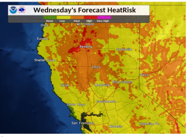
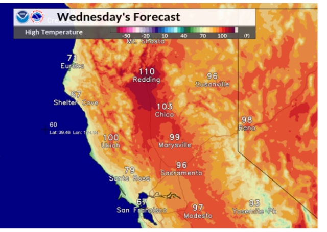
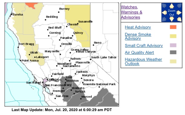
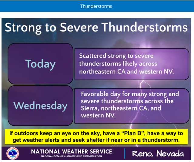
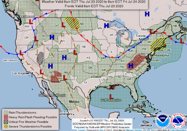
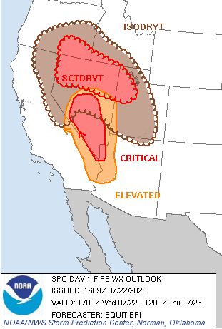
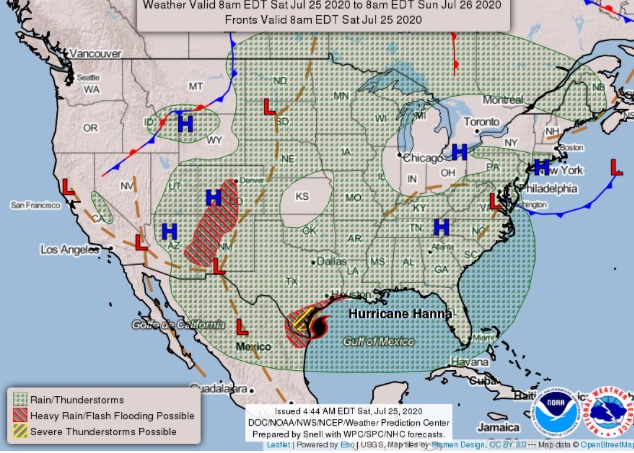
NOPS has high risk designated for the northern sierras and Far East side on Wednesday and Thursday for lightning.
2 Likes

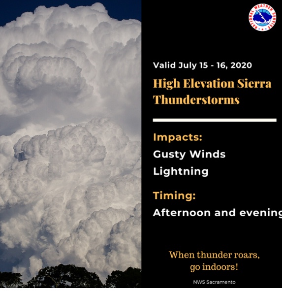
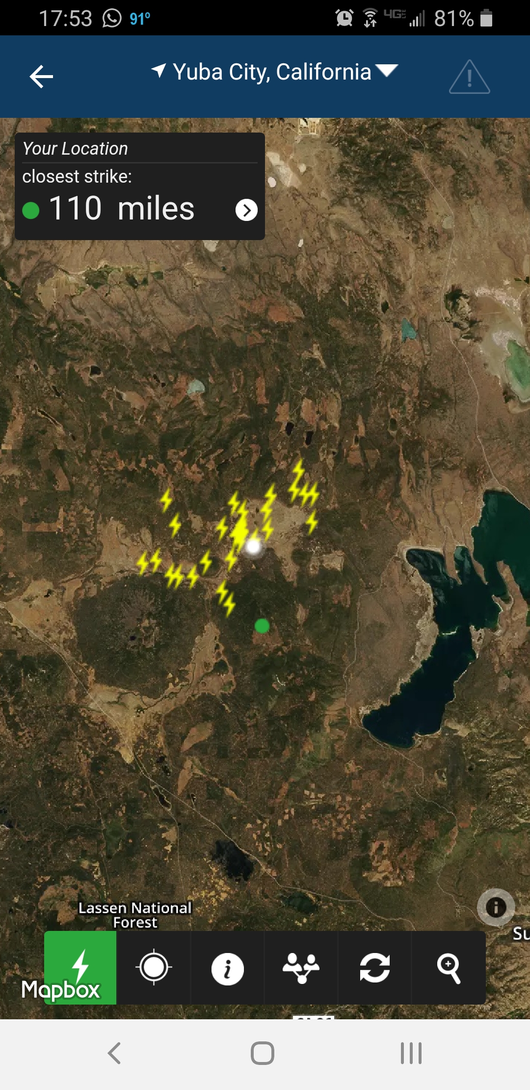
Looking at the lightning / storm tracker. Decent sized storms slowly making its way up the Sierra’s. Anyone in that area and seeing if it’s producing precipitation?
Scattered precip.
1 Like
Dumping hail and rain in South Lake Tahoe.
2 Likes
I’m in Truckee looking out over the North East mountains and it looks like it is dumping. Heavy hail yesterday near incline. tons of lightning and thunder.
1 Like
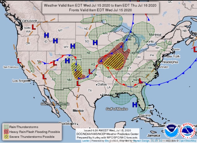
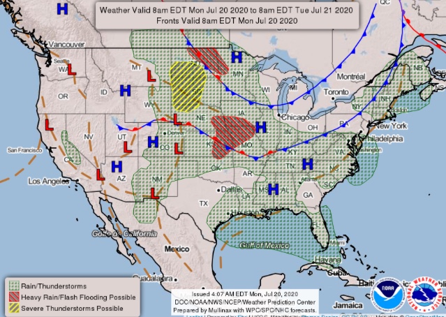
Regional Forecast
3 Likes
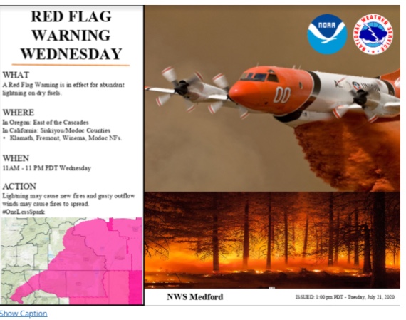
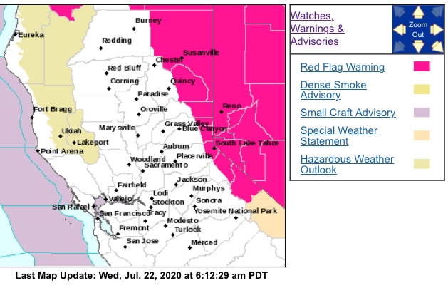
NWS in Reno has issued a Red Flag
Warning for thunderstorms and strong outflow winds, which is in
effect from 1 PM to 9 PM PDT Tuesday. A Fire Weather Watch has
also been issued. This Fire Weather Watch for thunderstorms and
strong outflow winds is in effect from late Wednesday morning
through Wednesday evening.
Thunderstorms…Isolated to scattered thunderstorms are expected
Tuesday and Wednesday. Storms will be a hybrid mix of wet and
dry. However, with recent unusually low humidity, vegetation
could be extra receptive to new lightning caused fire starts.
-
Outflow Winds…Gusty outflow winds up to 40-50 mph on Tuesday,
with gusts up to 60 mph on Wednesday. -
Impacts…Lightning can create new fire starts and may combine
with strong outflow winds to cause a fire to rapidly grow in
size and intensity before first responders can contain them.

2 Likes

Storm motion is going to be much faster today also slightly drier as the upper level low is closer, so expect more lightning starts and a high chance of outflow winds due to increase storm motion and inverted v profile.
3 Likes

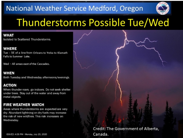
Heard some rumblings ( no pun ) of a fire weather watch on the Great State of Jefferson starting Monday…
Any info? With the lack of resources, could be another interesting week.
3 Likes