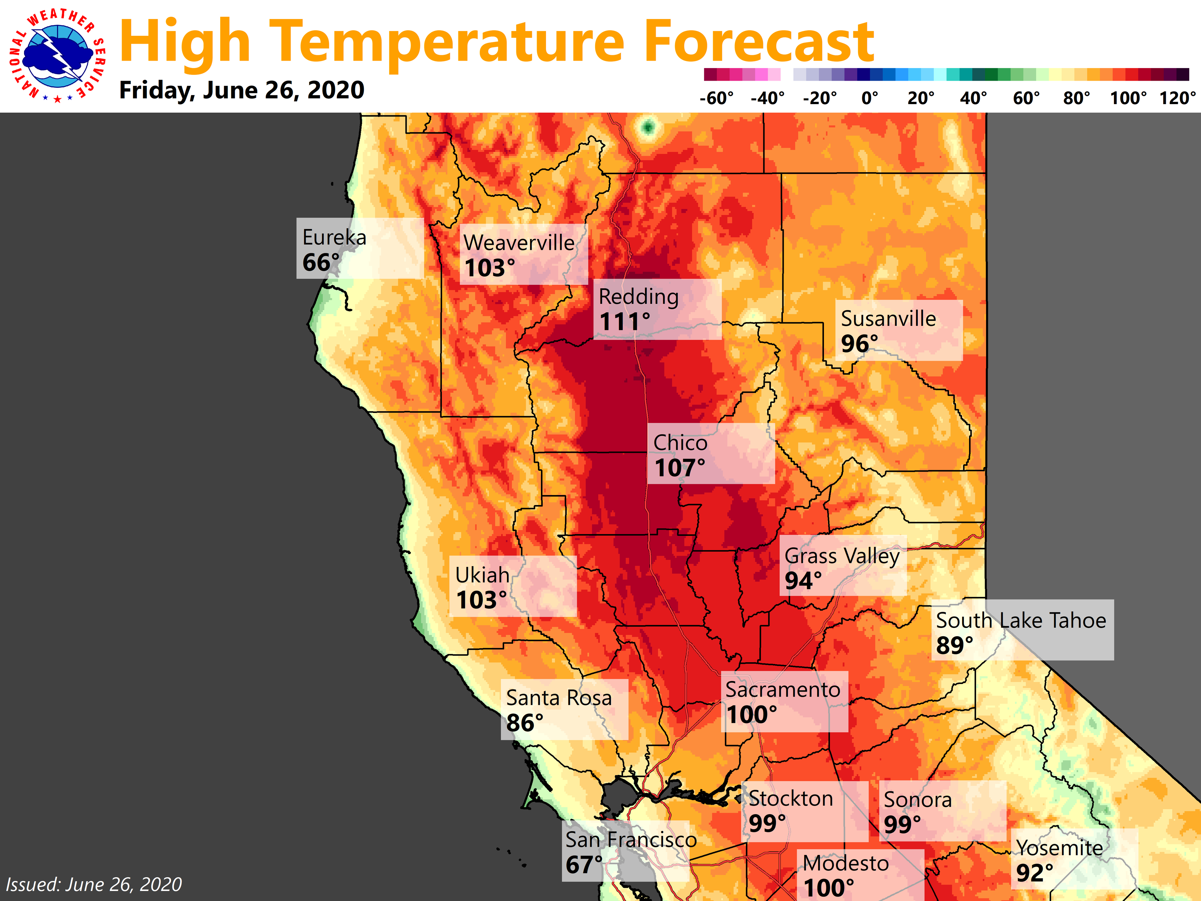
Regional Forecast
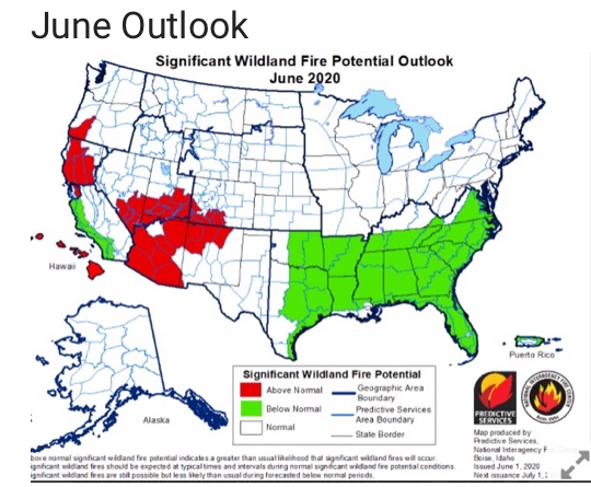
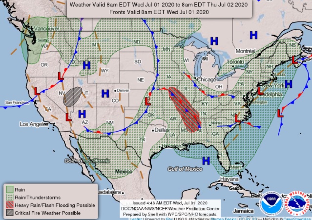
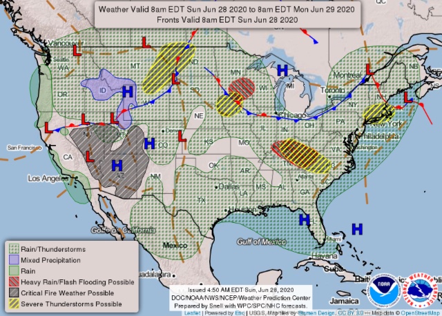
National Forecast Map
Regional Forecast
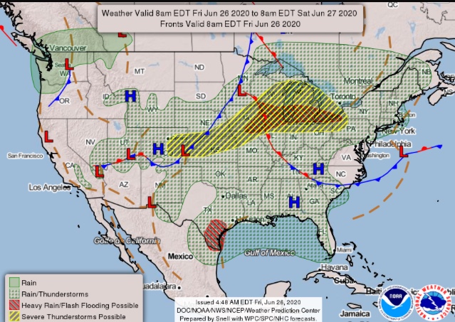
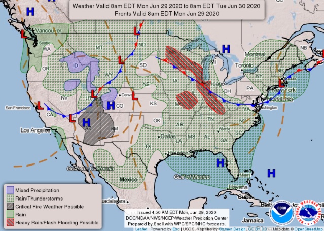
National Forecast Map
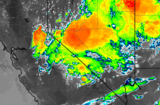
Watching the model trends, just wanted to update. The ridge erodes to the east today opening up the path for a large & unusually dynamic upper level low to move into the Great Basin. It is moisture starved in the low levels and isolated dry thunderstorms will continue to be an issue through the early next week.
What is very interesting and bizarre for this time of year is this path the trough takes sets up a weak Diablo wind event, and the northerly flow advects very very dry air for this time of year into Northern CA early next week. RH could fall into single digits compounding the stress on vegetation health (just went through a heat wave).
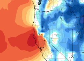
This figure shows temperatures aloft, classic Diablo Wind signal but the main threat is for very dry warm weather.
NAM pushes some dry thunderstorms into the West Sierra foothills this evening. Worth watching.
Thunderstorms are moving in over shuteye lookout in Madera county.
Deadwood camera near coarsegold looking towards shuteye.
http://www.alertwildfire.org/sierra/index.html?camera=Axis-Deadwood&v=81e003f
Madera county is considered south ops… so
You might consider making a new thread for south ops weather…
Only posted it here to state that the Nam forecast for thunderstorms to move over to the western Sierra was correct.
Strong storm approaching Amador City. Will be interesting to see if any downstrikes, this side of the Sierra is much drier than the Tahoe side currently. There will be a fire threat with any downstrikes.
There have been no detected down strikes since just west of Union Valley Reservoir. The area between Union Valley and Loon Lake got hammered with down strikes from this storm, but it looks like copious rain accompanied them.
Literally a new start on Sonora Peak, right now.
Regional Forecast
National Forecast Map
Regional Forecast
National Forecast Map
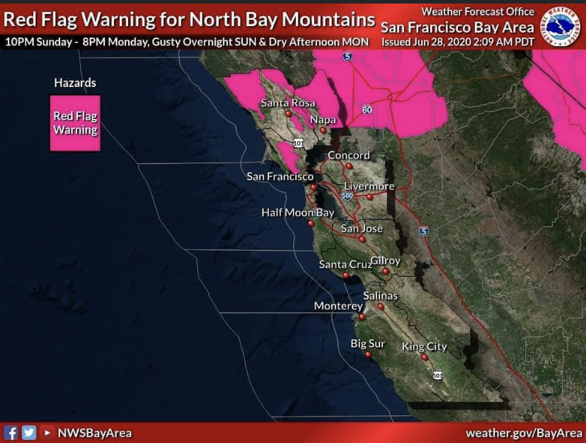
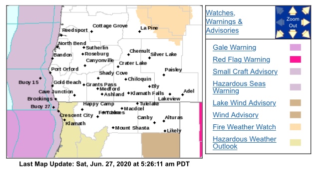
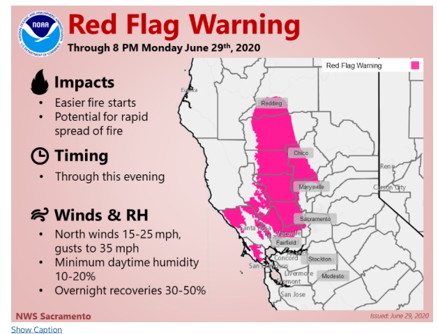
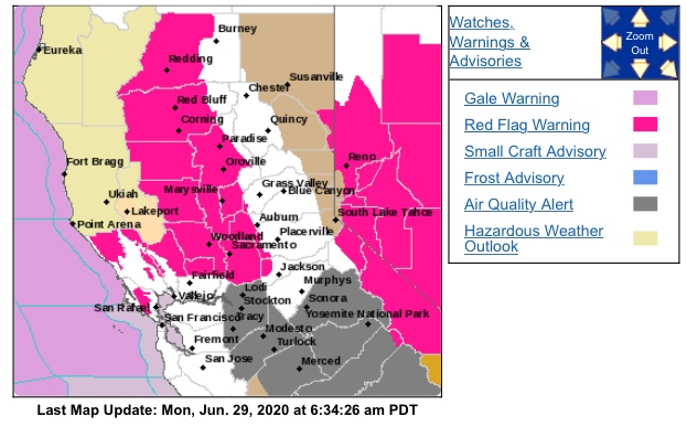
Red Flag extended into North Bay and Lake County.
The first red flag warning of the season has been issued for gusty offshore winds Sunday night and dry daytime conditions on Monday for the North Bay peaks above 1000 feet.
The red flag warning is valid from 10pm Sunday night through 8pm Monday evening.
Peak winds will be in the 15 to 25 mph range with gusts of 30 to 50mph possible over the higher peaks Sunday night. Winds decrease rapidly through Monday morning.
Humidity values will descend into the 15-20% during the day on Monday
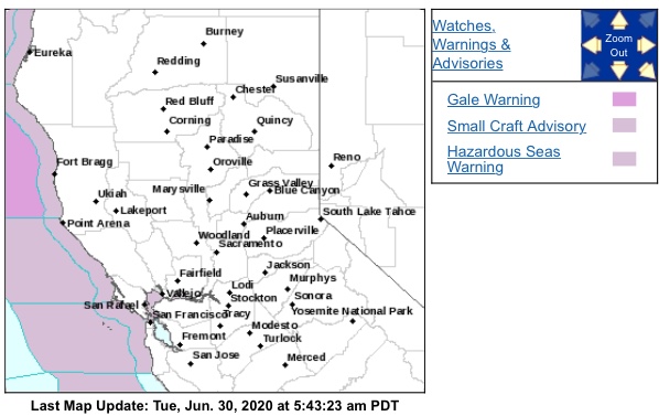
First for that area!
Which area ?
San Bernardino had one along with parts the Tahoe area. But I’m just being petty.
Regional Forecast
National Forecast Map
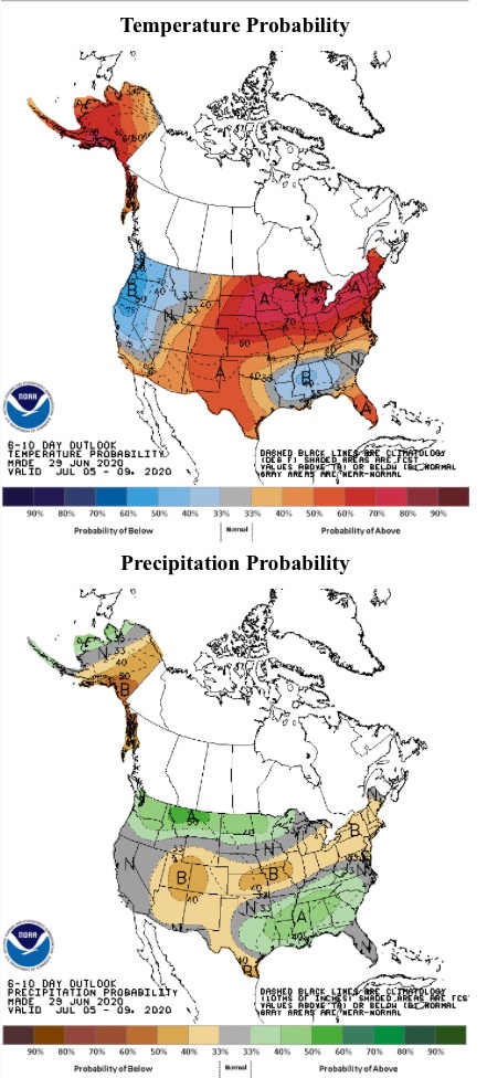
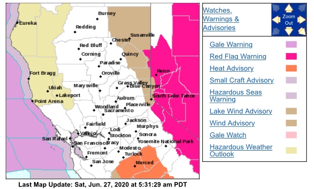
One more day of elevated to critical fire weather to get through, after which winds calm down. Later this week a pattern shift occurs, the western ridge re-orients from NW-SE to a classic monsoonal SE-NW pattern. This means zonal flow will return to northern california with cool onshore flow in the mornings/nights and warm seasonal temperatures in the afternoons. Humidity will rise and thunderstorms should occur in the Sierras.