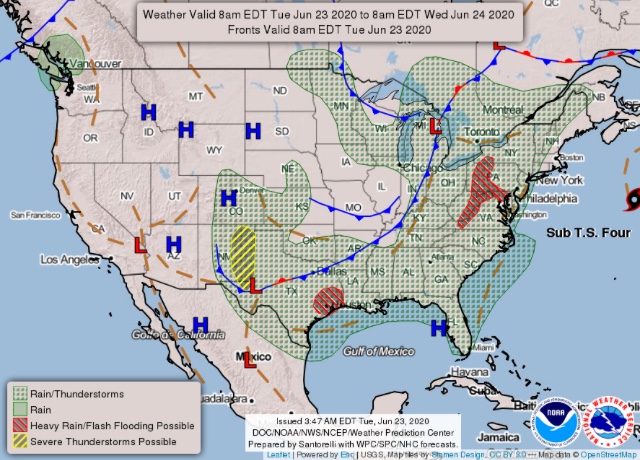
Regional Forecast
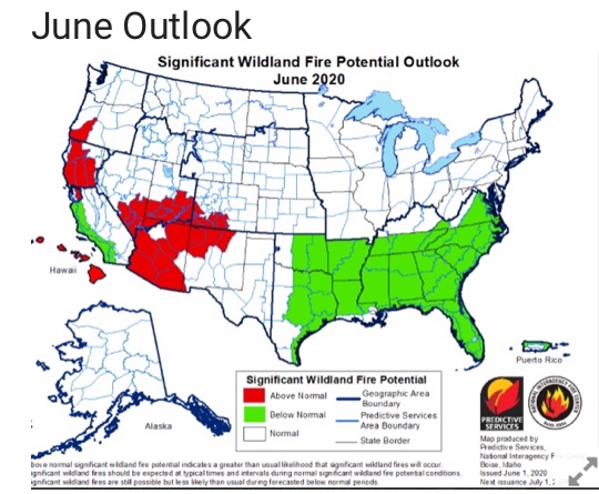
June Outlook
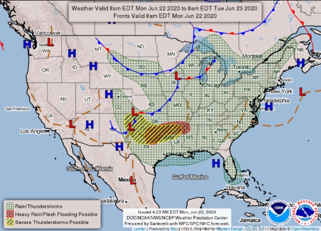
National Forecast Map
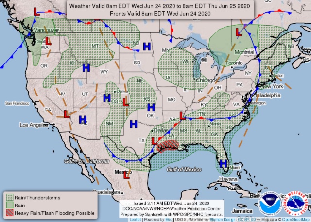
Regional Forecast
June Outlook
National Forecast Map
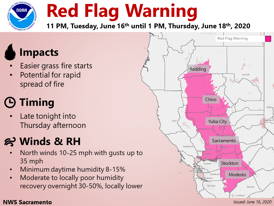
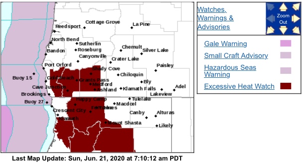
Red Flag now.
This week is looking quite brutal with the RFW followed by extensive heat. Initial attack will likely be pretty heavy.
Quick update on extended heatwave… both of the top forecasting models ECMWF and GFS agree that a large ridge will build in from Mexico starting tomorrow. Temperatures will peak on Monday. A blend of the two models and it’s ensembles are indicating temperatures across California’s breadbasket 8-15 degrees above normal. Elsewhere across the state temperatures will likely be 6-12 degrees above normal. The lower valleys of California could have temperatures over 100 degrees for 4 days straight, and both models agree that the hottest areas could hit 110 degrees on Monday.
Fly in the ointment: at this time the operational models agree that the ridge will break down slightly Wednesday, but rebuild on Thursday into the long term. The ensembles on both models keep troughing after Wednesday.
All in all it is looking very hot, with relative humidities in the 10-25% range for 5-7 days.
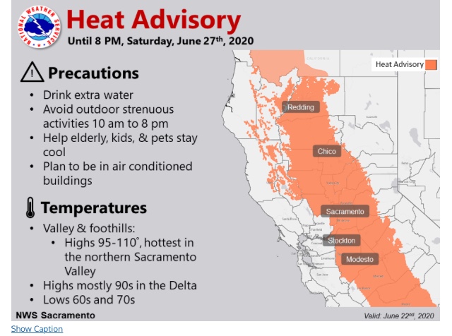
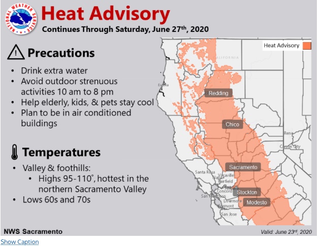
National Weather Service Sacramento CA
959 AM PDT Fri Jun 19 2020
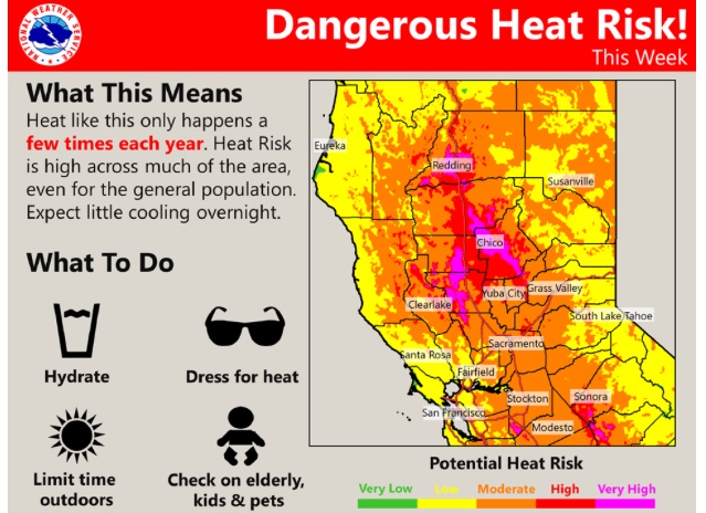
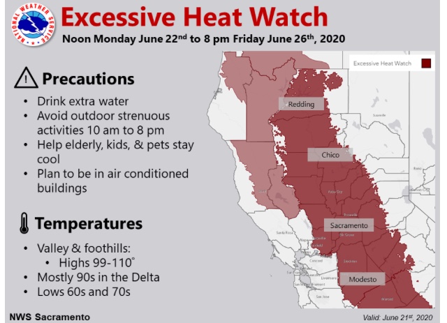
…Dangerous Heat Next Week…
.A prolonged period of very hot temperatures is expected next
week, with Valley and foothill highs in the mid 90s to triple
digits. Overnight temperatures will only fall to the mid 60s to
70s, offering little relief. Marine influenced areas may
experience slightly cooler overnight lows, but will remain hot
during the day.
WHAT…Dangerous heat with afternoon highs between 99 and 108
for the Valley, 95 to 102 for the Foothills and mostly 90s for
the Delta. Overnight lows in the 60s to 70s.
WHERE…Sacramento Valley and surrounding foothills, the northern
San Joaquin Valley, and portions of the Delta.
WHEN…From Monday afternoon through Friday evening.
Dangerous compounding heatwave: today through Saturday of next week temperatures will range from 100-109 degrees through Central/Northern CA middle valleys. The ECMWF has consistently run to run shown heights increasing above 596 DM on Thursday, which would support max temperatures 110-116 in the hottest areas. The duration of triple digit heat and low humidity will significantly dry heavier fuels out, IA should be moderate to heavy but lack of wind will keep large fire potential only moderate this week.
Regional Forecast
GOES West Imagery
https://www.star.nesdis.noaa.gov/goes/sector.php?sat=G17§or=wus
National Forecast Map
Thanks for the links via email. I was trying to fill in the gap between what you share for NOPS and SOPS. But I am technically challenged
Regional Forecast
National Forecast Map
PDS has been spot on with all their forecasts over the last few years. They may want to take a look at the “below normal” section for the central coast… been hopping there lately…
Regional Forecast
National Forecast Map
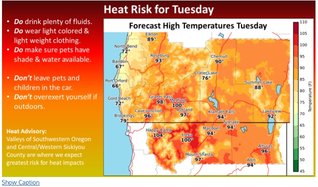
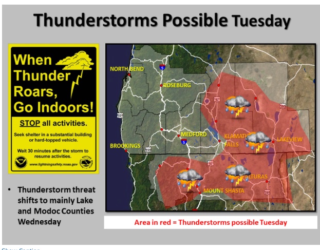
Looking very hot today through Thursday especially north of Sacramento as weak surface high pressure builds into the Great Basin & heights peak overhead. Offshore flow will cause compressional heating and max temperatures will likely be around 110. A highly anomalous trough digs into the Great Basin this weekend and this will lead to cooling and a chance of interior thunderstorms. However, onshore winds will increase significantly leading to an increased chance of large fire activity on desert slopes. Max gusts could reach 60 mph.
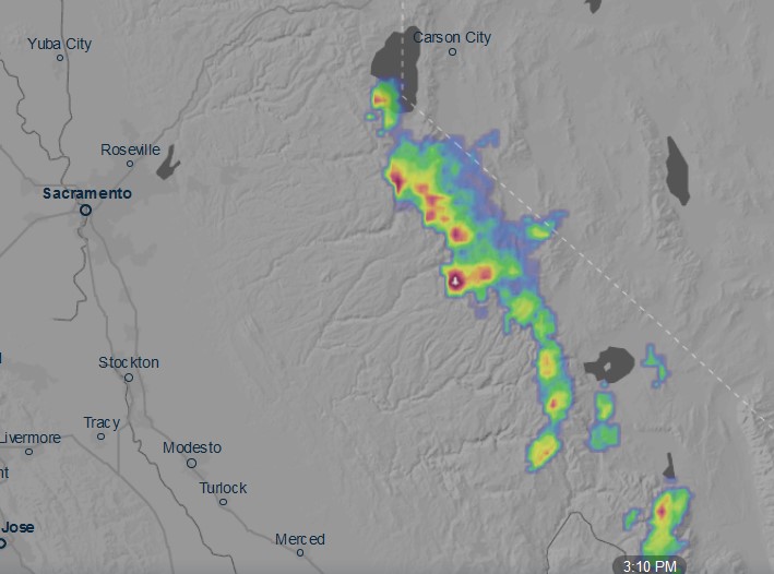
Thunderstorms over the Sierra are producing little to no rainfall 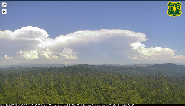
A few strikes…
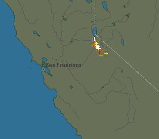
New starts here we go with a LAL 6
Where are there new starts??
New lightning fire north of Mono City
Looks like TBU and hearing traffic in the INF. More of a statement
CA-OVCC-Copper on Wildcad