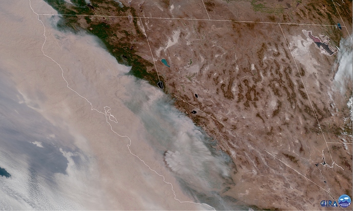
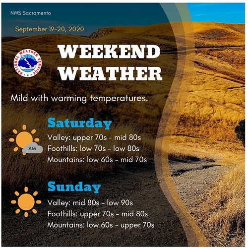
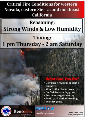
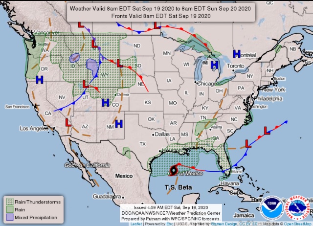
I think its Wolf Fire in Yosemite.
Thanks, just been studying the Rammb slider satelite loop and saw it. I also realized I was seeing a sand storm off the playa up by the Black Rock Desert. Must really have gotten windy this morning. Not a breath of wind where I am down my Lake Pardee.
Interesting to note solar radiation on most RAWS sites is way down. For instance the Konocti RAWS is only 7% of possible at high noon. I wouldn’t be surprised if this is true throughout 90% of the country west of the Rockies right now.
There is much talk in the wx sphere about a possible atmospheric river moving into Northern CA and Oregon next week. Unfortunately, often times forecast models bring early season storms too far west and too wet, in the mid term of the forecast run. A reverse trend is seen on the latest run of the GFS & ECMWF, slowing the storm down and shifting this system further east as an inside slider.
This storm system will bring cooler weather but will also significantly increase onshore winds.
NWS: San Francisco Bay Area 5:01 PM Sun Sep 13 2020
Highlights:
SYNOPSIS… Smoke conditions are forecast to improve as southwest winds aloft arrive
in response to a deepening trough over the Eastern Pacific.
An offshore wind event may develop by next weekend as the trough ejects eastward.
Good afternoon.
Both of our main global models and their ensembles are in agreement that a robust offshore wind pattern //Diablo winds will develop at about D8. This will lead to extreme fire behavior on any existing uncontained fires and new fires. At this time, the confidence for this pattern is medium. If run to run consistency continues the next 3 days, confidence will be bumped up to high. The exact timing and strength of the event is unknown. I would expect the possibility of at least 3-5 days of offshore winds at or around 9/26-10/2.
Is there any websites that I can keep up to date with on the up coming event. I have been checking NWS Eureka and Bay Area and haven’t seen anything.
Weather sites:
Check comment section also
Personally I have found the “fire service” related weather forecasts to be over exaggerated. I like the regular ol weather peeps for their opinion
I use https://tropicaltidbits.com/analysis/models/ for model data.
NWS is extremely conservative and does not over forecast these events unless it’s within the 7 day range.
Try Reno NWS.
Thanks. In the past all I have used is NWS.
North Ops and South Ops both have a decent fire weather page that they update morning and afternoon. They also have a a webcast each morning that will keep you updated each morning.
https://gacc.nifc.gov/predictive_services/weather/weather.htm
https://gacc.nifc.gov/oscc/predictive/weather/mobile.htm
From NWS Bay Area AFD:
" The long range pattern shows flat zonal flow next week with ridging over SoCal nudging northward. This should keep temps near to slightly above normal though the pattern looks to be more progressive just to our north with stronger winds aloft likely keeping the airmass well mixed. Models are auguring a stronger trough passage into the PacNW the weekend of Sept 25th with a possible stronger offshore wind pattern behind that which would fit with climatology as we get towards the end of Sept with colder air dropping into the Great Basin and Northern Rockies."
Here is my added take on this: both main global models are not resolving 90L well in the Gulf Of Mexico. I expect this to become a hurricane and disrupt the high pressure in the midwest w/ landfall on 9/23. Models are not showing that/struggling with that scenario. In the case of a landfalling hurricane on the Gulf Coast, I would lean to a stronger-sharper trough through the Great Basin.
CMC run showing a potential strong Diablo wind event near the end of the month. The red is high pressure at the surface while the lighter colors are lighter pressure. The gradient is pretty strong. I am leaning towards something of this scenario, and await run to run consistency of other models to support this.
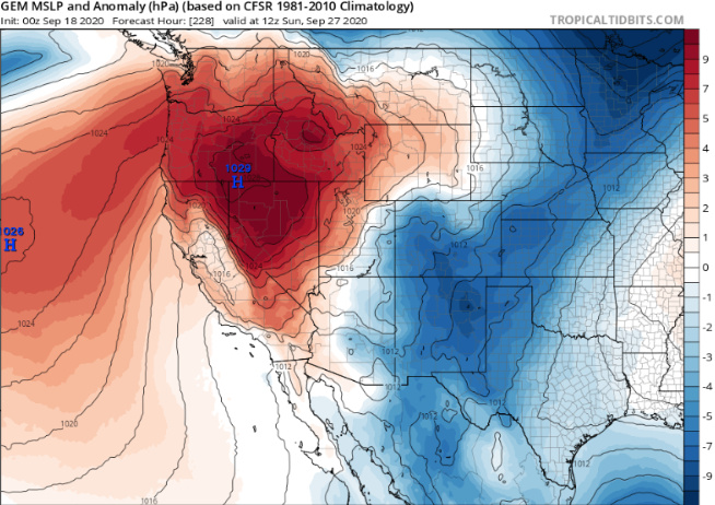
Models continue to flip flop between a large subtropical high pressure system and a surface high pressure over the Great Basin. It’s pretty late for a subtropical high so continue leaning towards climatology which is surface high pressure and offshore Diablo winds on 9/27. The 00z GFS trends more towards that scenario this morning. The CMC trended towards the subtropical high this morning.
Still need to watch for the high pressure scenario as it has had every other run consistency, and would push temperatures up 10-20 degrees above normal.
Update… 12z Euro brings a strong Diablo wind event Saturday-Tuesday. Starting to get a little consensus on the situation.
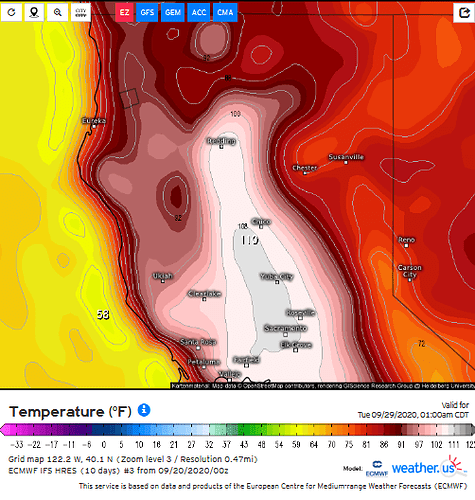
Update: model consensus is building for the combination of an offshore wind event, of moderate strength + above average temperatures ranging from about 10-20 degrees above normal. 9-26 to 9-29
This is a complicated scenario because a very strong ridge is building overhead just west of surface high pressure. This potential scenario (strength of these features) does not have much historical precedent adding to the complexity. The only details left to iron out is exact trough placement and strength, but the pattern seems set in stone.
ECMWF is the most aggressive temperature solution at this time.
This is an excerpt from the NWS AFD from Monterey.
“ Its still quite a ways out, but basic projected synoptic picture is reminiscent of the October 4-5 1987 heat wave, when Downtown San Francisco reached a high of 102 degrees, third highest of all time. And, of course, the combination of hot and dry conditions and possibly gusty offshore winds, is of significant concern from a fire weather perspective. Well be monitoring this closely over
the coming days.“
From NWS Bay Area:
" All attention then turns to the weekend forecast. Confidence increasing for potentially significant offshore wind event. Temps will warm rapidly on Saturday with highs bouncing well back into the 80s and lower 90s as a 594dm high builds off the coast with some offshore winds near the surface. Ensemble solutions remain consistent with building ridge leading to hotter temps and stronger offshore winds into Sunday. Would expect widespread highs into the 90s and even some lower 100s. The dry airmass will allow for decent night time cooling that should preclude widespread significant heat impacts though even the overnight lows will remain warmer than normal where the offshore winds blow all night. Right now the peak of the winds looks to be Sunday morning for the North and East Bay hills but still several days out to dial in the details and exact timing. Confidence is high overall and Sunday does look to be hotter than Saturday as heights builds to at least 596dm with persistent offshore/drying winds. Interestingly enough the pattern looks to take hold for several days with the ridge anchored along the West Coast at least through Weds of next week. Right now the only hope of cooling looks to be a southerly wind reversal along the coast."
