
Yeah I went on my honeymoon in late September and early October 2017 and I thought I was coming back for a layoff because of the rain and I was almost timed out, but I can back and went out for 33 days after I got back home.
3 Likes
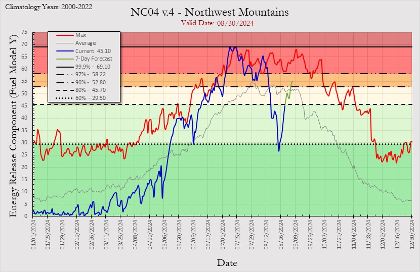
Id make an off of the top of my head comparison to the fall of 2019. In mid September the Red Bank, Lime and South fires essentially got rained out by a deeper and wetter trough much later in the month. Spring/winter of 2019 was cold and wet (though clearly not as wet as 2023) but summer of 2019 was slow/normal. It never got super busy again but Tick/Getty/Kincade occurred in late October. This year is feeling more like that at the moment. Hilary has impacted SoCal and recent rains over the NW are/were substantial. The Klamath/Six Rivers ERC values where most of the IMT are deployed are in the tank.
https://www.cpc.ncep.noaa.gov/products/predictions/814day/index.php
5 Likes
It rained up there and on the rough fire east of fresno.
5 Likes
5 Likes
I’m not sure ‘Blaze’ is the proper adjective. Things seem pretty subdued at the moment.
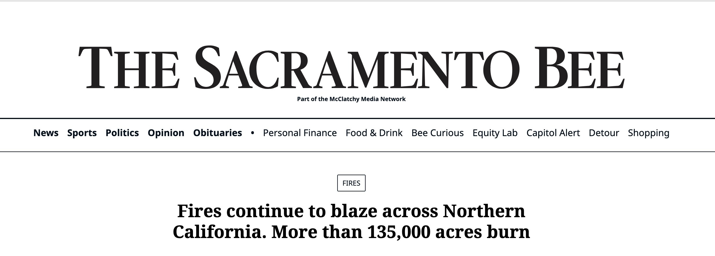
Nor would I probably call a fire that took almost 20 days to burn 4,000 acres a ‘rager’.

6 Likes
After seeing first hand the evacuations in Sonoma County in 2017, 2019, and twice in 2020, 20 people being evacuated seems like dramatization by the journalist. Unless you are one of the 20. I guess your house being 1 of 9, instead of 1of 5,000 doesn’t change much for you.
4 Likes
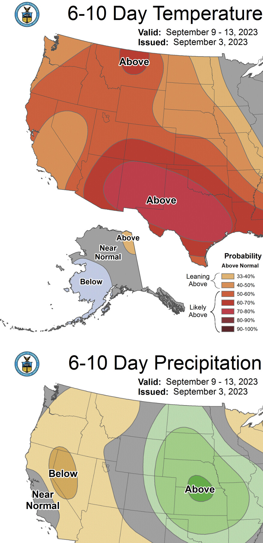
The upper level low that just moved through the state scoured the monsoonal moisture away. This sequence happened last year with TS Kay and then an upper level low producing excessive rainfall over the deserts. Forecast models are showing subsidence returning to the US as surface cold fronts start to move into the eastern Great Basin and Central US, and I would expect the monsoon is pretty much over except for the advent of a landfalling tropical cyclone in Texas boosting it temporarily in late September. The transition to surface cold fronts should bring offshore winds and compression drying and heating events earlier than expected.
So in “essence” that cold upper level low just mixed out that monsoonal airmass and it manifested as some precipitation in some areas especially to the east.
It’s almost a detriment that we had no large fire activity across the west before offshore wind season hits, as it leaves the maximum burn and vulnerability potential if ignitions occur, and an intact grass crop going into the fall season. Moreover, precipitation deficits across Northern California, the Pacific NW, and desert SW could lead to abnormal fire activity this fall across areas that typically don’t see much fire activity in the fall.
15 Likes
4 Likes
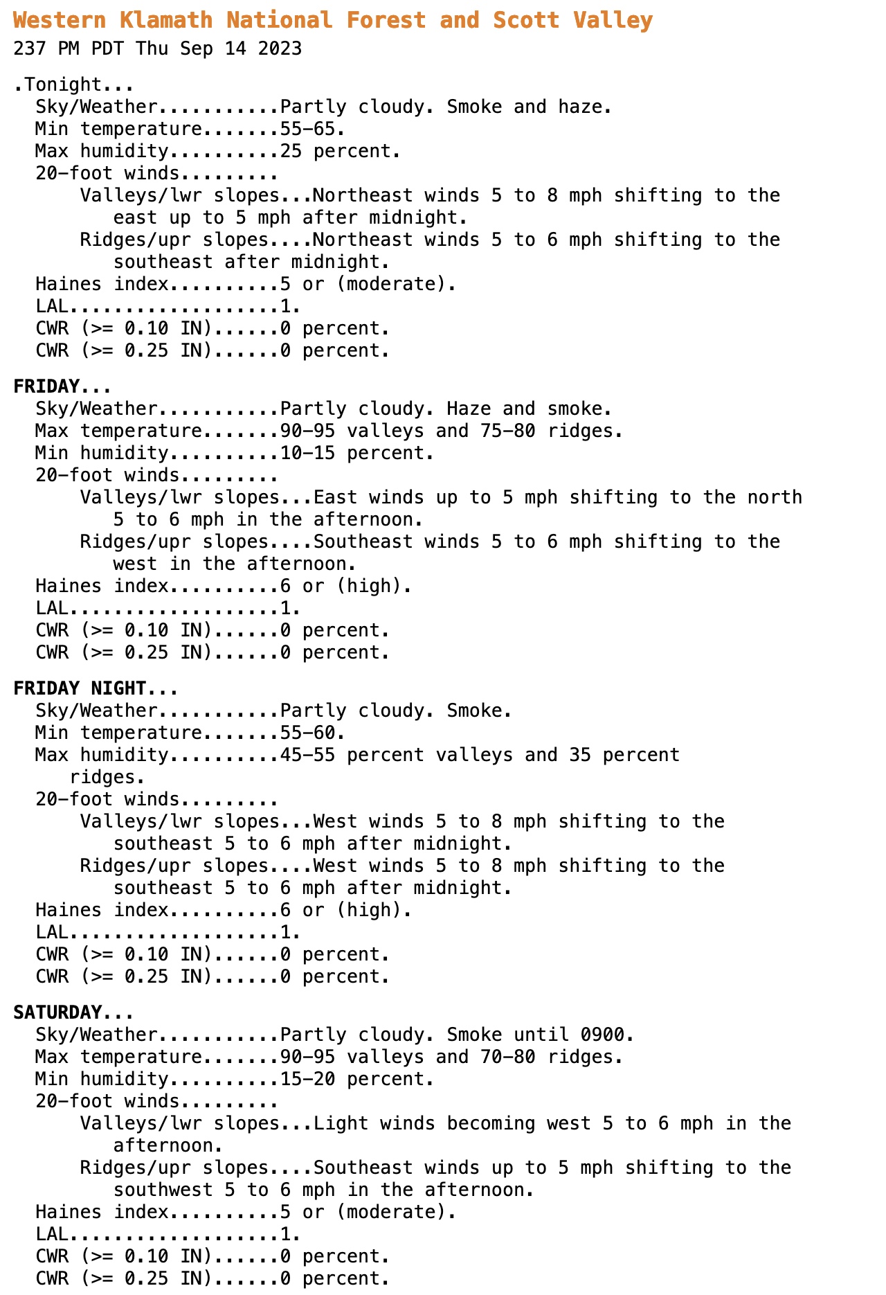
Humidities have dropped significantly in far Northern California since being at 60-70% at 8am. Outlook is for poor recovery overnight, then in the teens next several days. Luckily, we are not looking down the barrel of any major winds at the moment.
90 degrees in Orleans right now…
Been liking this PG&E weather website:
https://pgewam.lovelytics.info/pge_weather_app/
9 Likes
Some interesting fire weather over the next 96 hours for NOPS??
All the NWS offices are not that bullish on storm activity with the cut off low but PDS has issues high risk for three PSA’s.
Looking at the GFS the soundings suggest storms on the mixed side wet and dry. Slower storm motions means more rain cores hitting the ground but also the potential for gustier outflow winds.
The timing of the storm development may allow some storms to hold together after the sun goes down and the steering flow would allow for some storms to make it into the valley north of Yuba City.
High resolution models do show some scattered activity early Sunday am. Greater signature appears to be MEU/Trinity Horn and Tahoe areas.
Once the wave moves through the trough lingers and then eventually moves into the GB.
That trough brings in the first cooler air of the season and might be the driver for a stronger side wind event. Too far out to sign onto anything yet but it would line up with with the standard climate for this time of the year.
7 Likes
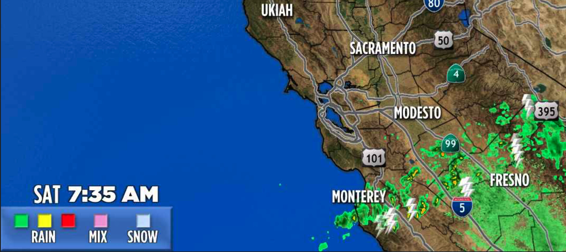
Lots of lightning from Yosemite Valley - Susanville… pretty good show here in Verdi. So far dry.
4 Likes
Historically average fire weather for this time of year. My time in BTU in the late 90’s was this weather pattern.
8 Likes
4 Likes
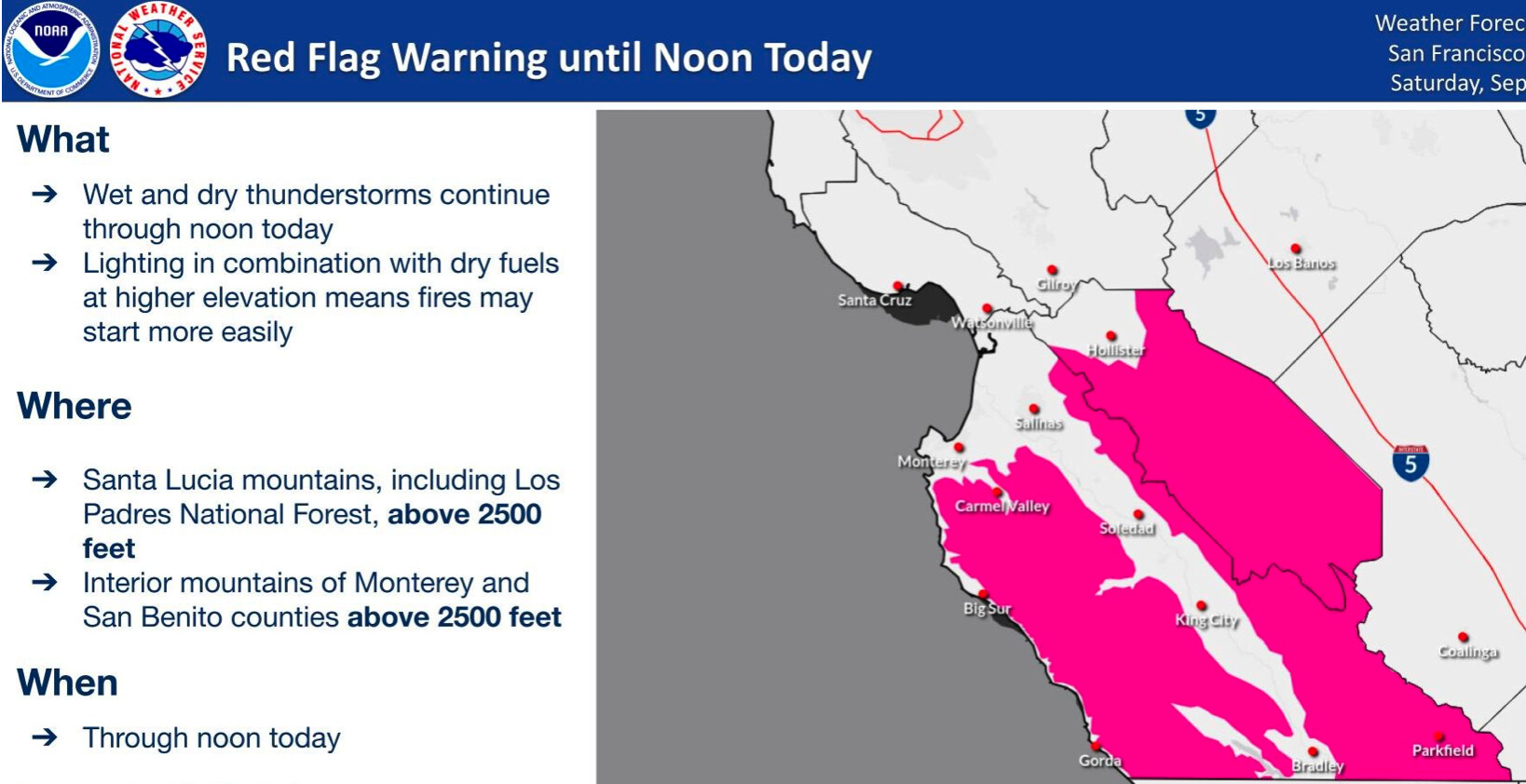
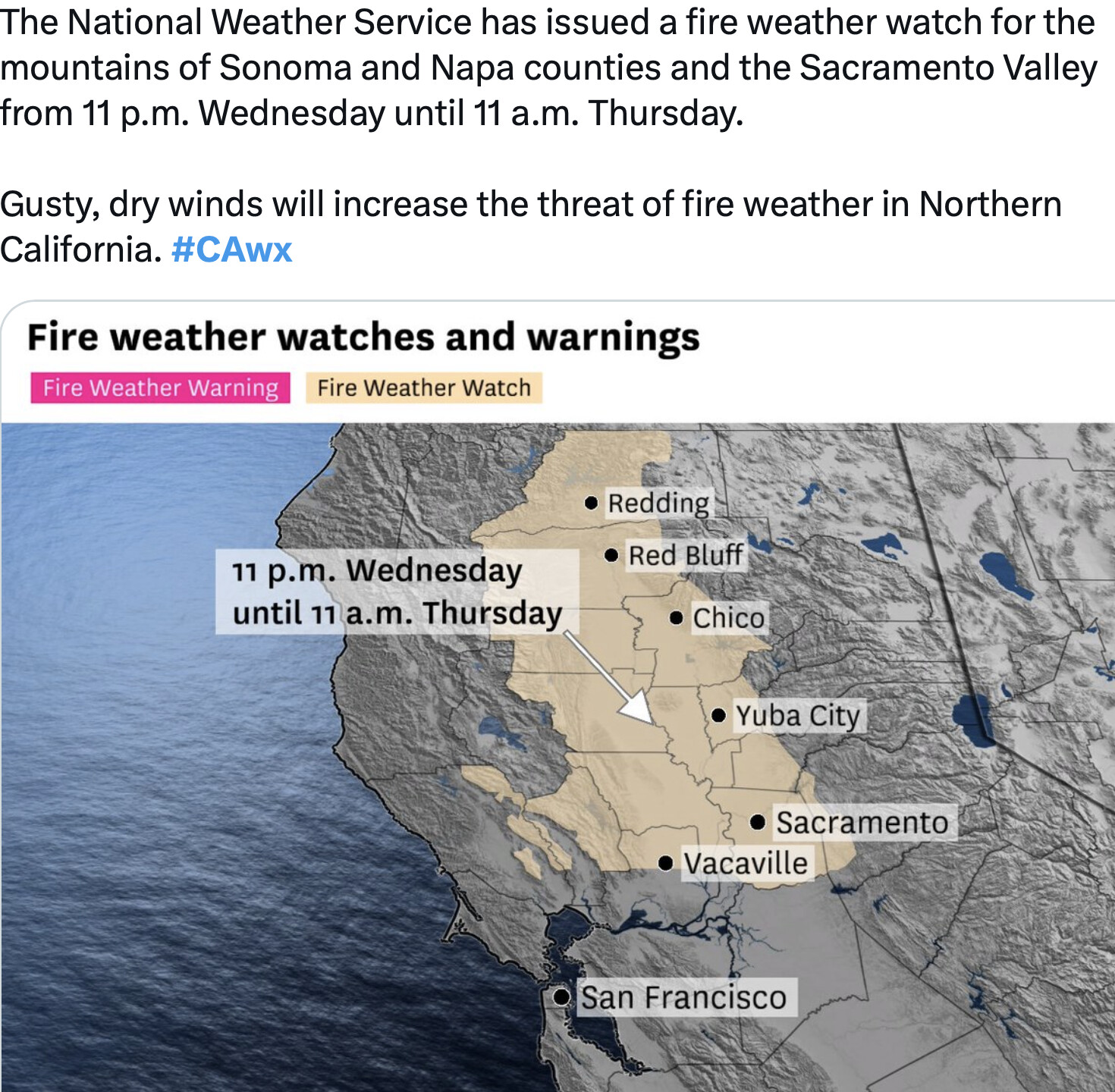
Upgraded to Red Flag Warning
https://forecast.weather.gov/wwamap/wwatxtget.php?cwa=STO&wwa=red%20flag%20warning
5 Likes