**River Level Observations **
https://water.weather.gov/ahps2/index.php?wfo=st
**Blizzard Warning **
https://forecast.weather.gov/wwamap/wwatxtget.php?cwa=STO&wwa=blizzard%20warning
**River Level Observations **
https://water.weather.gov/ahps2/index.php?wfo=st
**Blizzard Warning **
https://forecast.weather.gov/wwamap/wwatxtget.php?cwa=STO&wwa=blizzard%20warning
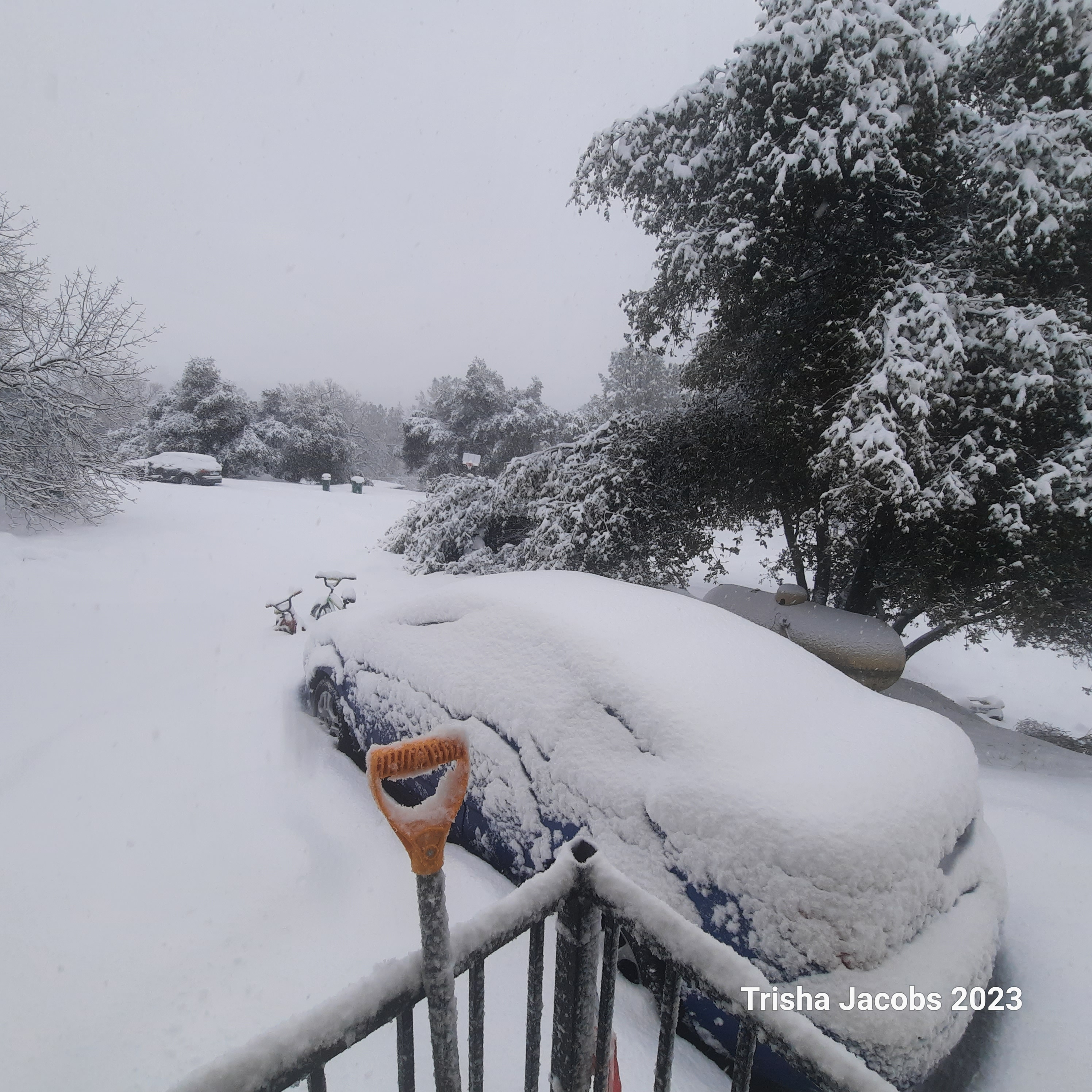
Everything in the Motherlode this morning is a freaking Train Wreck above 2000 to 3000 FT.
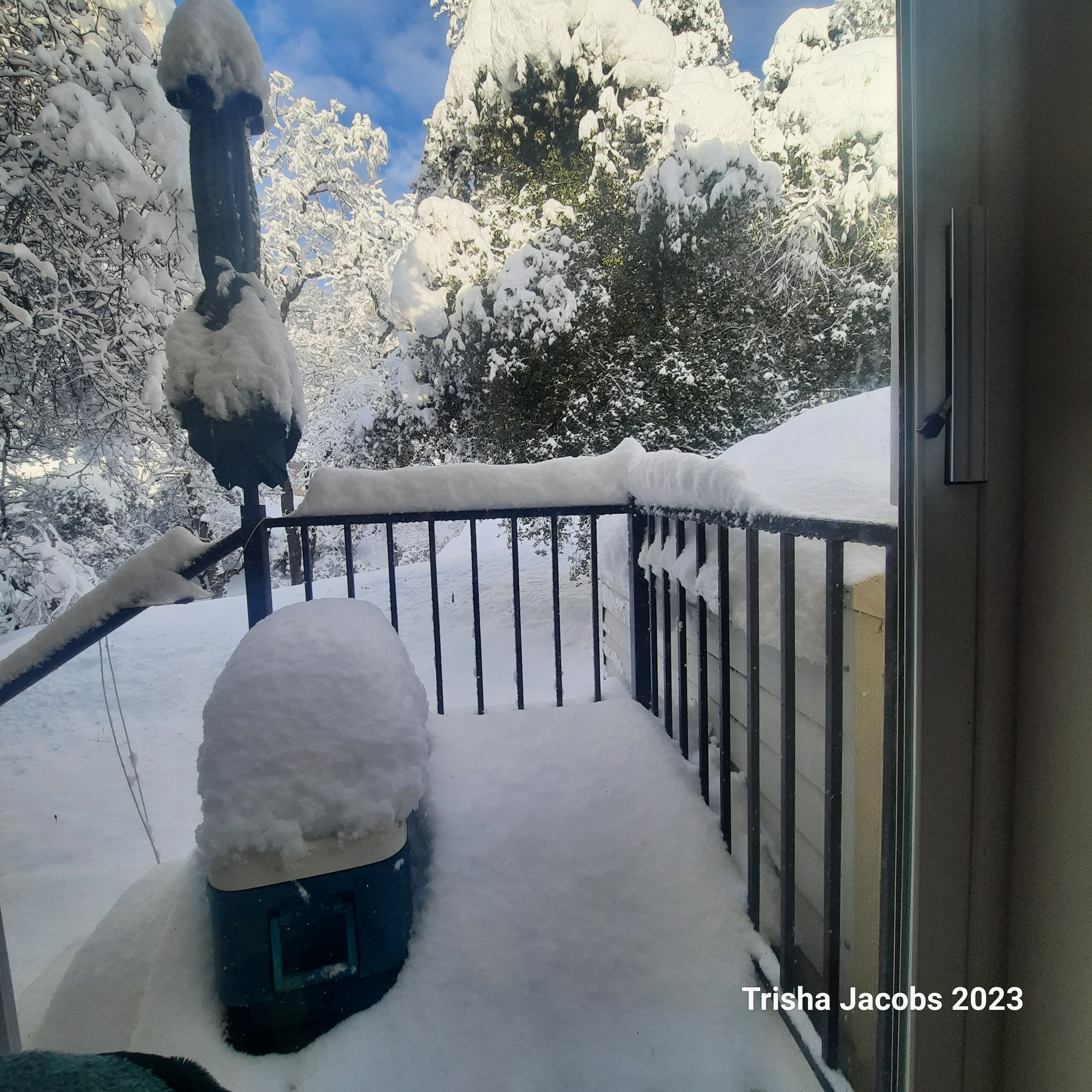
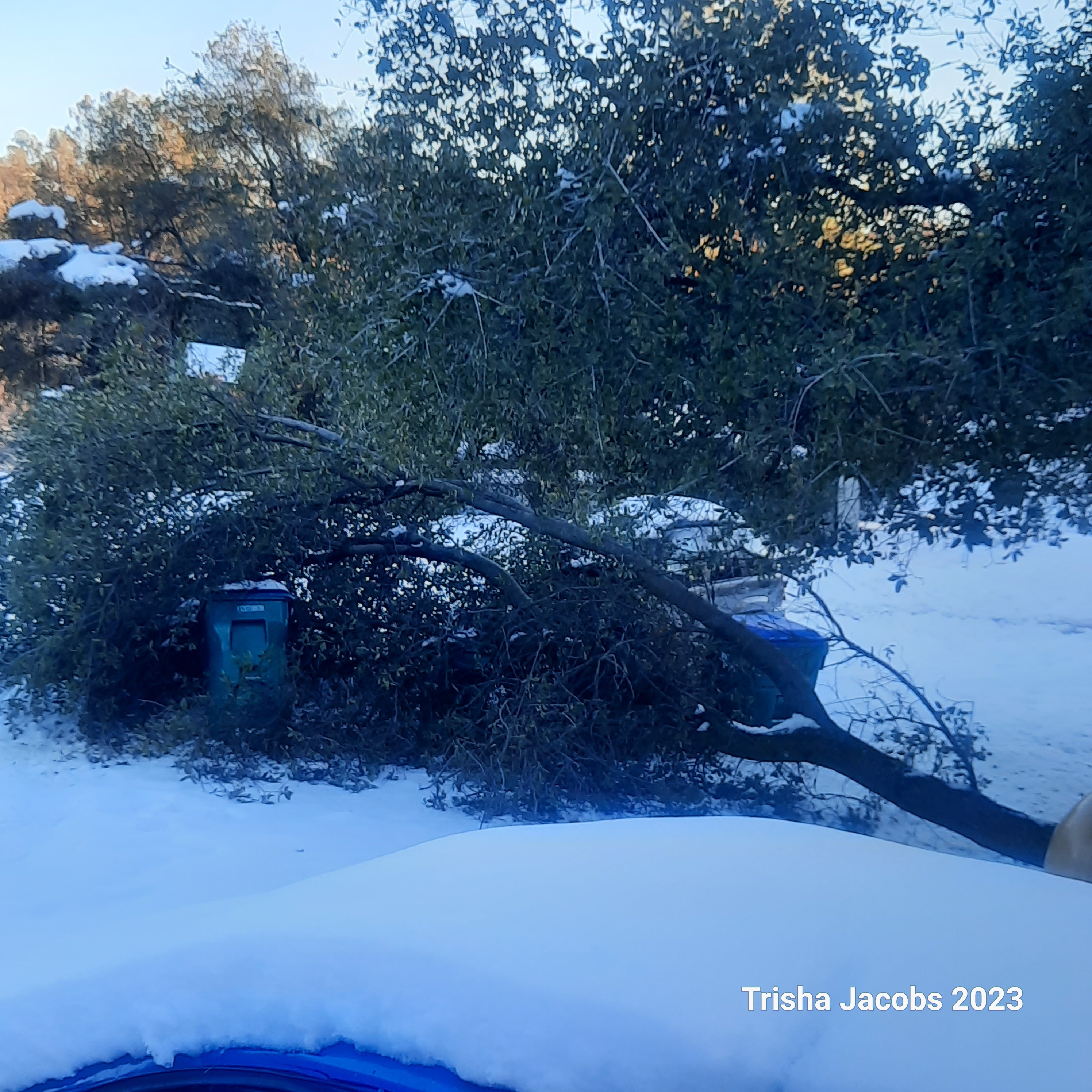
I took a ride up to Twain Harte yesterday. Trees and limbs down everywhere with broken power poles and lines down. Berms four to five foot high from the plows. Saw a few sheds flat on the ground from snow load. Lot of weight on roofs. When you have to take a square point scoop shovel to clear a roof to vent it, you haven’t lived. It’s pretty much a mess up the hill. Be ready Motherlode another round of low snow starting tomorrow. Snow down to Jamestown if not lower. Both my Kids have been without power for five days. Hopefully they get it back on today. Slasher hope those roads and driveways were cleared before this next round. On the Bright side…we will have water to drink this year and streams and rivers to fish.
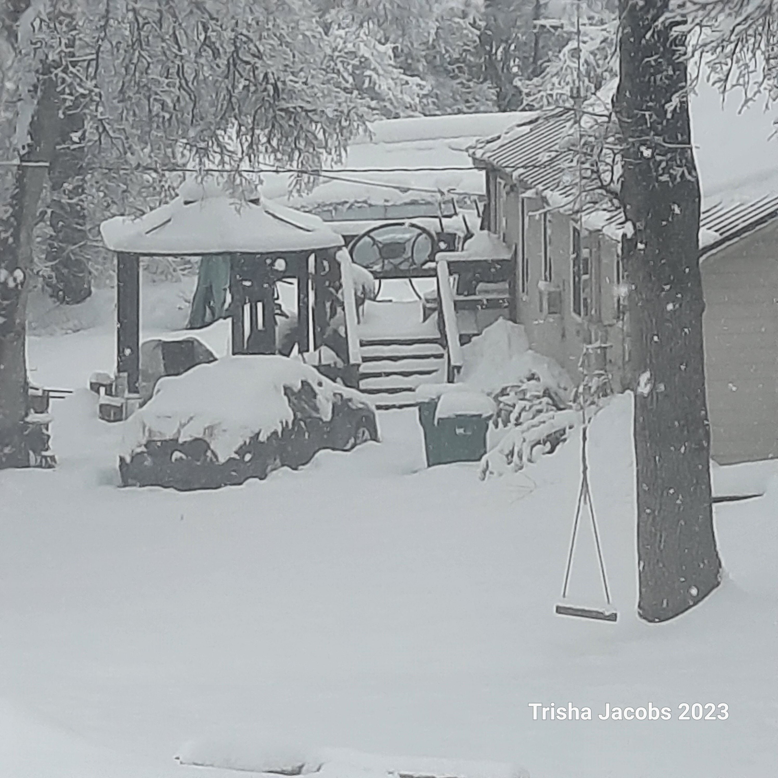
Soulsbyville… was trapped in my house for 6 days. broke my ankle on Monday in the snow trying to deal with my cars. EMS came and got me Tuesday for a trip to the ER With much trouble. cul-de-sac is County maintained but cul-de-sacs are last on the list and I’ve been here 2 years and it’s never plowed. finally got a friend with a tractor to clear a path for one car to get out. lots of trees and limbs down all over. neighbor took the kid to the store and today we have Walmart orders to pick up to resupply. I can’t get out yet because non weight bearing and crutches and snow won’t do. gonna ride out the next storm at home but hoping we keep our power on.
Damn!!! I Hope you have power.
our one saving grace is that we have power aside from a few flickers! but now 3 days later we’ve received another couple of feet of snow and are completely snowed in again. I’ve never looked forward to rain more in my life.
There is a ton of snow in the Three to Four thousand foot elevation everywhere. Snow down to two thousand feet on the ground in the Motherlode. Keep hearing of an Atmospheic River possible by this weekend. This would be not good in so many ways. Flooding and the amount of weight that’s already on so many roofs. Any info on this event, can anyone confirm or is it still just wait and see?
trishawcfirewx this would not be good for your area and above!
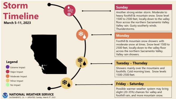
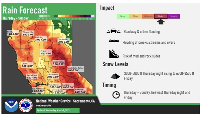
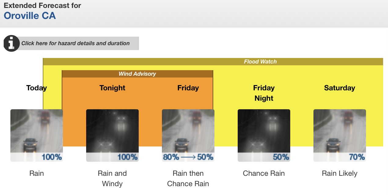
Tired of the snow? Buckle up! Another wave of “flying” rivers, this time subtropical and warm -
A strong storm system over the Eastern Pacific Ocean will approach
the coast of the Pacific Northwest Thursday night and Friday. An
abundance of subtropical moisture will move inland over Central
California along the southern periphery of this storm system
Thursday night through Friday night. Mild air associated with this
air mass will cause snow levels to rise to around 8000 feet Friday.
In addition, heavy rainfall and the mild air mass will result in
rapid snow melt in areas that have received several feet of snow in
the past few weeks.
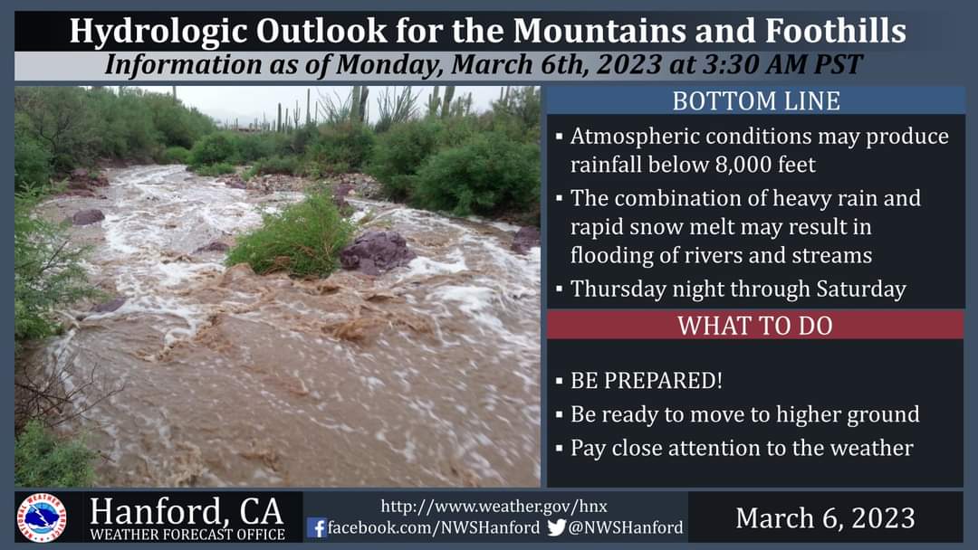
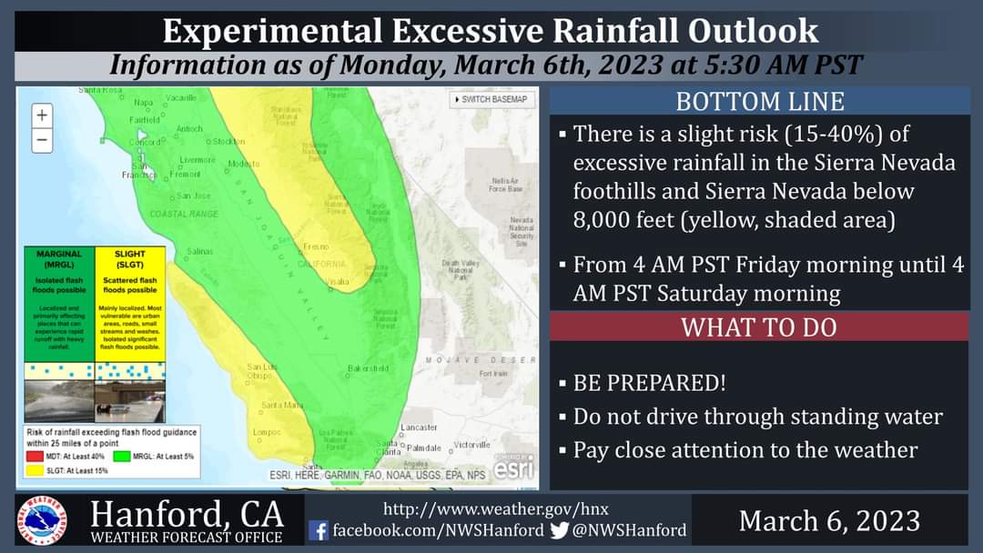
In the Sierra Nevada foothills, two to four inches of rain is
possible Thursday night through Saturday. In the Sierra Nevada below
8000 feet, three to five inches of rain is possible Thursday through
Saturday. The majority of this rain should fall Friday and Friday
night.
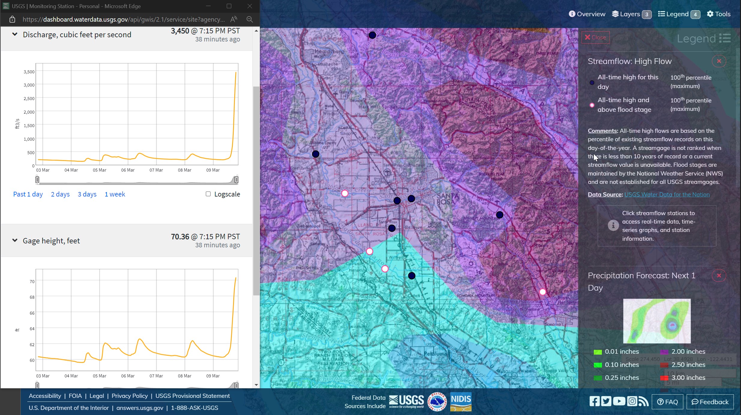
The combination of heavy rainfall and rapid snow melt will cause
water levels to rise on area rivers and streams Thursday night
through Saturday. Persons living near rivers and streams should
closely monitor water levels and be ready to move to higher ground
if the threat of flooding becomes imminent. If you live in a flood
prone area or near rivers and streams, now would be a good time to
prepare and have an evacuation plan in place in the event high water
becomes a threat to your safety.
I might recommend moving the current year weather discussions to the North-ops 2023 page instead of this one from last year.
Wilco. If there are means for the mods to correct the error, please do.
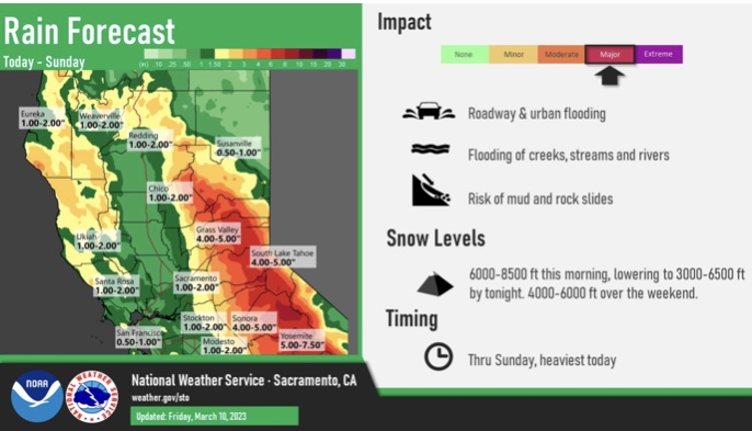
2.5 inches of rain at our house Sonora area. Heard snow level was at the top of Dodge Ridge Ski area and that’s roughly 8000FT.
looks @3 1/2 here in Soulsbyville. hearing reports that it’s raining above Tioga which is @9k