With this round of warmer weather grass is starting to turn. Cut banks and shallow soils are browning out faster. Under the oaks will take awhile longer and a few more hot spells. Sounds like an Allstar grass crop all around this year.
6 Likes
Crossed over the altamont twice this week. Every season there’s multiple grass fires there. This years grass is the tallest I’ve ever seen it. Some areas looked to be 5-6 feet tall. Same deal with the lower elevations of calaveras, amador, placer etc. Probably the same story state wide where I haven’t seen. Definitely all star level.
4 Likes
grass fire season will be here really soon. already heard dispatches to Dinosaur Point for MMU and Milton for TCU. This is when I know those grass fires are right around the corner.
4 Likes
Absolutely. Milton is another that burns every year regardless. Anywhere between Farmington and copperopolis.
2 Likes
From Lake Camanche to Blanchard in the front county of TCU should be interesting.
3 Likes
I’m not good at video, just posting this as a thank you. Last year (or so?) a fire burned to the top of the ridge in the opening shot, Mt. Gibson, above Lake Vernon, above Hetch Hetchy. The lake is around 6500 ft. Usually you can jump over the creek.
Snow Melt - May 2023
8 Likes
Incidentally, I was up that way last weekend again and noticed they pulled off a very good controlled burn. South of Hetch Hetchy, between Camp Mather and 120. They timed it out perfectly before the rain came in. I saw a couple trucks pull in on the road as I headed home, gave them a friendly wave. Thank you!
2 Likes
We burned at Chico Airport today. Temps in 80s, humidities in high 40s for most of the day (68% at 0900). Variable, highly changeable winds, but without wind, fire would barely back in moderate-load grass, and just skunked in lighter grass. Star thistle was too green to burn in most places. With wind, things burned just fine!
14 Likes
3 Likes
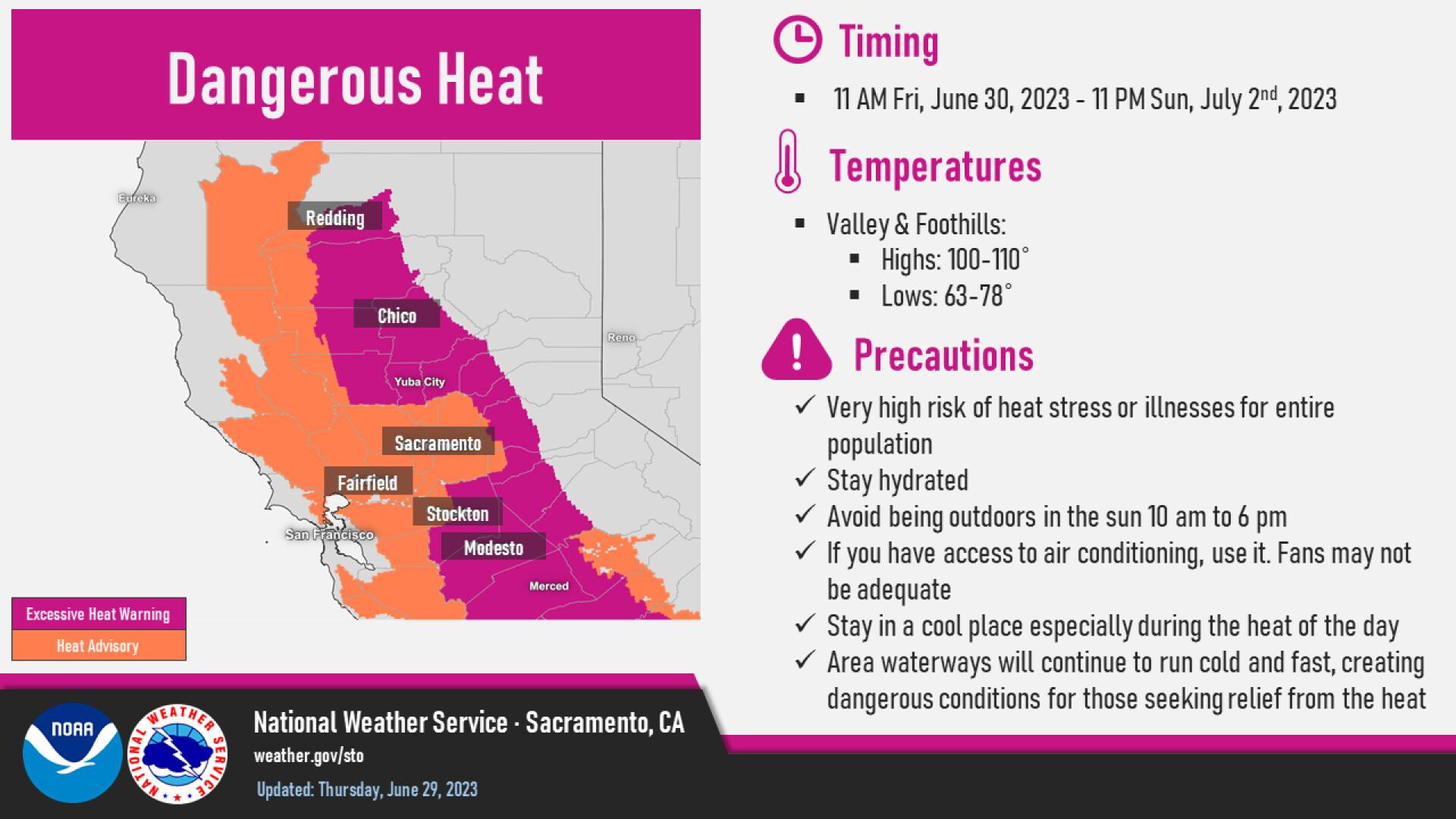
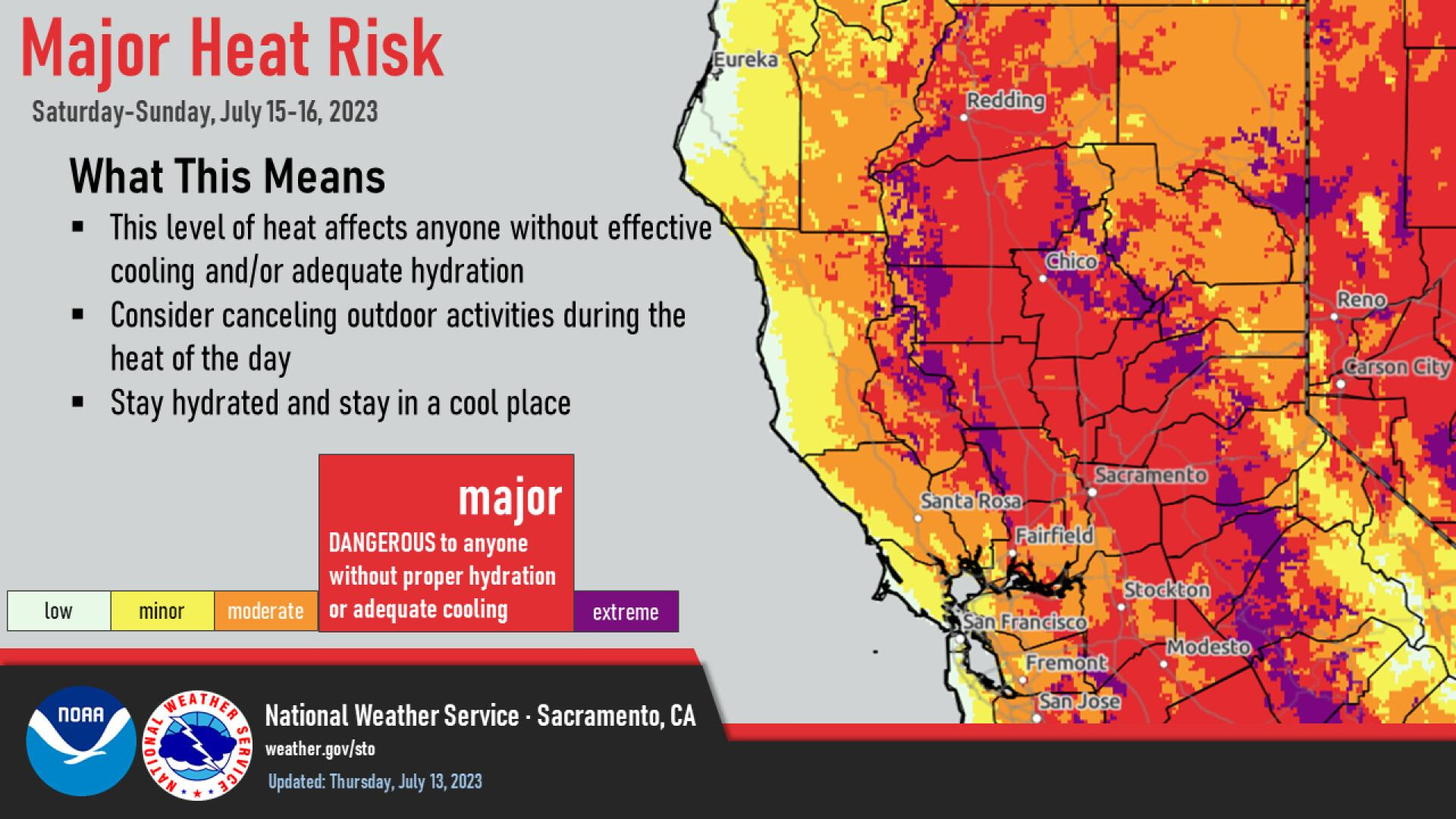
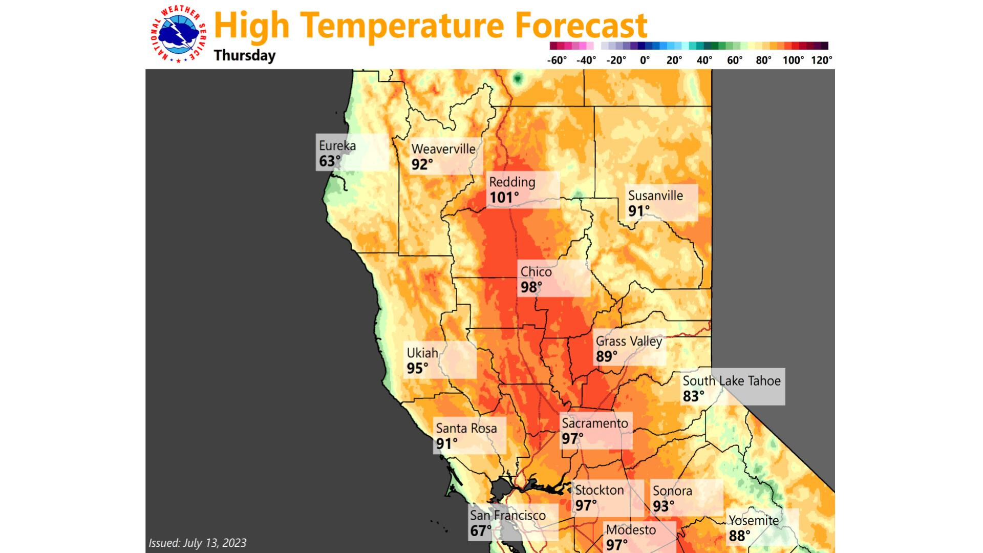
A surface high pressure building into the Williamette Valley/Great Basin combined with the North Pacific high pressure nosing in off of the pacific system will lead to significant heatwave with temperatures 10-20 degrees above normal. Compressional heating from offshore flow enhances temperatures. Heat advisory and excessive heat warnings should be expected.

5 Likes
You knew the hammer was gonna fall on the “nice” weather at some point - i was kinda hoping against hope that NOPS would remain in the coolish zone till at least Oct!! Buckle up y’all & hydrate, hydrate hydrate!
6 Likes
Copy that, Hydrate the word…Good By to me lower PG&E bill it’s going to take a beating with this kind of heat.
4 Likes
Any thoughts on the length? From what I can see it looks like a two day event and then back to seasonal norms.
1 Like
I guess snow in July is out of the question then for us…? Looks to stay warm thru the fist of next week, Just got to hope the winds stay on the calmer side
4 Likes
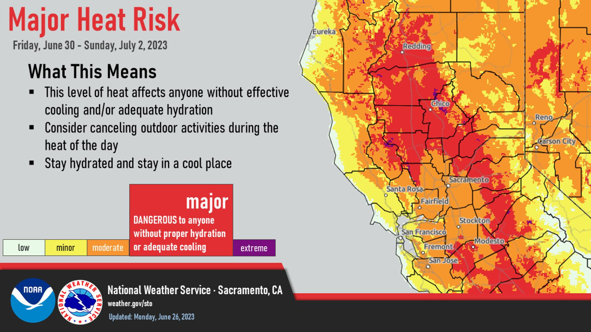
Very similar scenario as previous heat wave but hotter. Upper level high pressure building into California will dominate the weather pattern with dry SW flow aloft every afternoon undercutting the ridge. No monsoon or disturbances of impact in the SW flow. Surface high pressure building into the Williamette valley and Great Basin could lead to compressional heating across the Sacramento valley. Maximum temperatures could peak at 110 degrees or above.
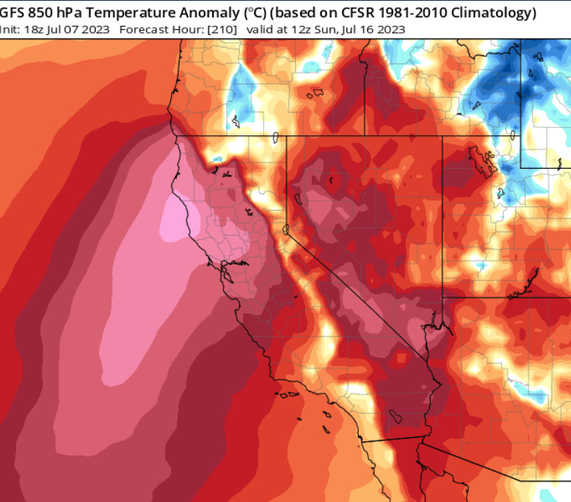
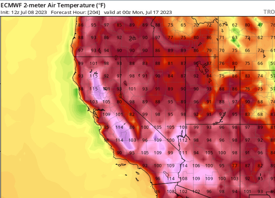
This heat wave lasts at least 5 days, and as the ridge breaks down there could be extreme fire weather conditions on eastern slopes especially the Sierras.
13 Likes
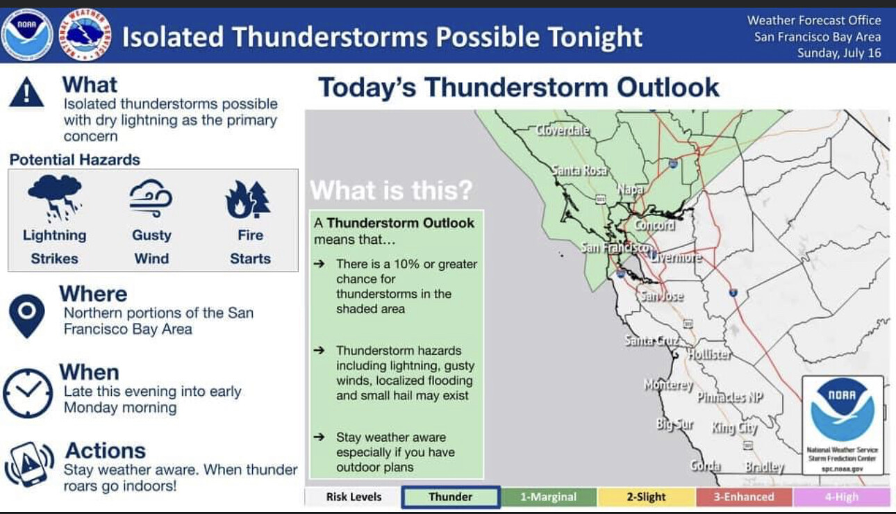
On Sunday/Monday a shortwave moving around the big ridge of high pressure will force some elevated convection to occur. PWV’s are pretty good to the west but very hot temperatures drag down overall RH. Further east in the Sierra, PWV’s are less and there will be a chance of dry lightning strikes.
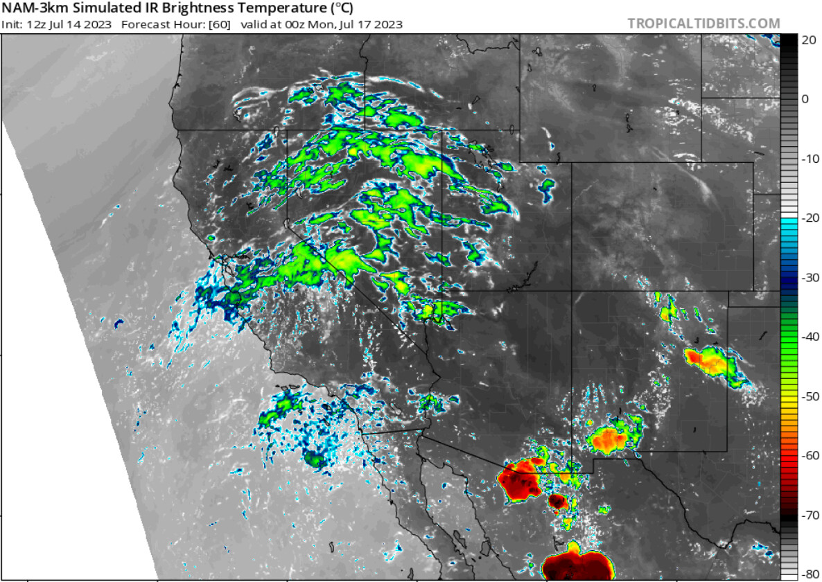
11 Likes
Thanks Anvilhead for your post, but I had to look up PWV’s. I found the following: Precipitable water vapor (PWV) is the vertically integrated amount of water vapor in the atmosphere, and it is a valuable predictor for weather forecasting.
7 Likes