2 posts were merged into an existing topic: South Ops Weather - 2024
A post was merged into an existing topic: South Ops Weather - 2024
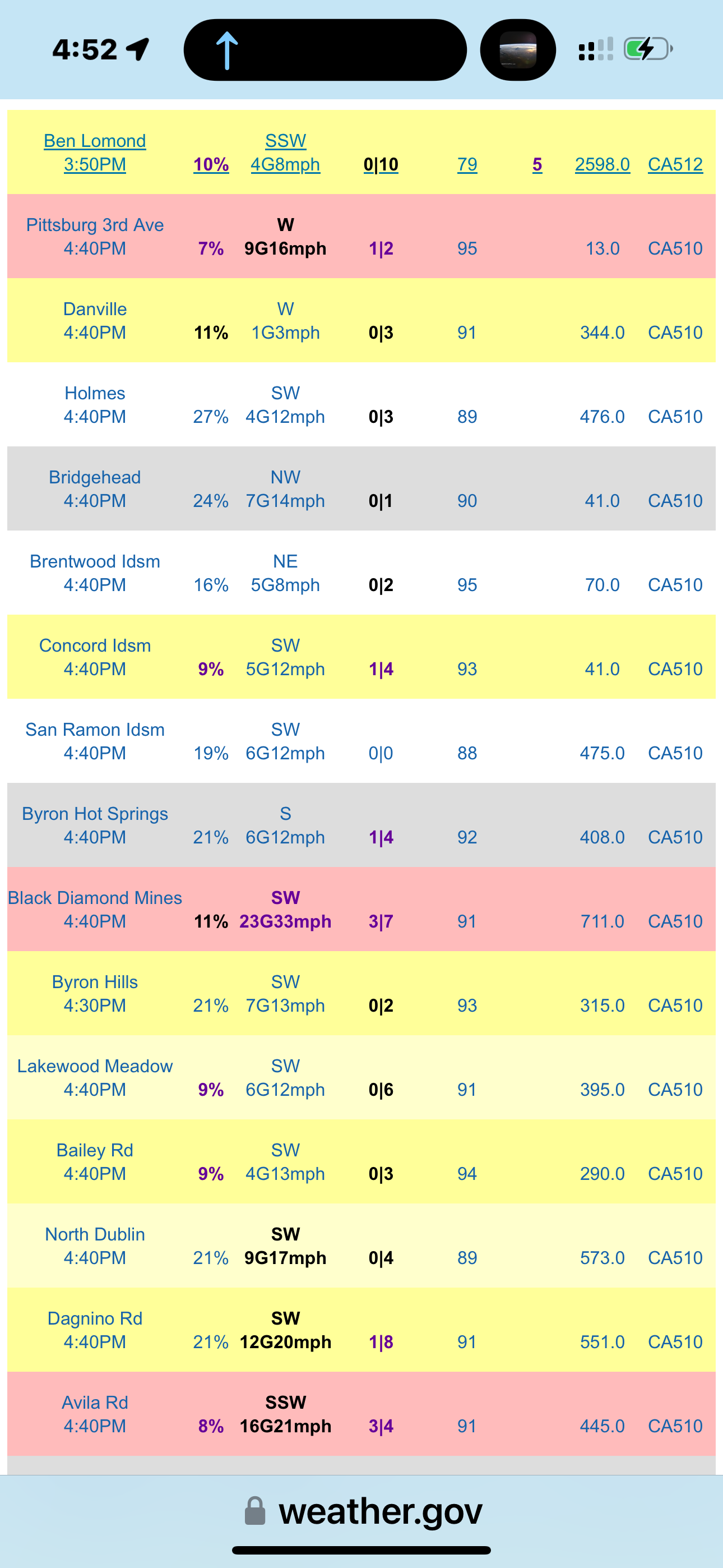
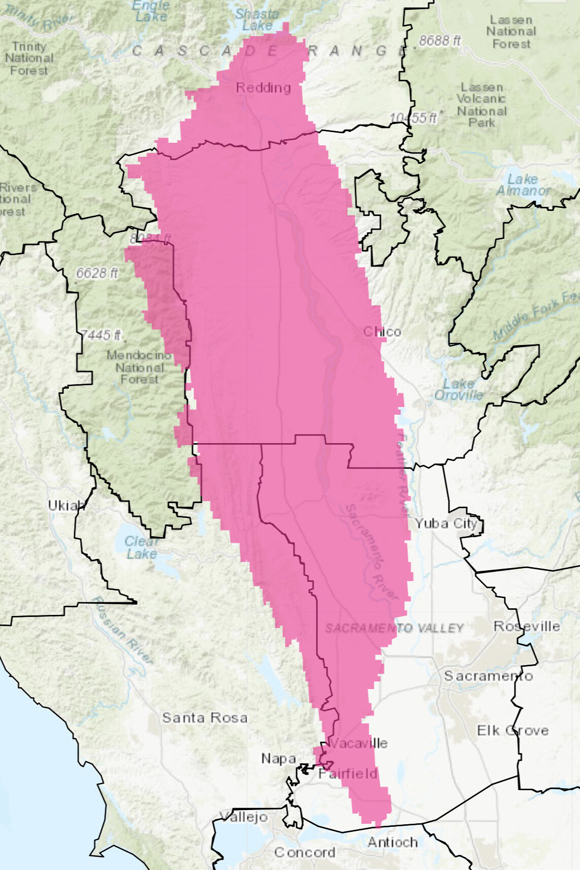
Note the humidity values in geographic areas West of I5. Today’s T storms were all South and East of these RAWS stations which are located in the updated forecast area for the greater Bay Area.
5 Likes
Great…just what I want to hear.
1 Like
5 Likes
From NWCG 7 day :
Lightning tonight followed by strong dry winds Wed for Modoc Co. and Far Eastside****** High Risk for Strong Winds & Low RHs Far Eastside Wed ***•
High Based isolated thunderstorms possible today and tonight spreading from the coast eastward across Sac Valley and Sierra this afternoon and evening. Storms may continue overnight into Modoc Co and eastward trending on the drier side.
• Mix of wet and dry storms containing abundant lightning today and this evening around Lake Tahoe.
• An upper trough passage will bring widespread gusty W-SW winds to N Ops on Wed with Gusts of 25-40 mph across NE and Far NE, Coastal Gaps, Sierra Crest and E Bay/Delta…
• Breezy SW to NW winds will continue today with gusts generally in the 20-30 mph range through coastal gaps and from the Cascade/Sierra Crest eastward and locally up to 30-40 mph in Zephyr wind areas.
• Min RHs away from coastal influences will continue in the upper single digits to teens & 20s with poor RH recoveries becoming increasingly widespread along slopes and ridges tonight and Wed.
Winds will become more northwesterly on Thu and remain breezy but not as strong as Wed with the exception of southern portions of the Far Eastside where gusty W-SW winds will continue.
• Some moderation in RHs will occur in western most areas though on Wed due to marine influences there. However RHs in inland areas and especially in the Far Eastside will remain quite low Wed with some moderation by Thu.
• Weak N to NE flow may develop Thu night through Fri morning with gusty westerly winds returning to eastern areas Sat & Sun and a more impactful warm & dry northerly flow pattern possible early next week.
• An upper trough and mid level moisture returns this weekend for a renewed threat of thunderstorm potential.
7 Likes
4 Likes
seasonably warm weather persists today through mid-week; isolated showers are expected across the Central Coast and Sierra today, with thunderstorms this afternoon mainly across the Sierra Crest. Low pressure will bring a slight cooling trend from mid to late week into the weekend. Early next week, high pressure will build into the region causing widespread warmer and dryer conditions. Fuels: The grass crop has cured across the lower elevations and dead fuel moisture values are at seasonal dryness levels across the lower elevations of the interior. The moisture content in live fuels is near peak annual values in the higher terrain but decreasing to flammable levels across the lower elevations.
5 Likes
Lengthy detailed read, but I will say, the morning of June 21 felt a lot like it does this morning. Admittedly by this time that day fury had already been unleashed… but the weather felt the same.
11 Likes
2008 brings back some harsh memories. The Butte Complex was a nightmare to deal with . With the heat , humidity and cloud cover today it has a bad feel to it . For all our sakes I hope we don’t repeat 2008.
4 Likes
No sign at this point anything similar will occur. I spent 6 weeks in HUU/SRF.
4 Likes
5 Likes
Forecast models BBQ California on July 4th and there after as strong ridging noses in from the Pacific at the same time surface high pressure builds into the Willamette Valley/Great Basin. The ridge will be driving offshore flow with little to no upper level support so winds do not look strong, but compressional heating from the offshore flow with the ridge overhead will likely lead to an excessive heat warning situation. The heatwave begins around July 2nd and at this point in time being 4-6 days out there should be little change to the overall forecast for excessive heat and dry conditions and several rounds of critical fire weather + elevated haines indexes.

there was a
19 Likes
3 Likes

Final_June_27_2024_NWS_Release.pdf (33.0 KB)
NWS Hanford statement that forecasts beyond 7 days are not official
3 Likes
3 Likes
-
Winds…Northerly wind 10 to 20 mph with gusts up to 30 mph.
Strongest wind gusts Tuesday morning and along the western
half of the Sacramento Valley into the eastern Coast Range. -
Humidity…Minimum relative humidity of 5 to 15 percent.
Nighttime humidity recoveries will also be very poor in the 15
to 25 percent range.
5 Likes
Altamont Pass and State 152 Hollister to San Luis Reservoir may see some of that 25+ gusting onshore, too. Maybe, with marginally better rH.
1 Like
3 Likes