Lower Middle Klamath-Hoopa-Van Duzen/Mad River-
W Mendocino NF/E Mendocino Unit-Trinity-
1031 PM PDT Fri Jun 27 2025
…FIRE WEATHER WATCH IN EFFECT FROM MONDAY MORNING THROUGH
MONDAY EVENING…
The National Weather Service in Eureka has issued a Fire Weather
Watch, which is in effect from Monday morning through Monday
evening.
AFFECTED AREA…Fire weather zones 204, 211, 212, 277, and 283.
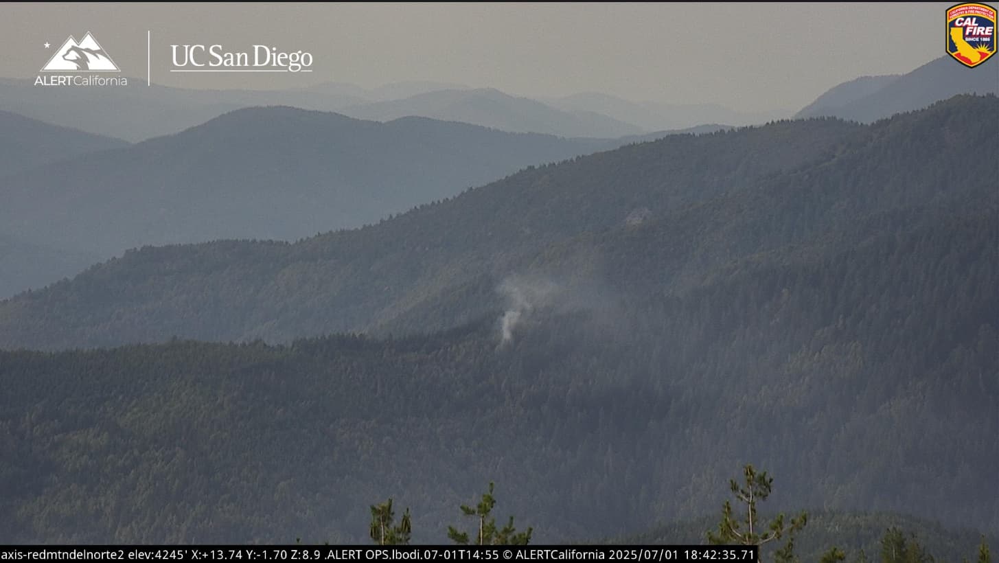
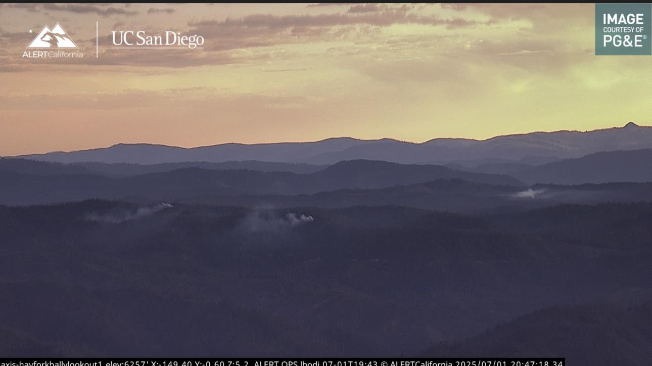
THUNDERSTORMS…Scattered dry thunderstorms are likely (25%
chance) Monday afternoon over the coastal mountains. There is a
more slight chance (10%) for isolated storms as early as
overnight early Monday morning and again as late as Tuesday
afternoon.
OUTFLOW WINDS…Gusty and erratic outflow winds are possible up
to 50 mph.
IMPACTS…any fires that develop will likely spread rapidly.
Outdoor burning is not recommended.
***** High Risk Mon for Abundant Lightning across Dry Fuel NW Mtns & NE CA PSAs. Nocturnal Lightning possible Mon Night into Tue morning with additional abundant lightning Tue & Wed *****
Upper level ridging will continuing strengthening just to the east today as a closed upper level low forms along the central CA coast pulling increasing amounts of mid level moisture and instability into North Ops with building heat,dry airmass near the surface and increasing lightning chances with stronger associated outflows/downdrafts the main upcoming weather concern.
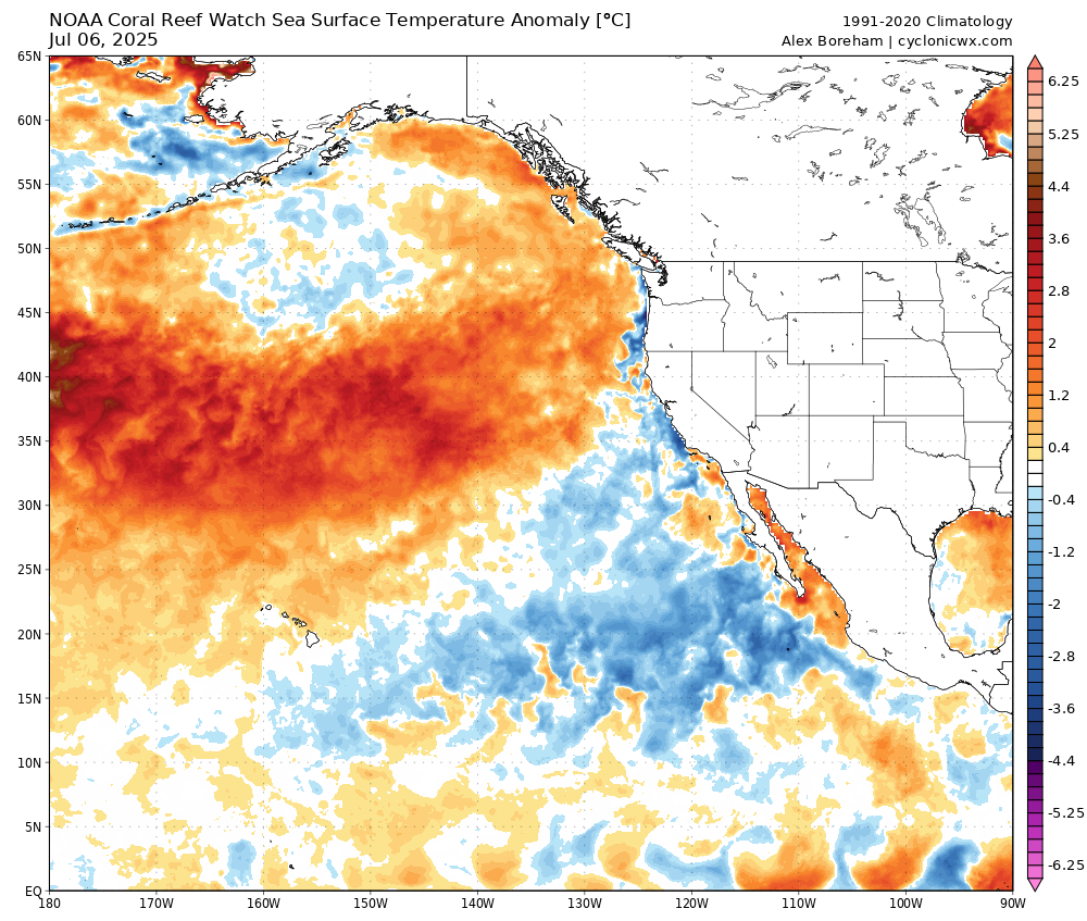
Sea surface temperature anomalies of 3-8 degrees above normal should continue to move SE. Less of a temperature gradient between the inland valleys and coast should lead to higher heat potentials as the summer progresses.
ENSO neutral conditions continue a slow build of summer with neither the subtropical or northern jet stream dominant. High pressure over SW Texas extending now off the coast of Baja continues to suppress the monsoon across the West.
The high pressure system is set to expand further west, but be centered generally over California or to the south over the next couple weeks, and thus the monsoon is not expected to be a major factor.
The monsoonal push could be compressed into a couple of individual events later towards the back half of summer.
An interesting week ahead on top of an interesting last two months. Strong for the season area of low pressure hanging out over NorCal. This has dropped temps to below normal with some areas seeing a 20 degree departure from normal. Tomorrow in Sacramento it may not hit 81 degrees..
The current low will move north and east but another low will form off of the coast. This low will be buttressed by an area of HP in and around the 4 corners region but further east from its normal location. This position of the 4 corners high has been consistent this summer.
The details after Tuesday get more interesting.. The circulation around the low off the North Coast will advect moisture into the state.
IMHO this will be similar to the event last month in coverage but unknown in intensity. The convective parameters look to be enough to generate some convection perhaps even in some areas along the coast.
This low off the coast is displaying some “cut off” characteristics.. meaning it will sit and spin for a few days. There does appear to be some stronger steering winds initially so that would mean storm motions would be faster( trailing rain cores with strikes outside the cores).
On the plus side.. this is not coming on the heels of heat wave in fact the opposite so ERC’s should be trending down. There does appear to be a ridge that will build in next week.. but not a huge signal for a strong ridge. If persistence.. persists.. the ridge will be on the weaker side and short lived.
Will be interesting to see what the smarter than me people at PDS have to say..