
8 Likes
RFW also now in effect for portions of nops.
2 Likes
As the low moves closer the coast and works its way inland coverage of the storms will increase today and tomorrow. The ingredients are there for storm development.. CAPE, trigger(low proximity to the land form) and available moisture at the right elevations. The storms do look to be primarily on the wetter side. The tricky part of the forecast has to do with storm motions and longevity. With faster storm motions the rain cores can be limited and trail the formations allowing lightning to strike far enough outside the core to escape moisture. The second is the duration of the storms. With the atmosphere in the condition with the cooler air and the CAPE seeing some moderate values there is a chance for the storms to hold together after forming over terrain and to move off the slopes into the valley. If that occurs the drier air of the valley will mean a greater chance of limited moisture. There are some sounding showing a large spread between dew point and temp.. that would imply a drier sub cloud area( below 10,000 feet).
It does look similar albeit smaller event than last month. A mix of wet and dry storms. The circulation around the low will allow storms to form over the higher terrain and drift to the west and south. There is a small chance of storms holding together until they hit the valley floor. Whether they have lighting or not will have to do with timing. Better chance of some stray rain showers, but as with last month.. a few strikes can be associated with the showers. Watch for scout clouds this am…
The further north areas look to have some potential for some stronger if not severe storms.
18 Likes
Good copy on all! This reminds me that class is always in session this time of year & Wx (like) Fire gives the test ahead of the lesson..
7 Likes
CAPE stands for Convective Available Potential Energy and is the amount of fuel available to a developing thunderstorm. More specifically, it describes the atmosphere’s instability and approximates updraft strength within a thunderstorm.
I google so others may live
17 Likes
Yes, sorry. You often hear people say that the forecasters always get lightning outbreaks wrong.. either too much hype and a non event or too little and we have an outbreak. There are many factors that need to align for convection to occur during our summer months. Available moisture at the right atmospheric levels, CAPE, PWATS( saturation or available moisture) steering flow, atmospheric trigger..
When air rises energy is released that energy acts as a booster for the molecules to continue their vertical movement. Often we have lower CAPE which means either less dynamic storms or no storms at all just fair weather cumulous. When we see higher CAPE values we can see stronger lapse rates which can translate to stronger or more severe storms. That means stronger outflow winds and potentially more intense rain cores( the two are linked). You can see CAPE referenced in the AFD’s or you can find it by looking at soundings for a given area.
When I see patterns like this.. it reminds me how extraordinary the 1999, 2008 and 2020 lightning outbreaks were.. true dry lightning.
14 Likes
3 Likes
Your assessment has/is playing out as predicted - i’d say take care of that crystal ball you must have.. Way to call the shot so to speak!! ![]()
4 Likes
I remember the morning of August 16th, 2020.
It was just before sunrise. I had been tracking the overnight lightning storm ![]() that rolled across California — a dry, chaotic barrage that lit up the radars.
that rolled across California — a dry, chaotic barrage that lit up the radars.
Then it happened — the heat burst near Vacaville. Travis AFB was sitting at 81°F. But within an hour, the temperature spiked hard: 85, 90, 95… and then 100°F by 6:40 a.m. Relative humidity plunged to 19%. Winds gusted into the 40s. There were some traces of rain — but it was evaporating before it even hit the ground.
A surreal event.
Though I’m not sure what conditions were like at every ignition point that day, if any of them looked anything like what happened near Fairfield — well… good luck.
Lightning just rolled through here ![]() —a couple of hours ago—in the American River Canyon east of Auburn and north of Georgetown. There were no downdrafts or drops in relative humidity like on that day in history.
—a couple of hours ago—in the American River Canyon east of Auburn and north of Georgetown. There were no downdrafts or drops in relative humidity like on that day in history.
15 Likes
3 Likes
It’s been cold out lately in the North. Fall like cool — the kind that settles deep in the canyons and makes the nightshifters pray for a glimpse of sun before sunrise. Even the thermal belts, those usual pockets of warmth, have gone missing. Just quiet cold and still air.
Out there in the predawn dark, you can picture them — hands wrapped around dented metal mugs, steam rising off the coffee like a morning ghost. The smell of dew and diesel and pine in the air. Nothing moves fast, not even thoughts.
Folks are wondering when this cold snap will break. When the sun will return and the chaparral will start to bake again, as it always does. The long-range outlook keeps showing ups and downs — ridges, troughs to the north, the usual this summer— but forecasts are only guesses dressed in which model is the best.
For now, it’s just cold. The kind that makes a fireline quiet in the pre dawn hours.
14 Likes
2 Likes
Somewhat of a California climate discussion…
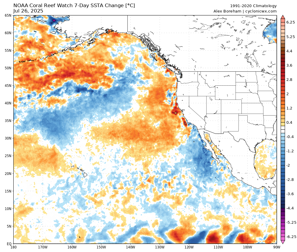
We have been in a persistent pattern of weak high pressure and strong for the season troughs. The two lightning outbreaks in NOPS have been historic and thankfully came with a lot of moisture bookended by cool moist patterns. This has helped to reduce ignitions.
Both of these episodes were spawned by a cut off or near cut off low that entrained available moisture and set up the environment for convection.
As Anvilhead commented the 4 corners high has been weak and set up to the east of its normal home. This has reduced the amount of monsoon moisture and along with that heat for California.
There are a lot of theories about what is causing the anomalous cool weather.. in very basic end user terms… a persistent trough pattern off the coast and a weak 4 corners area of high pressure.
Will that persist or will we see a change. We are heading into the end of the peak of summer heat.. generally late August, then we switch to high pressure moving from the 4 corners to the coast and we get offshore winds and heat to the coast.
Looking out long term.. much of it fantasy land.. but does line up with what we would expect(climate).
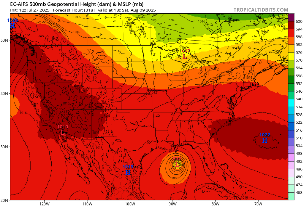
Models do show a strong for the season area of LP impacting the PNW.. that strong of a system could allow the 4 corners high to move west and impact CA. The counter clockwise flow around that low with interaction of clockwise flow around the high to the south could help to pump up a ridge over CA. If the area of LP moves further south.. it could instead bring a repeat of a long wave trough pattern with cooler temps over CA.. further north perhaps a stronger ridge builds in??
In the end of the model runs a TS appears to move north in the Pacific. Could the strength of this system disrupt the atmosphere enough to cause a reset to more “normal” weather? If the system moves along the coast some of the moisture could be caught up in the flow around the 4 corners high and be advected into CA.. especially SOPS. If it remains further offshore it could spin itself out to sea and cooler waters..
Perhaps we might see a dramatic shift to what we would expect? For now..the sleeping weather has been great and has allowed time to model ride and guess what might come our way..
17 Likes
It is difficult to predict the weather, especially when nothing is normal. Back in April, the fire season predicters called for another mother of all fire seasons, but some of us retired on the side lines, said anything could happen. I asked what if the 3000’ marine layer locked in for the summer? Well it may not be truly a 3000’ marine layer, but instead the pesky cutoff low scenario that is even more difficult to predict. Stay tuned…
7 Likes
The MJO will likely be moving into a more favorable phase for the Atlantic basin, this should be a net rising air/stronger monsoon trough there and subsidence over western US. This should weaken the dominance of the Bermuda high that has been amplifying west over the Southern and SE US.
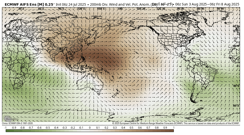
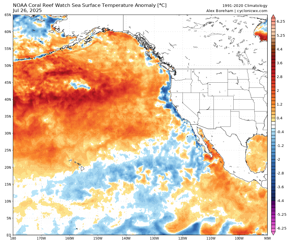
This is in sync with the warm pool of water that has been dominant over the northern Pacific moving into the area finally. Out ahead of this water the air is rising. So it acts as mostly dry troughing due to SW zonal flow. At some point the Eastern Paciifc is going to get out of ‘cool phase’ which really isn’t ‘cool’ now statistically speaking, which goes to show how warm the oceans are right now overall.
This is out in fantasyland, but this is a really good representation of what the MJO moving into the Atlantic would likely result for the upper air pattern.
Gone is the dominance of high pressure over the south with a more robust monsoon trough/wave train (tropical cyclone being a manifestation of that rising air). Ridging is more amplified over the West, with the chance of excessive heat and monsoon influx.
9 Likes
Will the MJO finally push the 4 Corners High far enough west to actually allow the heat dome to build? Or will the persistence of the PNA being neutral to positive overwhelm the High and continue its dislocation to the middle of the CONUS?
Big picture, isn’t this the classic set up for a “La Nada” neutral El Nino/La Nina setup? Something we haven’t seen in lin like a decade?
1 Like
PNA positive outcome would lead to surface high-pressure building/cooler temperatures into the middle of the country, and thus the high-pressure over Oregon, Idaho, stronger than the four corners region. A late summer early fall type pattern. Deeper troughing into the upper Midwest plus an amplified tropics in the Atlantic basin should bring extra subsidence here. Position of the high-pressure would suppress the monsoon most likely. We are running out of runway for any type of monsoonal moisture. Makes me think if the monsoon manifests here again it could be in one singular events like we have been seeing the past few years with Kay and Hilary.
A neutral phase probably keeps the high pressure hand offs depending on the troughing cycles. Big issue now is we are about 3 weeks away from when the high pressure system tends to be centered over California. For now we should focus on what happens with the tropics and upcoming lionsgate, seems like something happens around the 8/8 portal every year.
Another big reason why the weather has been quiet is that the western pacific has seen very little tropical cyclone activity despite SST off the charts there, until recently. The remnants will work the way down stream and affect things here.
14 Likes
THANK YOU SIR!
You and “Mesh” are my 1-2 goto when it comea to the big picture, no nonsense explanation of the “what & why”
Side topic
Has any research been done to correlate the solar maximum peaking with all the sunspot activities and the effects on everything here on the “3rd rock from the sun” weather wise?
5 Likes
You’re welcome! I’m glad I can provide a lot of information and ideas people may overlook. There are a lot of recent studies that show that the weather can be influenced by solar maximum. The amount of energy being loaded into the Earth is transformed.. for example, mega thrust earthquakes tend to happen on the downward side of the solar cycle. As we come out of solar maximum towards solar minimum, all of the energy loaded into the system is no longer being pushed down into the earth and can be expressed through the global electric circuit as the solar activity reduces. I don’t have any specific studies on my person at the moment… but I recommend watching geophysicist Stefan Burns work on YouTube as he is very good at explaining and theorizing the relationship between solar weather, archetypal energies, and earth meteorologically events.
One of the things I will say with certainty is that every single time there’s a large earth facing coronal hole that is centered in the Earth direct zone, the high-speed coronal hole stream will influence high-pressure on earth a couple days after it arrives by amplifying the ridging. It happens every time without fail so it’s not correlation… so on the models that are showing the big amplification in the ridge around the eighth, it will be at the same time the huge coronal hole that’s been around for the last 10 months is rotating earth facing again. (Assuming it survives another rotation)
20 Likes