NV-HTF-Tamarack???

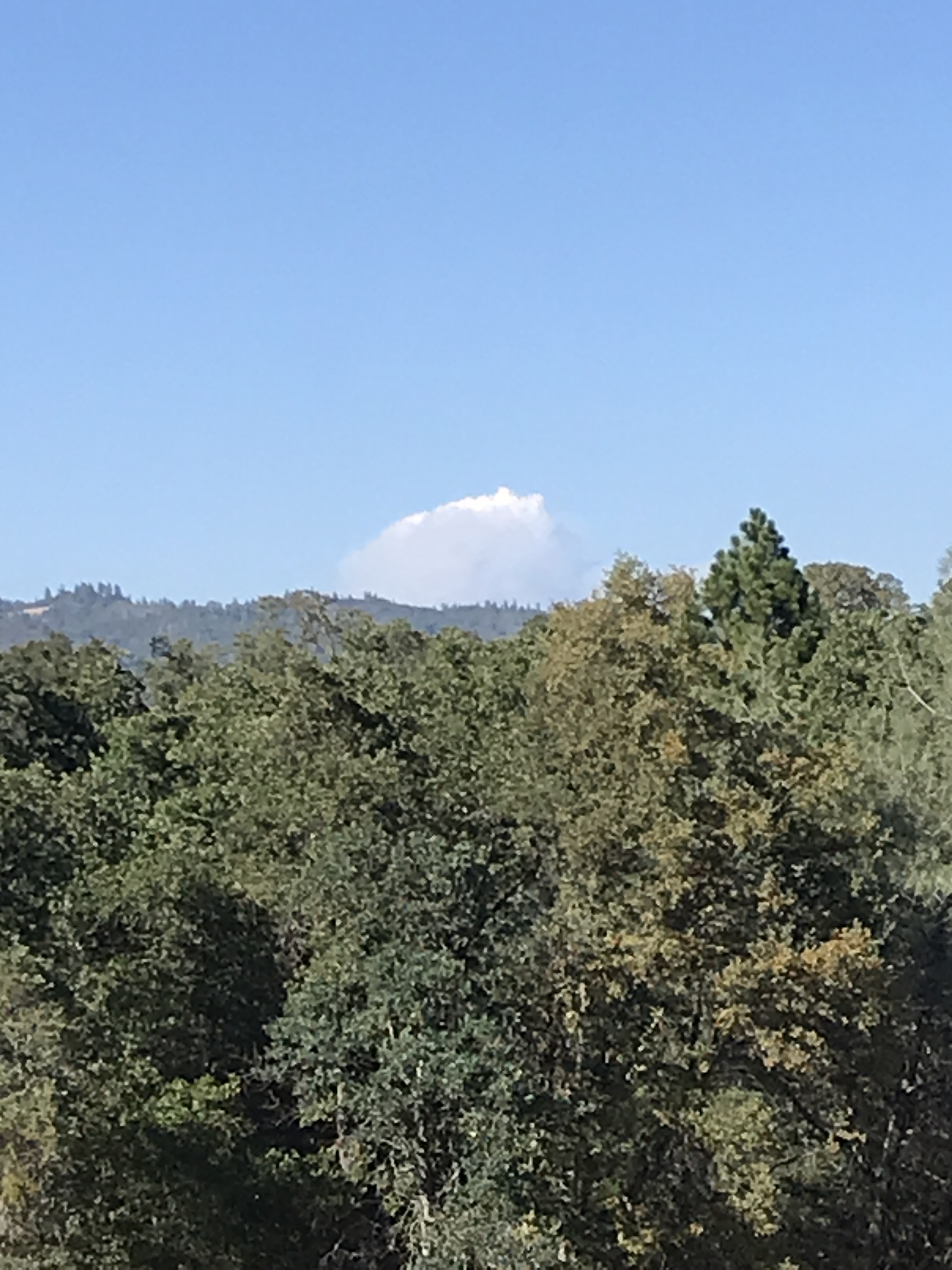
Tamarack fire started on 07/04/21 and has been in monitor status since. Yesterday it started showing more smoke, and today has now taken off.

Fire is partially in the wilderness.

Also it is NV-HTF but is located in California.

State ID: NV
3 letter designator: HTF
Fire name: Tamarack
Location: 38 37.668, -119 51.414
Reported acres: Unknown
Rate of spread: Unknown
Report on Conditions: burning in timber, on steep terrain with very little access. Spotting, torching, up canyon runs.
Structure threat: No
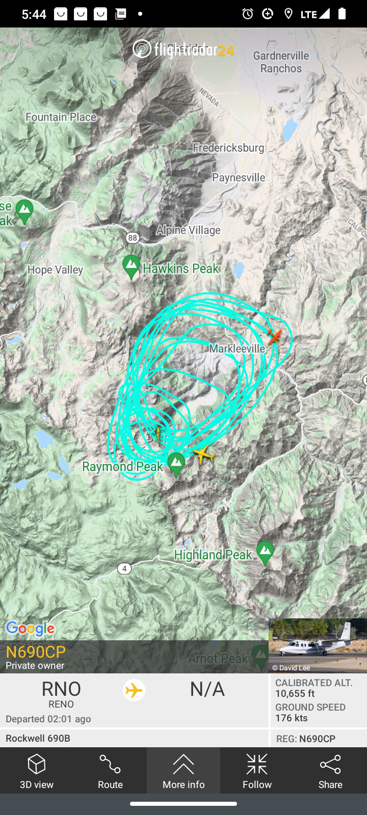
Resources: AA0CP, Black Mountain Hot Shots, Type 1 helicopter on order
Hazards:
Weather:
Radio channels: HTF Hawkins
Webcam link: ALERTWildfire | BLM Nevada

I will post more as it develops

4 Likes

Its making big runs.

It is really lighting up on the RAMMB/SLIDER. You can barely see the Henry south of it.

https://rammb-slider.cira.colostate.edu/?sat=goes-17&sec=full_disk&x=13702&y=3341&z=5&angle=0&im=24&ts=1&st=0&et=0&speed=130&motion=loop&maps[borders]=white&lat=0&p[0]=fire_temperature&p[1]=cira_natural_fire_color&opacity[0]=1&opacity[1]=0.5&pause=0&slider=-1&hide_controls=0&mouse_draw=0&follow_feature=0&follow_hide=0&s=rammb-slider&draw_color=FFD700&draw_width=6

How would this be a nevada fire? Thanks

1 Like

20 minutes ago, 100 acres, RROS, Crown runs and spotting. 1 structure in front of it, with possible alinement in a drainage with the town of Markleville. (5 to 6 miles from the fire at this point)

2 Likes

The Humbolt/Toyiabe Forest in NV extends into CA and the fire is HTF DPA and in the Great Basin GACC

6 Likes

Visible from Vallecito

2 Likes

Taken from North carson city NV 10 mins ago!
Column is now capping out

2 Likes

http://www.alertwildfire.org/tahoe/index.html?camera=Axis-Alpine&v=fd40729

1 Like

From Vallecito

2 Likes

Per AA, fire has spotted to about 1/4 above the first structures town of Markleeville.

2 Likes

Almost 100% alignment. It’s ripping in pleasant Valley drainage which leads directly to Markleeville.
And the winds are showing directly down that valley.

It really popped around 17:30
http://www.alertwildfire.org/blmnv/index.html?camera=Axis-NorthMok&v=fd40729

The Hawkins cam showed the fire initially behind Thornburn peak. The fire has come around the shoulder of thornburg and working into thornburn creek as well.

Dang, it’s moving faster than I can type and paste link.

2 Likes

2 Likes

http://www.alertwildfire.org/blmnv/index.html?camera=Axis-BaldNV&v=fd40729

2 Likes

1 Like

Acres? And threat?

ALERTWildfire | Tahoe
it’s cookin’

1 Like

i have a cabin there at the hot springs. spent the night there last night. went up on the hill to look at the fire last night. wasn’t doing much. now it looks as though we may lose our place…

6 Likes

Watch the one hour from the NorthMok cam. It just explodes, hope Markleville is getting the hell out of the way.

http://www.alertwildfire.org/sierra/index.html?camera=Axis-NorthMok&v=fd40729

4 Likes

http://tiledisplay.alertwildfire.org/?urlcamset=Axis-BaldNV&urlcamset=Axis-Leek&urlcamset=Axis-NorthMok&urlcamset=Axis-HawkinsPeak&urlselectedviewing=true&urlregions=blmnv&urlregions=sierra&urlregions=tahoe