Processed a Sentinel-2 L2A Satellite image to remove some smoke and overlaid it with yesterday IR flight and some land status polygons. Only the west side of the fire is in the image

3 Likes
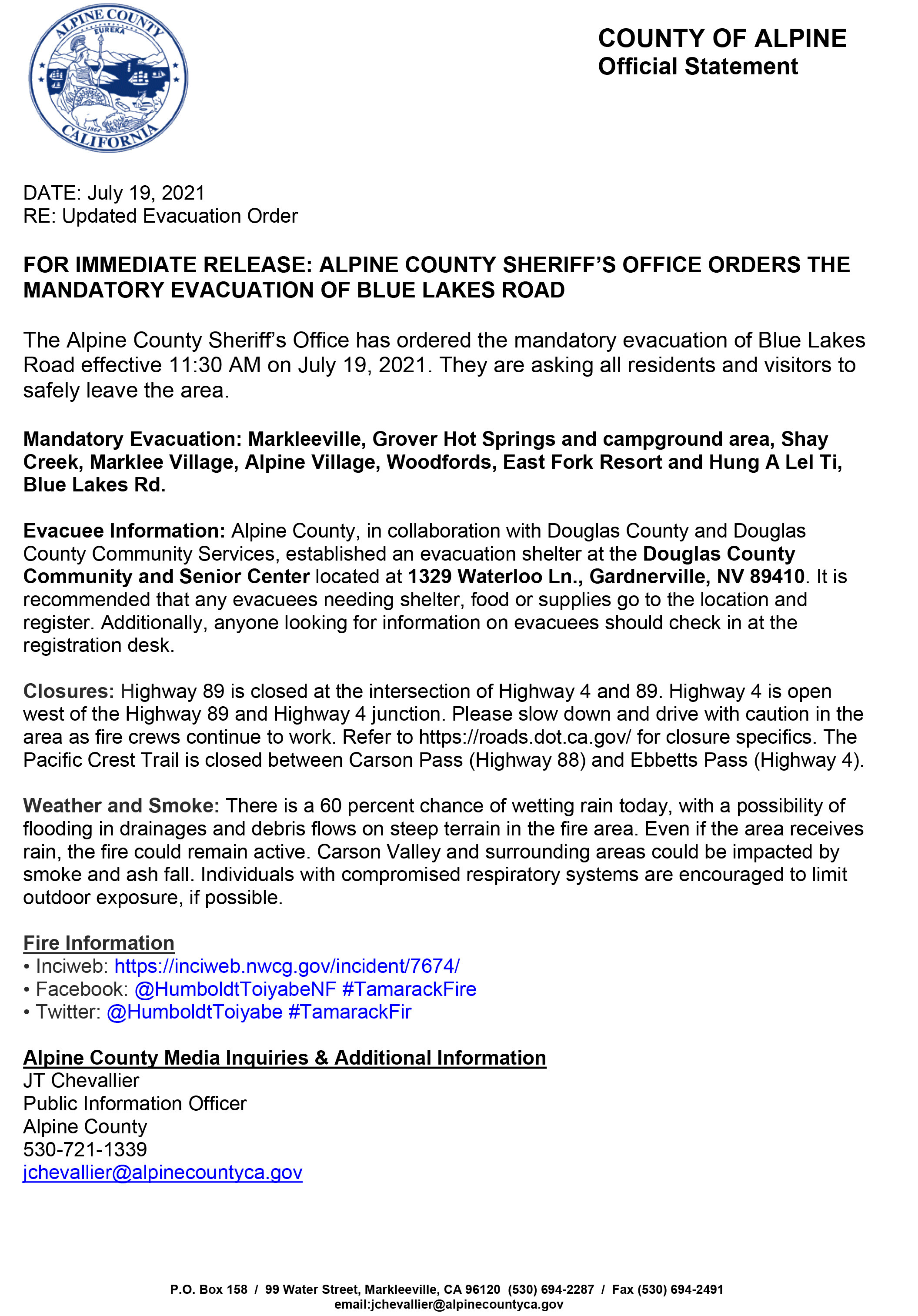
23,078 acres as of 7/18/2021, 1500 Hrs
2 Likes
A post was merged into an existing topic: NV-HTF-Tamarack???
Getting some wetting rain with the T storms in Div K
4 Likes
That’s good to hear. Doesn’t look like much in the way of lightning on the radar
2 Likes
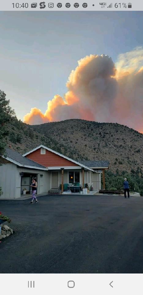
Been looking like that most of the afternoon…was coming up a little further in the background
3 Likes
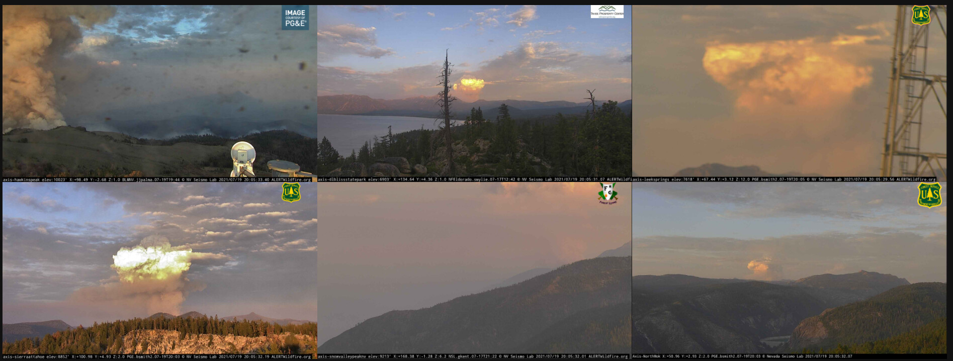

Two distinct heat heads on GOES RAMMB/CIRA SLIDER: Satellite Loop Interactive Data Explorer in Real-time with GOES-16 and Himawari-8 Satellite Imagery
2 Likes
Used IR from last night from NIROPS combined with MODIS for google earth. Screen Shot 2021-07-20 at 10.34.33 AM.png - Google Drive
1 Like
Picture of Bald Mtn Camera at 10:41. Other pic google earth from Bald Mtn angle with 7/20/21 NIROPS. Comparing two very similar pictures.


3 Likes

7/20/21 NIROPS. Angle from South. Shows west side of fire. I wanted to understand why there hadn’t been any westward expansion with the di-urnal reprieve. This is why. There are two east west bowls. One goes up from Burnside, the other more the the south goes up to Da-Ek-Dow-Go-Et & Raymonds Peak. Lots of rock!
3 Likes
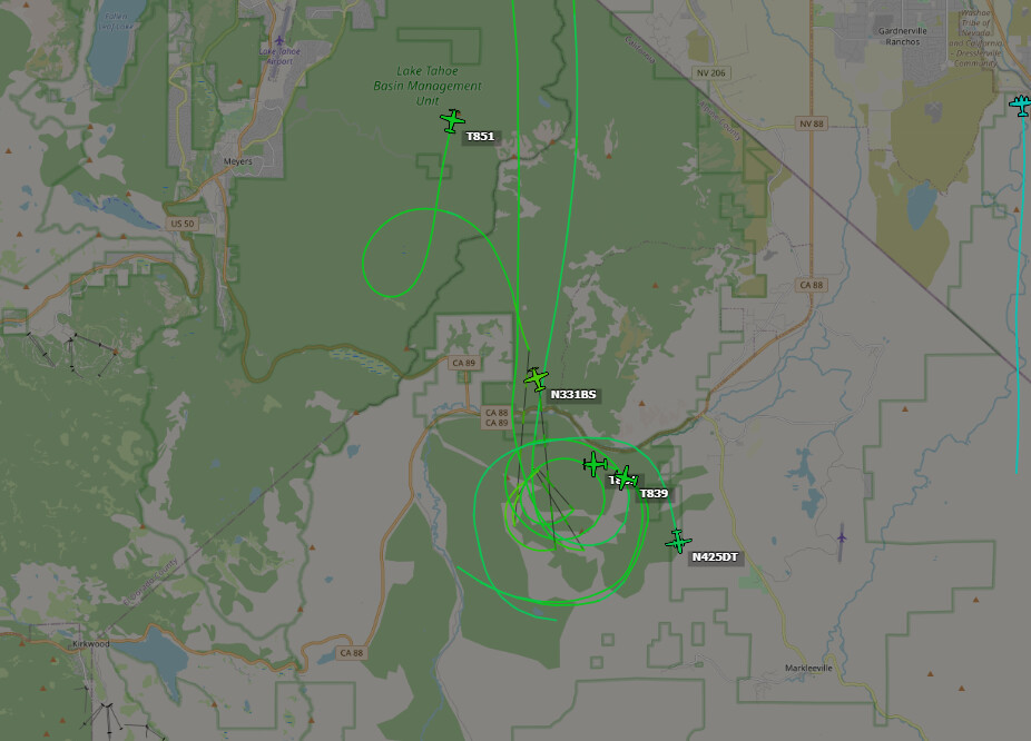
Was looking through the posts…maybe I missed it… anyone have a link to the Teams’ GIS products and IAP’s? Thanks.
They should be available through the NIFC FTP site
https://ftp.wildfire.gov/public/incident_specific_data/great_basin/2021_Incidents/2021_Tamarack/
4 Likes
When the team transitioned to Rocky Mountain Team I (today first day), Team I started updating NIFC site with more than just IR. FYI They have also created a very informative FB page with lots of great info including operational briefings. See link.
4 Likes

False-color Sentinel imagery of Markleeville from Tue 7/20, with topo and Microsoft building footprints for reference from CalTopo.

2 Likes