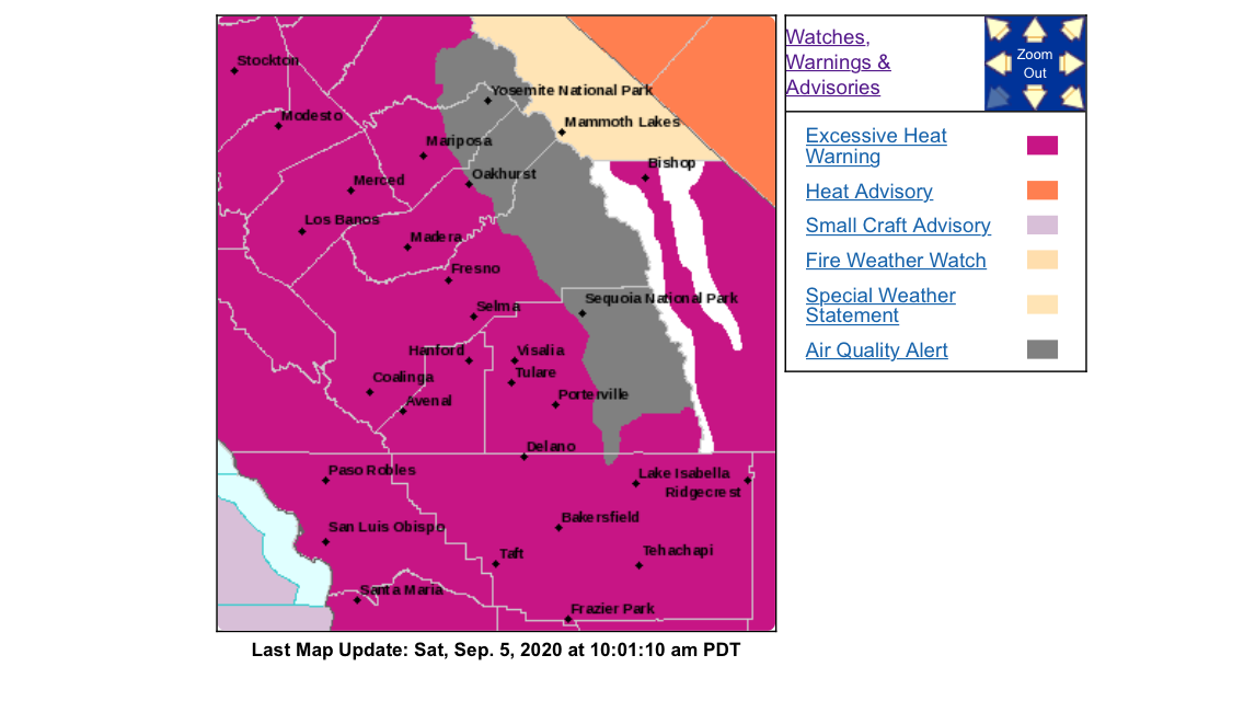
Regional Forecast

Forecast Discussion:
https://www.weather.gov/wwamap/wwatxtget.php?cwa=sgx&wwa=all
SDG&E Weather site:
https://sdgeweather.com
Central Valley
Forecast Discussion
https://www.weather.gov/wwamap/wwatxtget.php?cwa=hnx&wwa=all
Regional Forecast
Forecast Discussion:
https://www.weather.gov/wwamap/wwatxtget.php?cwa=sgx&wwa=all
SDG&E Weather site:
https://sdgeweather.com
Central Valley
Forecast Discussion
https://www.weather.gov/wwamap/wwatxtget.php?cwa=hnx&wwa=all
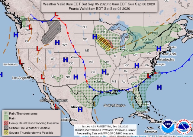
About 36 hours before the Santa Ana winds start in the mountains. Some models are slowing down the progression of the upper level low in the Great Basin region, and this scenario will need to be monitored as it could mean a longer duration offshore wind event. This is likely due to models historically underdoing the strength of the summer high pressure off of the Carolina’s (notorious for tropical cyclone track forecasts).
It will be interesting to see how far this cold airmass progresses over the eastern half of the US in relation to the ridge I mentioned.
This is a bizarre pattern with not much historical prescient so the exact strength of offshore winds is in question. Sticking with the ‘moderate’ tag until more data is known.
Watching the expected temps and movement… measurable inches of snow as far south as Denver expected with “feet” in the upper elevations.
Do you know if the models will forecast keeping TS Julio pushed to the south, moving west, keeping that monsoonal air from moving up for another lightning series?
Julio’s moisture should stay away.
Yes, this pattern is crazy… it’'s still mid-late summer technically.
NWS just issued RFW for most of SoCal at 109pm. Runs from noon tomorrow til 8pm Wednesday. Gusts to 55 in the wind prone locations!!
Hear is the Santa Ana wind wildfire threst index.
Forecast models starting to hint at another inside slider in about 7-8 days. Very amplified, aggressive pattern will continue.
does that mean another NE wind episode? if so that explains temp drop 7-10 days out in Wrightwood. we do not get any wind here, just cooler weather. at 6000 ft at SBF and ANF border.
This is correct. Will watch model trends and update accordingly
Santa Ana winds update:
As I suspected the models have slowed down the ultra aggressive shortwave dipping into the four corners region, and it appears now that we may get some offshore flow into Thursday now.
The GFS peaks LAX-DAG gradients only @ -4.5, and this is due to the stronger strength of the upper level low than originally resolved by the model, the kicker is the 24 hour pressure trend is a whopping -11.4… so in theory this should drive winds towards coastal areas as well.
The NAM-WRF peaks gradients @ -7.0, and with an impressive 24 hour trend of -10.2
From NWS LOX AFD:
“This Santa Ana event has all three ingredients we look for including solid offshore pressure gradients (LAX-Daggett gradient peaking around -6 mb on Wednesday morning), upper level wind support (850 mb winds 40 to 50 knots), and cold air advection across the interior. The expected LAX- Daggett pressure gradient of -6 mb for Wednesday morning is very rare for early September, a 99th percentile event for this time of year. Also of note is the significant offshore trend from the moderate onshore gradients we are seeing tonight.”
Sticking with the idea of a moderate Santa Ana wind event starting above 5,000’ after midnight tonight… with NE winds 15-25 MPH and gusts to 35 MPH common. An extremely dangerous event due to the fact that several large fires are already burning and will likely see extreme fire spread, due to resource draw down. Any new ignitions will likely not get enough resources due to drawdown. The ridge is anticipated to rebuild over the area for potential 90-100 degree weather later in the week.
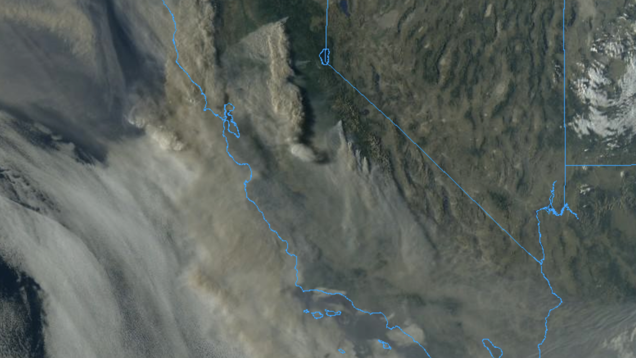
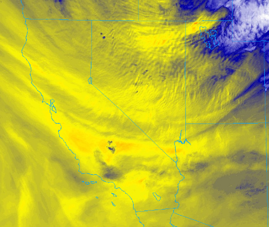
The strong winds are currently where the end of the PNF complex fire smoke column ends (near Fresno) moving south.
Update: Other than the typical areas, a widespread Santa Ana wind event is no longer expected to materialize. Forecast models had a bit of a rough time on this one, and it’s not hard to blame them since the set up doesn’t really have any historical precedent.
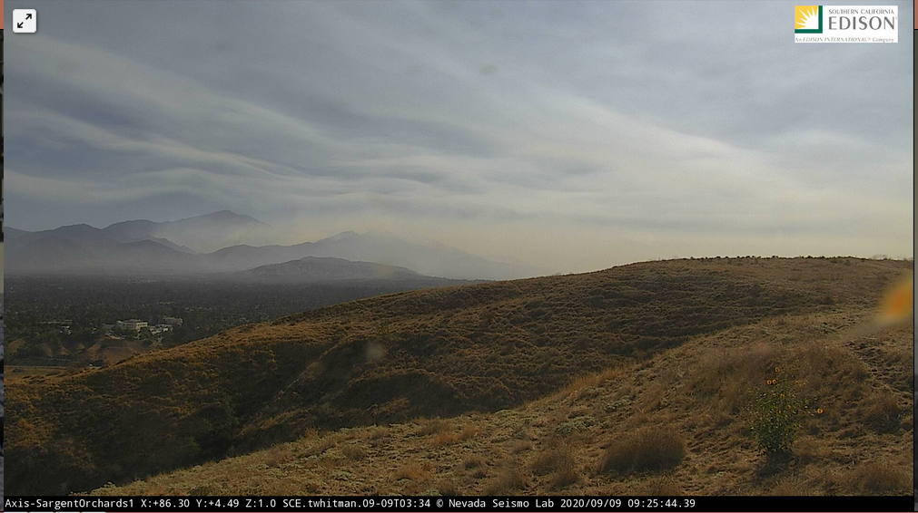
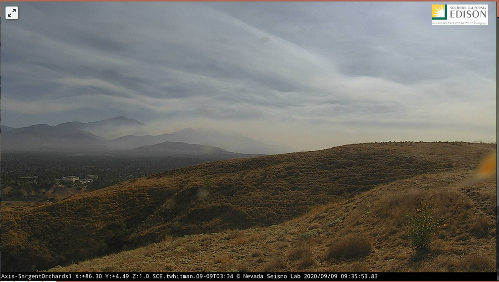
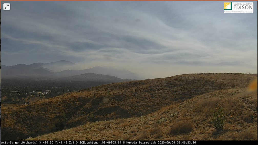
Wind influence moving into the San Bernardino area this am & skies clearing. screenshots over one hour 0900-1000 from Redlands looking east over Crafton Hills and Yucaipa towards the #ElDoradoFire
Sky has started clearing from the NE in northeast San Diego county and an easy breeze has reach my location in Valley Center 11:50
Outlook for the rest of the month:
Ridging returns through next week. It looks flat and stagnant but temperatures rise a few degrees. Weak offshore flow inland will keep temperatures elevated. Next weekend an inside slider moves into the Great Basin. Currently it appears to lack cold air and dynamics, but could result in a sundowner wind event.
Ridging extends across the entire southern US and is acting as a dam against cold air intrusion from Canada. A tropical cyclone targets the US on 9/23, breaking down the ridge in the south east and midwest, and amplifies the high pressure system off of the California coast again for the possibility of another heat wave. The next meaningful Santa Ana wind event should follow this pattern towards the end of the month, a bit similar to the pattern we just experienced (lower temperatures likely though).
Pretty solid confidence of above average temperatures dominating through the end of the month, except for the inside slider knocking temps down next weekend.
I will add to this specific post as more data becomes available over the coming days.
Quick update 9/13:
Omega blocking across the entire Southern US continues through much of the month. Several strong tropical cyclone remnants are going to head north into extremely cold airmass in the Arctic, very highly amplified situation and the dam across the south must break at some point leading to cold intrusion into the US.
Rain now appears likely next weekend across far northern CA. Still looking at potentially a drying trend though. A sundowner wind event looks likely as well with the trough passage.
How does the weather look like the end of next week? temps in Wrightwood looks like a NE condition.
That’s really different. Got my interest.
That’s very interesting.
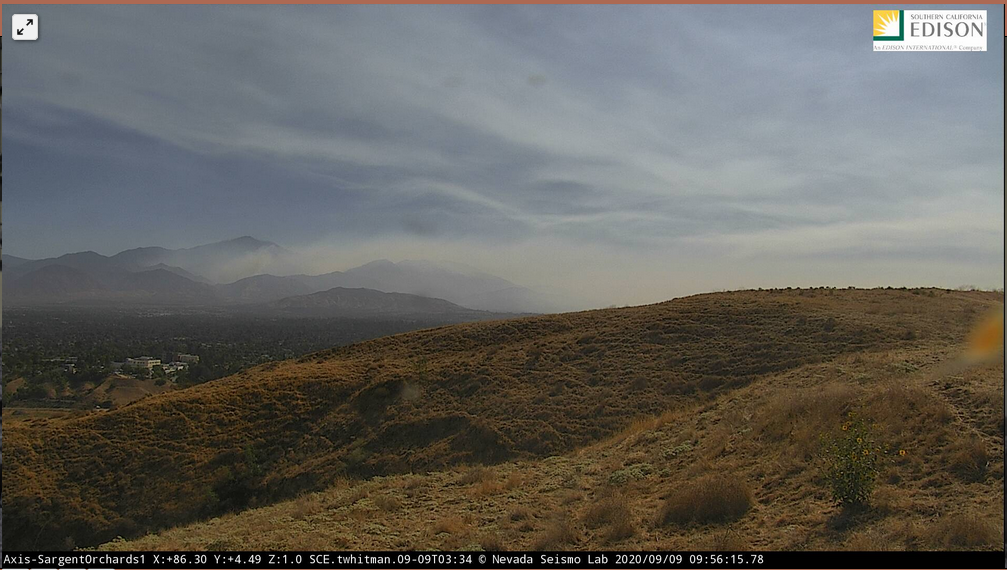
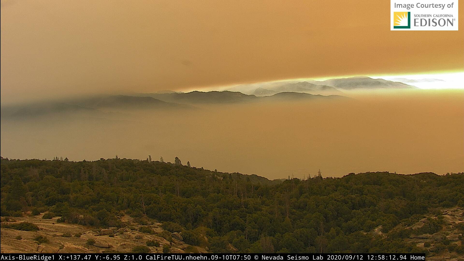
The inversion is the clear layer between the smoke at different heights. It’s because there is so much smoke high up in the atmosphere from other fires in addition to this fire burning at this location, and/or the fire putting off smoke at different elevations