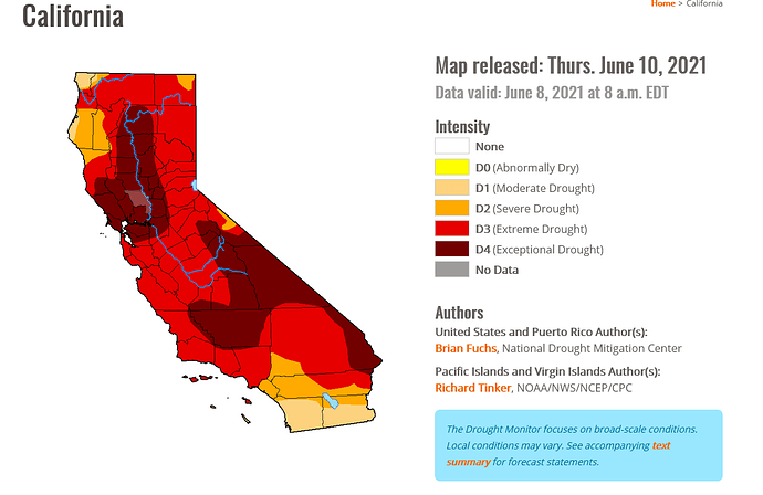
Yes I was.
Zonal flow is developing next week. The subtropical high pressure will expand over Arizona and New Mexico and kick off the monsoon in those states this weekend. Troughing will respond by deepening across the NW.
Onshore flow will bring temperatures down and increase winds and fire danger on desert slopes early next week.
Ridging should begin to build back mid to late next week with warming temperatures.
6/7
The ECMWF brings a monstrosity of a ridge across California next Monday that would push temperatures up to almost 130 degrees in the lower deserts. The GFS is further east with the ridge but is trending towards the EC. Nonetheless temperatures will be rising by the end of this week so enjoy the cool weather while it lasts during the next 72 hours.
Southern California Weather Force had a post on FB this afternoon. Echoes exactly what anvilhead is speaking of!!! This looks to be a big time event.
Copied from the FB post…credit again to SCWF
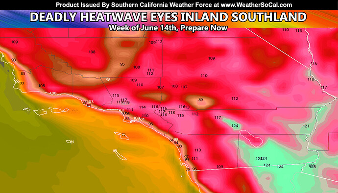
Southern California Weather Force has issued a Special Weather Statement out ahead of the week of June 14th as a deadly heatwave is showing up in the latest numbers being crunched for inland residents so plan where to get cool soon, so read on for details …
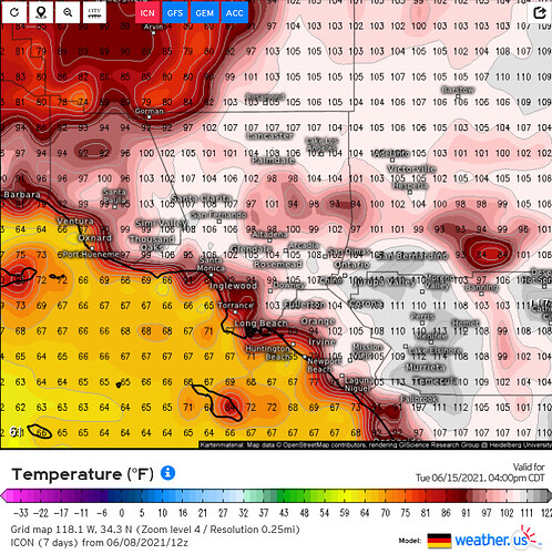
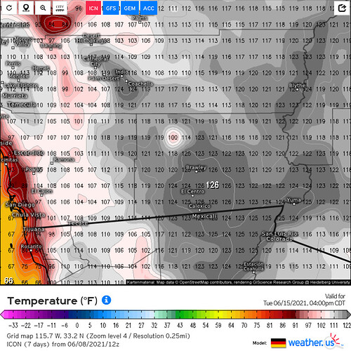
The cooler weather we are experiencing now is due to a very large trough of low pressure well off the coast, bringing rainfall further north into the Pacific Northwest. As this starts to weaken, a large ridge of high pressure will form over Arizona, which will extend into Southern California. This ridge does not have much cloudiness associated with it … so temperatures underneath the sinking air dome will skyrocket as a result. The image in this article shows over 115+ for the Inland areas like the SCV/SFV to the Inland Empire. Furthermore, it shows a whopping 124F in the Imperial Valley with many low desert zones at 120+, including the Coachella Valley.
The temperature profiles are preliminary and will be for the week of June 14th, however, such large ridges are not hard to forecast so we are looking at a heatwave level event that will be deadly in the populated zones so if you need to schedule to be somewhere cooler, do so at your earliest convenience.
The guy that runs that site is not a reliable source of weather information. If you want reliable weather information then follow Weather West.
Matches what my iPhone says for next week lol
at WeatherWest on Google, all I get is old long range forecasts and such. could you be a little more specific in the site where current info can be found. thanks
Weather forecasting more than 7 days out is always fun. NWS, GACC predictive services, weather apps, private reliable local forecasters, climate scientists, some off the wall forecasters…either way the source its always about pulling in data from multiple sources and making your conclusion. At least that’s what I do. All data is good, certainly never 100% accurate, usually lands somewhere in the middle. Either way, tune up the AC and be ready. If the first major heatwave ain’t next week its probably the week after or the week after or the week after…
Meteorologist… how does the old saying go - the only career you get to be wrong every day and get to keep your job.
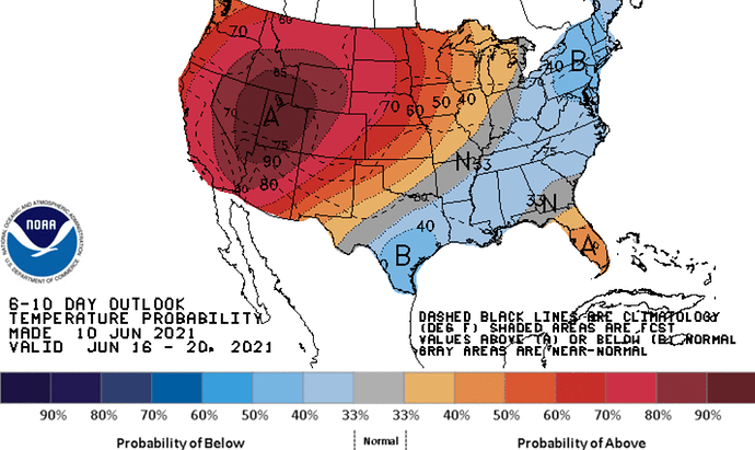
Tonight’s runs of the GFS and ECMWF are in near perfect agreement for the upper air placement and strength of the high pressure. Due to run to run consistency, and ensemble mean support a long duration heat wave is near certainty starting late this week peaking early to mid next week.
The only thing in question is max temperatures. It’s a bit early in the year for a really widespread severe heatwave & it’s a very bad sign for later in the summer when the peak heatwave arrives.
Maximum temperatures in the hottest valley locations at 105-108 is a safe bet.
Maximum lower desert temperatures 115-119
Coastal 85-88
Add or subtract 3-5 more degrees to those values depending on if things change.
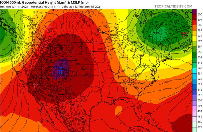
Here is the high resolution ICON model now up to that time window.
I agree it is not a really reliable source, however his forecast seem to be fairly accurate lately and I take all his forecast with a grain of salt. I do agree that Weather West is the go to and Daniel is great, problem is he only gives updates about once a month! It would be a much better tool if he could somehow find the time to update weekly.
Art Bell at Weather Bell is one of the most accurate forecaster out there. However, his service isn’t free as he has a business to run and provides PAID FOR forecasting for utilities and large industrial farming. He pulls in data for ALL the models, even pays himself for some.of the European data sets. I agree Daniel at WW is the best we’ve got when it comes to WL FF.
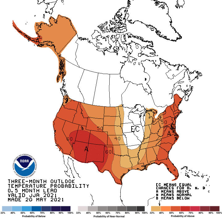
Look like this coming heatwave is just the beginning…CPC June, July and August 3 month temperature outlook. Its gonna be a grind the next 5 months…prepare now.
I can support what HookandladderUSAR said. This weather source (Southern California Weather Force) is bogus.
No changes based on recent model runs. There is likely going to be a gulf surge Wednesday. This will kick up humidity and make it feel unbearable especially in lower deserts. Any fires that become established could become plume dominated.
This is a very bad sign for next month for the following: a lot of times the weather pattern has ‘memory’ and when you can expect the peak heatwave I’d anticipate next month to bring another round with hotter temperatures.
Also since we are going from highly amplified high pressure for this early in the warm months the high pressure will be de amplifying from a place of very high amplitude down to more normal heights as part of the normal 10-14 day amplification cycle. This means even though temperatures will cool next weekend temperatures are still going to be hot & above average before the ridge restrengthens again in about 12 days.
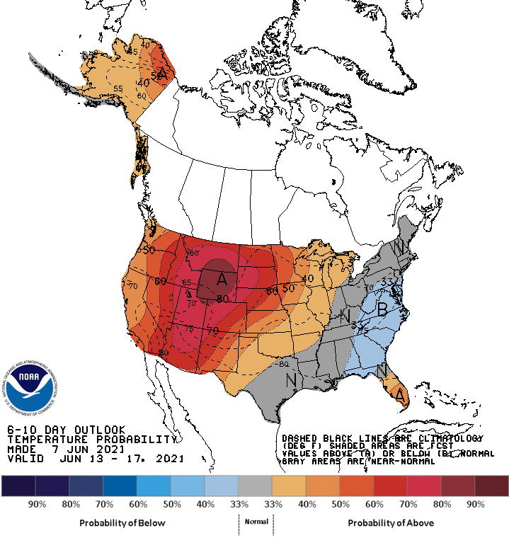
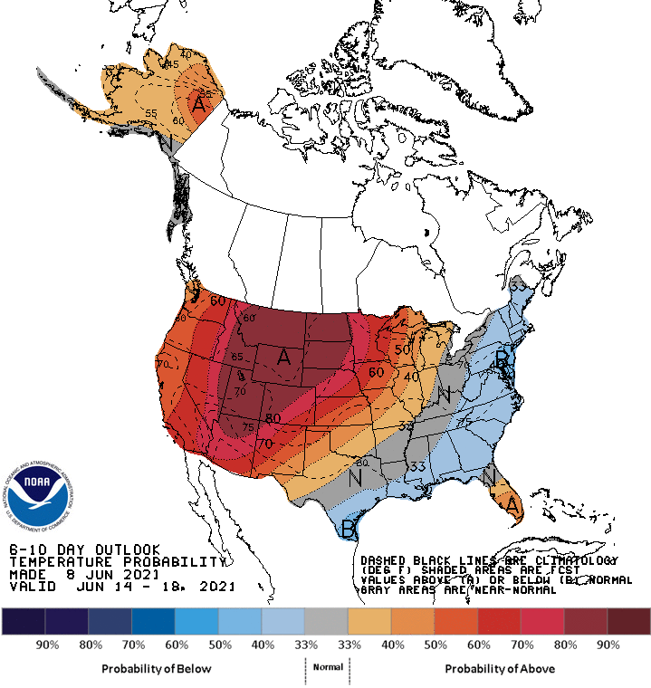
So it’s a very grim outlook as far as temperatures go as reflected in the climate prediction center temperature outlook.
Just adding because you have to appreciate the purple. Insanity.
What’s the purple significance?
