The colors are not indicative of actual temps…just the probability of that area having above or below normal temps. The purple is saying there is a 90%+ chance of above normal temps
The purple indicates heights above 600 hp at 500MB. A very rare sight in the US.
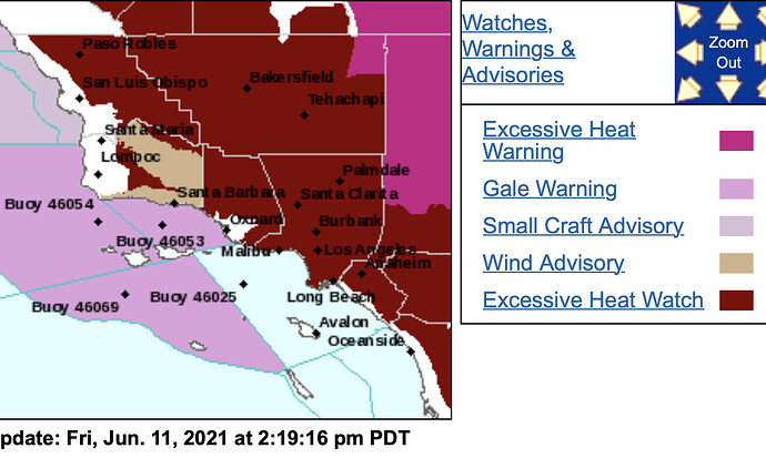
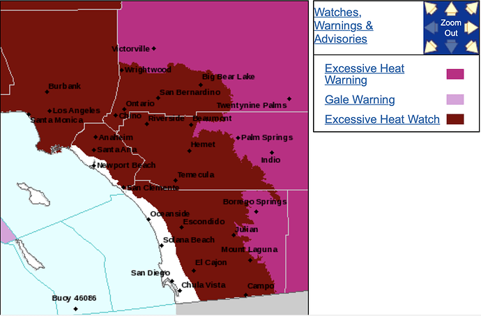
NWS LA: 203 PM Fri Jun 11
…EXCESSIVE HEAT WATCH IN EFFECT FROM TUESDAY MORNING THROUGH
FRIDAY EVENING…
-
WHAT…Dangerously hot conditions with temperatures up to 109
possible. -
WHERE…Santa Ynez Valley, Ventura County Interior Valleys,
Ventura County Coastal Valleys, Santa Monica Mountains,
Ventura County Mountains, Los Angeles County Mountains
excluding the Santa Monica Range, Antelope Valley, Santa
Clarita Valley, San Fernando Valley and San Gabriel Valley. -
WHEN…From Tuesday morning through Friday evening.
-
IMPACTS…Extreme heat will significantly increase the
potential for heat related illnesses, particularly for those
working or participating in outdoor activities.
This mornings ECMWF keeps the strong high pressure all the way into Saturday. In fact, temperatures could now peak on Thursday or Friday in some areas.
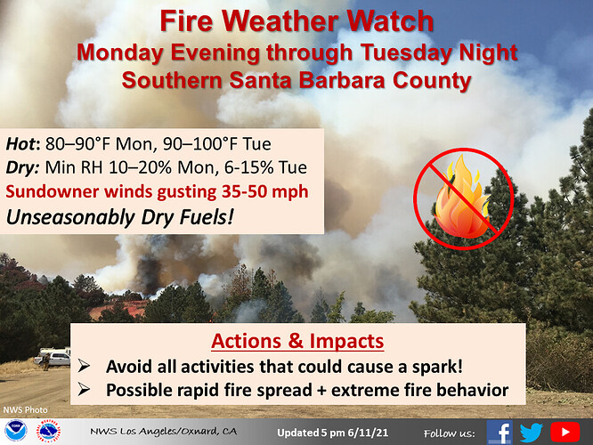
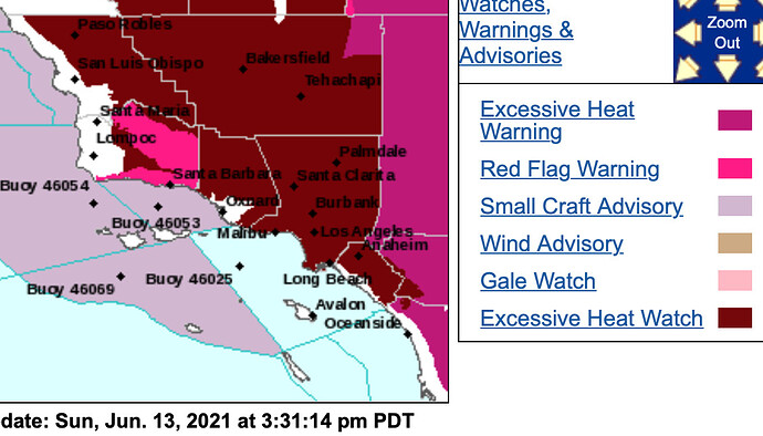
NWS LA - Sunday 3:30pm
Red Flag Warning FOR WIND AND LOW RELATIVE HUMIDITY, which is in
effect from 6 PM Monday to 6 AM PDT Wednesday. The Fire Weather
Watch is no longer in effect.
-
Winds…North winds 20 to 30 mph with gusts to 50 mph. Isolated
gusts to 60 mph will be possible. Strongest in the Santa Ynez
Range and below passes and canyons Tuesday and Tuesday evening. Forecast gradients peak with current numbers indicating the potential for 60+ MPH wind gusts around Montecito. -
Relative Humidity…25 to 40 percent Monday night falling to as
low as 6 to 12 percent Tuesday into Tuesday night.
Follow up on this post from April 29th, this all appears to be coming to fruition as the stronger than normal 4 corners high pressure system is leading to much above average temperatures for this time of year. Ridiculous heat for this early in the season (it isn’t even the first day of summer yet!) The monsoon is starting early but as stated the lack of low level moisture availability will likely keep things dry for the time being.
Update coming after the model runs come in.
Levi’s website is down… so no update for now.
Increased strength of the Monsoon, Four Corners High and warm temps… sounds like a recipe for active weather and more thunder on the Eastside, Plateau, and the Sierra’s. More high Haines index and plume dominated fires…
Could this cause lightning storms like we had rip through NorCal last august?
Yes, increase in Monsoon activity can lead to increase in lightning events. California is on the periphery of the annual Monsoon, and the last three years have featured much reduced activity. Its not to suggest more fires, but more activity. The storms could be on the wetter side.
It has been a long time since we have had a significant lightning outbreak in the Sierra’s. Other than in BTU, most of last years activity was confined to the coast ranges.
We will see what happens…
Let’s hope that this does not happen…anything in the Mid to Lower elevations would be devastating. From TUU to NEU this would be NO BUENO. Lots of people and structures now days and more moving up out of the populated areas of CA.
Update…
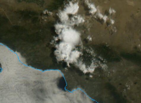
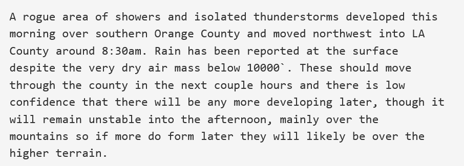
" Precipitable water has steadily increased since Monday, primarily due to mid-level moisture advection in the 300-500 mb layer. The NKX sounding PW was 0.59" Monday morning, 0.79" Tuesday morning, and was 0.93" this morning. Moist southeast flow aloft will continue to advect mid-level moisture into SoCal through Thursday when PW`s will likely exceed 1". Perturbations in the southeast flow around the Four Corners high could trigger scattered convection over the mountains Thursday. The HRRR, ARW and other high resolution models show the greatest chances over the San Bernardino County mountains, the Riverside County mountains and the High Deserts."
-NWS San Diego forecast discussion.
Ridging has peaked this cycle and will gradually wind down through the weekend. High temperatures will still be above normal in the inland locations through Sunday. Broad troughing will bring strong onshore winds starting this weekend which will increase fire danger on desert slopes. The latest run of the GFS shows troughing breaking down the ridge as far south as Orange county around the 22nd-24th of June.
The GFS has been advertising the ridge to start rebuilding & strengthening again around the 25th.
This time, it is likely that the strong high pressure system will amplify directly over California. This will shut down the monsoonal flow and promote strong drying, and sinking in the atmosphere. While it is still way too far out to forecast, it is possible that this ridge of high pressure develops & brings an equivalent or stronger heatwave to the state. The ridging is a little easier to forecast in advance, and should start to see some consensus in about 48 hours.
If the strong high pressure develops over CA, it will keep the low levels extremely dry. Going into the middle of next month, the extremely amplified high pressure system could either break down and move back to the four corners region or move out into the Pacific ocean. If the high pressure develops and moves out into the ocean, with broad riding across the SW… it could allow for some dry lighting type events in the middle of the month. The set up could allow for mid level disturbances to slip under the ridge as easterly waves move across Mexico or tropical cyclone remnants move north.
Also, I cannot post any supporting images because it says the website is full.
Live fuel moisture - LACounty:
anything on the lightning detector?
Things are starting to get interesting, couple of cells heading right up the 99 south of fresno along with some moving along the west slope north of lake Isabella.
Lots of lightning and thunder on east side of visalia.
Seeing a fair bit of cloud to ground from above auberry.

