South Ops Weather - 2021

From the Weather Force guy.

Southern California Weather Force has issued a Special Weather Statement effective Tuesday as the outflow from a disturbance over Central Baja, Mexico will reach Southern California overnight on Monday, morning early Tuesday morning, and going through the day, upping the chance of showers or thunderstorms for Los Angeles eastward, westward is out so read on for details …

We are having yet another break from tropical moisture in what were ‘surprise’ events within the last week, but another one looks to be brewing. A disturbance currently in Mexico will cross Central Baja, Mexico tonight into Monday. Powerful thunderstorms will develop within it and the outflow from them will be sent northward towards Southern California and Arizona. The last event came from Arizona, but this one will come from Baja, Mexico, which means that San Diego and Imperial County will be within the chance of showers or thunderstorms.

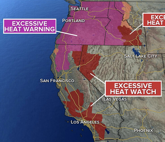
There is an upper-level low west of California that will keep a dry southwest flow west of Los Angeles, so if you are in Ventura, Kern, Santa Barbara, or San Luis Obispo County you are not in this forecast. There will be a fine line from dry air to moist air … the dividing line is Los Angeles County. So Los Angeles is the border of no activity vs activity, with most of it happening east into Orange, Inland Empire, San Diego, Imperial, Coachella Valley, San Bernardino Mountains, High Desert/Morongo Valley, CO River, and Las Vegas, just as the embedded article graphic says.

Depending on mid-level moisture, this could harbor a better chance of rainfall, not flooding type, however. It also does give the risk of fires due to lightning strikes under little rainfall in some of the cells. This will move off by Wednesday – so this is a one-day event. Stay tuned to Southern California Weather Force on social media, your member e-mail alert service system, or however you follow for further updates.
4 Likes

I would be suspect of that website and its “forecaster”. He is not a trustworthy person and has a dubious background in the weather forecasting realm. The only special weather statements should come from the NWS or PDS with consultation with the NWS.

13 Likes

I prefer Frankie MacDonald

3 Likes

I sure miss watching Dr. George Fischbeck with his wit and humor weather forecasts.

12 Likes

Dr George and his explanation of cut off lows.

5 Likes

So much dry lightning so early in the season. There will be a slight chance across South ops today and tomorrow. Oregon and Arizona are going to get hammered again. There is a better chance of lightning across North ops on Thursday…

6 Likes

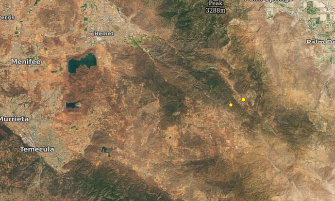
Seeing multiple downstrikes in the Ortega’s above Lake Elsinore. Some not registering on the lightning map

5 Likes

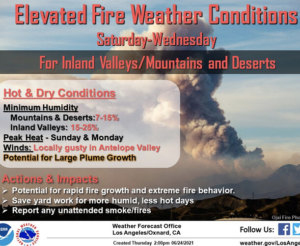
NWS Los Angeles - 3:00pm Thursday: We are looking at increasing heat and elevated fire weather for our interior areas(inland valleys, inland mtns, & the desert). Dry air & heat along with the potential for large smoke plume growth will be the main concerns.

5 Likes

potential for large smoke plume growth interesting verbage…

2 Likes

Significant weather possible in Southern Operations area through end of next week.

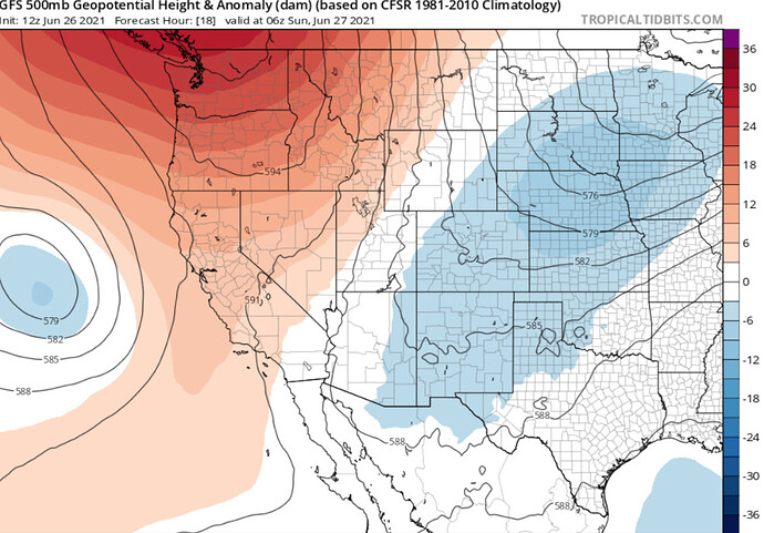
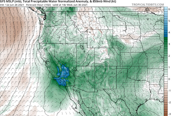
Omega blocking across the west coast will lead to moisture transport into Southern CA, increasing each day through Thursday. Middle level moisture will increase and this will lead to a chance of dry lightning through Tuesday. On Wednesday an inverted trough will sweep across the area leading to much deeper moisture transport. Strong thunderstorms could develop as long as there is no debris clouds. These storms will likely move into populated areas west of the mountains. The PWV >1.50" could lead to some very heavy rain & depending on the strength of the inverted trough there could be some damaging wind gusts with some thunderstorms.

Omega blocking… as the ridge phases it will lead to the eastern portion of the block to retrograde west across CA… interacting with deep moisture from Hurricane Enrique

PWV anomalies could exceed 4 standard deviations above normal on Wednesday/Thursday.

The strong ridge on the Pacific NW phases into the 4 corners region and depending on what happens with the ridge and the remnants of Hurricane Enrique we will need to monitor the middle level circulation as a trigger for dry lightning next weekend.

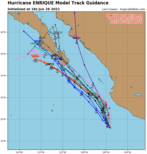
Spaghetti models for Hurricane Enrique. It is still unclear where exactly the remnant mid level circulation will end up as the strong ridge across the Pacific NW phases to the east with a subtropical ridge. The weakness in the ridge could lead to drying and possible dry lightning as this feature meanders north next weekend.

9 Likes

Evening notes.

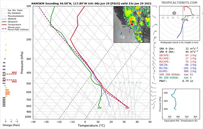
-A lot of dry lightning across the eastern Sierra today makes me think there could be a lot tomorrow across South Ops. The ENE flow really dries out the low levels of the atmosphere. PWV is only 0.79" tomorrow per NAM sounding.

-Wednesday and Thursday are trending much drier which is very bad news in regards to potential dry lightning strikes.
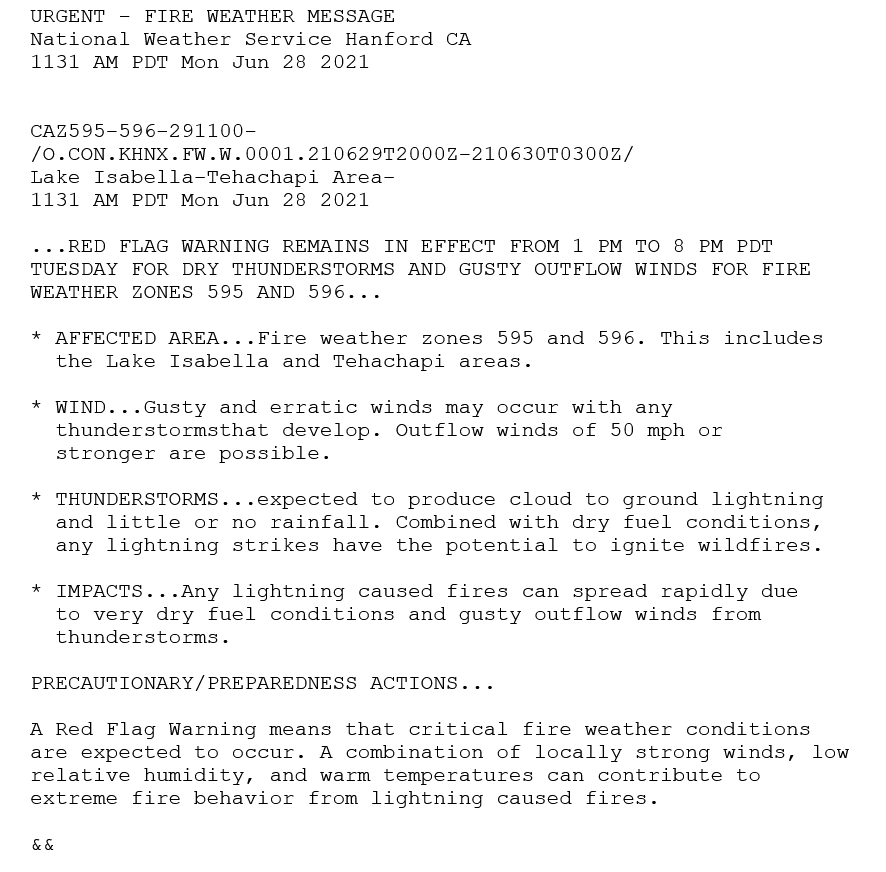
-A Red Flag Warning is in effect for following:

-The remnant circulation of Enrique is not being handled that great. Hard to gauge if it will be an impact yet.
-Heights don’t really fall much through the first week of July… very bad for the fuel conditions and water storage in general.
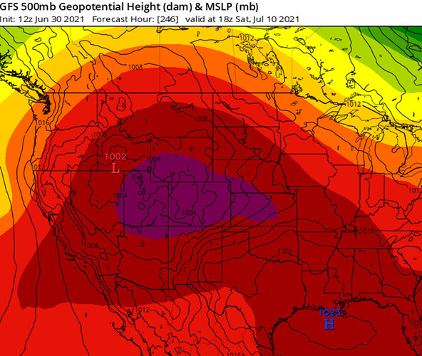
-The GFS and CMC want to rebuild the ridge directly over California around 7/8… it’s too early to say whether the center of the ridge will be over the Southern US or CA… the center tends to oscillate clockwise so that timing seems appropriate. More excessive heat, less monsoon likely at that time.

6/30 tidbit

dave-chappelle-huh

11 Likes

Good morning and happy holiday weekend.

Forecast models continue to project a dangerous multi day heat wave across the entire state starting as soon as Friday of next week. When I say heatwave, this is essentially a heatwave on top of a heatwave as atmospheric heights over the area remain high through next week and temperatures hot. On Friday the re-amplifying ridge should build across CA and this will bring temperatures 10-20 degrees above normal in some areas.

There is good consensus between the GFS, ECMWF, and their ensembles mean. Compounding the extreme heat issue is the presence of monsoonal moisture which could make heat indexes extreme to the max. This heatwave ++ could last until the following week. The climate prediction center gives a solid chance of above normal temperatures through 14 days.

16 Likes

Should get interesting in south ops by next weekend! 7/8-11

3 Likes

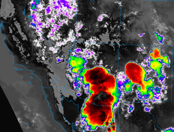
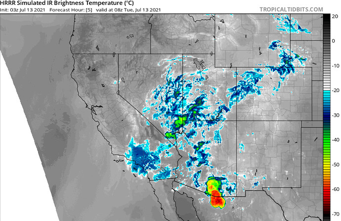
Watching a thunderstorm complex over Arizona that has been producing severe thunderstorms for the last few hours. Outflow boundary could move into eastern CA in next few hours. The HRRR has some cells making it to the mountains here. Forecast models struggle with these micro-features… so worth watching tonight.

image

5 Likes

If they make it that far it will be early morning…i.am sitting on my patio in Casa Grande waiting for them to hit any time.

4 Likes

A couple of lightning strikes over BDF/CNF

3 Likes

Last post of the night… I know I have been posting a lot

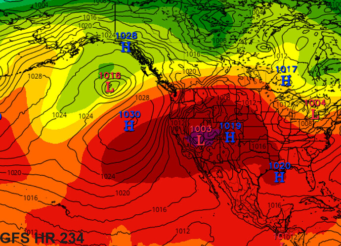
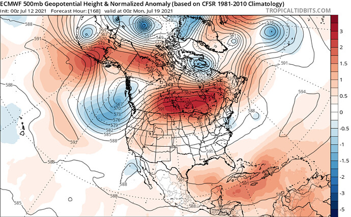
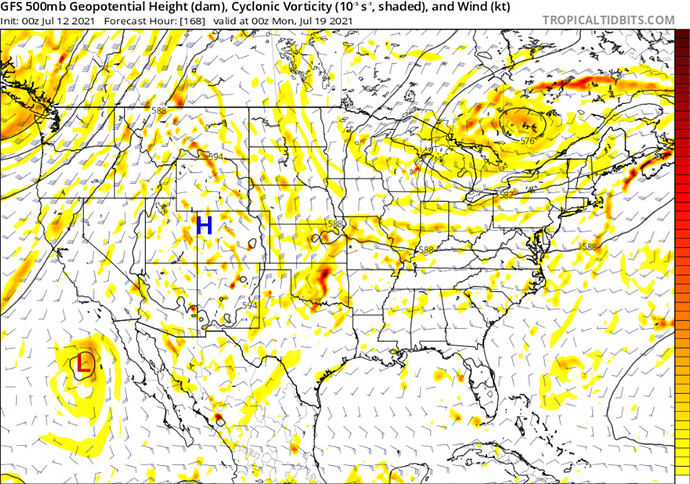
Forecast models show significant ridging building into Southern Canada extending all the way down to the 4 corners region starting about Sunday. It is really quite unprecedented to have another extreme heat wave that far north. Heights continue to stay in the 592-596 range across much of CA so the heat will continue each day, with strong onshore flow in the afternoon.

Unprecedented strong ridging well into Canada again

The pattern developing is essentially a Rex Block. There will be troughing off of the coast of CA. We will be sandwiched between this monsoon trough and the strong upper level high pressure system. The chance of dry lightning events will increase as the monsoon trough shifts from Mexico into the cooler waters off the coast.

3 Likes

Worth watching again tonight… the HRRR shows outflow boundaries from storms in AZ zipping across CA and combining to create elevated convection in a few hours.

4 Likes

How far North and West do you think these storms could reach?

HRRR shows going as far west as SLO and north as Tulare County. It is obviously picking up some kind of kicker to set this off… I suggest monitoring the satellite trend while still up as there does appear to be some altocumulus developing.

3 Likes