South Ops Weather - 2021

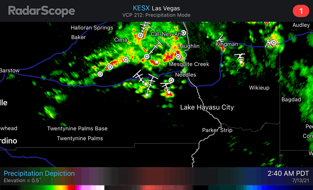
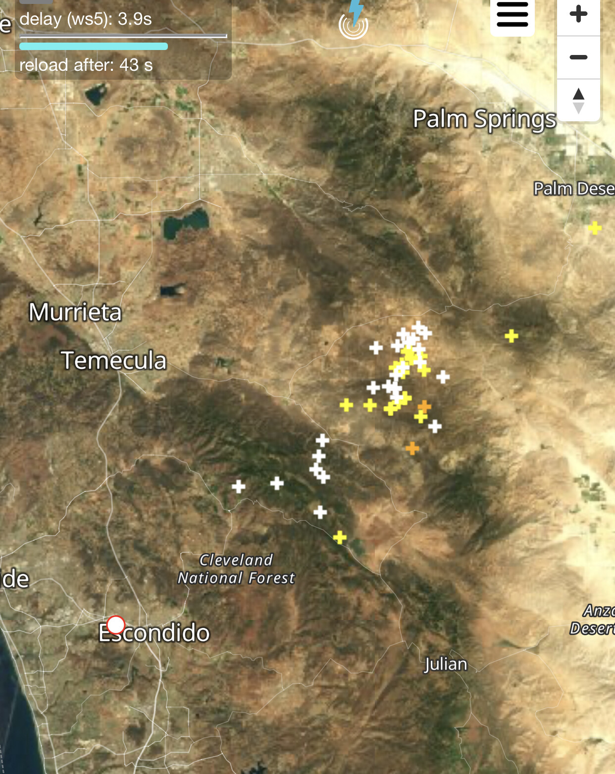
Crazy weather set up. There is an inverted trough over the Nevada/Utah border, the high pressure center over Death Valley, and a MCS over Arizona. The different directions of the atmospheric flow overlapping each other is creating a deformation zone with very heavy thunderstorm activity. This should propagate into SW CA in the next few hours

First two lightning strikes detected 6:03

9 Likes

https://forecast.weather.gov/wwamap/wwatxtget.php?cwa=hnx&wwa=fire%20weather%20watch

4 Likes

3 Likes

Will this mostly be on the west side of Sierras or will Mono and Inyo Counties be targeted as well?

1 Like

Cannot rule out thunderstorms pretty much everywhere.

The upper level low looks pretty dynamic with some nice trophospheric folding all the way into Nevada.

Also looks really dry btw

6 Likes

“High Risk” days added on this mornings Predictive Services outlook!!

National 7-Day Significant Fire Potential (nifc.gov)

5 Likes

Dr George had a few good ones. “A cut off low is a weathermans woe” and “tempus figits.”

5 Likes

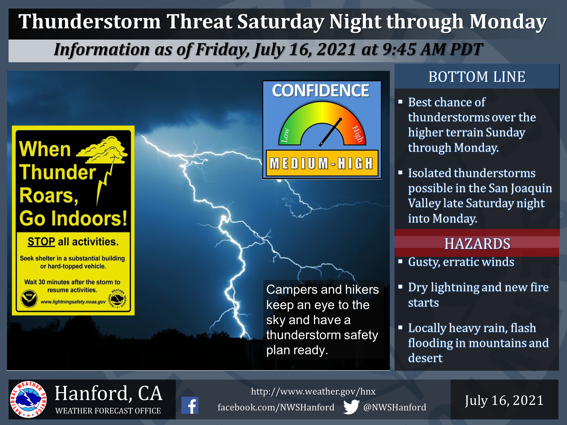
From the NWS LOX: LAL of 6 for dry lightning SBC, VNC Mtns and SLO:Threat of thunderstorms Sunday into Monday morning
Mix of dry and wet thunderstorms with limited rainfall likely
Gusty and erratic outflow winds (wind gusts up to 40 mph possible) Increased risk of lightning generated fire ignitions with rapid fire spread due to very dry fuels - prompting Red Flag Warning issuance(LAL 6)
Slightly lower threat south in LAC and VNC valleys.

4 Likes

Fire weather watches upgraded to red flag warnings for the Central and southern sierra and west side foothills.

8 Likes

Getting some rain and downstrikes in Eastern MVU near Los Pinos and Cuyamaca area.
http://www.alertwildfire.org/sdge/index.html?camera=Axis-CuyamacaPeakSouth

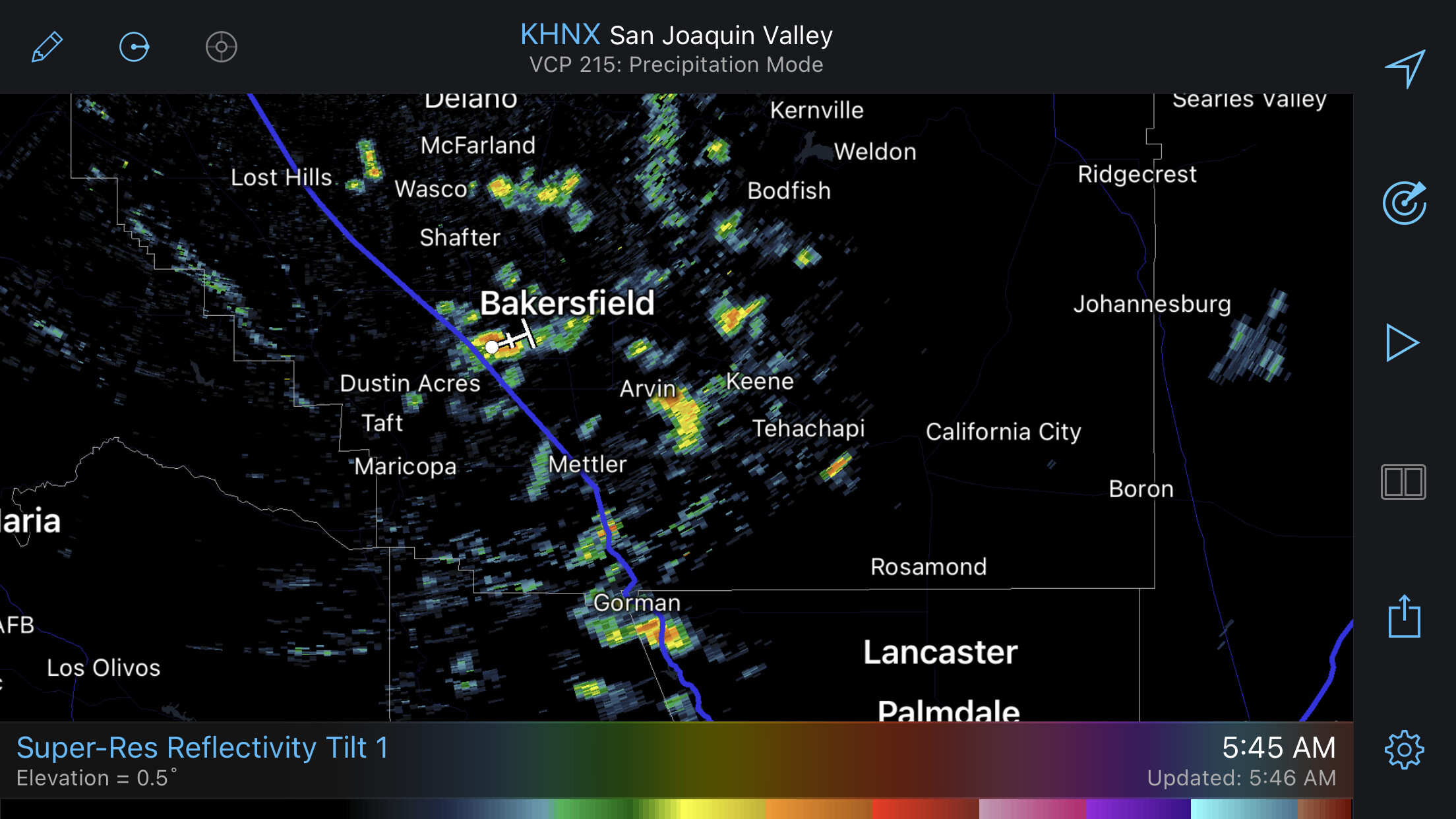
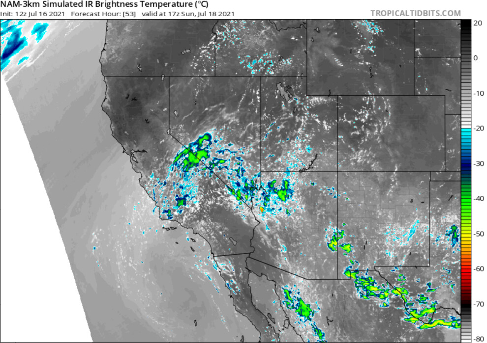
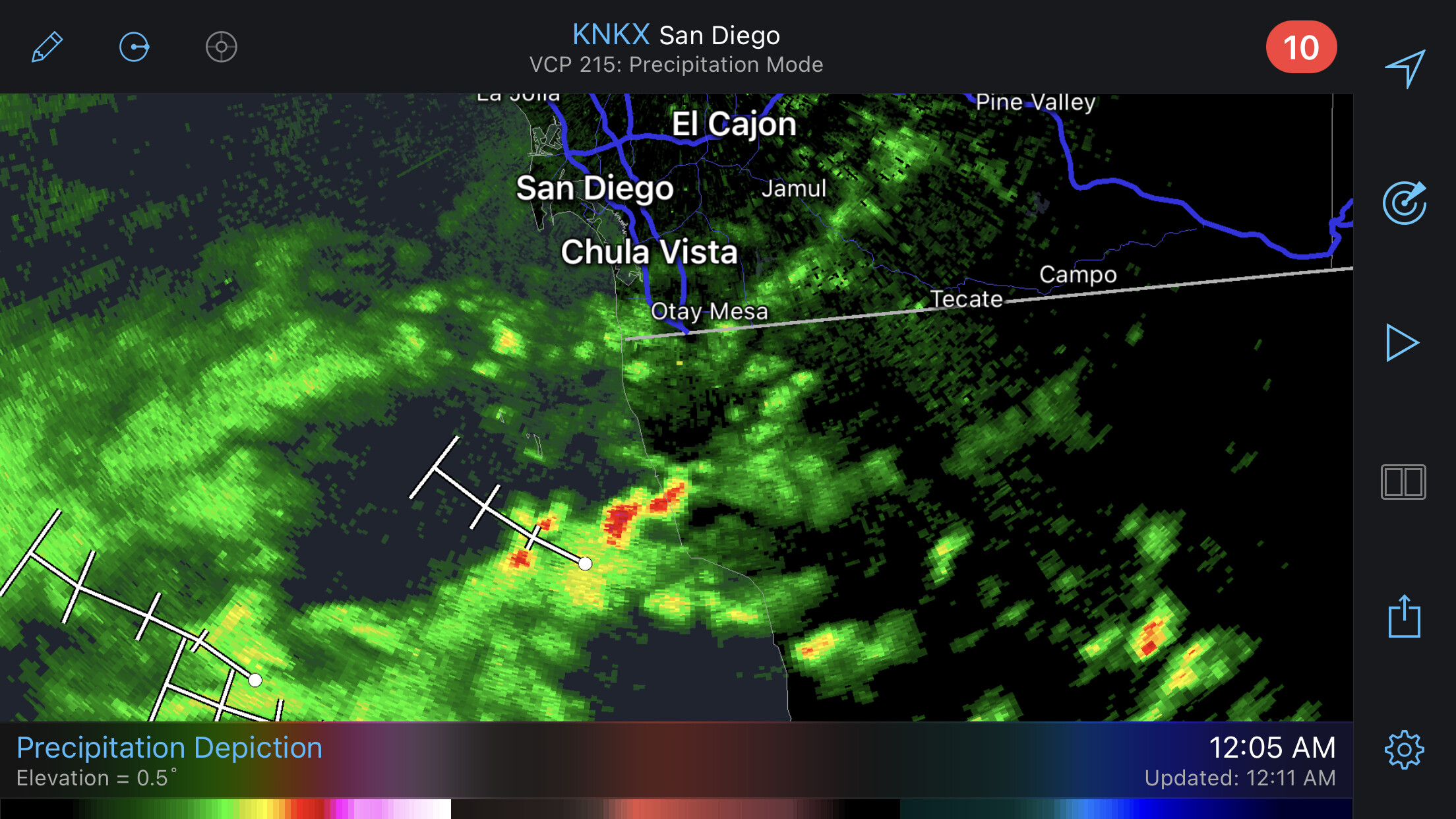
Surface based convection continues to bubble up and will transition to more of an altocumulus castellanus environment this evening as the upper level low moves into the area & interacts with thunderstorm complexes over AZ and Mexico.

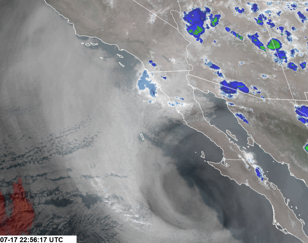
This is an image of the geocolor with an overlay of upper water vapor imagery. You can see where the upper level low is and how it has evaporated and disrupted the marine layer underneath it… plus the drier air in the upper level low.

7 Likes

Current lightning hitting in MVU/CNF:

https://map.blitzortung.org/#8/33.308/-116.429

4 Likes

The first lightning strikes of the elevated convection event

https://map.blitzortung.org/#8/32.747/-117.114

5 Likes

Im not liking the way this is setting up.

2 Likes

Over 30 cloud to ground lightning strikes now but all over water so far

2 Likes

Watching live from San Diego. Saw a few hit water but like you said, " most over water". Expecting to turn back inland over Santa Barbara?

3 Likes

Seems to be a better chance up that way.

2 Likes

Lighting has started across BDF, CNF and MVU.

3 Likes

Had several C to G strikes in Rancho Bernardo area. Moving NW

4 Likes

Per chp cad there are some lightning fires near Anza

Also listening to radio traffic 3 more fires reported

2 Likes