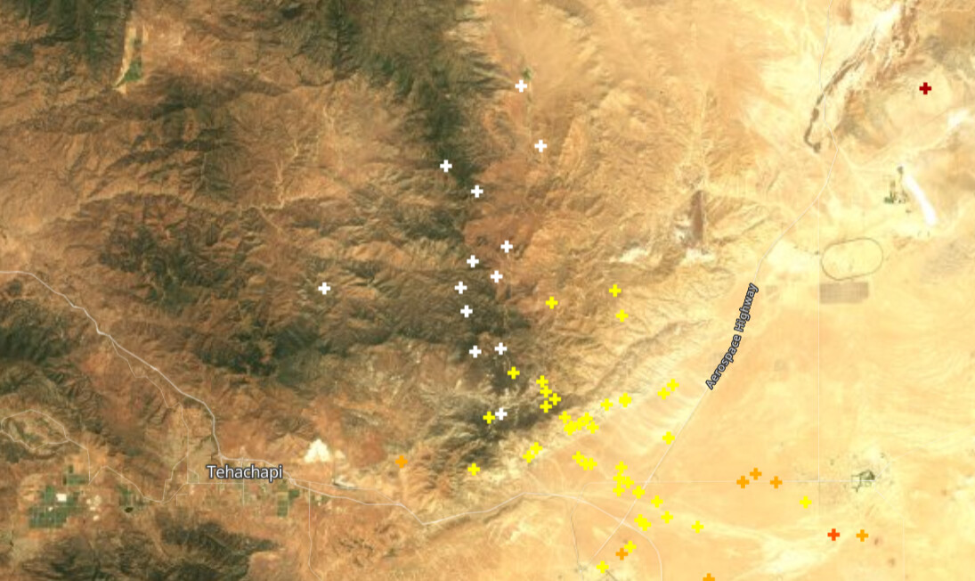
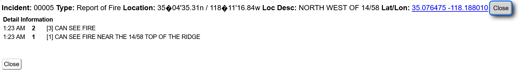
I’m looking at high point N cam and can’t see anything yet, but no doubt this is going to be a fire here, fire there kinda day…
4 Likes
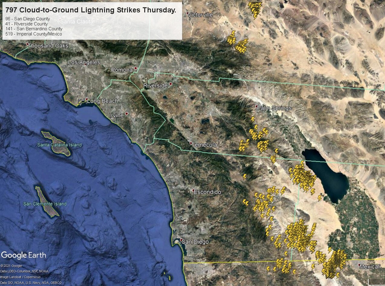
North San Diego getting a lot of Downstrikes as the storm cell moves to the northwest from Palomar toward the ocean
2 Likes
Large Squall from Camp Pendleton to Fallbrook going North. Very wet. Lots of lightening with it.
2 Likes
Taken from Glen Oak Hills.
Based on the amount of smoke reports already this morning I would not be shocked if some of these lightning strikes do hold over. Rain reports are generally in the 0.02"-0.10" range on NWS stations so far for the last 6 hours. Some stations in the mountains are reporting heavier totals though.
It will be interesting to see how many C-G lightning strikes there was in just far south ops but I am guessing at least 500 strikes so far…
This is all very bad news for areas further north that will have a bit drier low levels.
16 Likes
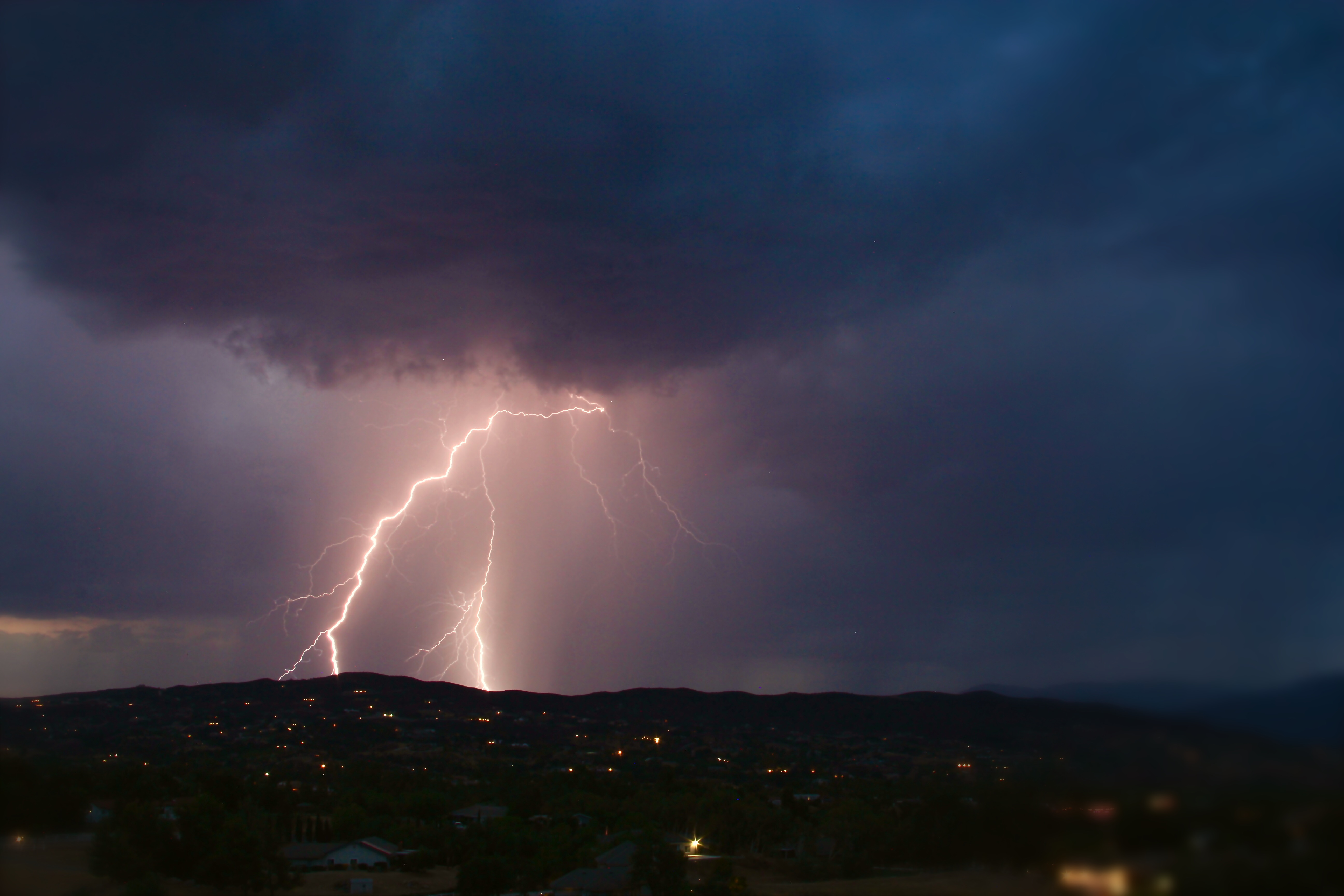
It got extremely loud and very bright in North San Diego County between 4am and 5am. Started out dry as we were outside watching then it opened up and poured ass rain for a good 15 mins. The storms moved off to the west and the rain stopped but it kept flashing for a good hour. The radio lit up with structure fires in Vista to pole and tree fires all over! I personally saw hundreds of flashes with a lot of cloud to ground!
12 Likes
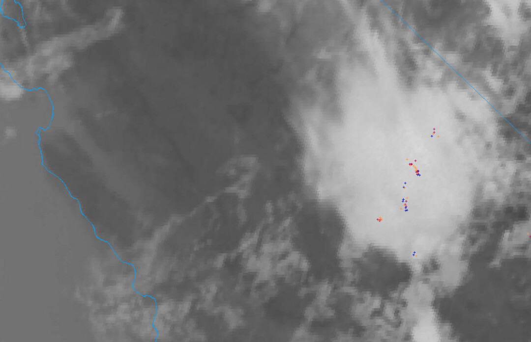
The lightning has made it’s way into the Sierra.
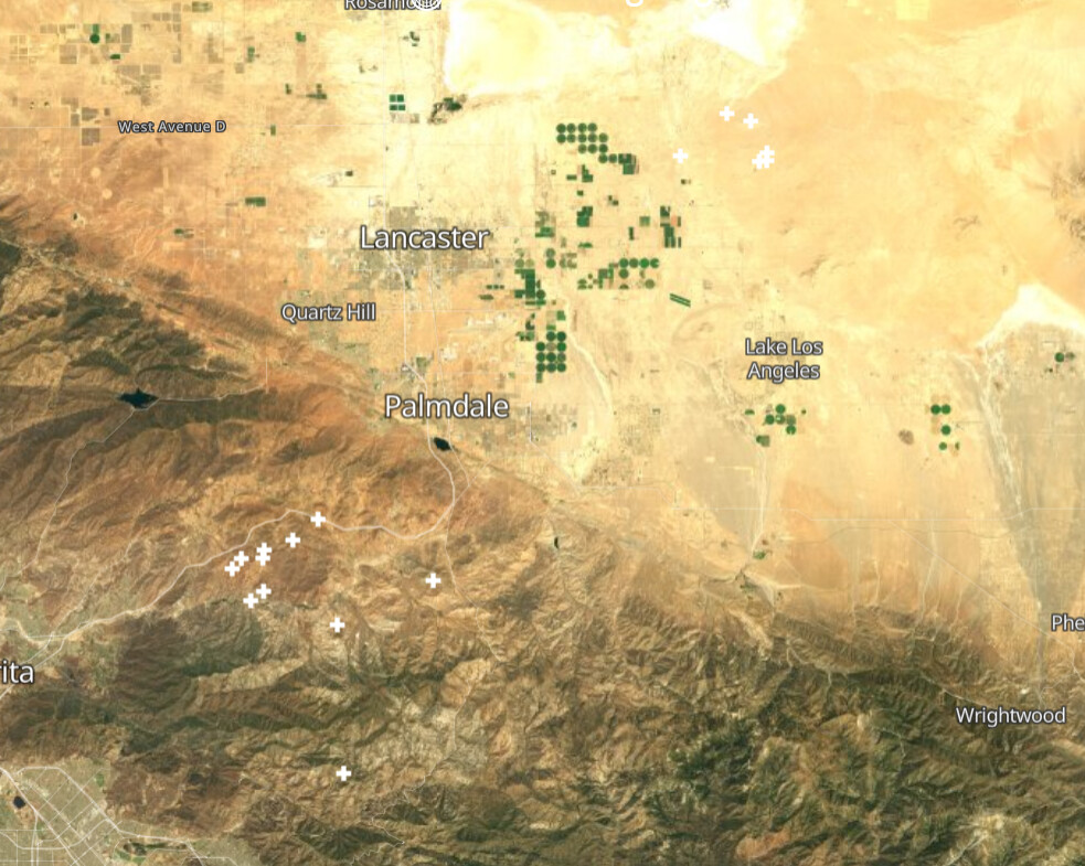
Also ANF/LAC
01:26
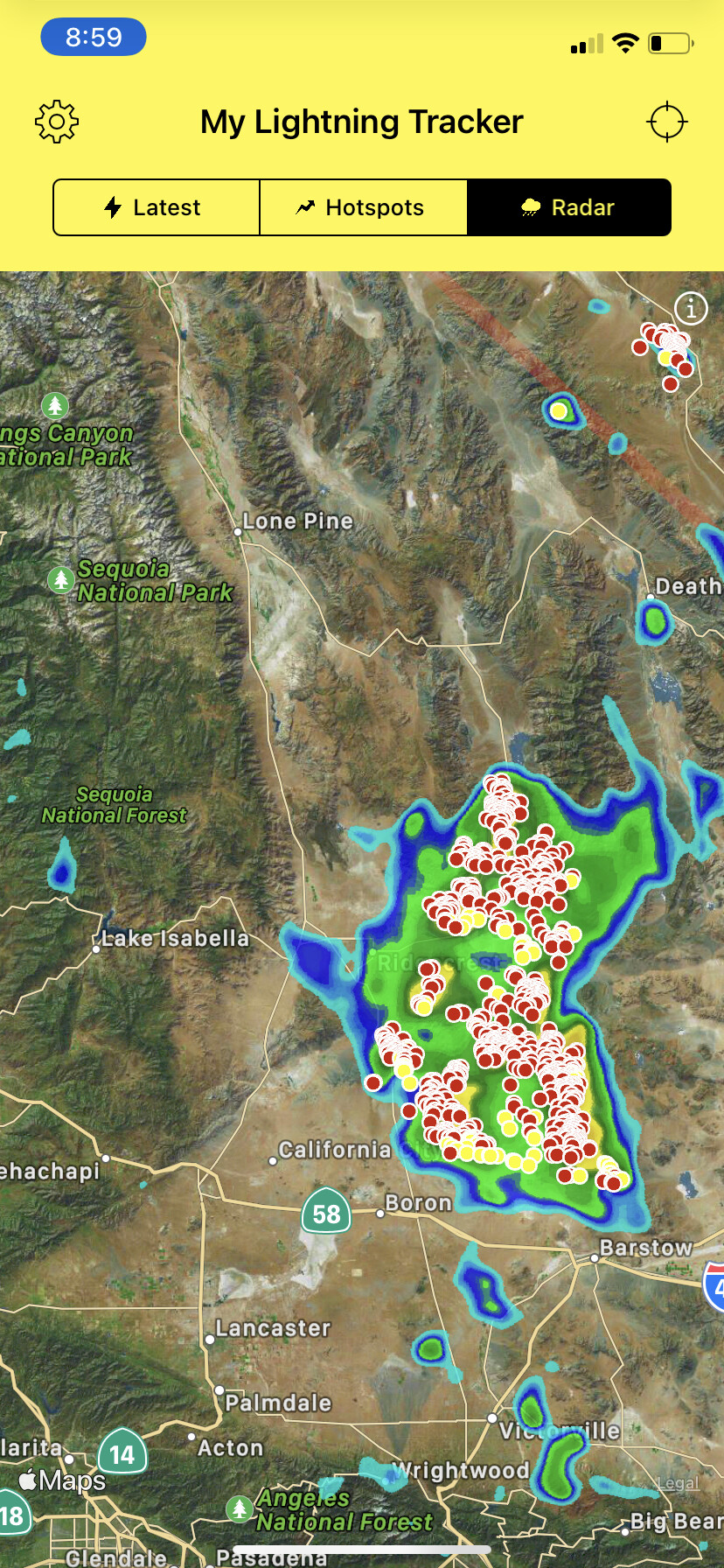
The Southern Sierra is getting hammered with lightning now.
4 Likes
for what is worth, getting some moisture (i do not think it will be measurable) but my lab is laying on the deck and is wet…better than nothing I guess. have not heard any lightening. smells good…Wrightwood, CA…in the mountains of ANF
5 Likes
Dropped the red flag warnings, now flash flood watches are in effect on the east side of the sierra.

6 Likes
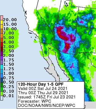
Interesting pattern setting up.
A large inverted trough of low pressure is expected to traverse the southern section of the high pressure system and move over Southern CA early next week. A mix of wet and dry thunderstorms could be expected. The monsoon flow should bring easterly waves through Tuesday which could produce precipitation… then as the large trough advects drier air and spins over the ocean, the mixed airmass could lead to dry thunderstorms later next week. Not trying to hype the situation, but it’s a scenario to watch for… and the focus of the dry threat will likely be north of the Grapevine.
12 Likes
5 posts were split to a new topic: GOES-17
Sounds like the San Jacinto district of the BDF got heavy rain with this system. Hope that was widespread.
6 Likes
I was in Big Bear as the cells came through up here, believe they had quite a bit of rain with the cells.
3 Likes
Posted on the NWS San Diego Facebook page, looks like some rain coming to South Ops’s area.
3 Likes
Getting our 1st lightning strikes in MVU already. Decent storm in and around the Lake Henshaw and Dudley’s area. Already 1 fire the MVU has full dispatch enroute to at Hwy 79 and Mesa Grande. Can hear the thunder in San Marcos and its getting even darker to the east of here!
6 Likes
Units enroute had smoke from a distance but are UTL due to heavy precip
4 Likes
Send that light speed to the Dixie Fire…They need all the help they can get!
4 Likes
Large cell just formed just south of Julian and west of Hwy 79. Moving to S/W slowly
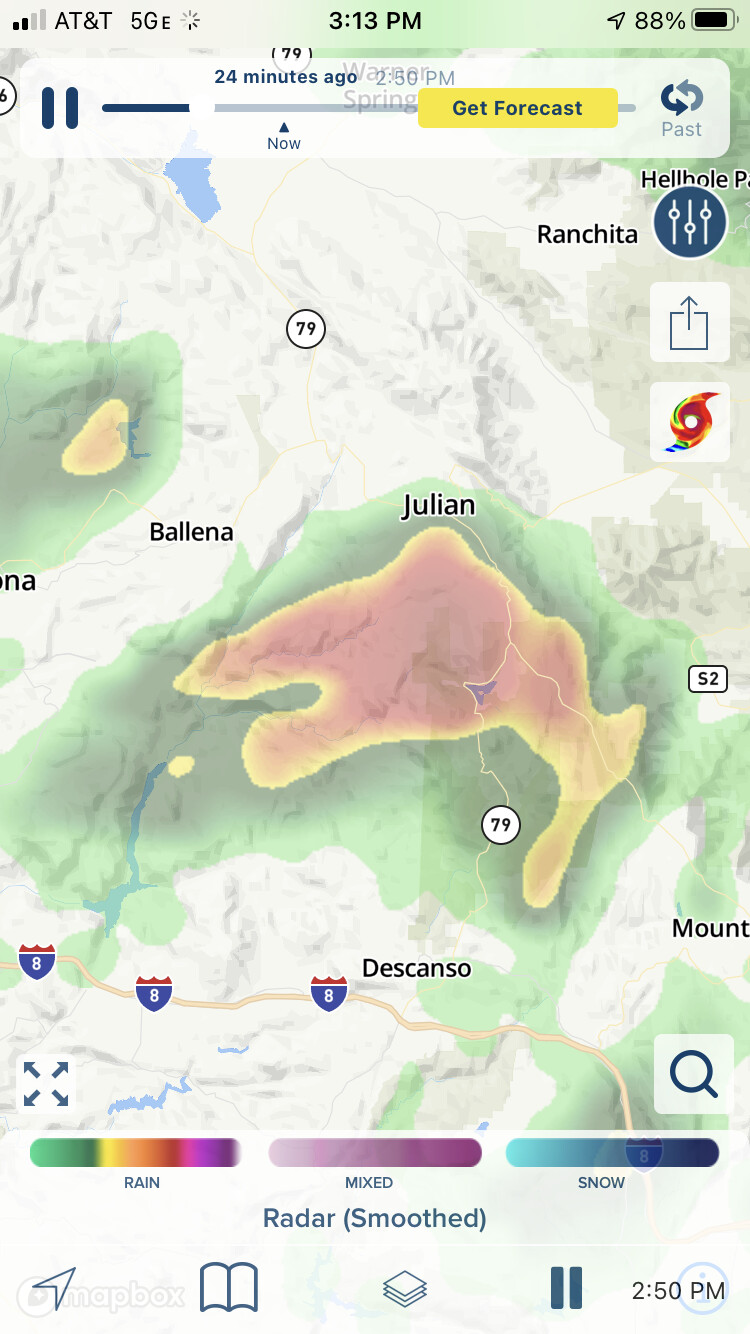
Update…this cell now has a flash flood warning!
6 Likes
NWS San Diego is reporting that Lake Cuyamaca in Eastern San Diego County accumulated 2.13 inches of rain this afternoon. At least down here the storms are very wet.
10 Likes