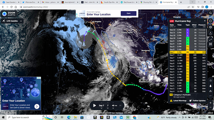
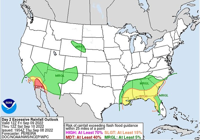
As anvil pointed out - latest track has shifted the storm considerably east for the next few runs. He will know better than me what this all means for SoCal etc.
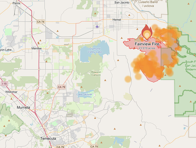
This article may be a little geeky but I think relevant for the Fairview and possibly Radford.
(edit- I’m not saying this is exact same setup but good review of what can occur when winds pass over pre-existing fires)
He just did a blog update today
Good read. Thanks
Weather’s cool….
Outstanding perspective.
For you FBAN and Meteorology folks, just joined the world of twitter, looking for some good follows to nerd out on fire Weather.
@weather_west
@nickynaus
@richIMET
@nplareau
@DroughtGov
From Predictive Services this morning…
As east winds increase Friday morning, fire danger may become more elevated and near critical
for a time, even though RH will be increasing, the effects of the higher winds will likely temporarily
outweigh the effects of increasing RH, especially in areas prone to easterly downslope winds such as on the Fairview Fire.
Downslope drying already evident this afternoon as the easterly flow undercuts precipitation bands. Areas east of the mountains could see a tremendous amount of rain and there could be a sharp rain shadow boundary as the moisture will be mostly in the low levels as a modified marine layer rather than convection.
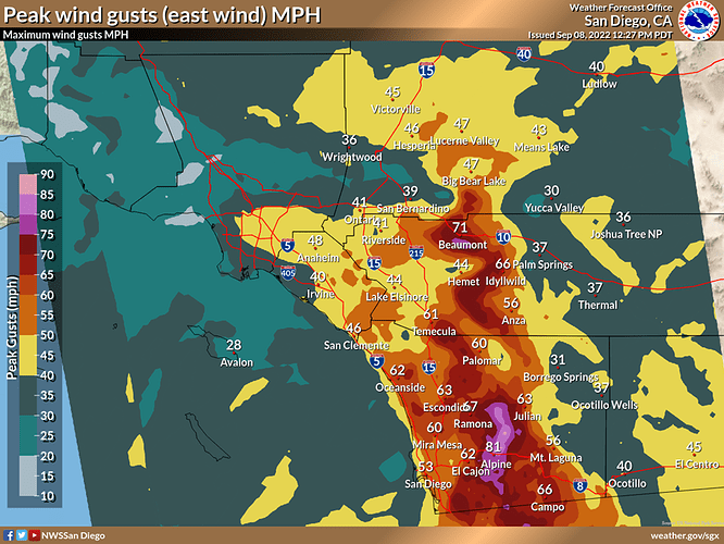
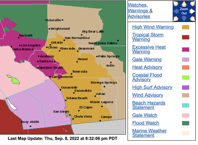
$hit is about to get real here in SoCal. This graphic was just released by the NWS office in San Diego. I am particularly worried due my house being in total alignment for east winds at the top of a cul de sac situated between to small mtn peaks. House has already been wind readied in advance of this. Hold on Dorothy
Are you aware if that easterly flow be making its way up to the Mosquito fire?
Light easterly flow from the inside slider
NWS SD 8:30pm
Excessive Heat Warning, dangerously hot conditions with temperatures up to 94 UNTIL 8 PM PDT FRIDAY
High Wind Warning, east winds 30 to 40 mph with gusts up to 60 mph expected. 6 AM FRIDAY TO MIDNIGHT FRIDAY NIGHT
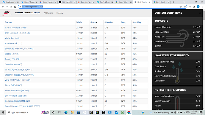
Have a feeling I will have this page up all day tomorrow…
https://weather.sdgeweather.com/
My favorite for getting regionwide wind and RH conditions.
Sorry this is dumb of me but I am getting mixed predictions it seems from here, do we think the fire will grow then be killed by flash flooding? Or just massively grow with little impact from the rain? sorry for the stupid question.
The answer is yes…
