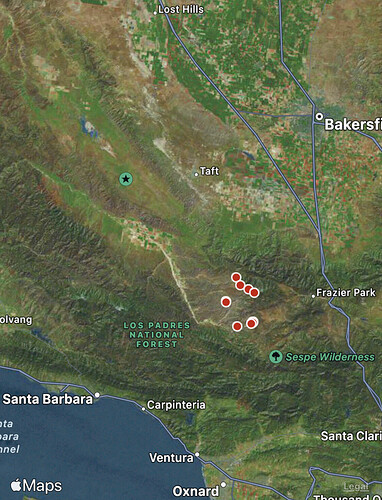
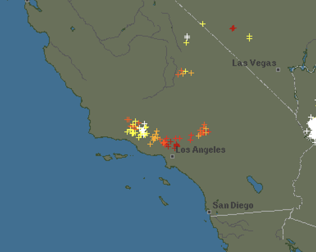
Yea all lightning there is a start on ANF single tree from lightning currently
In Wrightwood…seems to be West and radar showing moving NW of I5
Live Fuel Moisture:
DTLA snow storm update
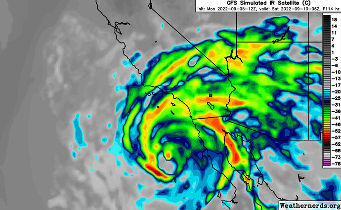
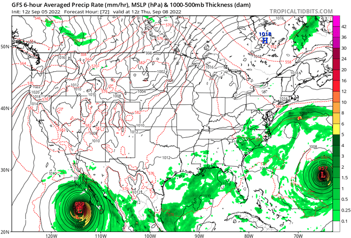
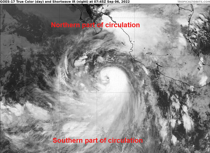
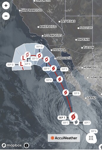
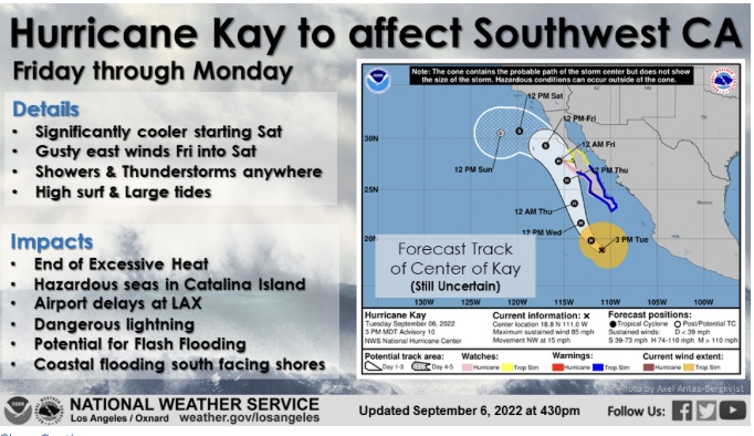
Hurricane Kay has rapidly intensified and is likely to continue to intensify quickly for the next 48 hours. Forecast models continue to show a track into the California bight on Saturday as a tropical storm.
Forecast models show a surface high pressure building into the Great Basin. Easterly flow around the large circulation and the high pressure system will likely set up a Santa Ana wind event this weekend. The exact precipitation chances will become a lot clearer as high resolution models come into play in the next 24 hours.
I know this is SOPS weather… but it does look like after the potential convection this week in the NW part of the state, gradients turn offshore…
Some night time thoughts.
Hurricane Kay’s circulation is gigantic, the influence of it’s circulation already extends up into Baja. The minimum central pressure is 977 MB and falling. For large storms, it takes longer for wind speeds to catch up to pressure falls. The storm is becoming more symmetric and rapidly organizing, and I would not be surprised if the minimum pressure reaches 950 MB.
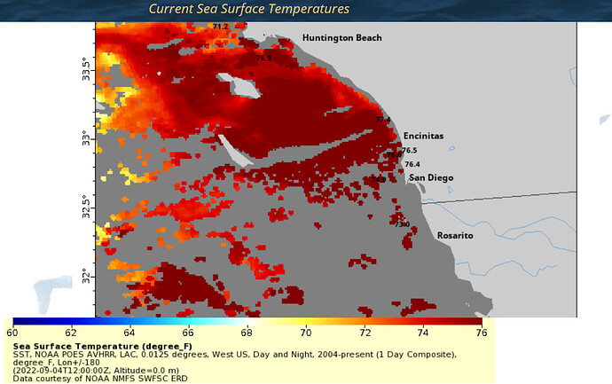
Sea surface temperatures have warmed to as much as 80 degrees in far Southern CA near the immediate beach, and with a few more days of offshore flow the overall average sea surface temperatures along the coast could rise… this of course would lead to less weakening of Kay as it moves up Baja.
Forecast models have little to no experience in this scenario, so do not be surprised if the offshore winds around the circulation are higher than forecast models show, as is the case even with very weak remnant tropical cyclones that move up Baja.
In my 60 years I have never seen the Southern California coastal waters as warm as they are now. Kay and warm coastal water is very concerning.
I lived in laguna. It’s been tropically warm waters back in the 60’s/70’s. Heard many say they never seen it that warm back then, but old timer told me about how warm it had been when he was a kid. Not very common, but it happens every few decades.
Question, where is the dividing line between NO & SO OPS?
I am in STF.
TYIA
Be Safe
You are in the northern most forest of South Ops:
https://gacc.nifc.gov/oscc/
Mokolumne River…
Here are a couple of maps that make it clear as mud between North and South.
Cal Fire maphttps://images.search.yahoo.com/search/images;_ylt=Awrjd0K6qRhj9VENLflXNyoA;_ylu=Y29sbwNncTEEcG9zAzEEdnRpZAMEc2VjA3BpdnM-?p=cal+fire+regions+map&fr2=piv-web&type=E211US1250G0&fr=mcafee#id=18&iurl=http%3A%2F%2Ffiredepartment.net%2Fimages%2Fcal-fire%2Fcal-fire-unit-map.png&action=clickusfs
I’d say the map with the Cal Fire logo is the accurate one. The California Fire Chiefs map appears to be something entirely different.
Good morning,
Forecast models have shifted the track of Hurricane Kay a little to the east. This would keep the storm along the coast, and much of the moisture could be confined to the deserts and eastern slopes.
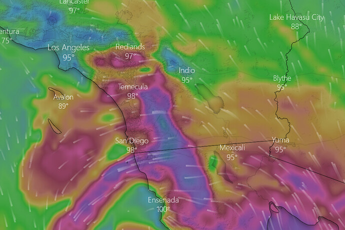
Surface high pressure building into the Great Basin, and the circulation of Kay will set up the oddest Santa Ana wind event you have ever seen for San Diego and Riverside counties.The NAM is quite impressive with downslope winds.
Moreover, the position of the center of circulation causes compressional heating west of the mountains and latent heat release from the rain shadow effect. Existing fires could see high growth before and moisture moves in.
Update for today:
Looking at all available model data, this will likely be a tale of two storms.
-Hurricane Kay has strengthened today on approach to Baja, with recon flight data showing a minimum central pressure of 964 MB
-General shift to the right in forecast track along the coast, followed by a left turn
-As the storm moves further north and weakens, the wind field size will increase and spread out… the tale of two storms is as follows. Thursday night into Friday night, a potentially severe Santa Ana wind event sets up for Riverside, Orange, and San Diego counties… this is before the rain starts, so there could be a 12-24 hour period of strong wind gusts across Southern CA… this would be bad news for existing and new wildfires, as even though the humidity will be elevated, down slope drying of the winds will counter act that.
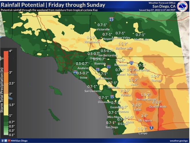
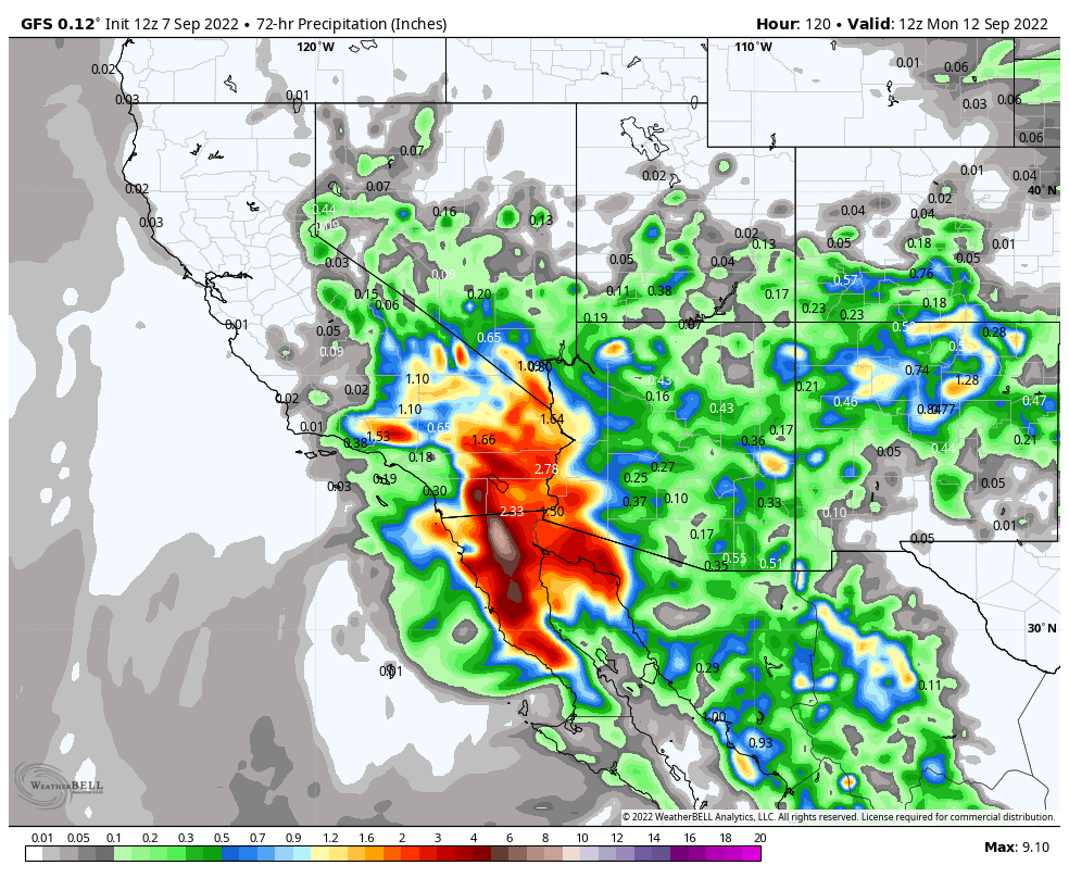
The second part of the storm will be the rainfall… this will likely be on Saturday and Sunday as the storm is closest to Southern CA and the cyclonic flow wraps around moisture. If the NAM were to verify and the storm tracks further east across Baja… this would keep areas west of the mountains much drier.
Here is the GFS precipitation output
