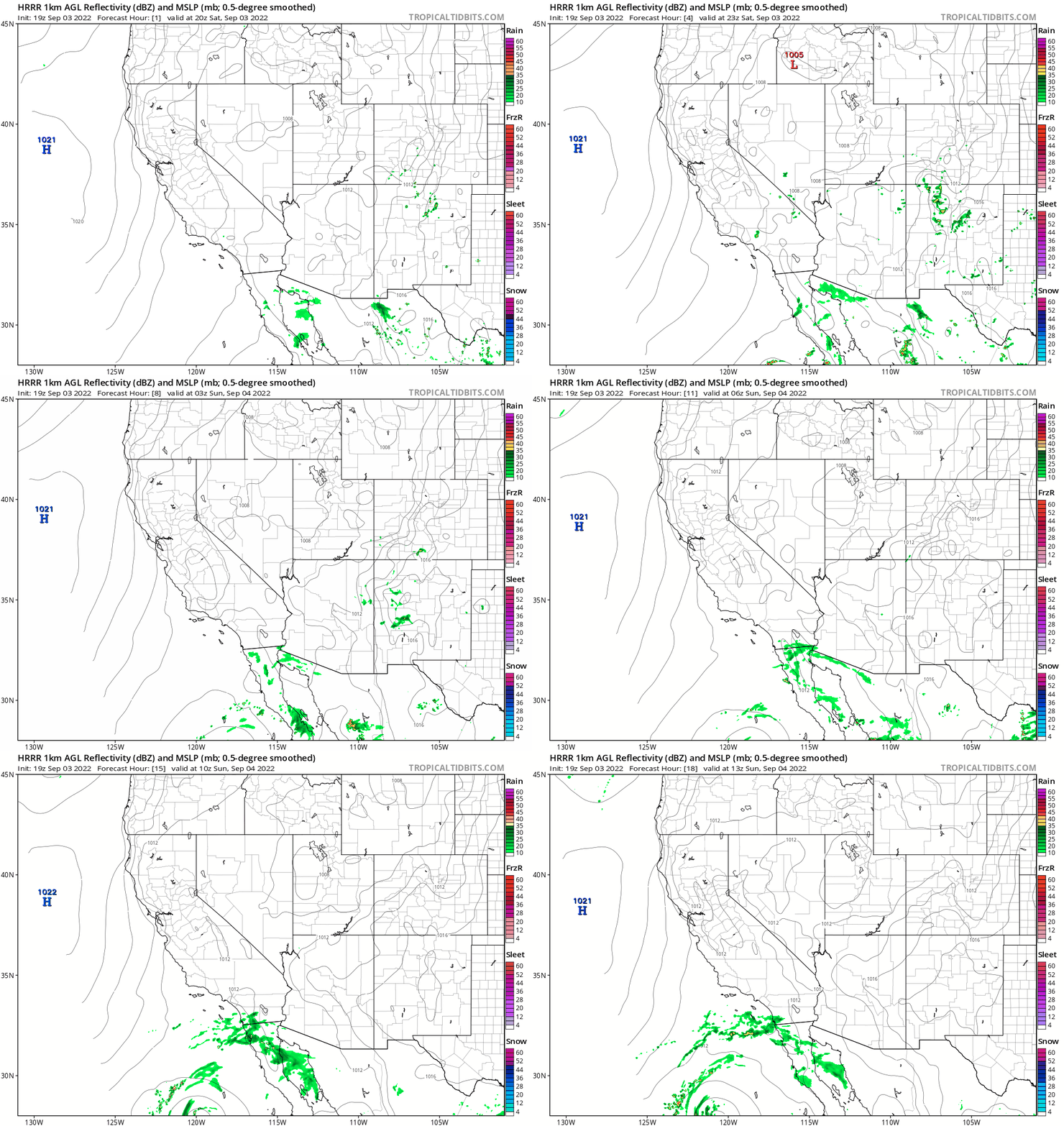
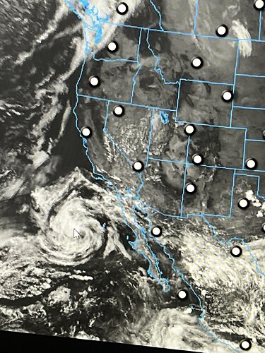
Any weather people see the influence from Tropical Storm Javier affecting South Ops?
Maybe T storms, monsoon, or wet/ dry lighting? Seems like tropical influance approaching the southern border.
The circulation could compound offshore flow west of the mountains tomorrow and boost temperatures. I mentioned this yesterday, and NWS San Diego touched on it in todays AFD. The mesoscale models show some rain or thunderstorms late tonight into tomorrow morning.
The real thing to watch, and I will bring it up now… 93E… which should become Tropical Storm Kay has been consistently shown to develop into a major hurricane and move up the Baja coast, all the way off the coast of Ensenada as a low end hurricane or Tropical Storm. The kicker here is… the circulation of this storm is gigantic, so there would be impacts well away from the storm center.
What works against this: large storms take longer to intensify, and we are talking about a forecast track that is 5 days away and that is difficult to project with tropical cyclones
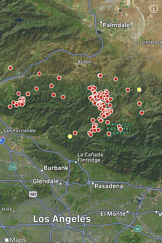
What moisture that is in the air has kicked off some lightning in the Cajon Pass and Lake Arrowhead area
Interesting scenario on this mornings 12z GFS, now that Tropical Storm Kay has formed I will touch on it.
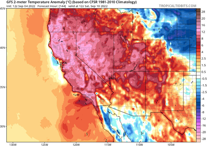
Forecast models bring a sharp trough into the midwest on Friday. This sets up a surface high pressure in the midwest in it’s wake. At the same time, the now Hurricane Kay has made it as far north as Ensenada with a minimum central pressure of 979 MB. The combination of the surface high pressure, and the offshore hurricane in the California bight sets up a Santa Ana wind event and compressional heating west of the mountains.
The gigantic circulation of this monster sized storm causes offshore flow in all of California, and if this scenario plays out there will likely be a heatwave at coastal areas that normally do not experience heat waves of this manner. This is an interesting thermodynamic scenario that needs to be monitored.
This is correct, the NHC forecast is conservative.
This is still many days out and could change dramatically. Could be season pausing on the low end and season ending for other areas on the high end of the models.
Quick! Everyone do the rain dance!
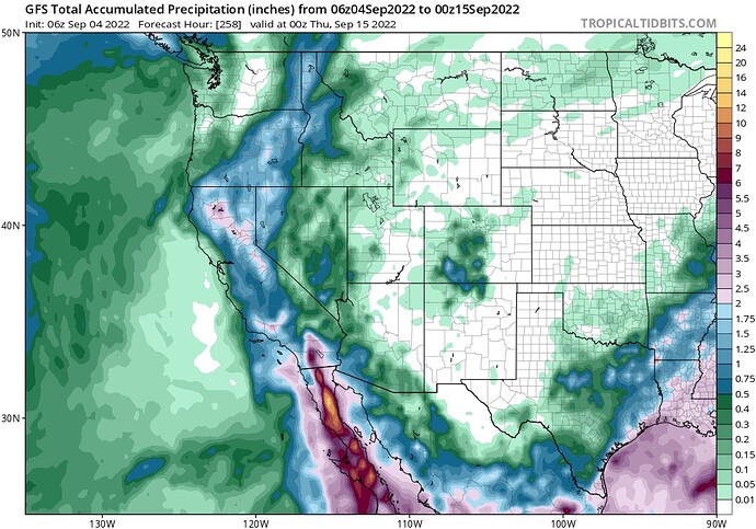
So one model shows heat and offshore flow and one shows rain?
My question as well. Some are talking season ending event, others are saying offshore event with compressional heating (and I assume drying). I am missing something in the timeline here?
The highest probability right now is for some rain in socal and little to nothing further north. As anvil said just monitor the forecast as it gets closer, bigger things to worry about this week
Please reference Daniel Swain’s update for possibilities this week. He clears up the guessing game to this unique weather scenario https://twitter.com/Weather_West/status/1566441260641964032?t=Uke3ujyezeXceKh6NtW-0A&s=19
Yeah, this is discussional forum. There is a potential for a heavy storm to impact all of region 5 to some degree or another… There is also a really good chance due to la Nina/ENSO fluctuations, climate and a billion other factors that nothing happens and this system falls apart going out towards Hawaii for up through central Mexico. But I really enjoy people alot smarter then me delving into the models and having these discussions vs pretending nothing will ever happen. Rather have it on my horizon and have thought about possible impacts. Thanks to all who contribute to my SA.
Tizzy update:
Key messages:
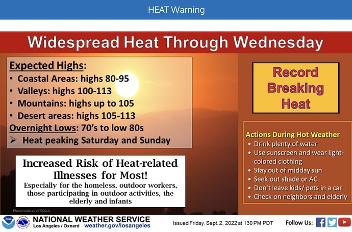
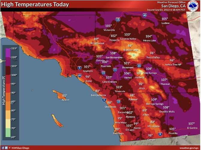
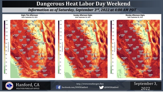
Record breaking heat through Thursday
Large, developing Hurricane Kay.
Max intensity depends on it’s ability to develop an inner core.
Hurricane models, GFS ensembles, and ECMWF all agree on track
Forecast track and envelop confidence is HIGH.
Confidence on upper air pattern is moderate.
The residual mid level moisture over the Pacific will be a potential source for dry lightning event towards the end of the month
No one is suggesting a landfalling tropical cyclone in Southern CA.
There will likely be a mix of precipitation and heat related issues from the circulation in CA
My guess is that a lot of the impact from the moisture will have to do with any disturbances rotating into the coast. Any LP systems that stay off the coast and the moisture remains cut off… you get a drier solution.
A stronger lobe and it tracks closer to shore- a possible wetter solution.
Models really gain accuracy at 72 hours- so we are a ways out from that.
The other thing to watch… the ensembles at this point are more trustworthy for the overall pattern as opposed to a specific “thing”.
I would remind people… “Climate is what you expect, weather is what you get” From the climate perspective… we would expect decaying hurricanes to send moisture into the state this time of the year. The remnants typically remain along the coast and Socal, but have( 1987) made it up north.
The bigger issue will be the heat and low RH the next 5-7 days.
Lightning?
