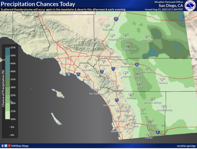
Nice wetting rain but it won’t be enough for a new crop of grass of any significance thankfully, any that does come up will not amount to much.
It was nice up in Strawberry this morning, started to rain about 5:30. Had to go to Sonora (ugh) just got home. Ground is wet about an inch down.
Be Safe
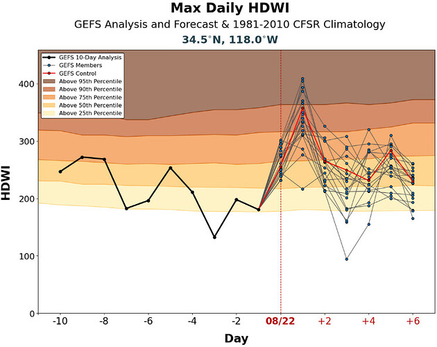
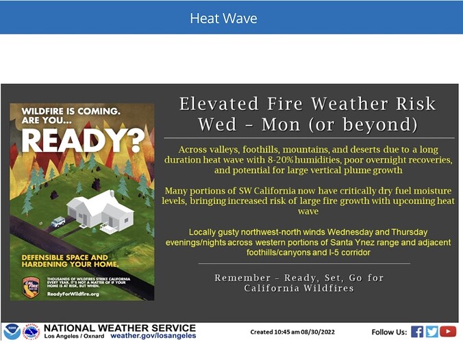
Critical fire weather conditions look likely for a few hours on Wednesday, on the slopes of the Antelope Valley. Excessively hot weather conditions caused by a ridge directly overhead will dry fuels Tuesday. Wednesday, the ridge breaks down and gusty onshore winds could lead to critical fire weather conditions.
GEFS Hot-Dry-Windy index reaches above the 90th percentile on most of the ensemble models.
Latest from Daniel Swain
Good afternoon all.
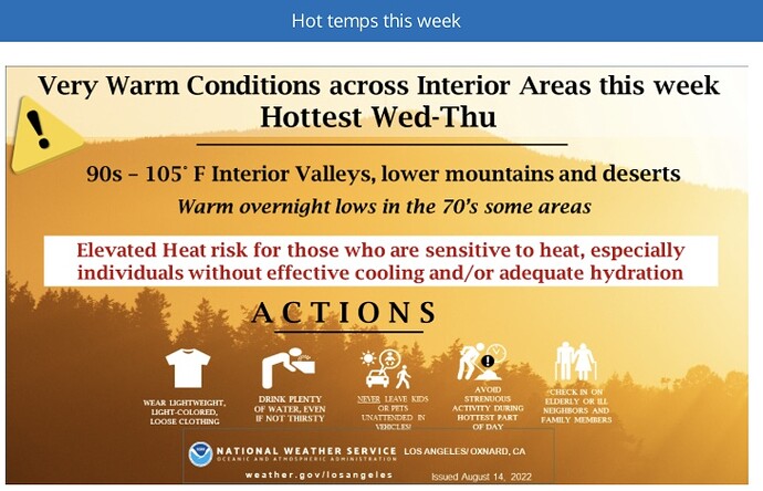
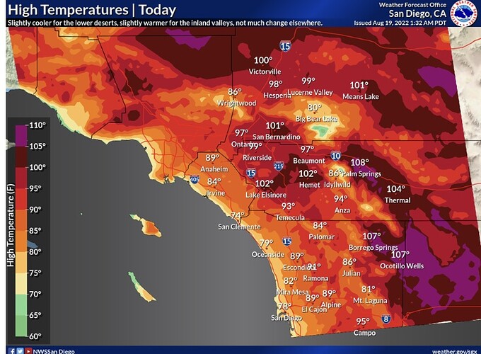
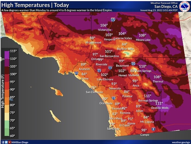
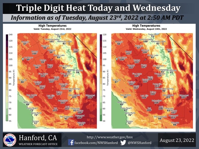
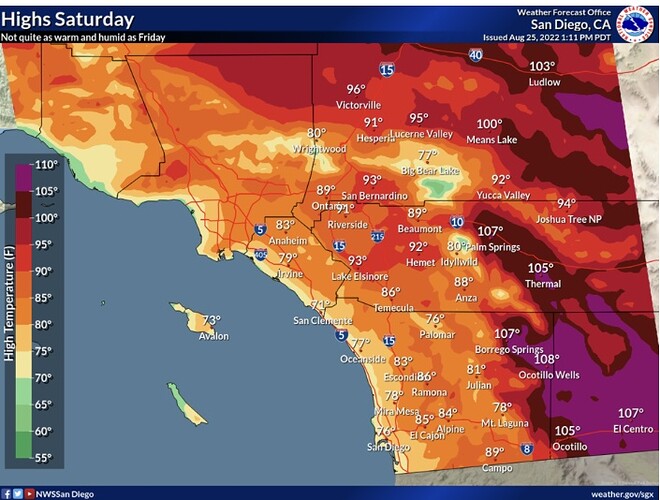
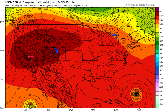
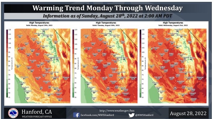
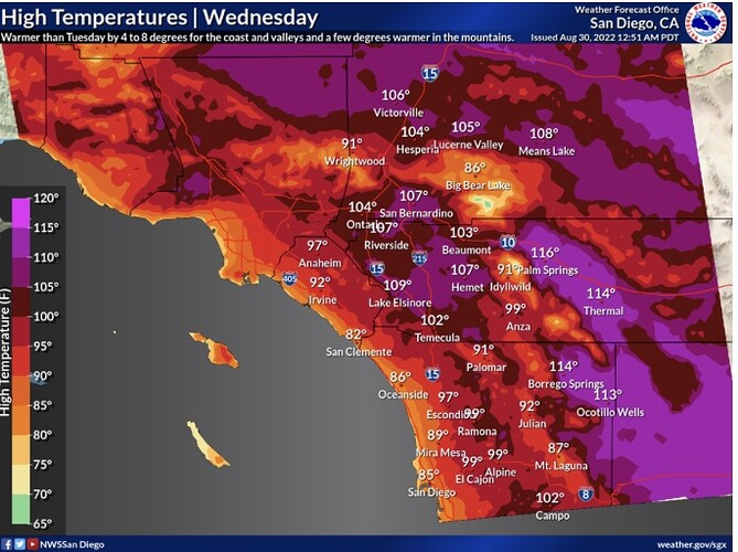
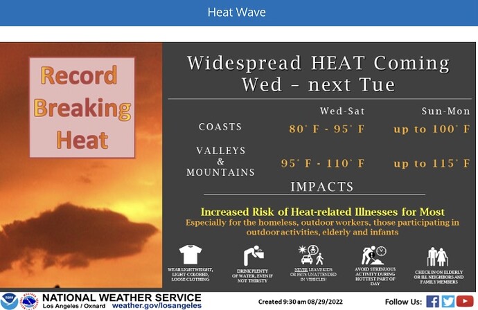
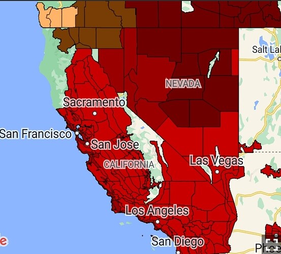
We have reached harvest season for North America. To kick off September, we are likely going to experience an earth-shaking heatwave that spans the majority of the West. 500 MB heights on the 12z ECMWF run exceed 595 DM across the West coast for an entire week straight.
This is an extreme heat scenario. Individual short waves rotating around the high pressure system build surface high pressure into the Great Basin, which may cause gradients to trend offshore… this would compound night time temperatures to very excessive levels.
This heat wave would set the precedent for potential blackouts, extreme fire behavior, and water resource issues. As this ridge breaks down, we need to watch the interaction between the Pacific NW trough and potential tropical cyclone landfalls in the US. This would make for a very windy situation the second week of September.
This mornings ECMWF run is almost unbelievable to a forecasters eyes. Due to the nature of the situation, I think the chance of this model run coming to fruition of maximum potential is very high.
12z ICON model depicting an extreme heat wave across the West, while a major hurricane approaches Florida.
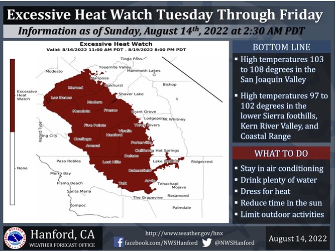
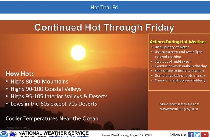
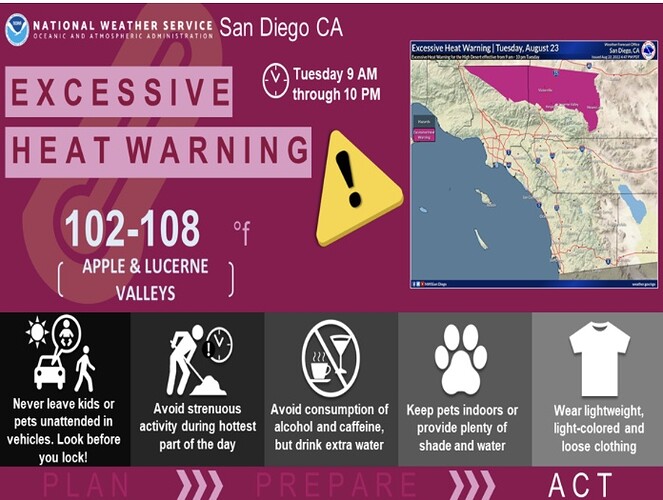
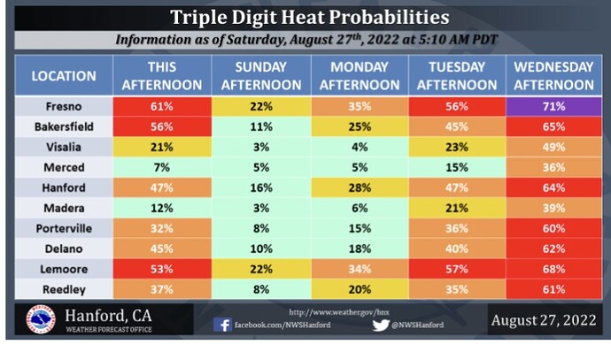
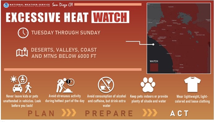
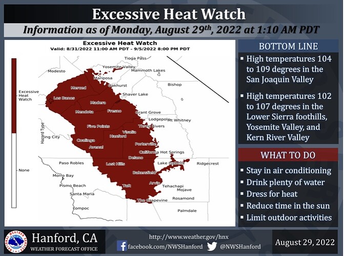
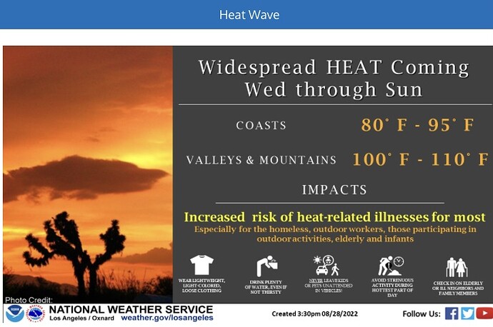
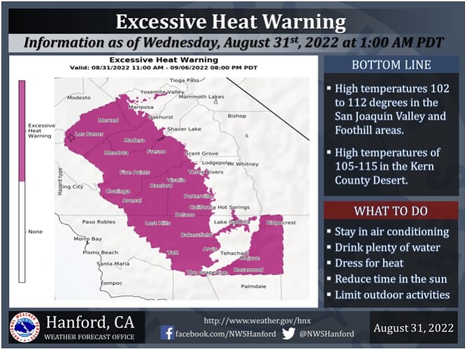
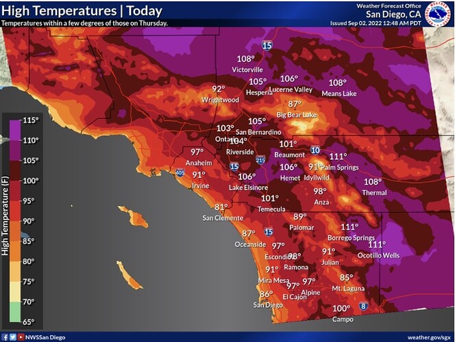
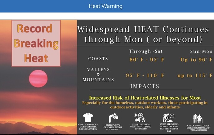
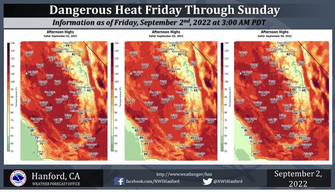
The excessive heat watch has just been upgraded to a warning! All the way through Monday Labor Day at 8pm. That’s 6 straight days of heat boys and girls. Buckle up.
Here is something to watch for for Southern California:
If Tropical Storm Javier strengthens enough, it’s circulation could cause offshore flow and additional compressional heating west of the mountains for Southern California on Sunday. Even if it remains well south… due to the fact that it is a very large circulation.
