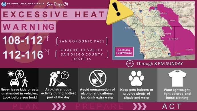
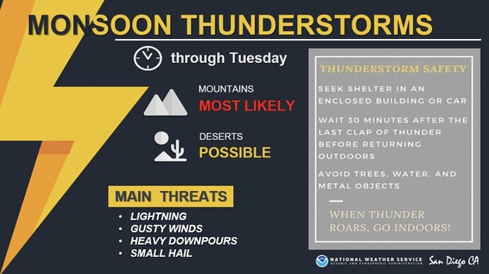
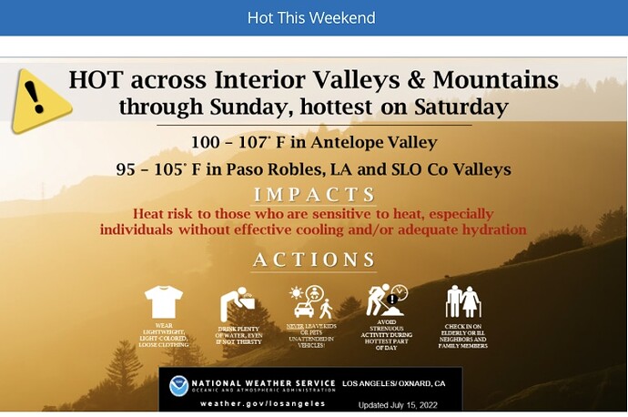
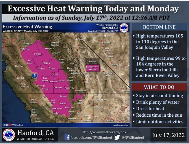
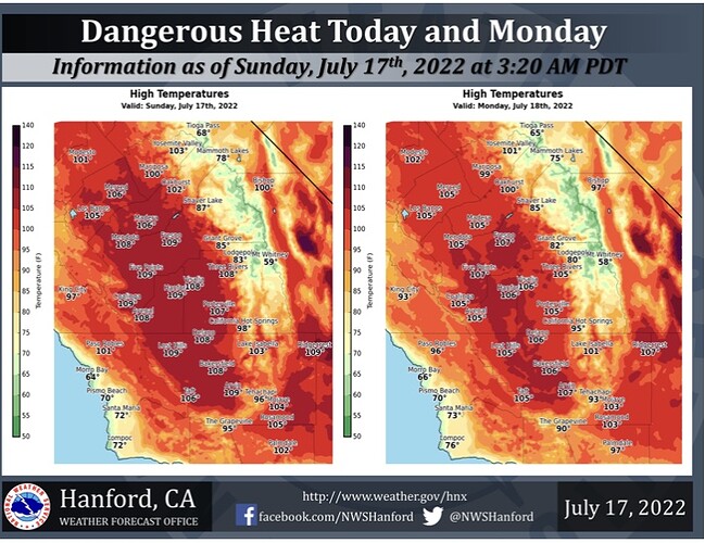
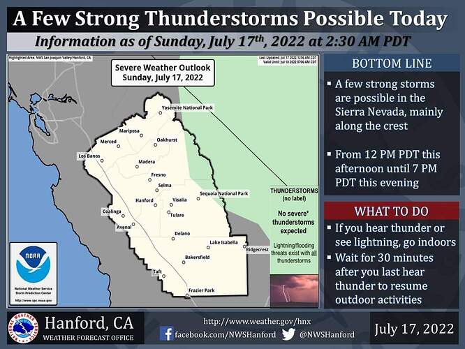
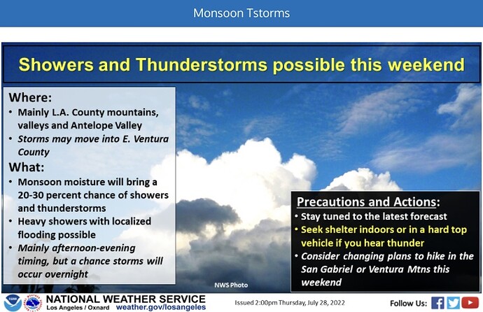
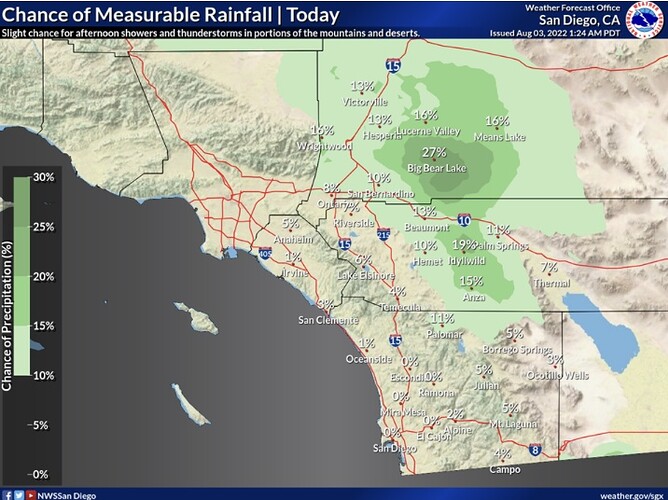
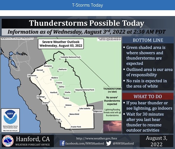
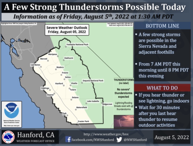
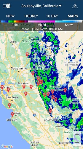
A few strong thunderstorms are possible in the Sierra Nevada, mainly along the crest, from 12 PM PDT this afternoon until 7 PM PDT this evening. Dangerous cloud to ground lightning strikes, wind gusts near 45 mph, and small hail are some hazards associated with strong thunderstorms. In addition, any thunderstorm can produce intense rainfall rates, leading to localized flooding.
New updates
Live Fuels Moisture"
URGENT - FIRE WEATHER MESSAGE…RESENT
National Weather Service Los Angeles/Oxnard CA
144 PM PDT Thu Jul 21 2022
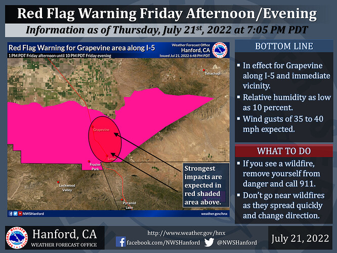
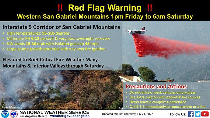
…RED FLAG WARNING IN EFFECT FROM 1 PM FRIDAY TO 6 AM PDT
SATURDAY FOR WIND AND LOW RELATIVE HUMIDITY FOR THE LOS ANGELES
COUNTY MOUNTAINS FROM THE I-5 CORRIDOR TO LAKE HUGHES…
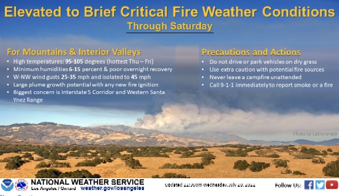
.A warm and very dry air mass will lower into southern California
on Friday, which combined with locally gusty northwest winds will
lead to critical fire weather conditions over the northern Los
Angeles County Mountains, mainly from the Interstate 5 Corridor to
Lake Hughes. If any new fire ignitions occur, this environment
will create extreme and dangerous fire behavior.
CAZ254-221800-
/O.NEW.KLOX.FW.W.0001.220722T2000Z-220723T1300Z/
Los Angeles County Mountains-
144 PM PDT Thu Jul 21 2022
…RED FLAG WARNING IN EFFECT FROM 1 PM FRIDAY TO 6 AM PDT
SATURDAY FOR WIND AND LOW RELATIVE HUMIDITY FOR THE LOS ANGELES
COUNTY MOUNTAINS FROM THE I-5 CORRIDOR TO LAKE HUGHES…
The National Weather Service in Los Angeles/Oxnard has issued a
Red Flag Warning fpr wind and low relative humidity, which is in
effect from 1 PM Friday to 6 AM PDT Saturday.
-
Winds…Northwest 15 to 30 mph with gusts to 40 mph. Isolated
gusts to 45 mph. -
Relative Humidity…As low 6 to 12 percent. Poor overnight
recoveries 12-20 percent. -
Impacts…If fire ignition occurs, conditions are favorable for
extreme fire behavior which would threaten life and property.
PRECAUTIONARY/PREPAREDNESS ACTIONS…
A Red Flag Warning means that critical fire weather conditions
are either occurring now…or will shortly. A combination of
strong winds and low relative humidity can contribute to extreme
fire behavior. Use extreme caution with potential fire ignition
sources.
Good morning all.
The monsoon trough is shifting NW towards northern CA. South Ops is entrenched in deep layer monsoonal flow. Wetting rains will keep fire potential lowered throughout the next 5-10 days.
As we head into the later part of August into September, the Pacific High pressure system that has been over the Pacific NW will likely shift over to California. The monsoon trough will likely shift further SW across Baja, and temperatures will increase. The door will open for dry lightning events, as the monsoon trough shifts over the cold water of the Pacific ocean which contains more stable air at the surface and lower PWV.
I do not have a forecast model or graphic to show on this, but my general thought process lends me to think that the high amplitude high pressure we have been seeing across much of the US and Western US will create a condition in which a 2020 style lightning event could occur. The atmosphere tends to cycle in predictable patterns during a season. The record amount of lightning strikes on June 22nd-June 23rd in Southern California on the first day of summer lends me to think we will see a similar event towards the end of the summer, but with more heat and way less precipitation.
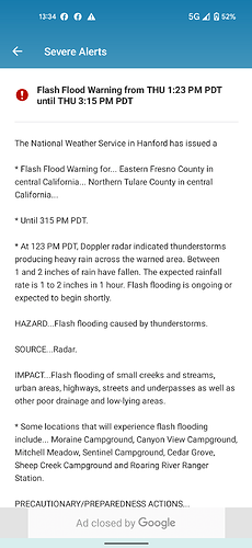
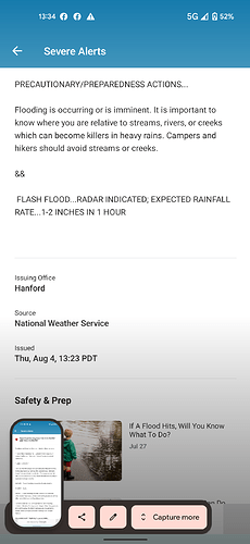
Not sure if this goes in N or S ops but NWS just issued this for Fresno/Tulare co mtns and foothills
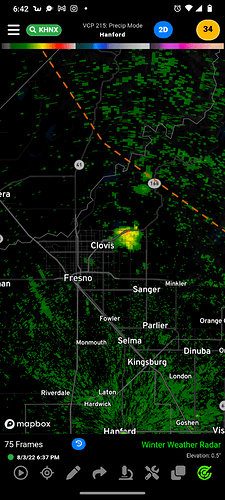
Actually getting a wetting rain right now in Clovis.
Light sprinkles in Mariposa started about 0600
Fresno is always the bridesmaid, never the bride — everything passes us by, good and bad. Amazing to have light rain coming down for a couple of hours or more now, and even picking up a little in intensity. But what will this do for the fire season by the end of September? I’m imagining a whole lot of new grass growing and then drying… but I know from my time in the foothills that many rural people tend to tackle weed-eating expense/effort once a year right before summer and might ignore new growth. While the rain is great for now, does it have a possible negative impact later on down the line?
JMHO it’s really not going to make a difference either way unless you consider the effect on my hair today 
Raining really good here now but the ground can’t even soak it up
Since I moved from Twain Harte to Sonora. I have not put a new rain gauge out, but under all the drip line of my trees it is wet. Standing water everywhere on asphalt and concrete. My buddy in construction said the rain stopped all the dirt work and paving they were doing today. It rained better this morning than most of our storms last winter. So much for the 20% chance of rain. Rain gauge going up after it stops raining.
Yeah it finally started actually wetting the pavement here about 30 minutes ago… 3 1/2 hours after it started raining.
