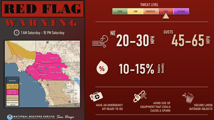
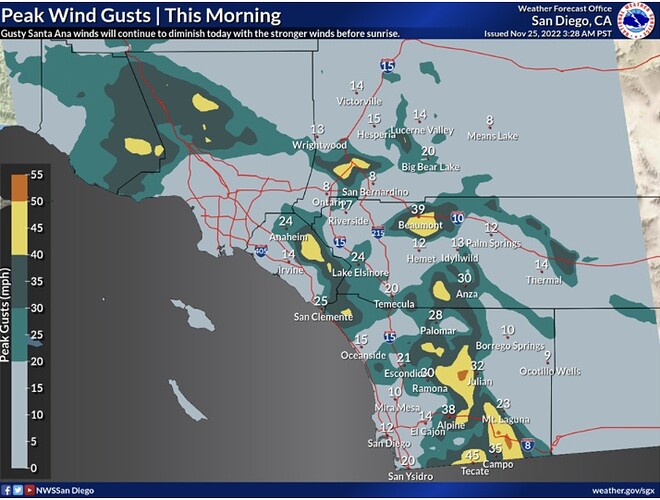
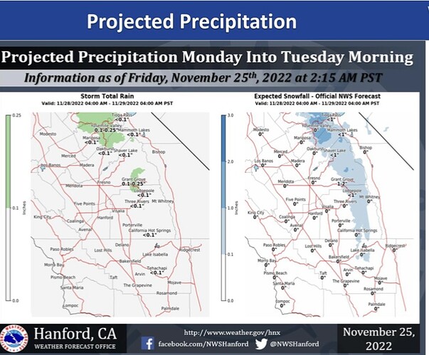
https://forecast.weather.gov/wwamap/wwatxtget.php?cwa=SGX&wwa=red%20flag%20warning
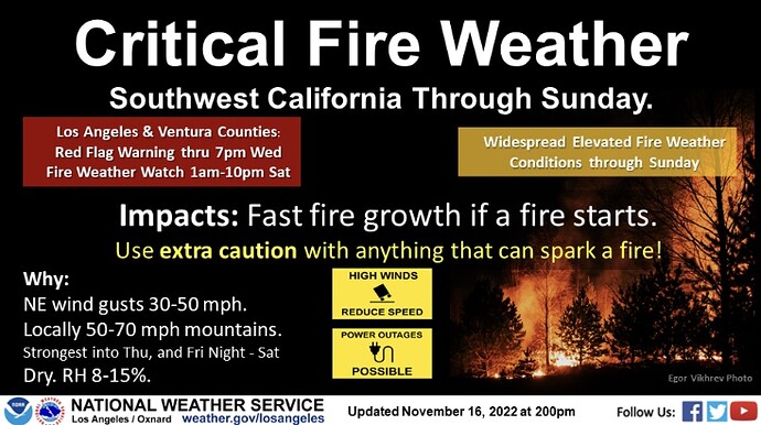
Red Flag “Warning” means it’s imminent within 24 hours or is occuring. Fire Weather “Watch” means could happen in the next 12-72 hours.
https://www.fire.ca.gov/programs/communications/red-flag-warnings-fire-weather-watches/
SHORT TERM (TDY-FRI)…15/214 PM.
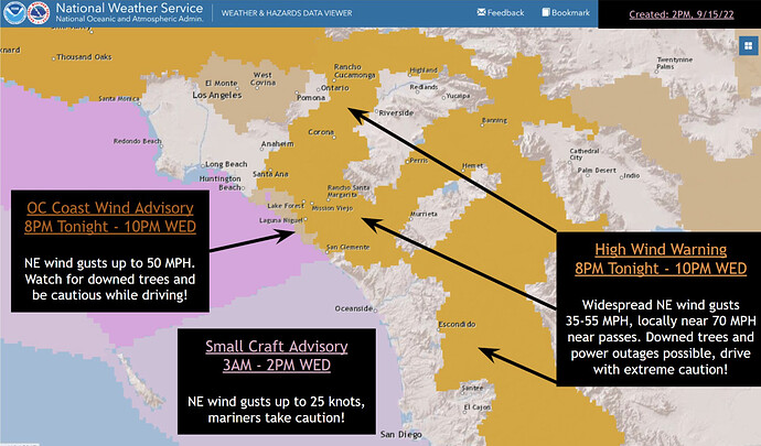
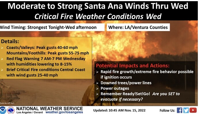
Everything is pointing to a significant Santa Ana wind event for
parts of LA/Ventura Counties tonight into Wednesday. If anything,
models have increased the chances of warning level winds
developing with strong support between 700 and 900mb and the
LAX/DAG pressure gradient near -9mb. Winds have already started
today, especially in the mountains and some of the higher valley
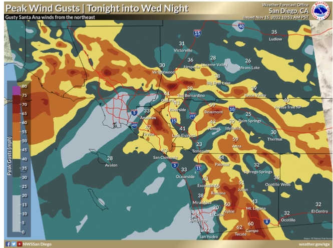
areas where winds up to 50 mph have occurred. These conditions
will become more widespread overnight into Wednesday morning and
even pushing far beyond the beaches over the coastal waters.
LONG TERM (SAT-TUE)…15/213 PM.
EPS solutions continue to trend stronger with another Santa Ana
wind event for Saturday following a dry trough passage through
the Great Basin. GFS LAX-DAG gradients are around -6mb and the
ECMWF is close to -9mb, which would **potentially make this a **
similar magnitude as the Wednesday wind event.
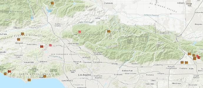
The winds have been blowing all day here in Eastern Ventura County but not too strong yet. There have been a few strong wind gusts. Wiley Ridge has had gusts of up to 48 mph.
I’m in Simi Valley at the bottom of the Santa Susana Pass and it’s definitely picked up the last hour or so.
Strong Santa Ana wind event developing over Southern California. This initial wind event will likely act to purge a lot of the moisture from recent rains. LAX-DAG gradients likely reach between -7.5 and -8.5 which is the upper threshold (-10.2 is the all time record as a bench mark).
Forecast models continue to increase the chance of another strong Santa Ana wind event on Saturday/Sunday. LAX-DAG gradients on the NAM, EC, and CMC reach around -8. The compound effect of the first offshore wind event plus this would increase the chance of large fire spread over a larger area as fuels dry under the stress, however the low sun angle really limits very rapid drying.
Check out Windy.com forecast, looks like Friday evening into Saturday afternoon will be the next round of Santa Ana’s.
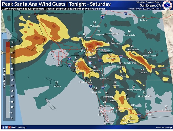
Winds will quickly ramp up this evening into the overnight hours and peak through early Saturday afternoon. Gradients and upper-level support are forecast to be slightly weaker than the past event. As a result, peak winds will likely be weaker with coasts and valleys of Los Angeles and Ventura counties gusting 35 to 50 mph (with local gusts to 60 mph in the foothills) and mountains gusting 40 to 60 mph (with local gusts to 70 mph for favored peaks and canyons). Humidity levels will initially start out above critical levels at the onset of stronger winds this evening, but will lower by early Saturday morning in the 12 to 20 percent range.
Camino airport 33 gusting to 48.
https://www.weather.gov/wrh/timeseries?site=KCMA&hours=72
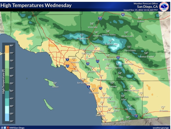
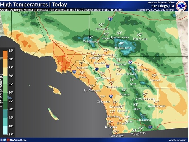
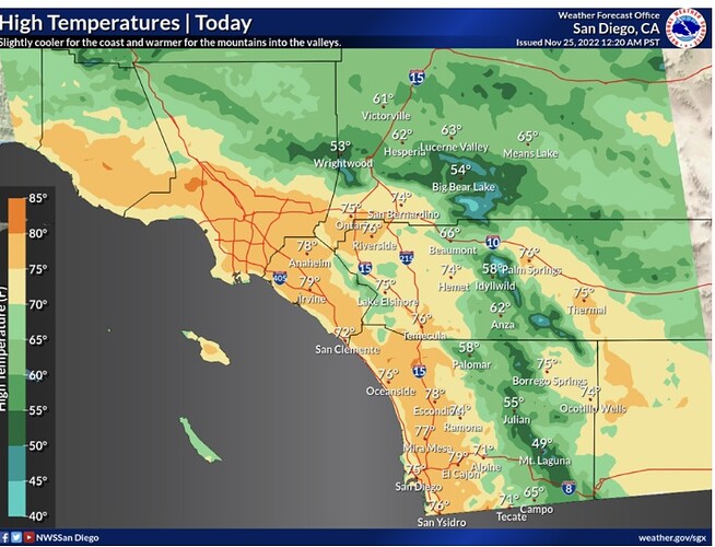
Pressure gradients were running 5.5 mb offshore between KLAX and KDAG and are expected to peak around 7.5 mb offshore at about 15Z. An upper low was currently dropping southward through Arizona with a sharp trough axis and associated vort lobe extending westward into the forecast area. As these features pass south of the region early this morning, winds aloft will turn more northeasterly and strengthen, and subsidence will also increase across the area. This increased upper support should cause an extra bump up in the winds around sunrise beyond what would normally be expected during the diurnal cycle. Expect gusts to 60 to 70 mph to become more common in the mountains of L.A. County including the Santa Monica Range, with gusts to 60 mph in the eastern Ventura County Valleys and the Santa Clarita Valley. At this point, blv that 60 mph gusts will be too isolated in the San Fernando Valley for High Wind Warnings, but there could be some near the Porter Ranch Area. Elsewhere, strong advisory level winds are expected in the central Ventura County valleys, the Ventura County Coast and the Malibu Coast. Max temps will likely be up several degrees today west of the mountains, especially on the coastal plain, where compressional warming will be best able to overcompensate for cold air advection.
Santa Ana wind event had peaked this morning with LAX-DAG gradients peaking at -7.1. A vorticity rotating around the trough helped spread winds to widespread locations across Southern CA.
Fuels are marginal for wildfire spread and an extensive grass crop is developing across southern sections.
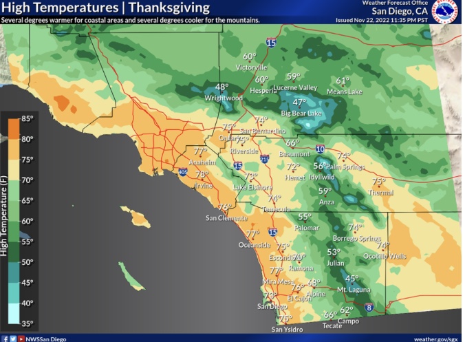
Next week, a trough is forecasted to enter the Rocky Mountains around thanksgiving and a ridge will build in behind it. Surface high pressure behind the trough will accelerate the offshore flow again but due to the trough being far to the east there will be no upper level support and cold air advection. Instead, the building ridge should be the primary driver of increasing offshore gradients. This situation will promote drying, increase temperatures, and locally gusty winds for several days.
The continued drying and eventual curing of the grass crop should be watched. We are entering the maximum potential strength Santa Ana wind season and if no precipitation falls in Southern CA on the next troughing cycle we could see a maximum potential Santa Ana wind event with highly receptive fuels.
Red flag extended in some areas until 10 am Sunday now.
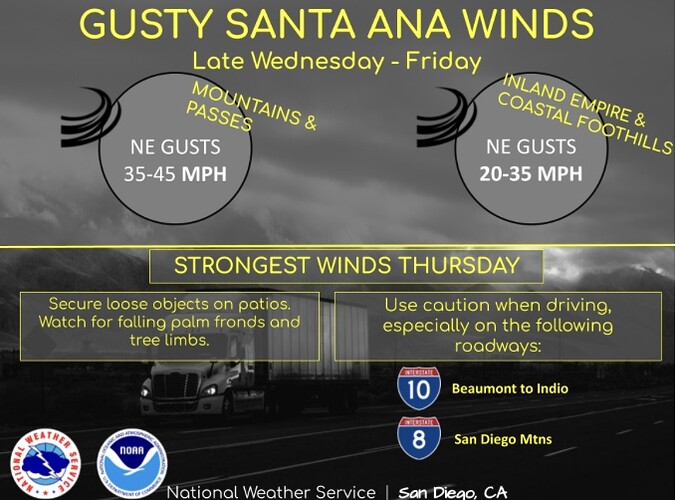
https://forecast.weather.gov/wwamap/wwatxtget.php?cwa=SGX&wwa=red%20flag%20warning
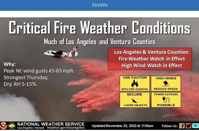
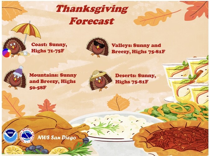
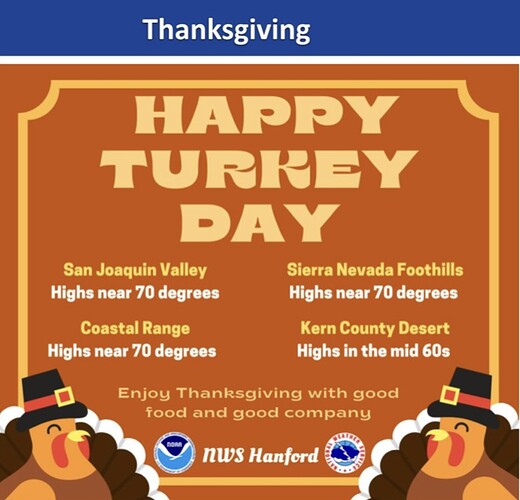
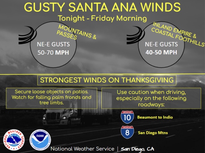
The Red Flags are flying for Thanksgiving…
https://forecast.weather.gov/wwamap/wwatxtget.php?cwa=LOX&wwa=red%20flag%20warning
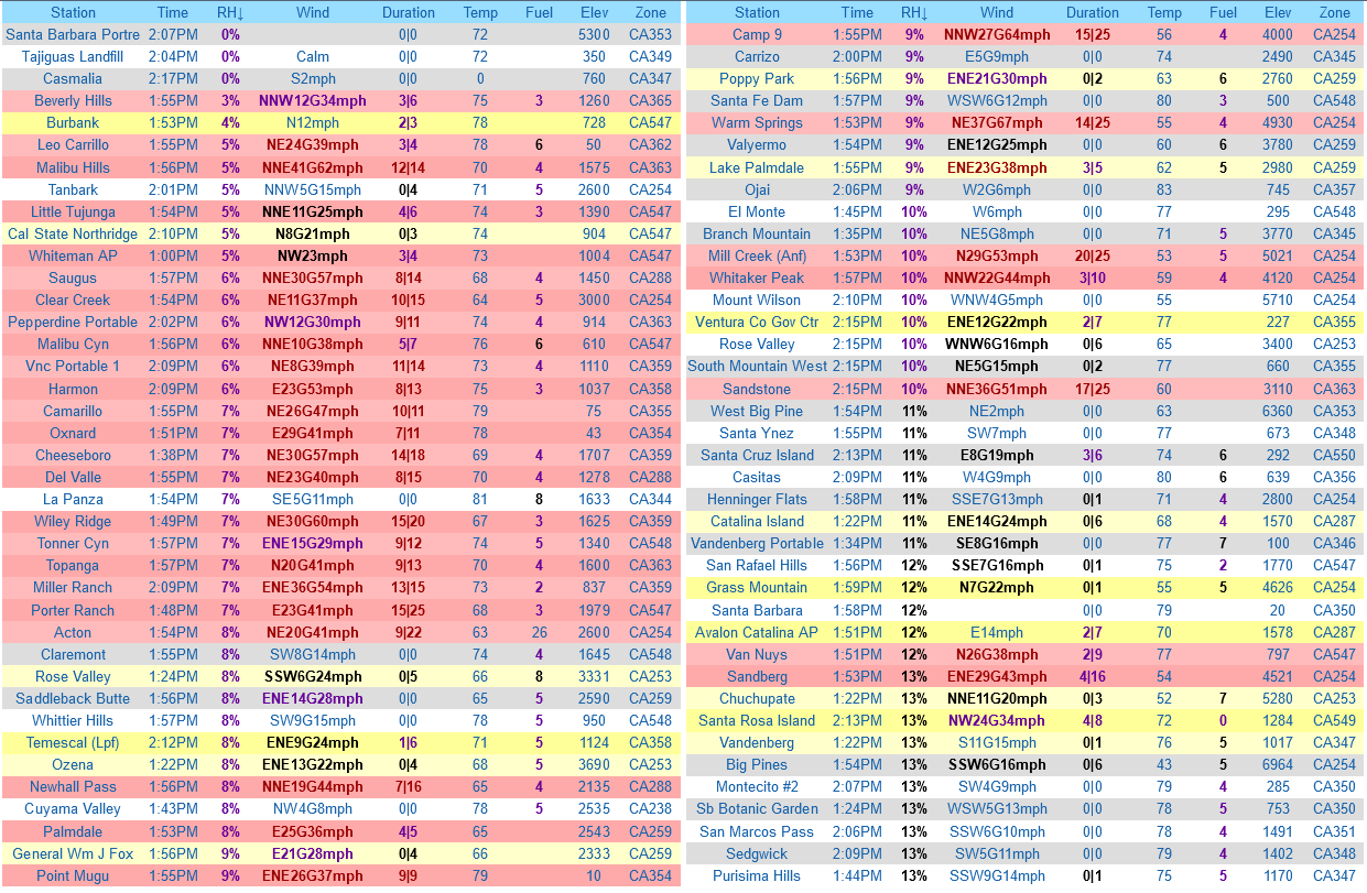
By far the biggest impact of this Santa Ana wind event is the widespread low humidity and the prolific drying of fuels occurring from this event. Check out below the widespread low humidity values around Southern California with almost all areas reporting RH below 15%. At 15z the LAX-DAG gradient peaked at -7.3 but absent strong upper level support this is a moderate Santa Ana wind event.
Forecast models continue the warm and dry weather through the weekend for continued drying. A backdoor cold front should approach Monday with gusty onshore winds, but models continue to trend drier regarding any precipitation chances.
