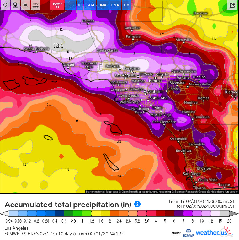
Today’s ECMWF run and it’s ensemble clusters are showing an inundation of rainfall from a slow moving atmospheric river coupled with a mid latitude cyclone. The exact positioning and movement of the mid latitude cyclone will determine where and how much rain falls in what areas with the associated atmospheric river. It is most likely that parts of the LA Basin could experience 24 hour rainfall totals in the 95th-99th percentile on Monday, which is what the ECMWF is showing. These dangerous rainfall totals could break several daily or 24 hour duration rainfall records.
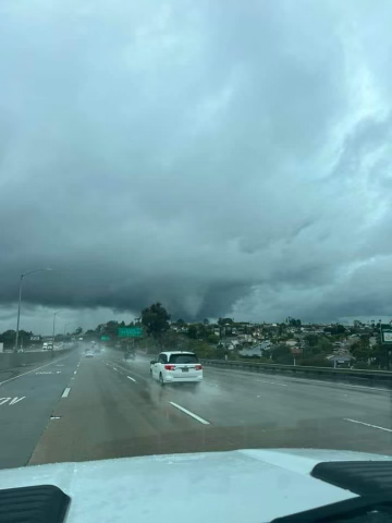
This type of rainfall on top of already saturated ground will lead to some major flooding issues. Less of what is being discussed right now, there could be some significant shear (for southern CA standards) in the warm front sector so embedded waterspouts and tornadoes could occur.
The National Weather Service (NWS) is warning about the risk of life threatening and damaging flooding during this weekend’s storm.
Santa Barbara, Ventura, and Los Angeles Counties are expected to get hit the hardest on Sunday evening due to “very heavy” rain intensity.
This second storm, that’s expected to begin on Saturday evening and go through Tuesday, can bring three to six inches of rain for coastal regions, and up to 12 inches of rain in the mountains and foothills. Snow is expected at 6,000-7,000 feet.
“This shaping out to be a life-threatening flooding situation especially during the Sunday through Monday time period. This is a lot of rain, with a potential for projections to go even higher. There is still time to prepare,” NWS stated on social media.
Alert from the Santa Barbara County Office of Emergency Management
The National Weather Service is forecasting a major storm with potentially life-threatening impacts for Santa Barbara County, expected to arrive Saturday, February 3 and last through Tuesday, February 6. Moderate to heavy rainfall lasting multiple hours and strong winds are expected. Isolated thunderstorms capable of producing brief heavy rainfall and dangerous flash flooding are possible. Detailed weather forecasts are available at Los Angeles, CA.
Evacuations are NOT being issued at this time. However, evacuations may be necessary. If you are concerned that this storm may cause unsafe conditions to your local roads and your home, leave the area before rain starts. Do not wait for an official evacuation notification to leave.
Precautions and tips to stay safe:
Stay away from burn scars, rivers, creeks, and other low-lying and flood-prone locations. Those living in areas prone to flooding should stay aware of changing conditions and be prepared to take protective actions, such as evacuating and sheltering in place.
Roads impacted during previous storms may experience flooding, mud and rock slides. Communities along these roads may become isolated.
Beaches, bluffs and the Harbor area may be impacted. This storm may trigger coastal flooding and erosion along the bluffs throughout the county. Residents and visitors are advised to stay away from beach areas.
Strong winds can cause power outages. Charge important electronic devices and be prepared in case an unexpected power outage occurs.
Secure belongings that could get impacted by strong winds such as outdoor furniture.
Residents should remain vigilant as conditions can change quickly. Residents are encouraged to:
MONITOR the weather
PREPARE and PROTECT your home now
PLAN on how to get out and where you might go
During Rain:
If you feel unsafe during the rainfall, shelter in place in your home by gathering your family and pets in the inner most room of your house, preferably on the top floor if you live in a multi-story home.
Do not attempt to drive at night or while it is raining, as roads may be damaged or your car may be swept away by moving water or debris.
Public safety officials are keeping a close eye on the incoming storm and working with the National Weather Service. Officials will continue to work together to further assess if protective actions, such as an evacuation warning, evacuation order, or shelter in place are necessary.
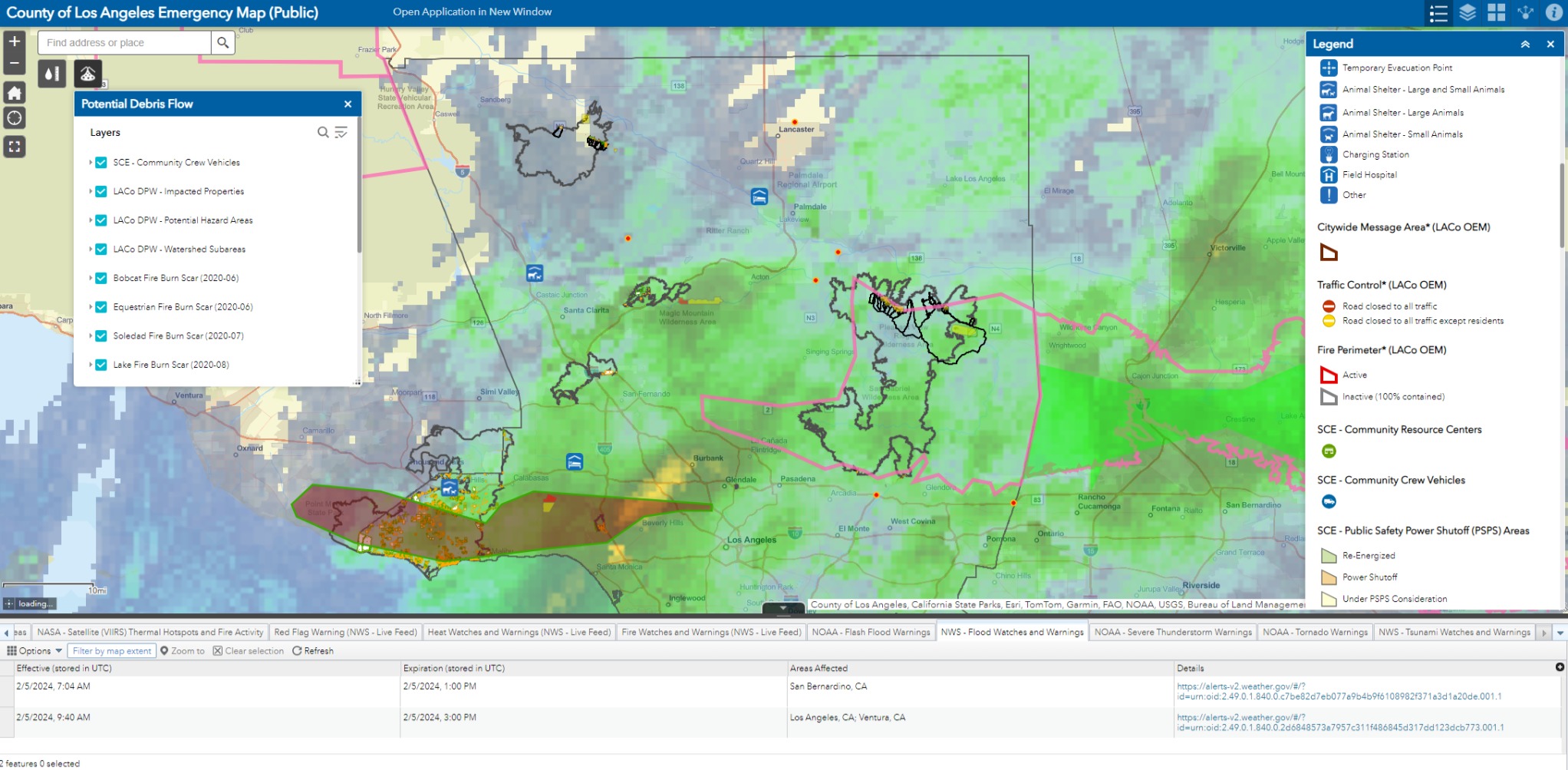
Featureful. Roughly; pink perimeters are current Storm Warnings, black perimeters are burn scars, solid bright red is evac, transparent red overlay is Flash Flood Warning. Lots of layers in this application, and some change with zoom level, so definitely open up the layers and legends.
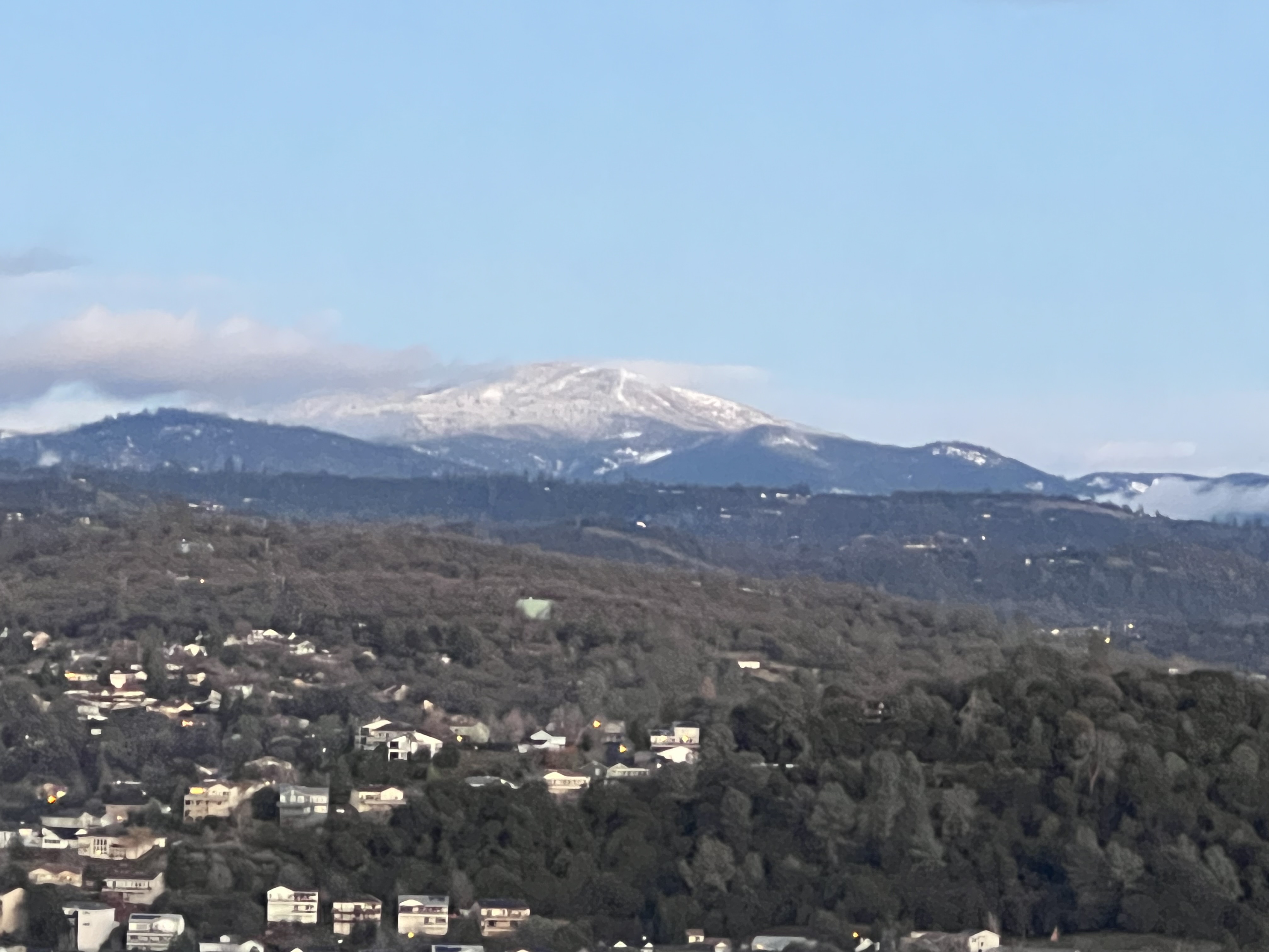
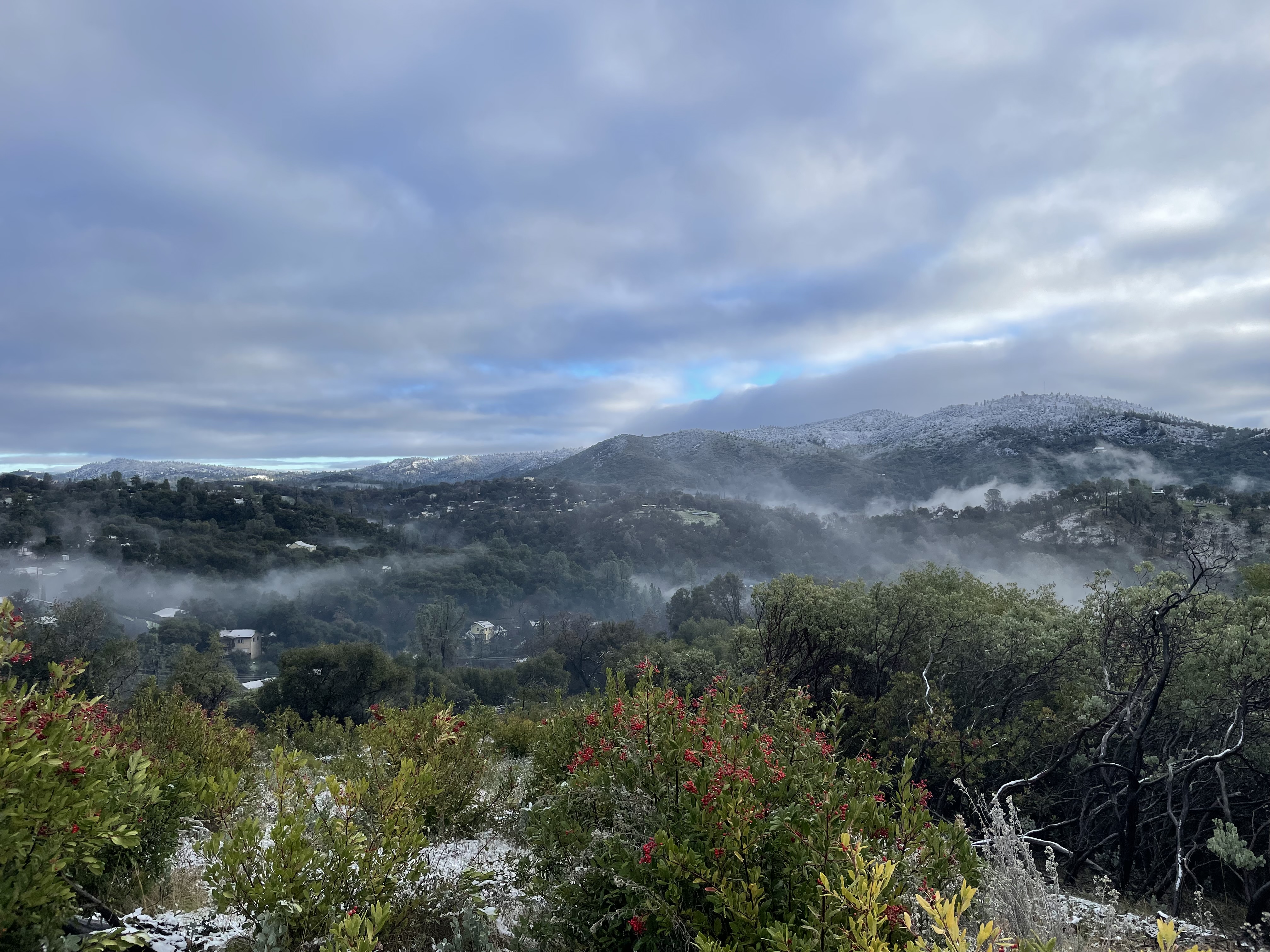
This evening pic of Duckwall Mtn with snow on it. Duckwall sits about 5800FT. Snowed down to about 2500 feet east Sonora area. We received one inch of rain during this storm in Sonora. Looks like the rest of the week going to be chilly with another shot of rain and snow Saturday. Dodge Ridge Ski area is opening this Friday January 5.
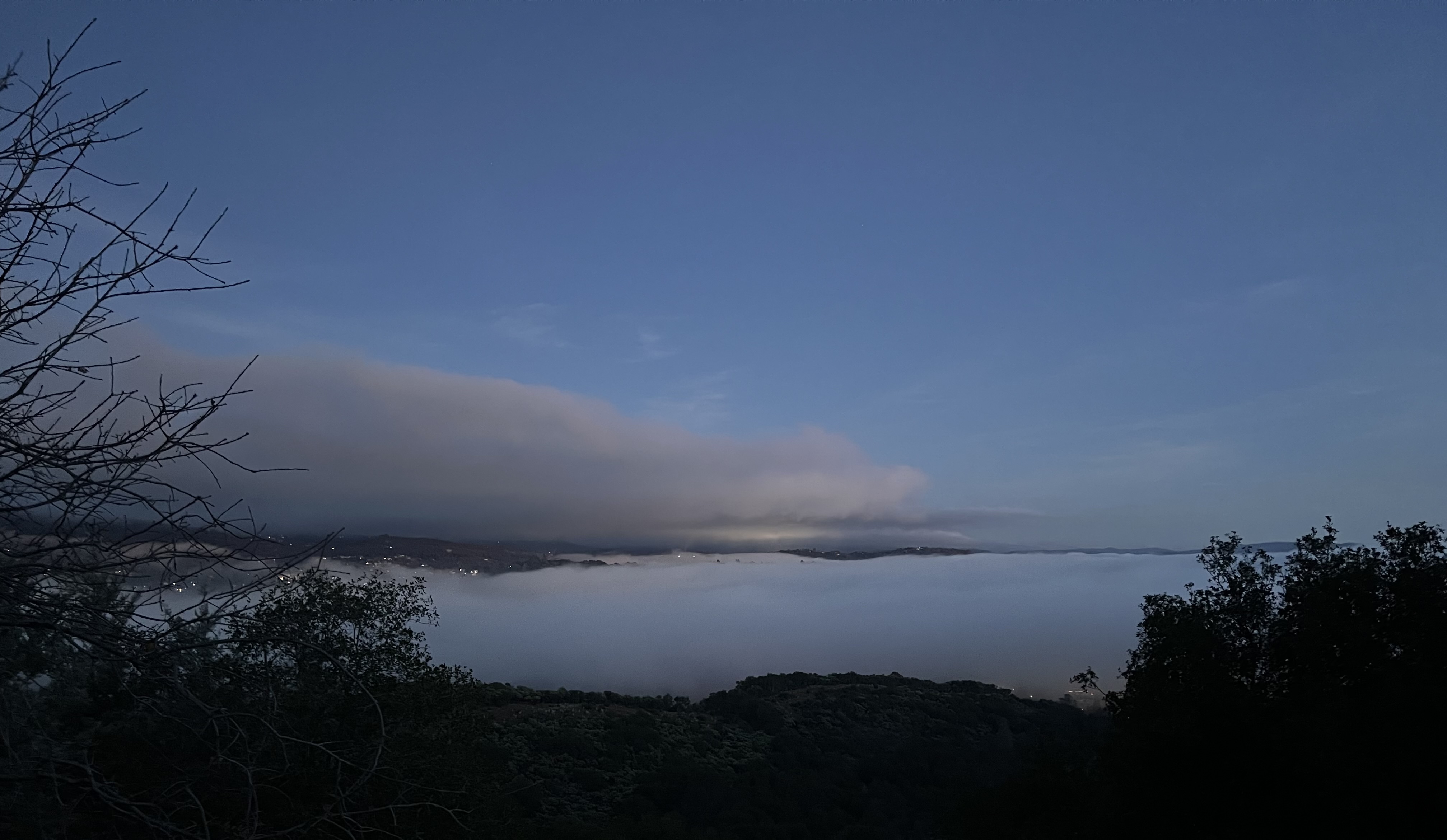
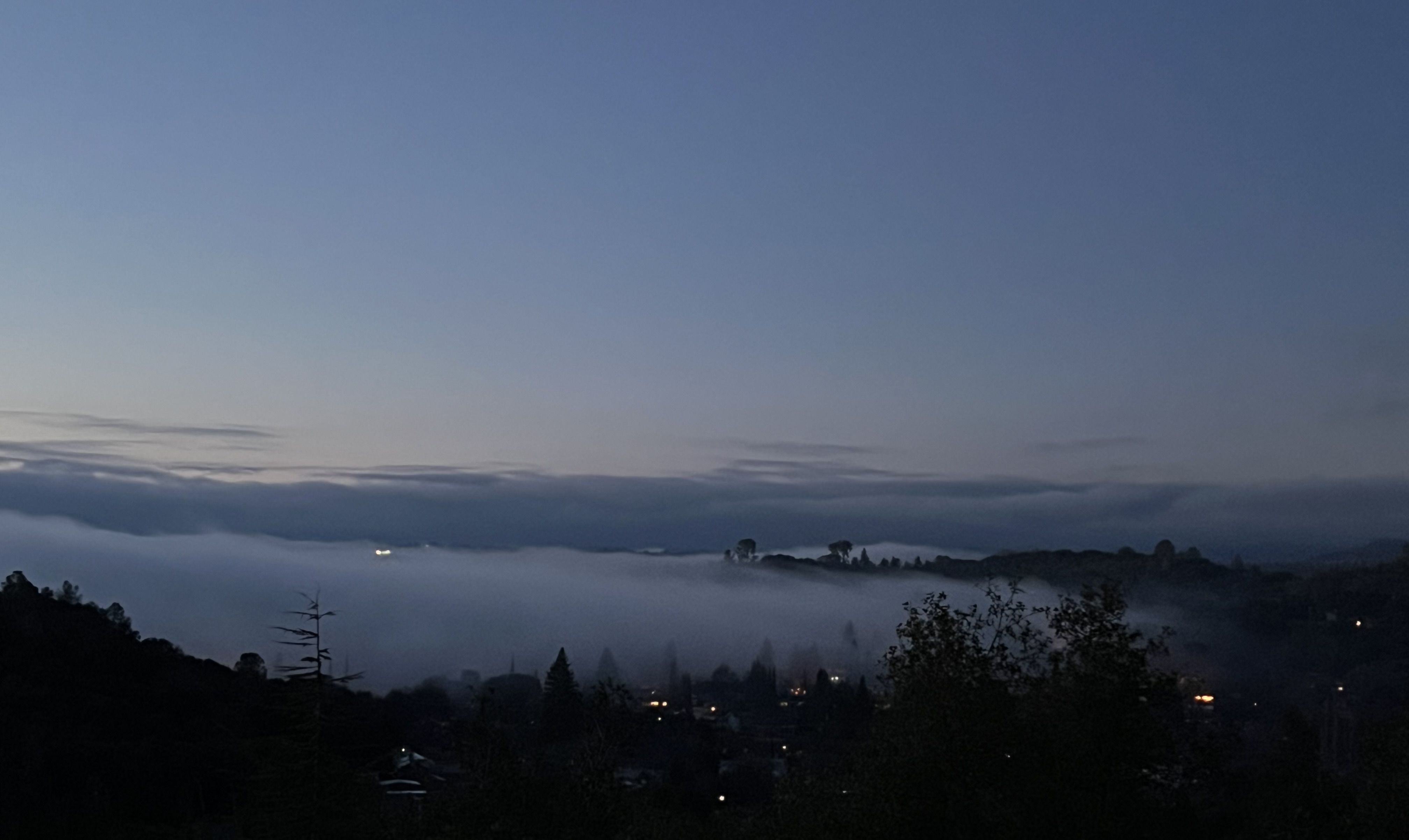
First pic is fog rolling in over the City of Sonora. Second pic is fog rolling in over Sonora Ranchos looking out towards Columbia. Reminds me of the good ole days working in Mid Valley and living in Fresno. Temp in Sonora 45 at this time, it was almost 60 today in the sun.
Side Note: the bright light in the second pic just above the fog is the Airport Beacon(light).
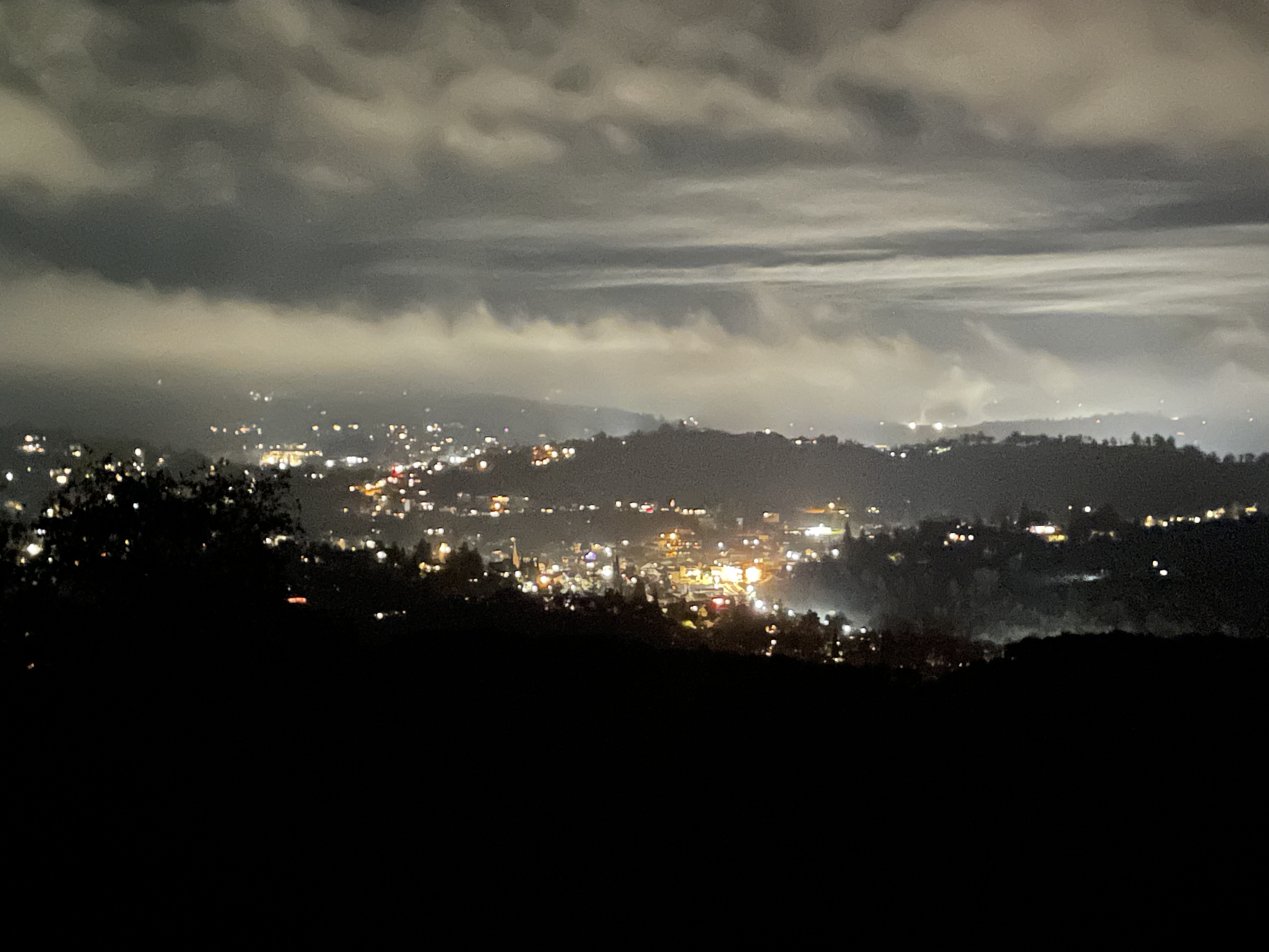
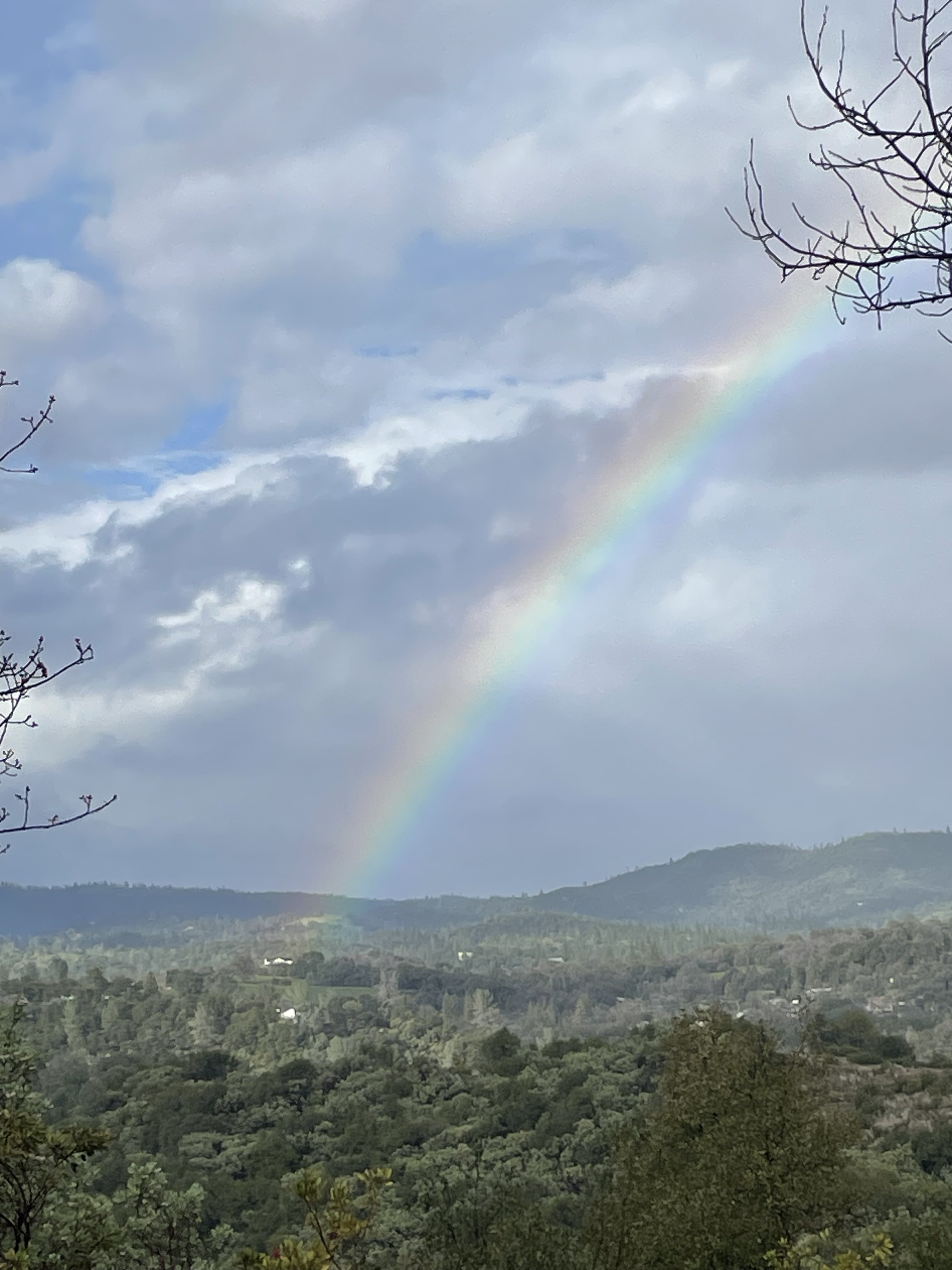
A break in the rain at this time. 3/4 inch in the gauge .Temp 51. Winds 50 plus at times…debris everywhere from this wind. Still have power so that’s a plus. Pic of rainbow is looking out between Columbia and Big Hill area.
Side note: will post some wind footage video when I figure out how to convert it to this site…
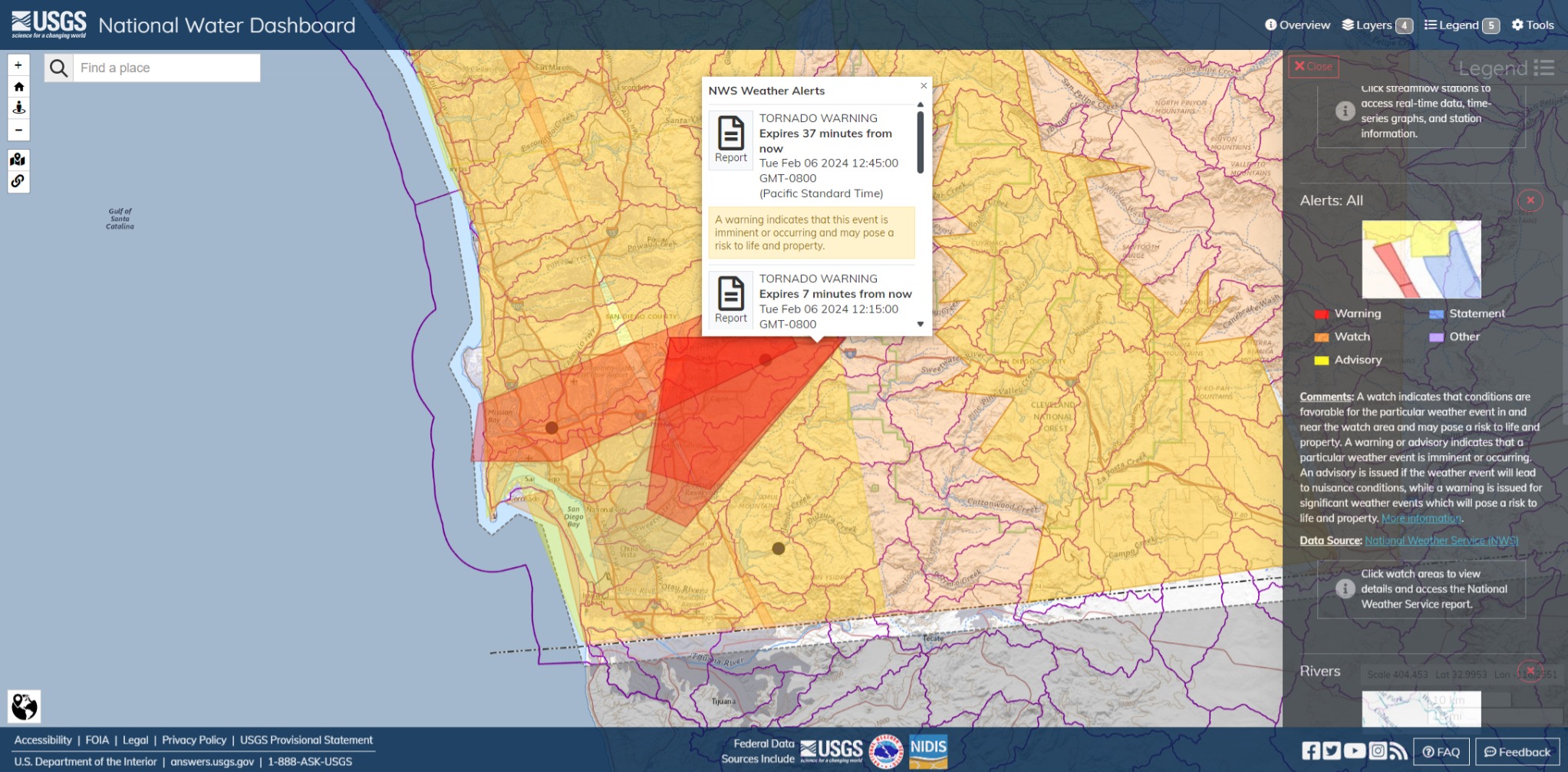
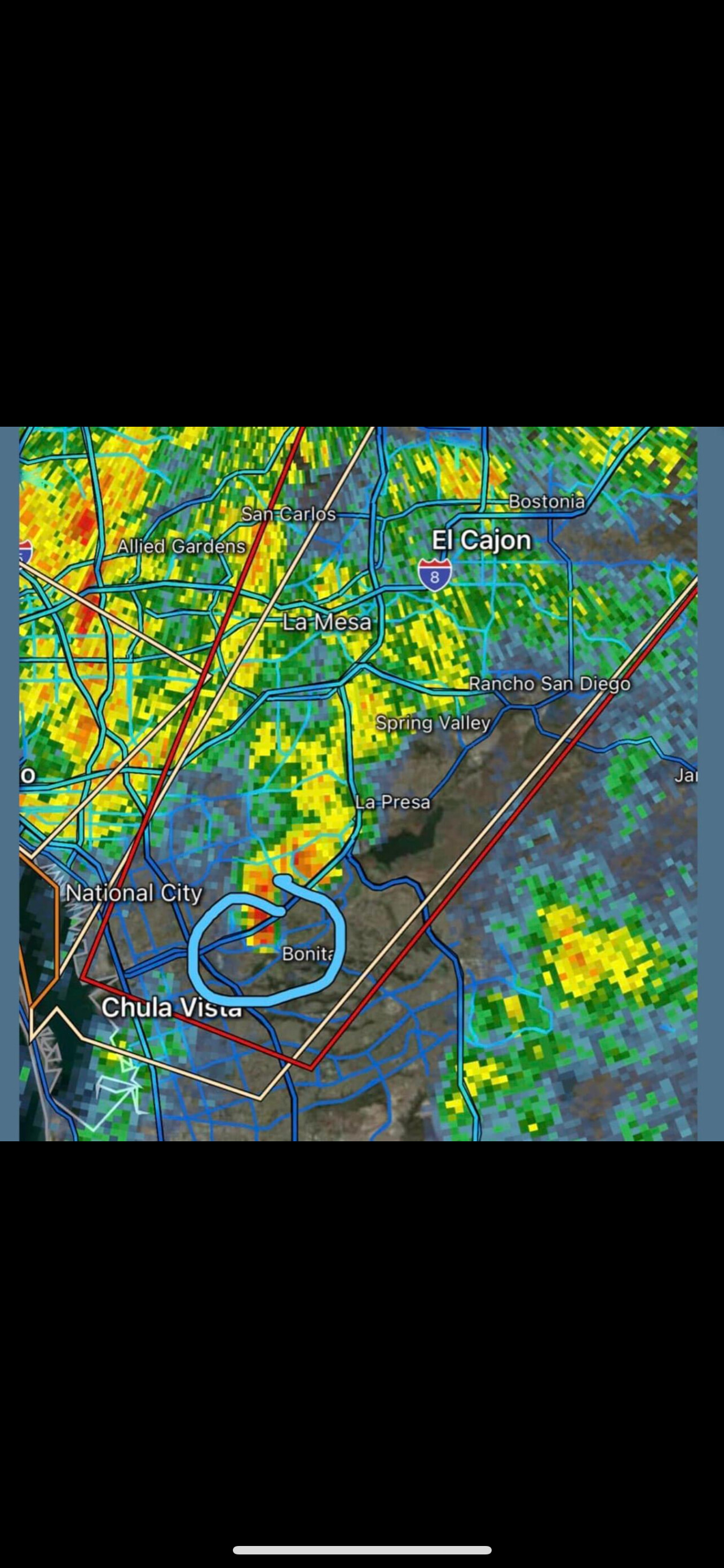
Tornado Warning issued February 6 at 12:00PM PST until February 6 at 12:45PM PST by NWS San Diego CA
TORSGX The National Weather Service in San Diego has issued a
Tornado Warning for… South central San Diego County in southwestern California…
Until 1245 PM PST.
At 1200 PM PST, a severe thunderstorm capable of producing a tornado was located over El Cajon, moving northeast at 35 mph.
HAZARD…Tornado.
SOURCE…Radar indicated rotation.
IMPACT…Flying debris will be dangerous to those caught without shelter. Mobile homes will be damaged or destroyed. Damage to roofs, windows, and vehicles will occur. Tree damage is likely.
Locations impacted include… El Cajon, La Mesa, Tierrasanta, Santee, Lemon Grove, Rancho San Diego, Spring Valley, Crest, Lakeside, La Presa, Lake Murray, Bonita, Winter Gardens, Harbison Canyon, Granite Hills, Bostonia, Casa De Oro-Mount Helix, Jamacha Lomita, and Flinn Springs.
Instructions
TAKE COVER NOW! Move to a basement or an interior room on the lowest floor of a sturdy building. Avoid windows. If you are outdoors, in a mobile home, or in a vehicle, move to the closest substantial shelter and protect yourself from flying debris.
A snowing morning in the Motherlode…This first pic is out looking towards Columbia. American Camp would be the peak on the left side of picture, Big Hill is on the right.
The second pic is look out over Sonora area and beyond. Rain gauge had 1 5/8 in it for the last two days plus 2 inches if snow yesterday and last night. When I took these pics it was 33 out.
If you live in the mountains please people carry chains! Longaway Rd and upper Phoenix Lake Rd were a freaking mess yesterday evening. Cars and no chains, it looked like Damnation Ally
I live at 2200 Ft. just to give you an idea of the snow level.