The vegetation is seasonally dormant, there will not be much impact to receptivity especially with the increasing ground moisture deficit.
**In SoOps we used to say 2” monsoon followed up by 10” Santa Ana’s **
Somebody forgot to tell the Bay Area this. The Units in this influence area are back to mid-90s by Tuesday.
The dates for this outlook are for the 23rd thru the 27th. Supposed to cool a bit again by next weekend. We’ll see.
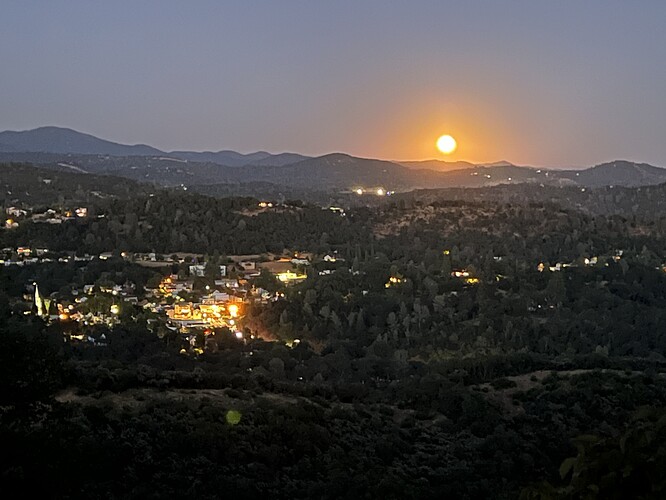
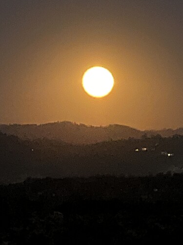
A awesome site tonite rising over Sonora and the mountains. The Super Moon is shinning in all it’s glory.
Temp is 81, RH 25 and winds 5 to 10. Big cool down end of the week. Then a Big heat up next week.
@anvilhead and @mesocyclone Your thoughts on these early season deep troughs that we’ve been getting over the last couple of weeks and if it is an early indication of an early offshore wind season? Or Quantity and strength?
No indication that August conditions have much, if any, bearing on autumn weather patterns. Right now, there continues to be a pretty strong indication of warmer than average conditions Sep-Nov, with a slight tilt toward a later than average start to the rainy season in SoCal (though the temperature piece is much stronger than the precip piece). This is largely consistent with the seasonal outlook from predictive services indicating above-average large fire activity in the offshore (Santa Ana and Diablo) wind-dominated regions beginning next month and likely continuing until the rains arrive. We do not really have any seasonal-scale predictability of offshore wind events, so I would assume near-average offshore wind event risk combined with hotter than usual conditions and possibly a late rainy season start in the south.
The one place where the weather right now will have some carryover effects is in fuel moisture up north (i.e., especially along the North Coast of CA and in OR/WA from the Cascades westward). The rain right now will be major season-mitigating (if not season-ending, esp in western WA/OR) precip event, so activity will be drastically lower to nil after this second Aug rain event up there. There will be at least a temporary increase in fuel moistures up in other portions of interior NorCal as well, including around Shasta and possibly NE CA (including the Park Fire footprint), but the amount of rain inbound is unlikely to be season-ending that far east. South of central Mendocino, any rain will be quite light and likely negligible from a fire season perspective except for during the next 7 days or so (when it will tamp down fine fuel moisture).
With the legacy of a heavy fine fuel crop from wet winters in 2023 and 2024 in central and SoCal and a record hot June-July across an even broader region, there’s a good shot that fire season takes off pretty substantially in these regions during coastal heatwave/offshore wind events Sep-Oct/Nov–something the seasonal modeling continues to support. So there will likely be strong contrast between below-average fire conditions up on the North Coast for the rest of the season vs potentially well above average conditions in the SA-dominated regimes down south (and possibly as far north as the SF Bay Area during any major wind/heat events).
Keep an eye your neighbors some are lighting up the fireplace because it’s 62 degrees at 4500 ft.
Sprinkles in Mariposa
Blowtorch incoming for the 1st week of Sept if this graphic verifies.
Does any of the weather experts have any insight as to our fall offshore events? I’ve seen everything from no wind events to several major/extreme rips. Mesocyclone/anvilhead…would love to hear your take on this.
I’ve heard above average wind events.
MVU - Read a couple posts above, I asked them the same question a few days ago. There is never a year with no wind events (I know you know this, you’ve been around a while). Multiple wind events varying in strength are part of the yearly weather pattern. One of the major factors as it affects fire season is with whether the wind events occur before or after wetting rains. DEC/JAN historically host the strongest wind events.
Sorry. I did not look back 5 days ago at your post. My bad. Yes, I have been around for a minute as I am born and raised in SDU….Grossmont Hospital. I have seen the worst in 2003 and 2007 and to a lesser extent our extremely rare major Santa Ana in May of 2014. My point was simply is that we in San Diego county have gone several years without a decent rip and was simply curious if this fall might have a different outcome. Regardless of fire starts……my go to favorite fall mornings is waking up to a warm and dry east wind with unlimited visibility. IMO….the best time of the year. Forgive me for wishing for a little pattern change. We have had fog and marine layer almost every morning this month. It was socked in fog here 8 miles from the coast. That never used to happen growing up. Once June gloom was over its was sun for months. I long for those days when it wasn’t damp every morning in late August….just a lifer in socals opinion. We will see what Mother Nature has in store soon enough
Definitely agree about Fall months being the best weather for all the things you described. Great for star gazing too!
I will take a shot at answering your question. The two cold fronts that impacted Nops were anomalous but not unheard of. The large ridge in the central part of the US allowed a trough pattern to develop over the PNW. There just happened to be an area of LP lurking out off the coast and was caught up in the flow and tracked over the west coast. Rain in late August is not unheard of for NW Ca but 1/2 inch in the Sacramento Valley is… about a 1/10 return interval for that event.
I do not think it is a signal for any large scale pattern changes or seasonal changes other than what we would expect.
The first offshore wind events for NOPS are driven by troughs and “inside slider” systems passing the state to the north and then HP building back in behind and creating that pressure differential.
Small scale Santa Ana events can occur in similar fashion but those are usually confined to the canyons and inland areas and usually are more notable for their heat and low RH than wind. To get a real deal SA you would want to watch for cold air pooling in the Great Basin. The first really cold snap for that area and a passing trough sets up the pattern change in the Fall where we see cold air pool up and then be pushed across the deserts and into the coastal areas.
I think it is too early to give a specific forecast for below or above average SA events. PDS does a great job at those fall forecasts.
As far as trying to “predict” the future, for now we are the only things that can predict the future and with regard to weather that is only really reliable 3-4 days out. Acorns dropping, leaves turning color and dropping are a reaction to past events( heat, drying, precipitation amount) and are not a specific prediction of the future relative to plant anticipating some large scale change. Animal similarly cannot predict the future, but rather they react to the now( they do not have access to super computers). Every year I hear people talk about deer moving and squirrels being more active.
If you are relying on squirrels to provide you with long range forecasts… I would suggest you review your interactions with them on local roads.
So my take… a little too early to tell what this fall will look like. I would agree… it has been awhile since we have had a large scale region wide run of SA’s.
Oh, you forgot the Scorpions crossing the road😅
Ah yes, in addition to the famed TAL Tarantula activity level haha
Let’s not forget woolly worms
Years ago you could almost predict such things with serious accuracy.
Late Aug, early Sept almost always brought rounds of dry lightning.
Late Sept/early October the Santa Anas were pretty much a sure thing on and off thru Thanksgiving and I remember sending folks south during Christmas several times. Made a few enemies there lol.
All before the term ‘Year round fire season’. For those who are old enough fire season typically ran from May to the end of Oct except for So Cal and the Santa Ana’s. Nor Cal ended a bit sooner. FF1’s left and we didn’t see them until next season. Times have changed. Weather has changed. Everything has changed lol.
Now? Roll the dice and flip coins.