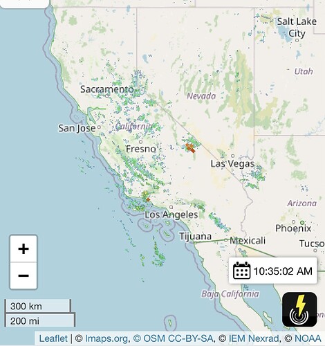
It’s starting early, EGP is showing the same thing
Up at 4 a.m. here and have been watching a light show to my east from Visalia. Lots of down strikes, many in the low country. (and high as well). Some up and over the crest as well. NWS Hanford is predicting these dry thunderstorms will possibly drift out over the foothills and possibly over parts of the valley later today. Morning low here so far is 84° w/ 46% RH. Gonna be a long weekend I’m afraid.
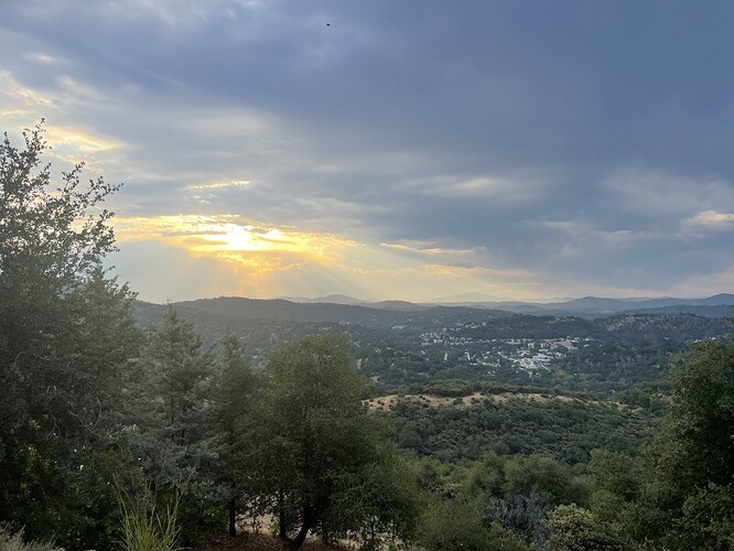
It was 82 out when pics were taken. 86 now. Looking SE and S of Sonora. AC been running triple overtime this week. Hottest two days yesterday 107 the day before 109. Going to breakfast this morning a few little sprinkles on the windshield. We will see if this burns off, moves out or produces something. No one can emphasize enough the importance of staying hydranted in these conditions. Stay Safe Folks.
Abundant lightning in MMU. Observed mostly cloud to cloud with precip in the Coarsegold area but maps show lots of strikes especially in the Usona/Bootjack area of Mariposa. Scanner sounds like they are already out hunting a reported start.
Read your post, walked out to look, I have a direct line of sight to Mt Bullion in MMU. Must be getting a little moisutre with this. Could not see Mt Bullion but three down strikes in ten minutes. That would place them between Groveland and Bullion. When this blows out AA 440 will recon. No moisture in Sonora yet but you can smell it in the air.
Looks like between Buck Meadows and Groveland are starting to take strikes. Greenley Hill area too.
I live in MMU and the lightning started 0515 this morning in the bootjack area. Got over an hours worth of lightning and quite a bit of precipitation. Enough to flow in the ditches at the house. Lightning was back to back to back to back for most of the duration.
Closing the Mariposa LCA at 1400
Will keep the Madera LCA open for a while longer. Trying to find a smoke in the Creek scar on the SNF
Knock on wood nothing on the fku side other than some exploding trees and power outages today.
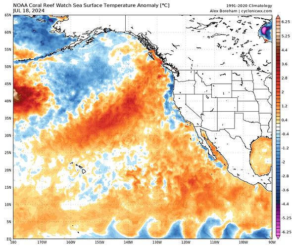
I will throw this out there for the third year in a row. With a prolonged heat wave + marine heat wave over the next 10 days, it will be interesting to see if there is a tropical cyclone threat for Southern CA for the third year in a row in August. The Eastern Pacific has had the lowest recorded amount of tropical cyclones this far into the season (1) so if things get going there is plenty of oceanic heat content building up to work with. Will have to watch how far north the 26 degree isotherm gets this year.
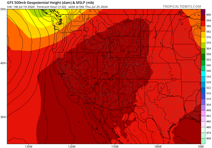
This ridge building in over us extending to the tropics is absurd.
Some T-Storms with heavy rain moving through Eastern SDU. Los Pinos down through Lyons.
Cam…https://ops.alertcalifornia.org/cam-console/2086
There was a fire in Potrero but the rain put it out. Just a couple engines at scene.
Radar and EGP Lightning showing a couple of pretty good cells, pretty wet from the sounds of it.
Very wet under the cells. With 60 mph winds. Non stop thunder…
Upgraded to red flag warnings now.
https://forecast.weather.gov/wwamap/wwatxtget.php?cwa=HNX&wwa=red%20flag%20warning
Light rain in meadow lake with thunder heard off to the east.


