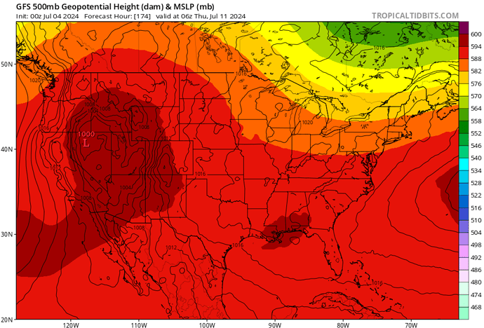
Hurricane Beryl will be entering the Gulf of Mexico and approaching the Gulf Coast. The high pressure system centered over Northern CA will be deamplifying slightly and moving over Southern California. The heatwave continues on and a major problem is that the tropical cyclones track in conjunction with a sharpening trough over the midwest will be reamplifying the high pressure system over Southern California. This is occurring just as the high pressure cycle is winding down. The taller (stronger) the hurricane, the more it will subsequently ‘pile up’ additional air for stronger high pressure over California. Thus at this point there is no heat relief in near sight. Mid to late July is likely the earliest the monsoon trough will move over the area.
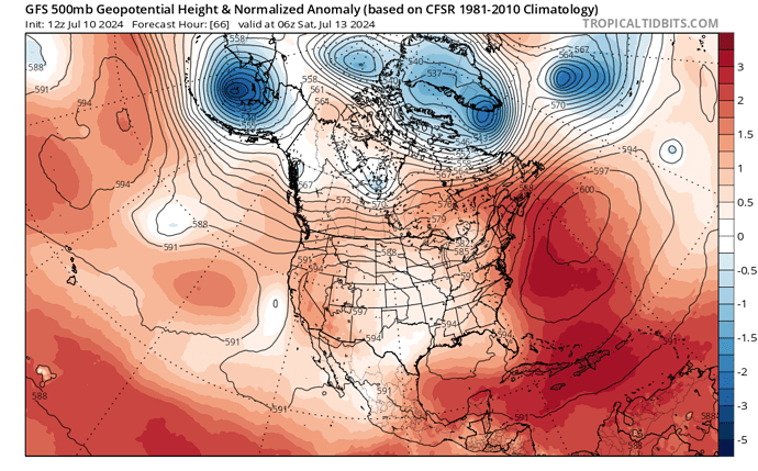
I don’t like to dramatize things but if a sprawling 605 dm high pressure system is occurring over the North Atlantic July 13th something similar will be possible here, likely in August. There hasn’t been any solar weather amplifying anything recently which is alarming. August looks completely unhinged especially as SST begin to peak.
The current heatwave over Ca already has me wondering why humans invented clothes, now your prognosis makes me wonder what other spasms and/or herky-jerky Wx humans are going to get to observe in the near term?! This inter-glacial period we find ourselves in has serious “hold my beer” potential to say the least!! Studying paleoclimate gives a glimpse into some of the shenanigans we can expect. We ain’t seen nuthin yet folks…
The heat comes before the cold 

Anvil what does this mean in non weather person terms ?
It means that it could be very hot.
Anyone have any insight into the possible thunderstorm activity this weekend?
The moisture in the low levels is too little for surface based convection but the mid level moisture surge could lead to elevated thunderstorms. There is no real kicker for south ops, so the mechanism for thunderstorm genesis would be theta. There is an upper level low off of the coast that would increase the chance of high based /dry thunderstorms for north ops, with the add forcing.
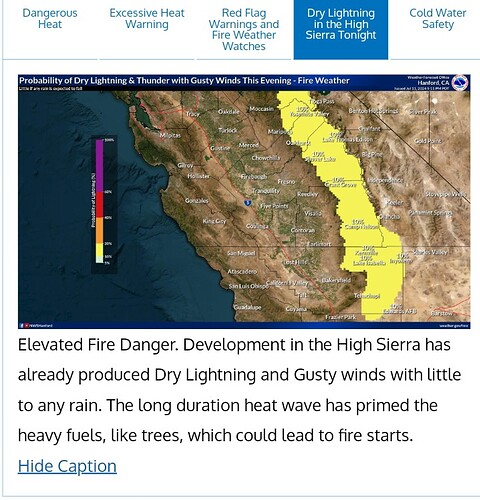
I know that doesn’t add much, but the biggest chance of a dry lighting fire will likely be up in the Sierra timber/east of the crest
NWS Hanford has issued a fire weather watch for the sierras.
https://forecast.weather.gov/wwamap/wwatxtget.php?cwa=HNX&wwa=fire%20weather%20watch
It’ll be interesting to see if the low moving in has any effect on the lake fire.
Upgraded to a Red flag warning.
https://forecast.weather.gov/wwamap/wwatxtget.php?cwa=HNX&wwa=red%20flag%20warning
For tonight…
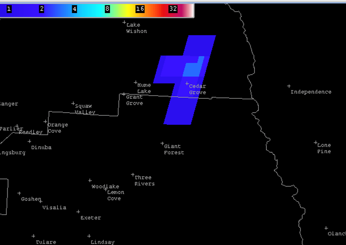
Starting to see numerous lightning strikes in the Sierra front country from about the Visalia line south. Unsure on any precip.


