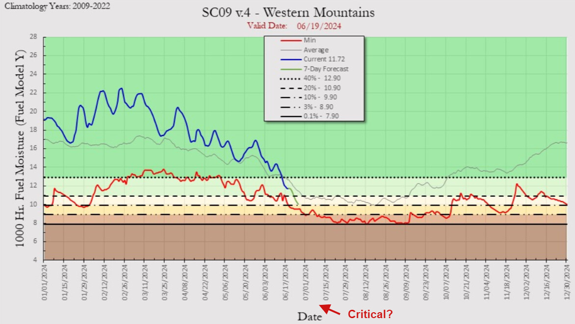
The excessive heatwaves that have built into the NE US and Southern US will establish a heat bank that can be advected into the area as the ridge cycles west. The first taste of this will be this weekend and mid week as the heat wave reaches maximum intensity over the desert SW. Zonal flow off of the ocean will keep the monsoon away from Southern California for the most part, and will keep fire danger elevated across desert slopes. It is looking like the week of July 10th uncrustable season could kick into full gear, as the high pressure system over the South should retrograde over the four corners region in response to tropical weather in the Atlantic. This is in conjunction with 1000 hour fuels reaching near critical levels. The background environment of much above average temperatures in the established heat bank over the Southern US plus the marine heatwave over the Gulf and warming water temperatures over the West coast is very bullish for excessive heat.
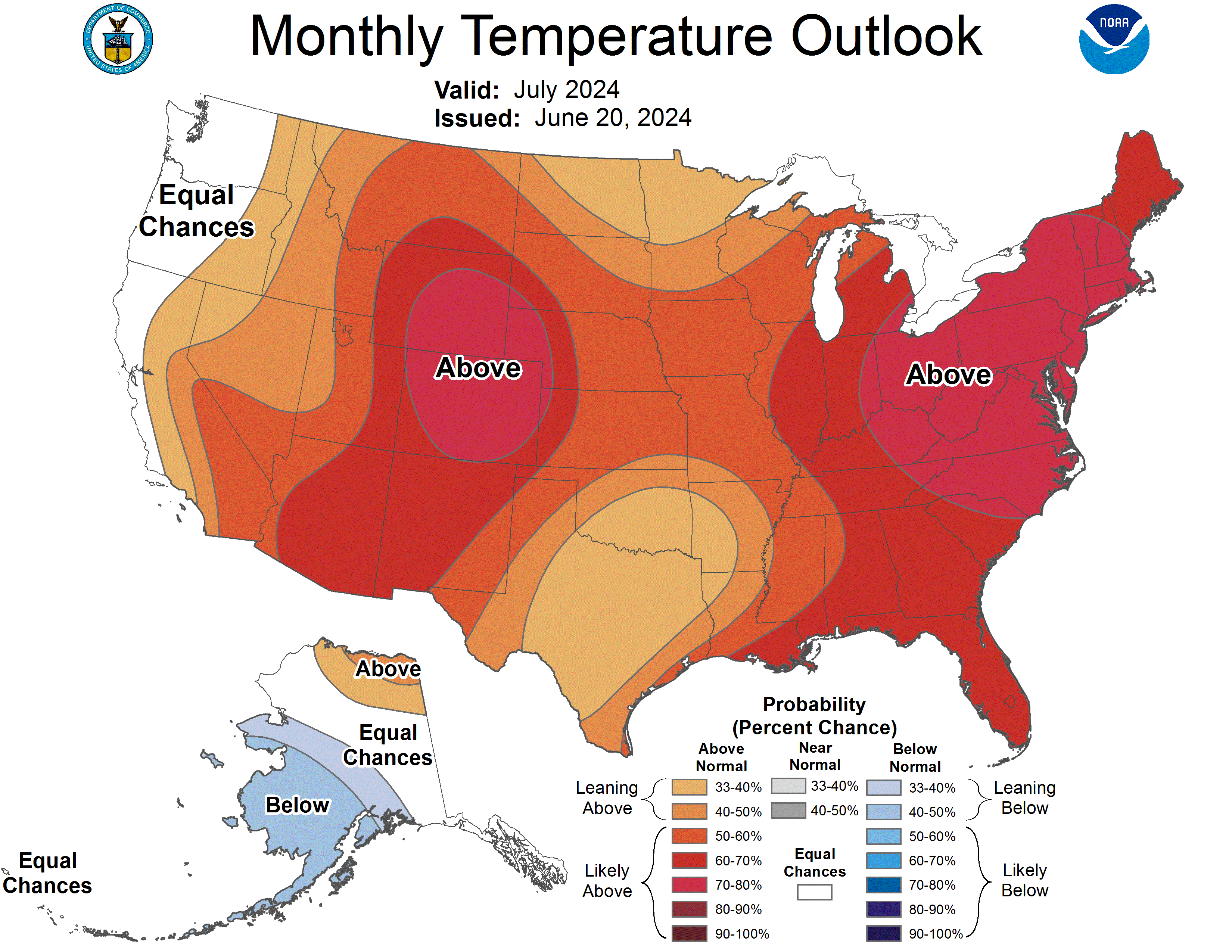
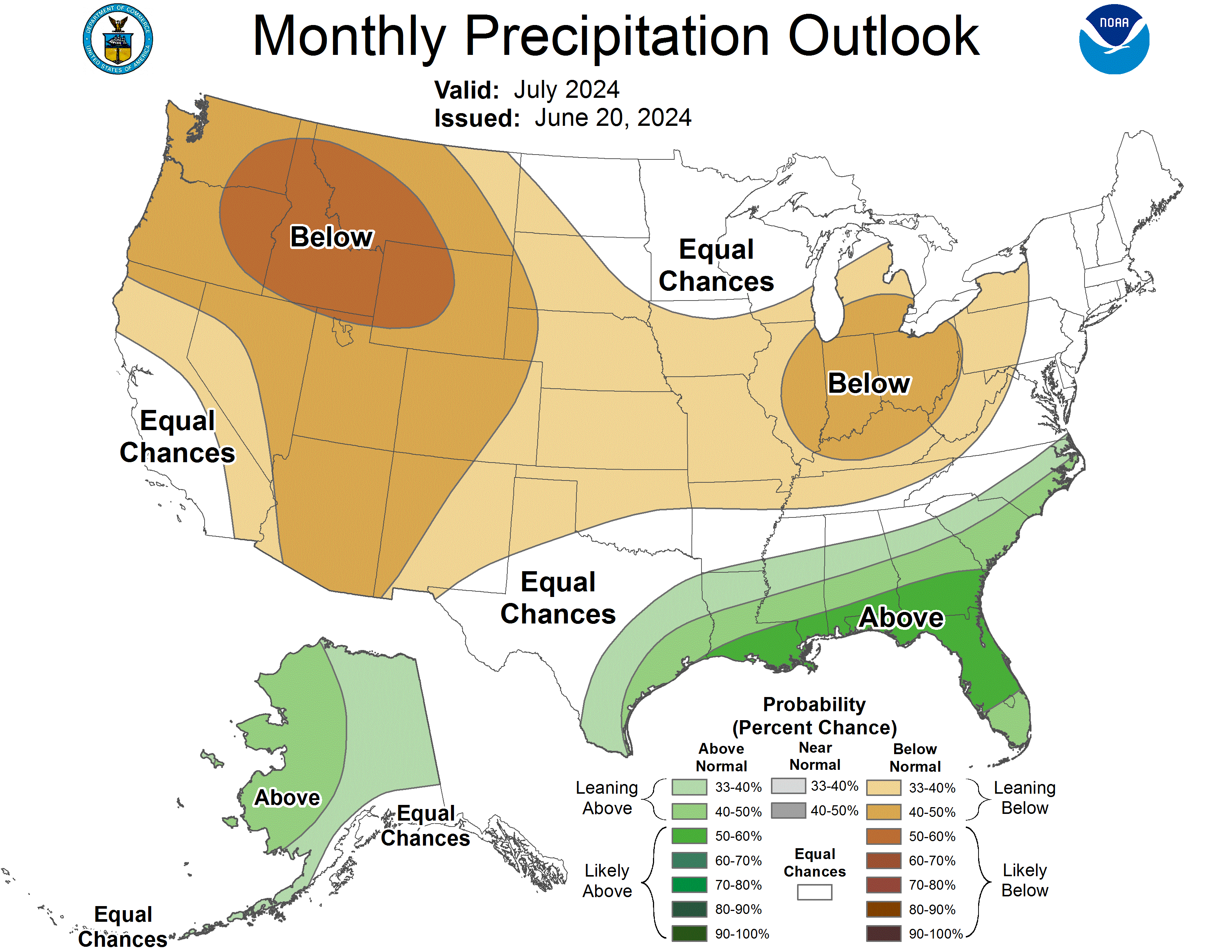
Zonal flow keeps the monsoon shunted away as high pressure migrating north in combination with the enhanced North Pacific jet stream moving into Canada keeps the monsoon trough directed into the Gulf Coast and NE Mexico
Fair bit of rain and lots lightning.
https://forecast.weather.gov/wwamap/wwatxtget.php?cwa=HNX&wwa=special%20weather%20statement
Can see it on the lighting map, you answered the question about moisture.
Going to be interesting as it heads into the foothills.
Several Lightning starts in the valley and now a new start Tollhouse Road and Nicholas (SRA) Eastern Fresno County
Dry lightning moving N/NW up the middle of the Valley area of Fresno/Madera
Draw a line from Dinuba to Shaver lake and they are getting rocked by lightning
Could get interesting, looks like some SRA being hit NNE of Fresno.
I often thought that lightning storms like this were much like playing jacks when you were a kid. When you’ve got only 1 jack to pick up before the ball bounces again, that’s pretty easy. When you’ve got 2 jacks, then 3 jacks, then 4 jacks to scoop up before the ball bounces again, it gets a little tougher. Pretty soon the ball bounces twice and you’ve got a major fire.
I hope the folks in the South Sierras pick up all these fires before the ball bounces twice.
TCU getting sone lightning now. Two fires so far both contained. Kinsler five acres. Willms contained at 15 acres. Setting up staging at Green Springs and Altaville.
Public facing site that doesn’t separate “+” from “-” strikes, but gives an idea of area effected by activity
Models are in agreement that the epicenter of the biggest heat will stay north of Pt. Conception and will shake its way down at maximum intensity Friday/Saturday.
Anvil, how far south do you see the NE winds reaching or is it pretty strong certainty they stay north of Sacramento? Im in the area northeast of the Basin Fire and am just curious the certainty that they wont impact further south.
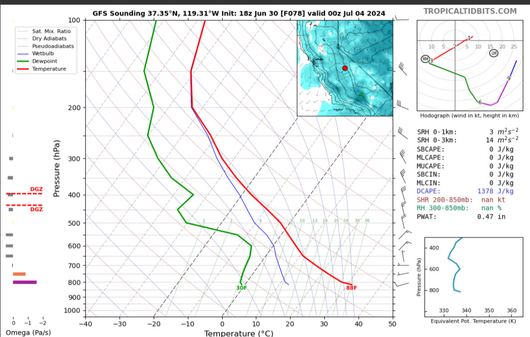
It seems like the winds are going to follow the thermal belt mostly in the San Joaquin valley all the way to the south with some marginally gusty winds. Biggest issue is that there is not much of an inversion at the fires elevation if at all with the winds aloft. Not much stagnant air despite extremely hot temperatures, so any column can easily tap into the winds aloft and modify the conditions at the surface.
This weather can lead to dangerous fire conditions that can lead to life safety… because heavier fuels will become acutely stressed out. That can lead to fire spread activity that is much more energetic than boots on the ground are accustomed to this year thus far. One day the heavier fuels are barely burning and the next they’re supporting sustained crown runs. So hopefully no one gets caught off guard.
Thanks for the info. Ive got a pretty good vantage point of the western end of the fire and the upper level smoke. Ill keep an eye out.
There’s a there’s a hair trigger on all that potential energy and the safety is off! So, heads up Y’all! P.s. Drink more water Troop’s, you gonna need it…