South Ops Weather - 2024

Hi, these images are available at tropicaltidbits.com → forecast models.

I use ensemble data, climatology, operational models, and some esoteric things to forecast patterns and trends in the mid range forecast which you may not see in a forecast package until closer to the event. I tend to get most of these forecast philosophies correct…. but always follow GACC, NWS, and other officials for weather information and use my info as supplemental.

15 Likes

Appears to be trending towards a Cold Offshore event for SO. Cal.
Thanks for your posts Anvilhead.

12 Likes

@anvilhead Bruh, or just troughing with small amounts of moisture for the next 2 weeks?

2 Likes

Seasons over

2 Likes

I agree. Another October in a long stretch of October’s with zero Santa Ana events for SDU. The lack of these dumbfounds me. I have been in SDU for all my 53 years and miss these offshore events tremendously. And not just for the fire weather. But the clear warm days, cool nights, dry winds and no RH and the amazingly clear air for unreal sunsets. It’s been about 4-5 years since SDU has had a decent rip all the way to the beaches. Gone are the days of 100 degree days and surf being stood up by offshore breezes. Not sure what has changed….but something has for sure. Fire season has largely bypassed SDU for the last 5-8 years (Border Fires do not count). I miss the predictability of the fall season and what it brings. But I do know this……Fire season is SoCal is done for 2024 unless Mother Nature decides to grace us with a few above average rips and right now….thats not in the cards.

4 Likes

With very little precipitation forecast in the 14 day, sure seems like everyone is jumping the gun…slow fall sure. But done? Thomas Fire amongst other started in December. Slow yes. Done…far from it (But we can hope.)

11 Likes

Every gambler thinks he/she knows the cards. Until tables turn.

6 Likes

Respect the post but here on the central coast, we have experienced many of large fires in Ventura county at or near Christmas time. And that is with some measureable rain prior to December. Gotta get 2" or more to start looking at the end.

8 Likes

Remember this statement the next time we get a Witch Fire or one of the others that severely damaged SDU.

9 Likes

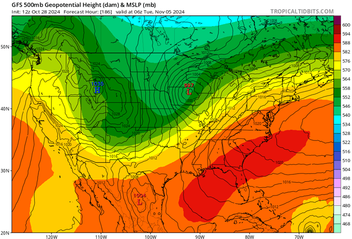
Forecast models are coalescing around the 3rd-6th time frame for an offshore wind event. The timing is adjusted slightly because models tend to rush cold airmasses/troughs by a day or two.

We go through this every year, even if we get precipitation it will likely be near the standard daily evaporation rate that would occur during an offshore wind event with low RH. So the baseline between fuel moisture recoveries and drying would be a wash. But keeping in mind we are still about 180 hours away from the 4th, so the signal for moderate-strong offshore wind events often shows up as what you see on the models right now, because during this time of year models can be too aggressive with the amount of moisture entrained with troughs and also shift them further inside.

The ensemble mean and climatology is pretty clear that it will at least be moderate strength.

12z GFS 10/28/24

Also note: have to be careful what we wish for.

20 Likes

Having been around 50+ fire seasons I learned a LONG time ago to never use the term ‘it’s over’. It’s similar to saying your first day on, ‘Boy, it’s sure slow today’.

9 Likes

14 days??? San Diego AFD this morning…

We could get our first significant
widespread rain of the season, or some light showers. According to
the National Blend of Models (NBM) there is a 60% chance of the
coast receiving 0.50 inch Saturday through Sunday night. Most
ensemble solutions gradually move the trough east for drier
weather Monday. This time of year the models struggle to come to
a confidence-building consensus, so the details on the upcoming
weather systems are far from being in clear focus. But I’d plan on
some rain this weekend.

5 Likes

Any update on the potential wind event?

3 Likes

They are burning Big Trees State Park near Arnold Ca for the next couple of days. Night shift going to need a warming fire with lows around freezing. It’s about 55 up there now partly cloudy. RH around 30.

8 Likes

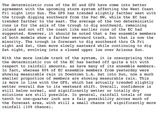
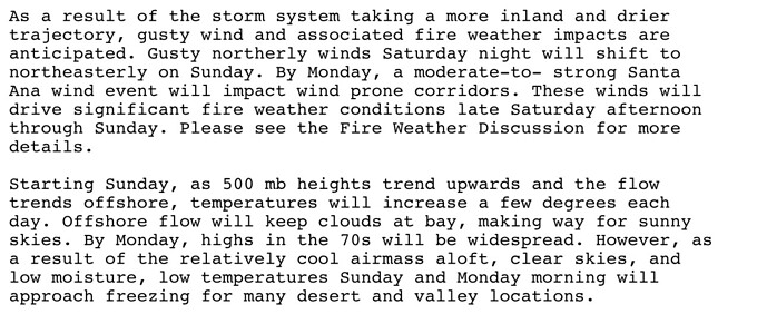
NWS LA/Oxnard AFD.

Beheld

3 Likes

And what about the wind forecast now that the precipitation has all but evaporated?

3 Likes

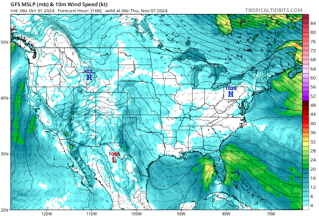
Just one Quick Look at one model this am shows a low end offshore event for this weekend. Another trough will swing through the state and right now according to the tea leaves there is a signal for a moderate to strong offshore event for much of SOPS from 11/6-11/8… and maybe beyond. It is still a long ways out to marry up to but it is well within climatology for this time of the year so that balances out the variability this far out. With that said the current waffling between the different models with regard to the current potential of precip is a good reminder about “model riding”. A slight shift east or west of the trough passage could produce a warm dry SA or a cold SA. With the progressive pattern up north and the cold air that has settled into the GB the ingredients are there for an event that would have fire weather implications.
Short term this weekend does look to have some wind but perhaps more of a NW event so effects could be mainly focused on the I-5 corridor and SB mountains. Need some more time for that to play out.
Below is a snapshot of Nov 7th gradients… it should be still considered fantasyland.

8 Likes

SoOps Predictive Services Assessment/Outlook Nov 24 to Feb 25

assessment.pdf

November 2024 – February 2025 South Ops Highlights
• There is a moderate tilt in the odds towards both above normal temperatures and below
normal precipitation for the next 4 months.
• There is a slight tilt in the odds towards an above normal number of offshore wind events
over the next 4 months.
• Significant fire potential will be near normal with most of the region moving out of season
and at little risk for significant fire but some potential remaining over Southern California

7 Likes

Fire weather watch

https://forecast.weather.gov/wwamap/wwatxtget.php?cwa=SGX&wwa=fire%20weather%20watch

San Bernardino and Riverside County Valleys - The Inland Empire-
San Bernardino County Mountains-
Including The Mountain Top And Front Country Ranger Districts Of
The San Bernardino National Forest-
144 PM PDT Fri Nov 1 2024

…FIRE WEATHER WATCH IN EFFECT FROM SUNDAY EVENING THROUGH
MONDAY AFTERNOON FOR STRONG GUSTY WINDS AND LOW RELATIVE HUMIDITY
FOR WESTERN PORTIONS OF THE SAN BERNARDINO COUNTY MOUNTAINS AND
PORTIONS OF THE INLAND EMPIRE MAINLY BELOW THE CAJON PASS…

The National Weather Service in San Diego has issued a Fire
Weather Watch for strong gusty winds and low relative humidity,
which is in effect from Sunday evening through Monday afternoon.

  • WINDS…North to northeast winds 15 to 25 mph with gusts 35 to
    45 mph.

  • RELATIVE HUMIDITY…Lowest daytime humidity of 12 to 15
    percent.

  • IMPACTS…Any fires that develop will likely spread rapidly.
    Outdoor burning is not recommended.

  • LOCATION…San Bernardino and Riverside County Valleys -The
    Inland Empire and San Bernardino County Mountains-Including
    The Mountain Top And Front Country Ranger Districts Of The San
    Bernardino National Forest.

7 Likes

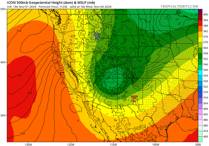
As promised, the first Santa Ana wind event on the 4th will be moderate to strong. Second one behind it could be even stronger.

From NWS LA AFD

18z ICON depiction of second wind event.

12 Likes