.15" rain in Mariposa
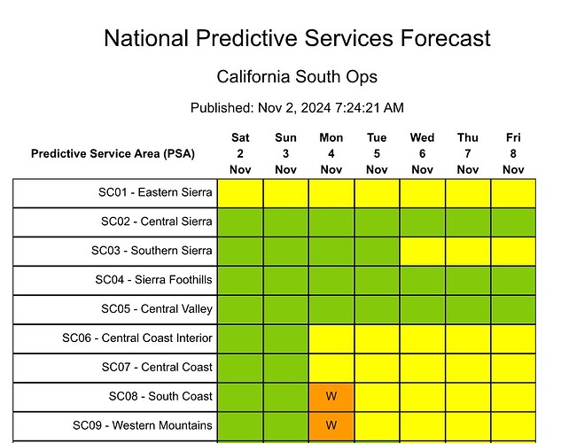
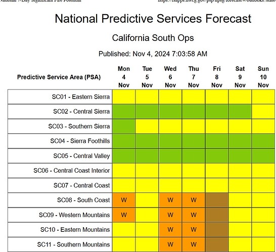
High risks days added for Monday. Still monitoring middle part of the week as it gets closer for additional HR days for a potentially stronger rip. Stay tuned…
Spotty the rain was. Still some dry area under the drip line of the trees in my area. Gutter just dripped never really ran water and no puddles on the roads. Could be a different story a couples miles down the road. Have to fine my rain guage and put it up for the season. Looked like some good cell went across the Big trees burn last night. Be interesting to see what they got in precep.
Did have the woodstove cranking last night, that time of year again.
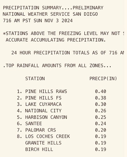
“storm” isn’t expected to reach far SoCal until this evening and overnight. Will be interesting to see what, if anything SDU gets out of this. NOAA calling for a few hundredths at the most for coastal and inland areas of SD County.
Classic inside slider set up with a moderate SA event following up.
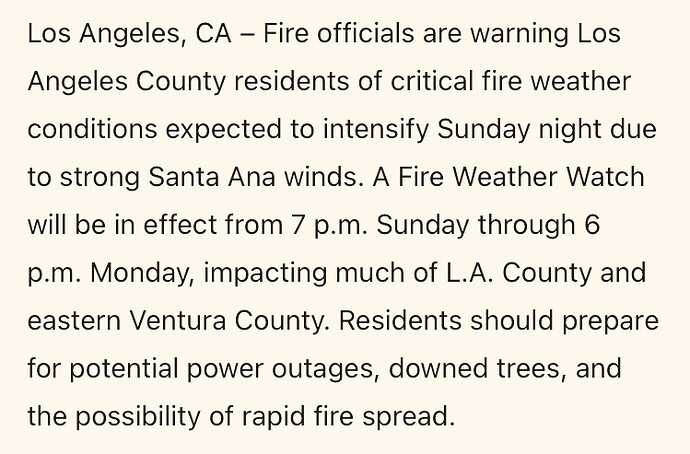
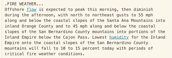
The FWW is already in the AFD. Don’t be suprised with less than a tenth of an inch of rain falls and the FWW becomes a RFW for Monday.
Looks like both the San Diego office and the LA office are upgrading the watches to Red Flag Warnings this afternoon, plus some elevated fire weather concerns for southern Mono County.
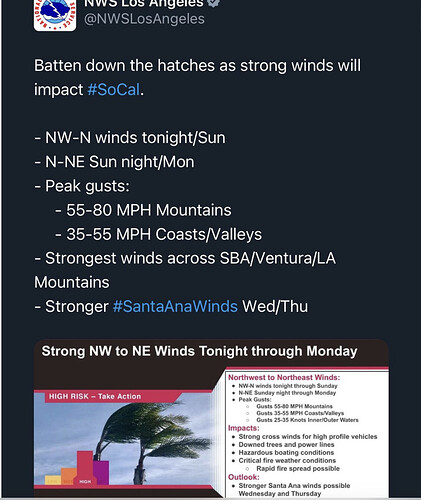
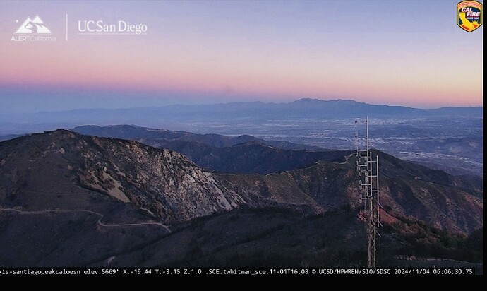
Get ready Sol Cal, this morning I have a steay 10 to 15mph with gust to 25 of winds out of the North here in Sonora. I do live on a ridge which catches a lot of wind. Sonora and Twain Harte have dirty for the Big Trees Burn this morning. Big trees burn lines will be tested today. 44 out right now and windy. RH on the high side at 48 but will drop with wind and sun.
Would the wind in Sonora be relevant to socal? It is well over 300 miles away? Serious question not a jab.
In some sense under a NW flow, yes as an indicator. That is occurring right now. But, as far as a Santa Ana wind much of the flow comes I from the Great Basin region from the Northern deserts. But that’s a N to NE flow.
Usually we will get the steady strong north wind 12 to 24 before Socal. This will follow a low pressure system like we had a couple days ago. Comes after a storm when the High pressure builds back in.This mostly happens in the Fall and Winter after storms.
This is not an East Wind just straight out of the North.
Yeah, matches up with a Santa Ana fed by cold air as the low moves from NW to SE through the Great Basin. A common outcome to this is Santa Ana’s starting up first in Santa Barbara and Ventura with N winds then moving to LA San Berdoo Cntys as it shifts from N to NE. That feeds the flow to Orange and portions of Riv County. Then finally if the flow is strong and south enough in the GB it will finish with an East wind feed SD Cnty. I know most know this process but it’s a good reminder of the phases of a solid Santa Ana wind
Appreciate the information. You guys have a great grasp on weather in our state!
I have learned a lot from Anvilhead, Norcal and a few other around the state who post on this site.
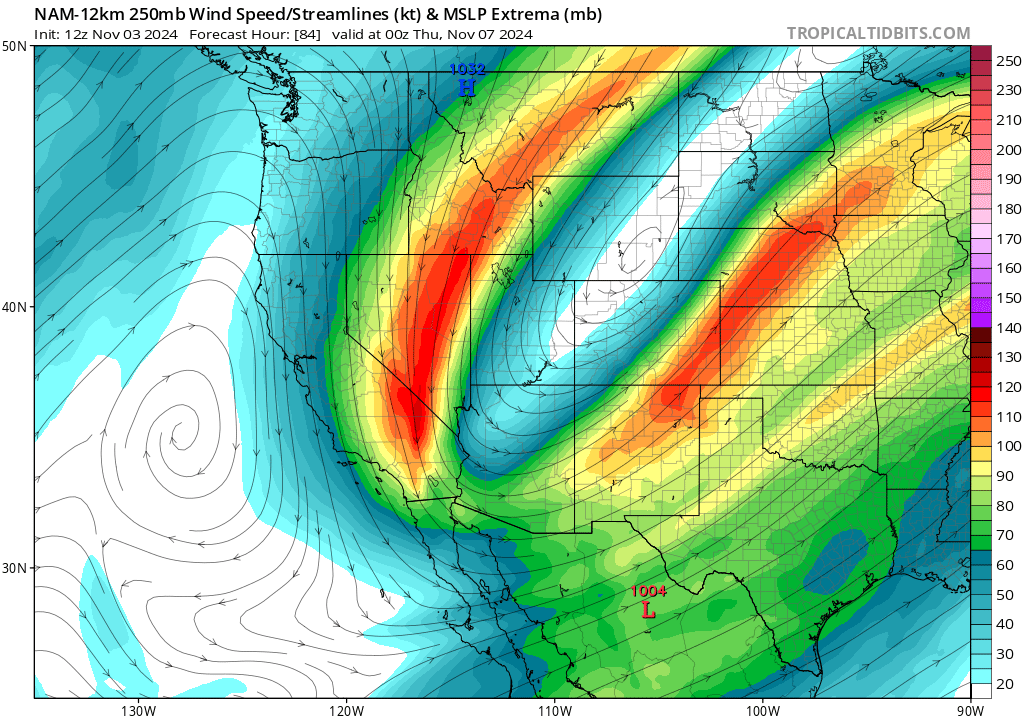
Without getting too technical about the wind event on Wednesday/Thursday. There’s a curved band of strong upper level winds that will be in alignment with the prevailing flow at the other layers of the atmosphere. The curvature and alignment of the jet streak can lead to enhance mixing. Picture it as like a cold front boundary but dry and inverted. The height gradient between the compact upper level low and ridging to the west should mean that the skies will generally be clear west of the mountains, and this should allow temperatures to rise and the boundary layer to mix, which would mean we reach the upper maximum of the forecasted LAX-DAG gradient. So it looks like a strong and widespread event. We have had events that look like they were going to be strong in the past be negated by one missing ingredient… but this one looks like it won’t miss.
Mountain wave potential ^
I would defer to Anivilhead on this… but
Depending on the track and strength of the low the wind can certainly show up first in the central state and then track to the south. Up north we watch a few spots in the Sacramento Valley as an indicator of when the winds will arrive.
The track of the low is influenced by many factors. A strong HP cell over the 4 corners would shunt the low to the east and spare much of SoCal from wind.
During the 2017 wind event which raked TGU and BTU and NEU then made it LNU and MEU… but mercifully moved east sparing places to the south the same pattern.I have theorized that if the low had not rapidly ejected to the east over Reno but instead moved further south into the GB … we would have had an even worse situation with CZU, SCU and areas along the Motherlode experiencing the same conditions with multiple ignitions and explosive fire growth.
When we see these large scale patterns you can begin to pick out the features that will enhance or diminish the impacts. For these two events… we have all the ingredients for an impactful event. The only limiting factor is the length of the event.
Very concerning words from Predictive Services this morning. HIGH RISK DAYS ADDED…
The fire weather pattern on Wednesday and Thursday is extremely critical. This type of pattern
has been associated with some of the worst fires in Southern California history. Any fires in wind-
prone areas on Wednesday and Thursday will have the potential to exhibit extreme fire behavior and
may show total resistance to any control methods.


