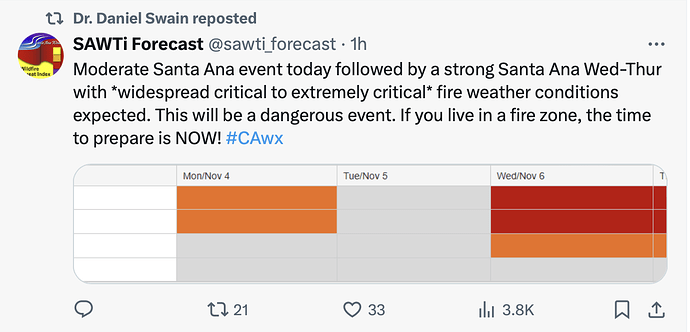
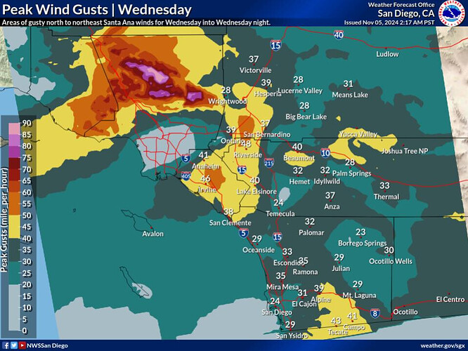
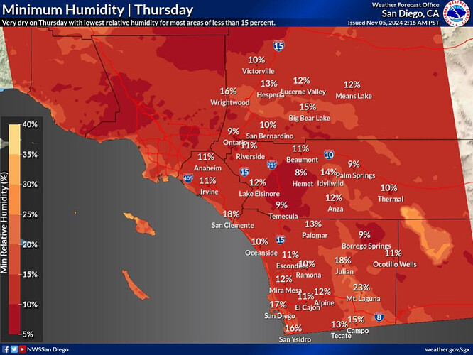
I haven’t seen the SAWTI with red in a few years. This may be an impactful event in So Cal.
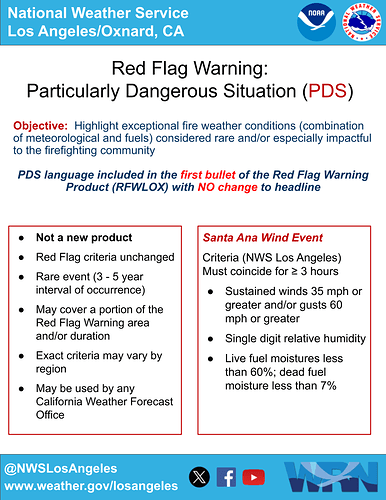
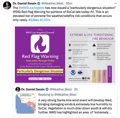
NWS LA has issued a PDS (Particularly Dangerous Situation) for tomorrow’s wind. This covers areas in parts of Ventura, Simi Valley, Santa Clarita down through Woodland Hills and to the Malibu Coast.
If you need to get away from Election Night TV drama, we just did a livestream with Tim Chavez about SoCal Fire Weather, here’s a link:
https://youtube.com/live/fT8S5XcvmBc
We talked about the mechanisms that drive Santa Ana winds, historic fires, initial attack firefighting during massive urban fires, red flag warnings and the difficulty in not over-predicting high-risk fire weather events, and about the importance of storytelling in wildland fire culture.
Also, Tim shared some good websites for gaging possible impacts of Santa Ana events - here:
SDGE - Center for Western Weather and Water Extremes - San Diego Weather Summary site
Pressure Gradient Tool - NOAA/NWS Storm Prediction Center - Pressure Gradient Model summarizer
CANSAC WRF Realtime Forecasts - High-res WRF model for SoCal.
LAX-DAG gradient peaked at -8.1 earlier today which is strong.
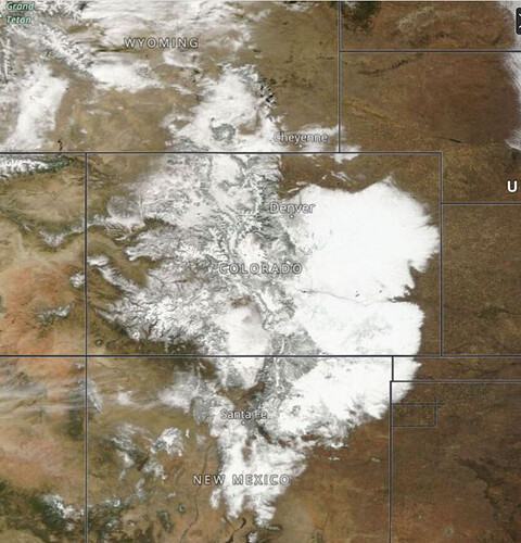
Good evening all, with the presence of cold air across the Great Basin firmly established due to a strong early season snow storm there will be greater ease for stronger Santa Ana winds later this month.
https://x.com/TomNiziol/status/1855751365428977869
Several feet of snowfall across Colorado and New Mexico.
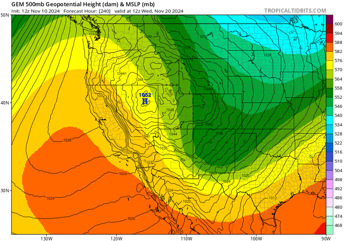
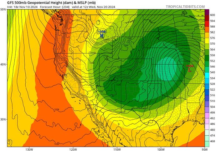
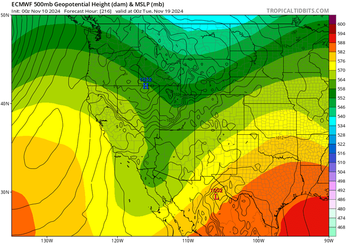
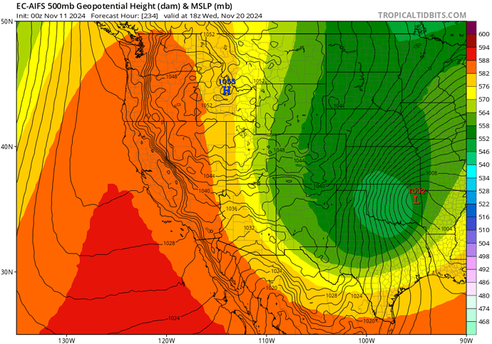
Forecast models have consistently shown solutions ranging from a cold Santa Ana wind event to record strong high pressure driving Santa Ana winds around the 20th. Almost all of the model runs have consistently shown a setup that would bring at least a moderate event to Southern California despite being in the mid to long term. The middle ground between the models is a low pressure system that establishes itself across Arizona and the four corners region with cold air advection across the region and a large height gradient again like the previous wind event. We are still too far out to put a forecast together and the odds of a Santa Ana wind event should be considered less than 40% at this time.
I would like to notate the model consistency in showing a huge pressure gradient due to the aforementioned already established airmass plus additional polar air moving into the Great Basin despite the low data points and resolution of the modeling being so far out. This should lend credence to a higher than usual chance of at least a moderate Santa Ana wind event.
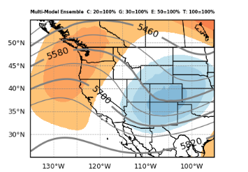
Here are some model depictions:
Will be interesting to monitor over the next few days.
100 member multi-ensemble solution for 4 pm Tuesday Nov 19th. Places in SoCal that dont get rain by this weekend will likely be seeing some type of Santa Ana by early next week.
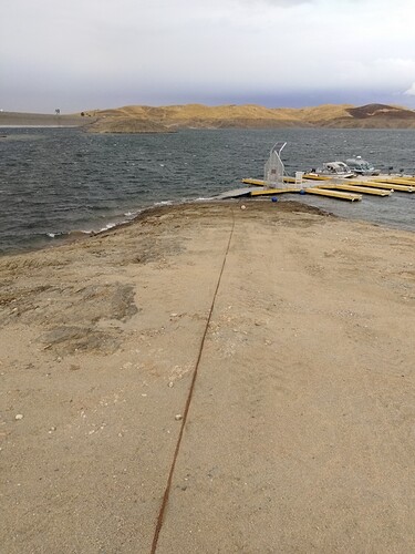
It got windy here at millerton lake. Gusts to 45 make some water move.
Doesn’t look to bad until you notice the dock is wet
We got a bit of wind down south as I walked through a section of the Bridge Fire…a lot of fire weakened trees…heads up in walking thru burn areas still a lot of hot spots…I am sure this ticket will be open well into next year… as well as the Line Fire
Just below a half inch of rain in my gauge Sonora area. 46 at my house almost 68 yesterday. We had some good wind when the front came thru. Fire Season my not be over but this slowed it down a bit in this area.
glad to see you are greeting some moisture u there. Spent some time at Jenness Park as a volunteer
We had a dust storm before the rain.
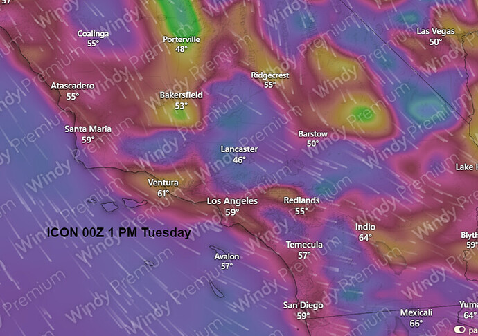
Forecast models will be variable while a tropical cyclone develops in the Caribbean and this interferes with the timing of the upper level features, but still ranging from a cold Santa Ana to very very warm Santa Ana wind event starting around 11/19 and offshore gradients for several days. For example, the ICON is an outlier that brings an extreme NW wind event followed by a powerful offshore wind event. The middle ground is a safe bet at this time because most of the models have a warm bias built in and they will rush these colder airmasses to fast and too far to the east. As a tropical cyclone enters the Gulf of Mexico in a few days, it’s strength will likely determine how fast the upper level trough ejects into the eastern US.
Although the ICON model is likely too strong for the Sundowner wind event on Monday, the sundowner wind event should not be overlooked because it looks like it could be a strong wind event due to a lot of upper level support over the area.
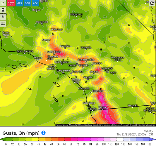
Tonight’s run of the European model showing the peak Santa Ana wind event on Wednesday of next week, currently favoring San Diego County/eastern aspects of the mountains.
Not over just yet!!! 50 acres between Valley Spring and San Andreas. Ran with a good wind on it. FROS stopped.
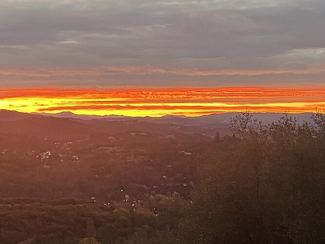
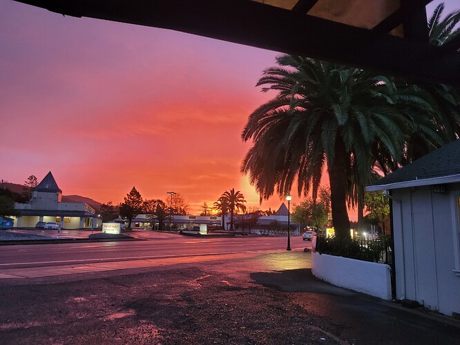
Red skies in the morning Sailor’s take warning. Breezy and warm in Sonora this morning at 0700. 57 out with SE winds at 10. All the rain been north of us. Sounds like tomorrow we might get some. Rain total for the last two storms just under and inch. Grass is just starting to show it’s self in some places.
To All, have a great Thanksgiving and if your traveling, Safe travels.
