And do not forget all the other necessities of life. CPAP’s, oxygen machines, electric gates, garage doors and lots of others that are rendered useless for a long period of time. Hope folks heeded the warnings and got gas and charged cell phones prior to being thrown into the dark ages.
And another safety issue. CHP log is lighting up with defective street lights. Mostly north county for now. Valley center the entire 76 corridor appears dark
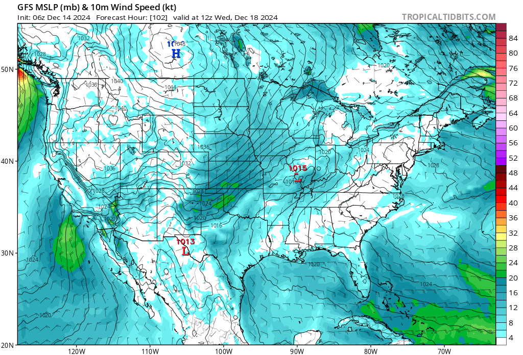
Hate to say it… but this Tuesday-Thursday could present another SA event similar to the one last week. The Baja Ridge looks to be firmly in control acting as a deflector shield for any storms to make it past Fresno. This past week looked to be the most promising for actual measurable precip, so not much hope for this current storm to make it south. As it storms here in NOPS the HP ridge will briefly build in as the storm passes on Monday. Some cold air will invade CA from the passing of the Monday storm. That pool of cold air will present in the GB by Tuesday. As HP builds in Tuesday night a pressure gradient will set up and with that cold air in place will provide an efficient set up for a SA. Looks to be similar strength to last week. Details will get fine tuned as we get closer…
73 peak gust on Mt Elizabeth Raws Twain Harte. My house on the ridge above sonora 50 plus.
It’s a mess in Tuolumne County! Christmas decorations, Trees and Debris all over the roads. Power outages like crazy. If you don’t have to be on the roads Don’t. Not much rain so far about .25 but coming down steady now. https://www.mymotherlode.com/news/local/3472281/rainy-windy-weather-wreaking-havoc-in-mother-lode.html
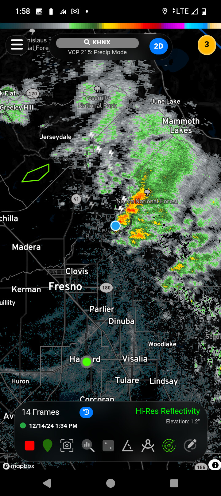
Wind at bald mountain west of shaver lake peaked at 36 mph, Fresno/Clovis got hardly rain. There was a monster thunderstorm that made its way east from Mariposa/Madera county on into the San Joaquin river.
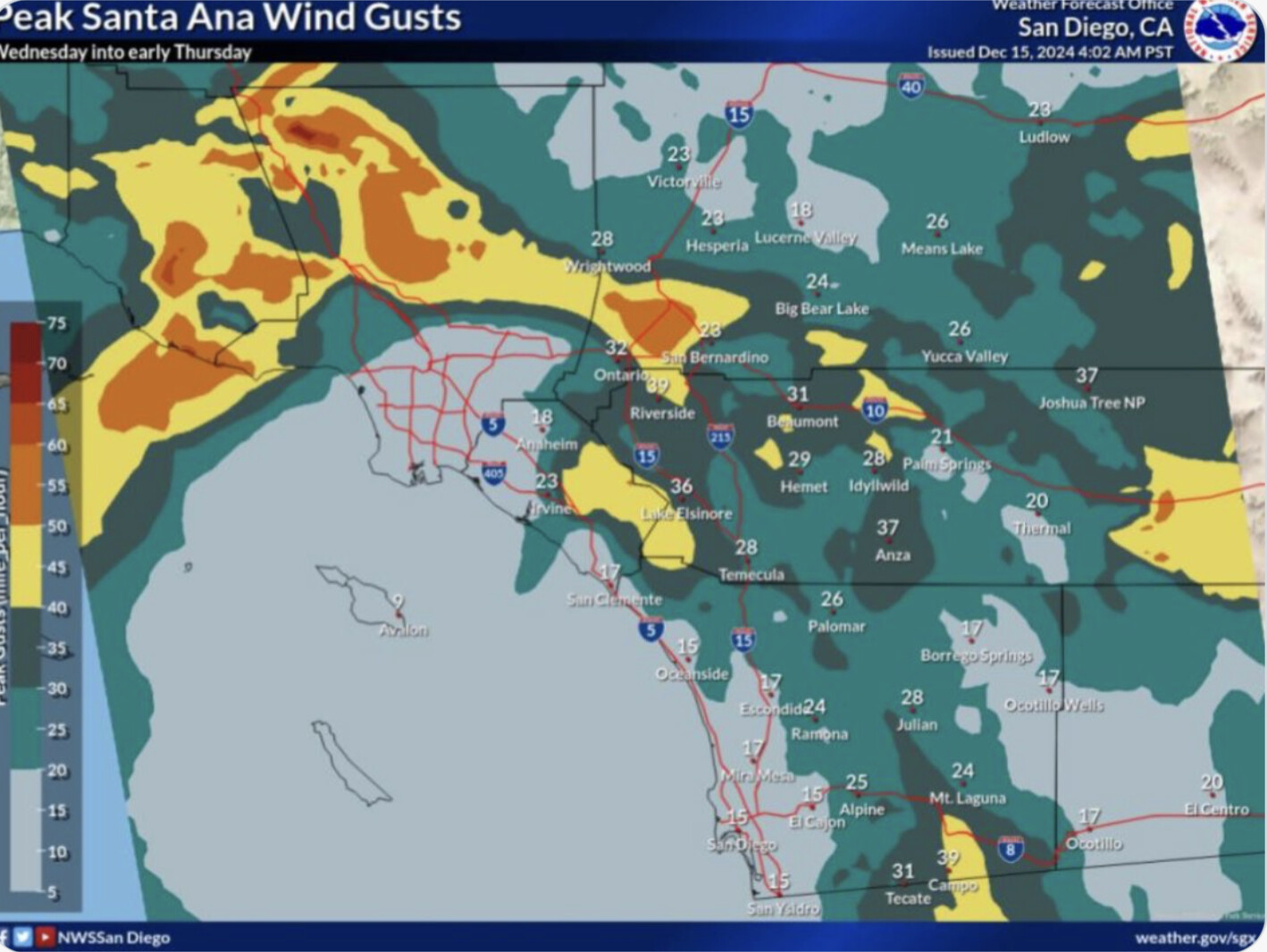
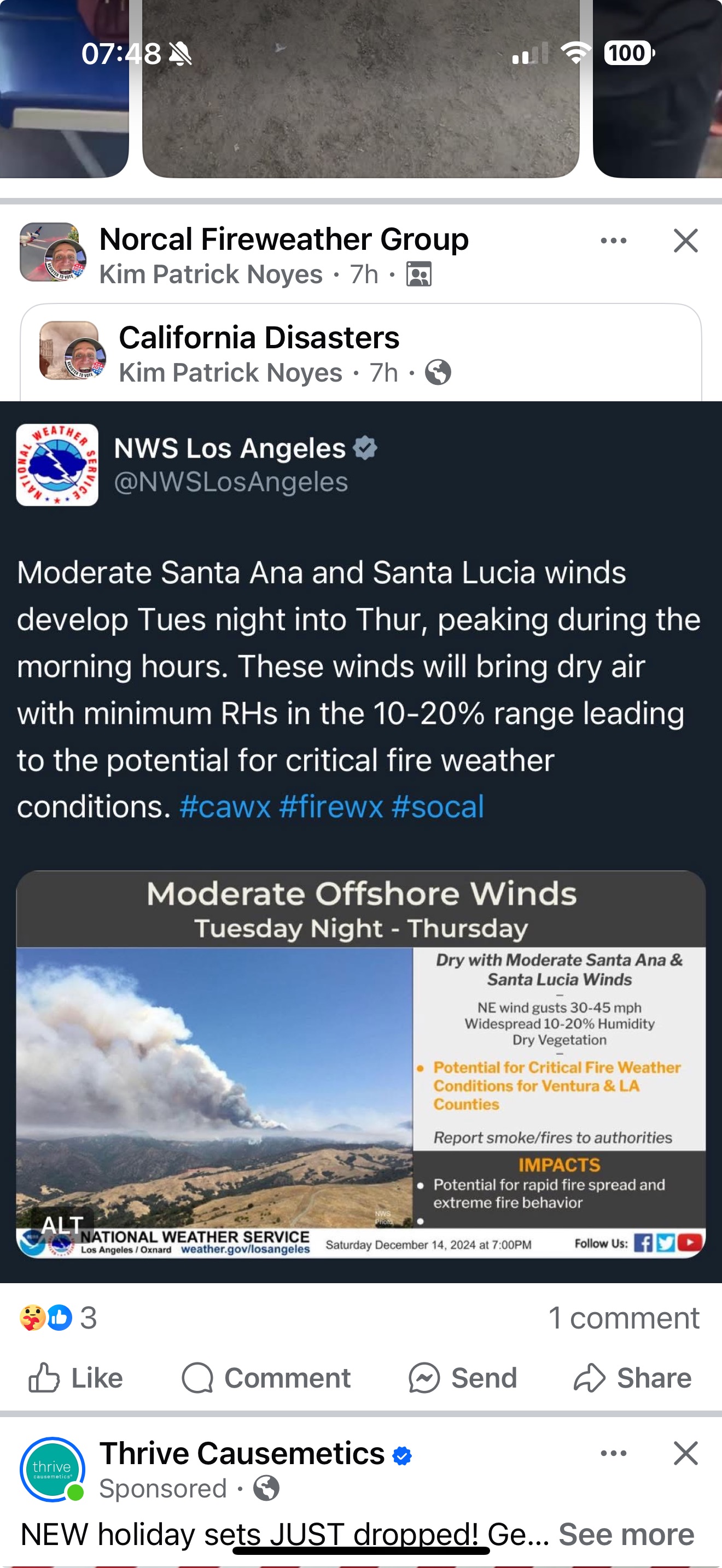
Up coming Offshore wind event this week in So Cal. As usual Santa Clarita down through Malibu looks to get the strongest wind. NWS San Diego calling this a moderate event.
I’ve always understood it to be gradient driven offshore flow specific to the central coast, named after the Santa Lucia mountain range. Local meteorologist John Lindsey gives a good write up here:
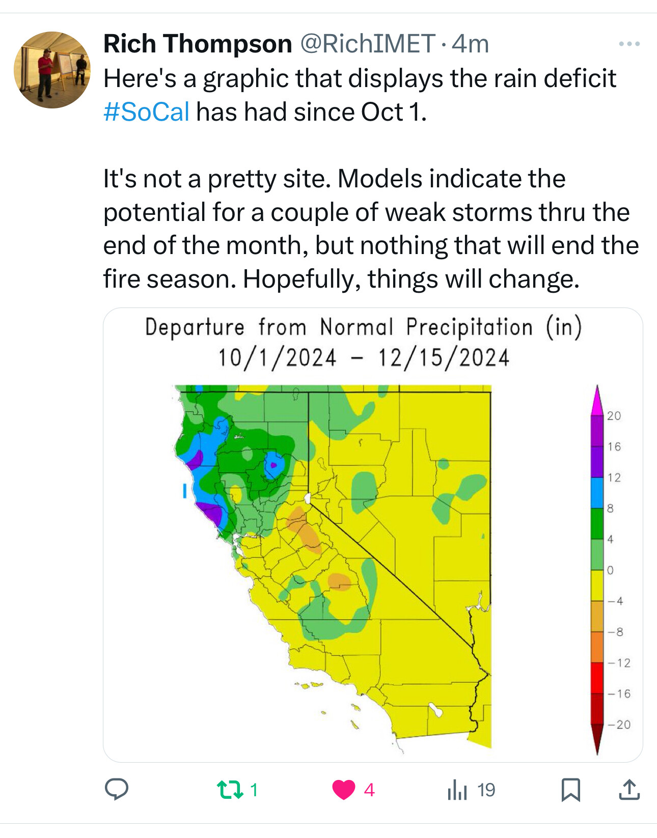
There is no moisture to speak of in the extended forecast for So Cal/SoOps (South of Tehachapi / Grapevine)
Next chance for a real pattern change is the 2nd week of Jan. For those of us who were on "Jesus IHC " old. We’ve seen this several times in our lives. 2013-2017, and 1990/91 come to mind.
The “March Miracle” rain event of 1991 was too little, too late. The good news is not enough late season rain for a 2025 grass crop if this current pattern holds. The bad news is the LFM in the brush will be lucky to recover to 100 by May/June. Meanwhile the 100 & 1000hr fuels will act like 1 model lower while the DFM will carry fire anywhere there is heavy dead and down fuel.
In layman’s terms we *&%$ed if nothing changes come 2025.