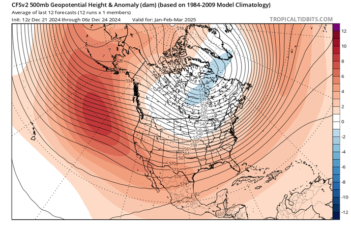
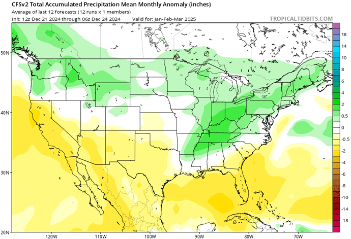
CFS weekly/monthly showing a blocking pattern over the North Pacific that would bring split flow pattern across the Pacific. This could direct troughs further north east and keep things dry for the winter. Because of La Nina the split flow ‘southern side’ which is the subtropical jetstream is not amplified and is not a threat to bring significant precipitation.
We’ve been fortunate with the number of and length of wind events in my opinion. Merry Christmas folks

Meanwhile in NorCal
Eastern Sierra Fuel Moisture
75% critical LFM
Current LFM
Rabbit Brush 46%
Bitter Brush 69%
Salt Brush 63%
No precipitation in the forecast for the next 14 days:flushed_face:![]()
![]()
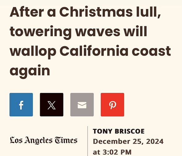
I assume the article means that little rain fell in the northern areas of Southern California, because here in Plumas County we have received a nice dose of precip. I don’t have numbers, but I did have roof leaks. That’s always an irritating but good sign.
Here are the cold DRY facts for Q1 of the 24/25 water year.
https://x.com/NWSCNRFC/status/1873781137627373626?t=q2OGO4LxaUcmC5V2m6lFxA&s=09
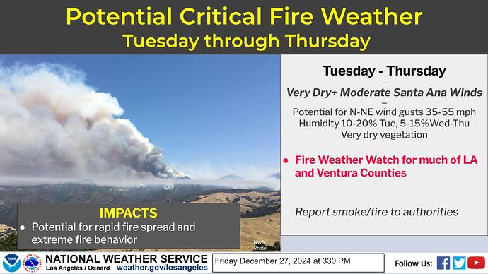
Meanwhile NWS LA has a RFW for the end/beginning of 2024/2024
Such extreme differences. And while I am grateful for the water we have received up here, I realize it can make for a challenging 2025 fire season. We completed a major thinning project this year and I am curious to see how the forest floor reacts in the springtime, wondering if we will have an explosion of light vegetation. Right now the woods look wonderful, clean and open.
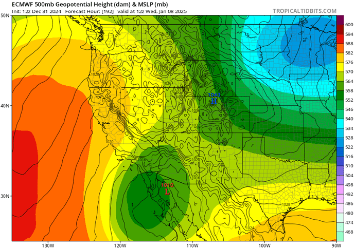
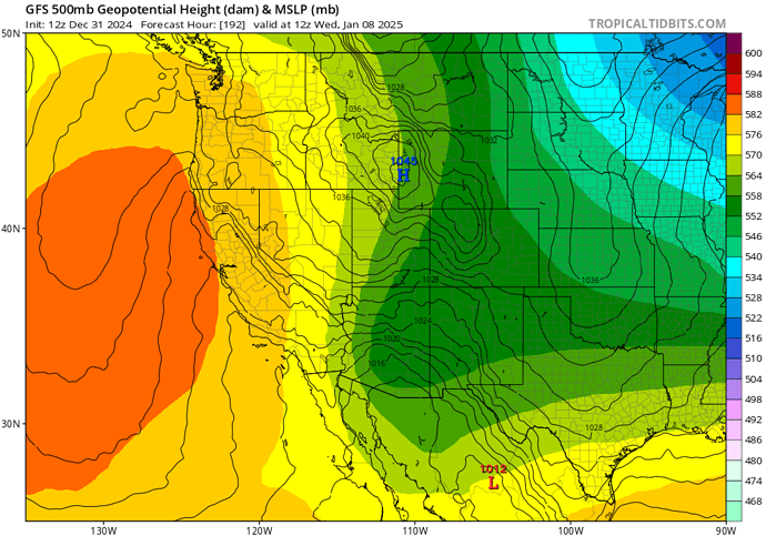
Dangerous offshore wind event could occur from 1/6 to 1/9 time frame. The ensemble means are in good agreement for the upper air positioning. With the amplified long wave troughing digging into the Southern US and the North Pacific ridge amplifying at the same time, it’s a classic offshore wind event set up that should result in a moderate to strong wind event. The EC /CMC camp brings upper level support / large height gradient directly over CA but the GFS is further east. Perhaps something in the middle occurs.
2 posts were split to a new topic: South Ops Weather - 2025
